Downtown Montreal

I’m back from a whirlwind trip to Montreal where I attended a three day Canadian Neuroendocrine Tumour Society (CNETS) conference. More about that in Friday’s post, but today I want to share a bit of that beautiful city with you. 

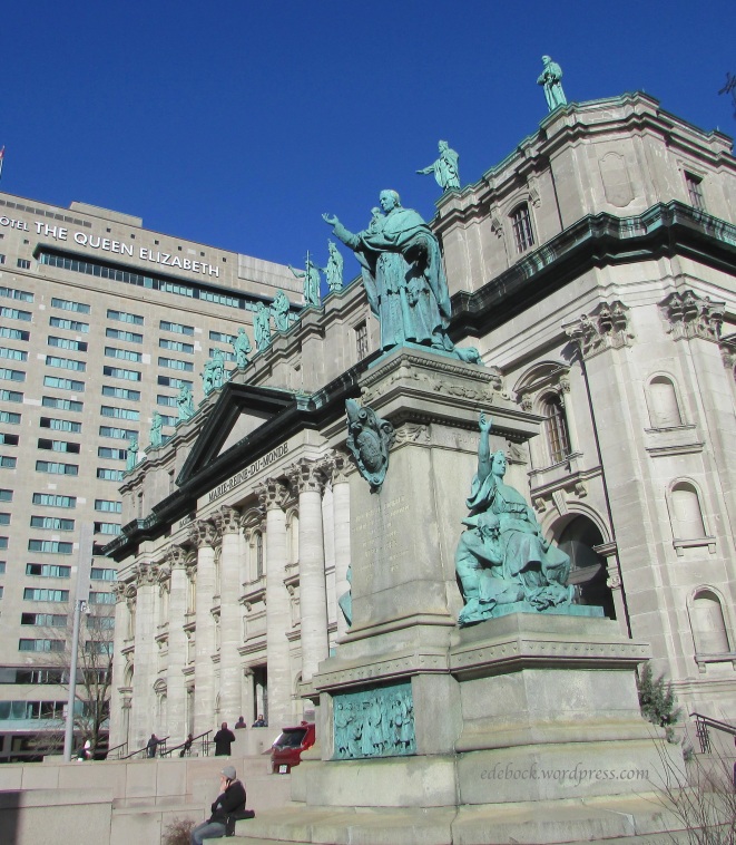
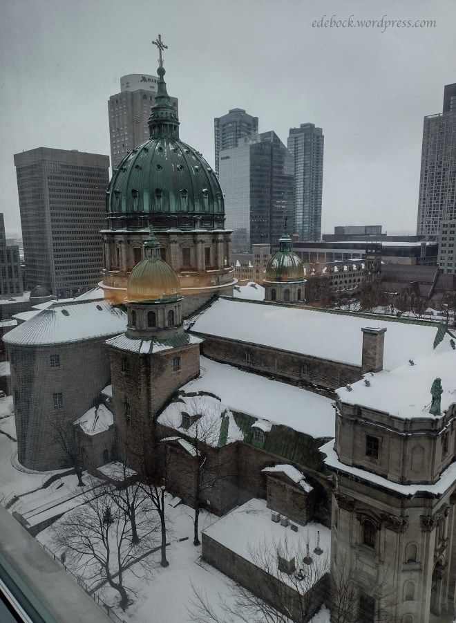
After my plane was delayed for four hours by a major snowstorm, I finally arrived late in the evening and checked into the downtown Fairmont Queen Elizabeth Hotel where the conference was being held. Entering my hotel room, I was awestruck by the view from my window overlooking the ornate Basilique Marie-Reine-du-Monde (Mary Queen of the World Basilica), a smaller replica of St. Peter’s Basilica in Vatican City. 

IMG_20240405_073719691_HDR

The following pictures of the basilica were taken on one of my walks after the weather cleared. 

IMG_6721 2

While the statues on the facade of St. Peter’s depict the twelve apostles, at Mary Queen of the World thirteen statues represent the patron saints of the parishes that form the diocese of Montreal.  Carved of wood and clad with copper, each statue is 9 feet tall. They were completed between October 1892 and October 1900 by Quebec native, Joseph Olindo-Gratton.

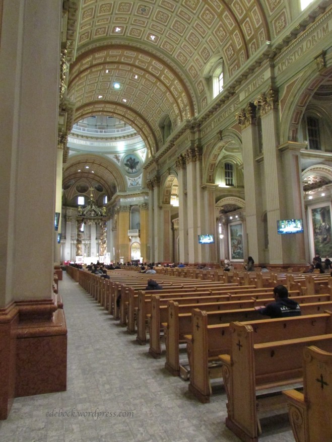
I was thankful to able to slip inside the basilica for a quick photo of the interior. 

IMG_6723

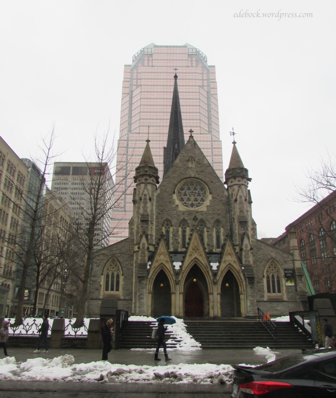
Downtown Montreal is home to many old stone churches. This one is Christ Church Cathedral and has been designated a National Historic Site of Canada.

IMG_6697

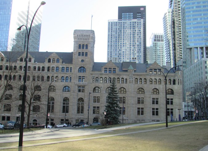
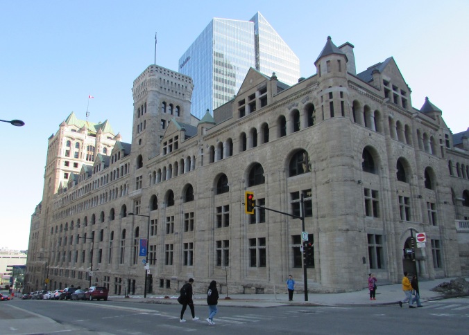
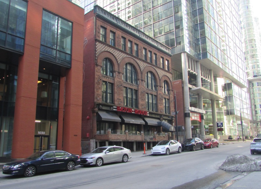
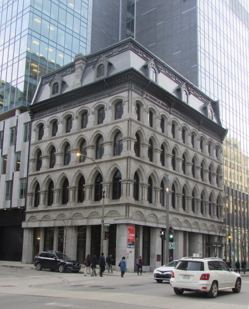
As always, I love the juxtaposition of old architecture and new. Here are a few other structures that caught my eye as I walked. The first is Windsor Station. Formerly the city’s Canadian Pacific Railway station and headquarters of the CPR from 1889 to 1996, it has been redeveloped into an office complex that also houses some restaurants and cafés. I can’t tell you anything about the others. 

IMG_6714

IMG_6708

IMG_6712

IMG_6716

IMG_6804

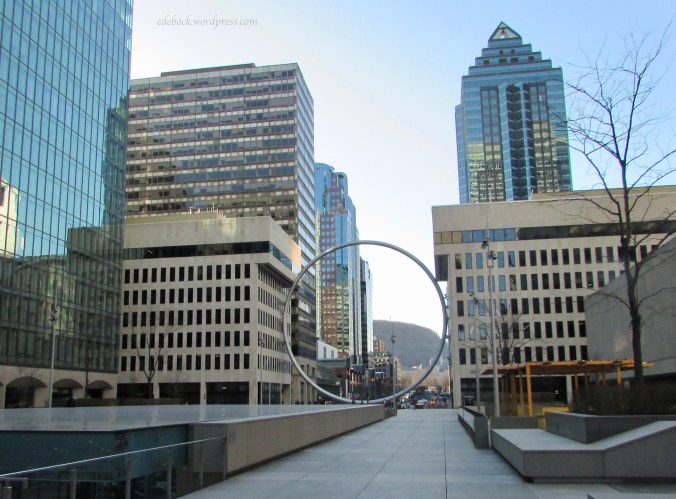
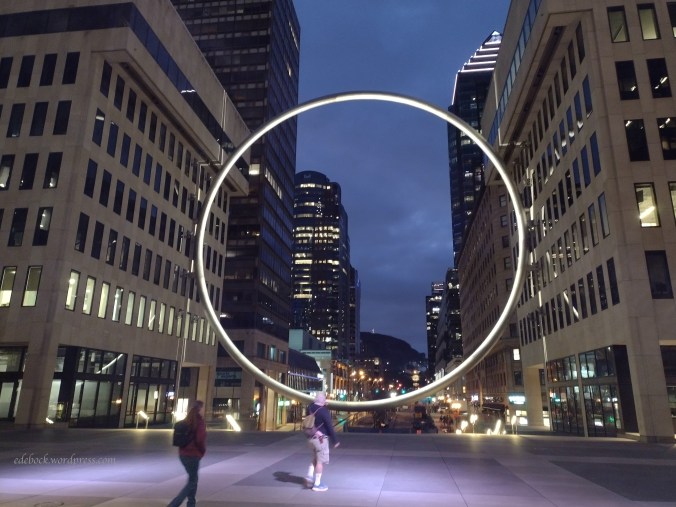
Though there is no end of old architecture to enjoy in Montreal’s downtown area, there’s also something new to see. Suspended between two buildings, 30 metres in diameter and weighing some 23,000 kilograms, The Ring hovers over the staircase of Place Ville Marie’s Esplanade directly across Rene Levesque Boulevard from the Queen Elizabeth Hotel. Installed in June 2022, The Ring serves as a window to more than 200 years of history, establishing a direct line of view from the hotel and Place Ville Marie to McGill University, the former Royal Victoria Hospital, and the illuminated cross on Mount Royal.

IMG_6744

IMG_20240406_195749629

Rowley, an Alberta ghost town

We spent several days camping this week and as a result, I don’t have a Fashion Friday post ready for you today. Instead, I’ll share one of the highlights of our short time away from home. After a horrendous storm Monday night, we woke to sunshine on Tuesday morning, but the wind was still much too strong to go golfing or kayaking and we’d already hiked the 6.5 km nature trail around a nearby lake. We didn’t want to spend the day sitting in the trailer though, so what should we do?

Hubby suggested a road trip to Rowley. In its heyday, Rowley, Alberta was an agricultural town of approximately 500 people, but at last count the population was 9. Yes, that’s right, 9 people and perhaps a few stray cats! Apparently, some of the residents don’t really like their hometown being referred to as a ghost town though that’s what it’s usually called. They take pride in the place and have worked hard to preserve the few remaining buildings and to turn it into a tourist destination. Once a month, the community association, made up of residents and people from the surrounding area, host a well-attended pizza and pub night to raise funds to help with the cost of maintenance.

As the ROWLEYWOOD sign at the turnoff on nearby Highway 56 suggests, the movies Legends of the Fall, The Magic of Ordinary Days, and Bye Bye Blues were filmed in the hamlet.

So, come walk with me and I’ll show you around Rowley, Alberta.

The Lion’s Oil Garage, complete with its old style gas pump, is a reconstruction of the building that originally stood on this site.

IMG_5901

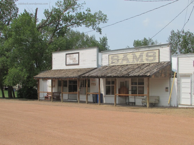
Walking down Main Street past Sams Saloon and the Rowley Trading Post, it’s easy to imagine ourselves transported back in time to the wild west. I could easily picture a couple of horses hitched to the rails and women strolling the boardwalk in old fashioned dresses. Built in 1920, the trading post was where Rowley residents purchased their dry goods and groceries until 1973 when it was the last business in town to close its doors.

IMG_5875

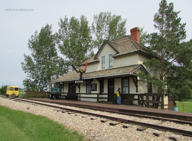
At the end of the street stands the beautifully preserved CNR train station. The station master and his family likely lived upstairs.

IMG_5878

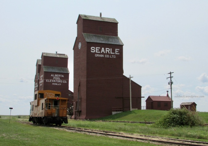
At one time, every little town on the Canadian prairie had its wooden grain elevators, but very few of these stately sentinels remain today.

IMG_5885

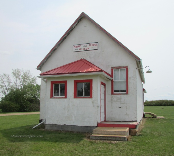
The Prairie School Museum is typical of the one room schoolhouses that dotted the prairie in days gone by. 

IMG_5891

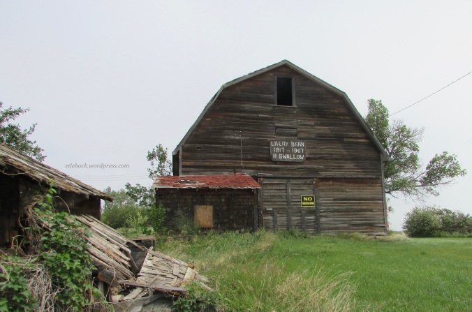
If you came to visit Rowley in the early days, you might have boarded your horse at H. Swallow’s livery barn. While some of the smaller structures around it are falling down, the barn still looks pretty sturdy.

IMG_5894

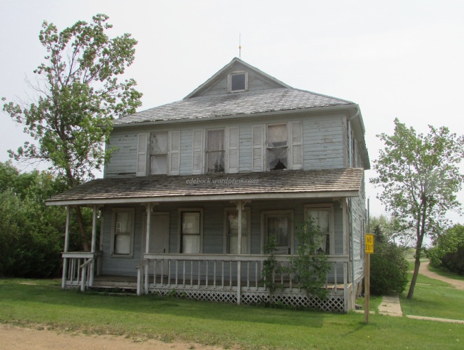
Circling back to the upper end of Main Street, we find this stately old house, weathered by time but still beautiful. Hubby and I thought that perhaps it had once been the town’s hotel, but after doing a bit of research I discovered that it was originally used as a hospital.

IMG_5897

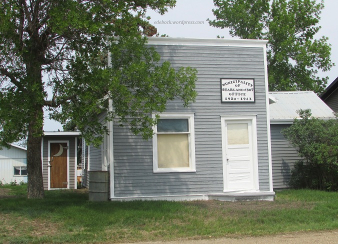
Across the street, the old municipal building has obviously undergone some fairly recent renovation. Though I’m happy to live in the day of indoor plumbing, we thought the backyard biffy was cute.

IMG_5898

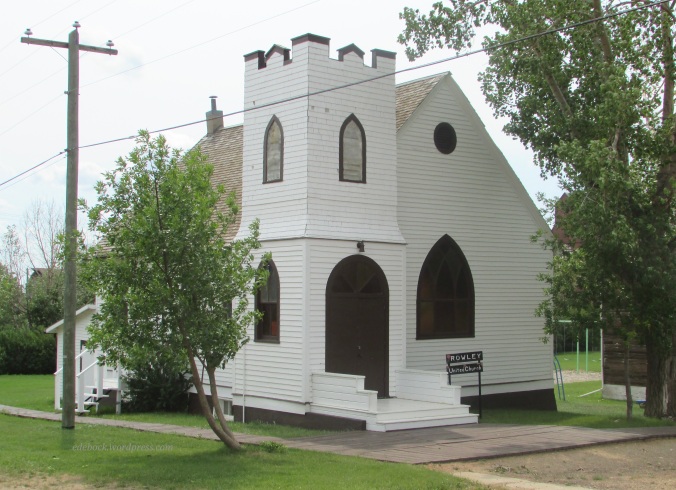
The Rowley United Church remained active until 1969 and continues to be used for the occasional wedding. 

IMG_5899

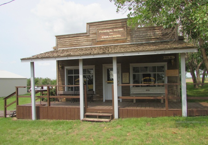
Like at least one other building in Rowley, not shown here, the funeral home across the street from the church was constructed specifically for the filming of the movie, Bye Bye Blues. Afterwards, the residents decided to turn it into a pool hall for their own enjoyment, but kept the front and signage intact. 

When we were there, we had Rowley almost entirely to ourselves and were content to peer through the windows at the artifacts housed inside the buildings, but should you wish to take a closer look, the Rowley community association hires local summer students to give free guided tours inside the buildings Thursday to Monday during July and August. 

Downtown Calgary walking tour

Over the years, we’ve been to Calgary about a bazillion times. That’s because our daughter moved there immediately after graduating from high school 22 years ago to go to college and ended up staying. It had been many, many years, however, since we’d spent any time in the downtown core. Yesterday, however, we had a few hours to kill before picking up a friend who was traveling with us. We took a self-guided walking tour to see some of the weird and wonderful outdoor sculptures that add to the vibrant life of the city’s downtown. It was a cool, blustery morning, but thankfully, it rained very little. 

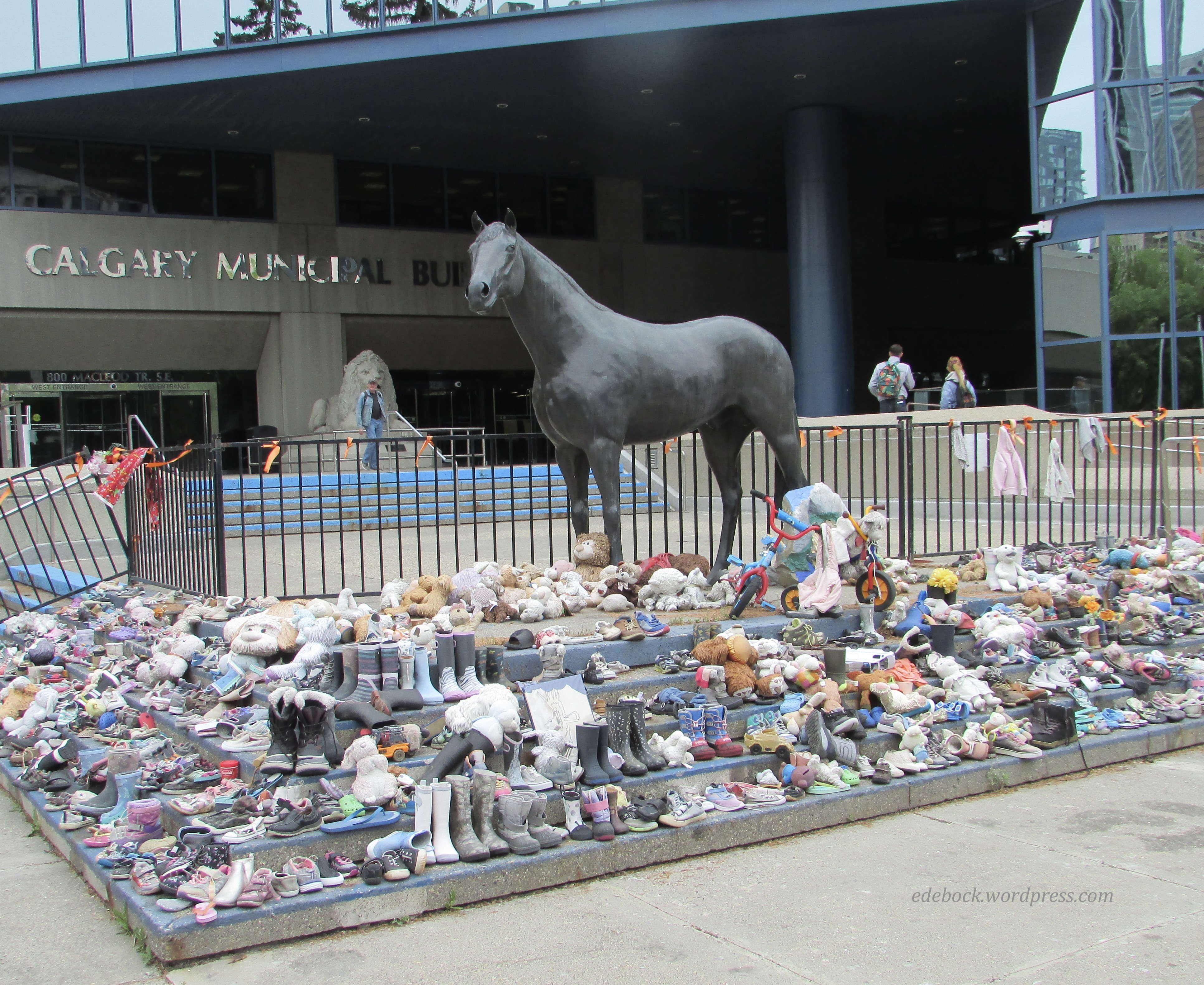
Our morning started at the somewhat pricey, but conveniently located City Hall Parkade and our first stop was just around the corner of the building. The Family of Horses, consisting of three statues, was donated to the City of Calgary by Spruce Meadows, a multi-purpose equestrian facility located near the city. The stallion shown in my photo is positioned in such a manner that he overlooks the foal and mare (not shown). At present, however, he stands guard over a temporary memorial to honour Indian Residential School survivors. The city intends to create a permanent memorial elsewhere once a location and design have been chosen. 
IMG_5682

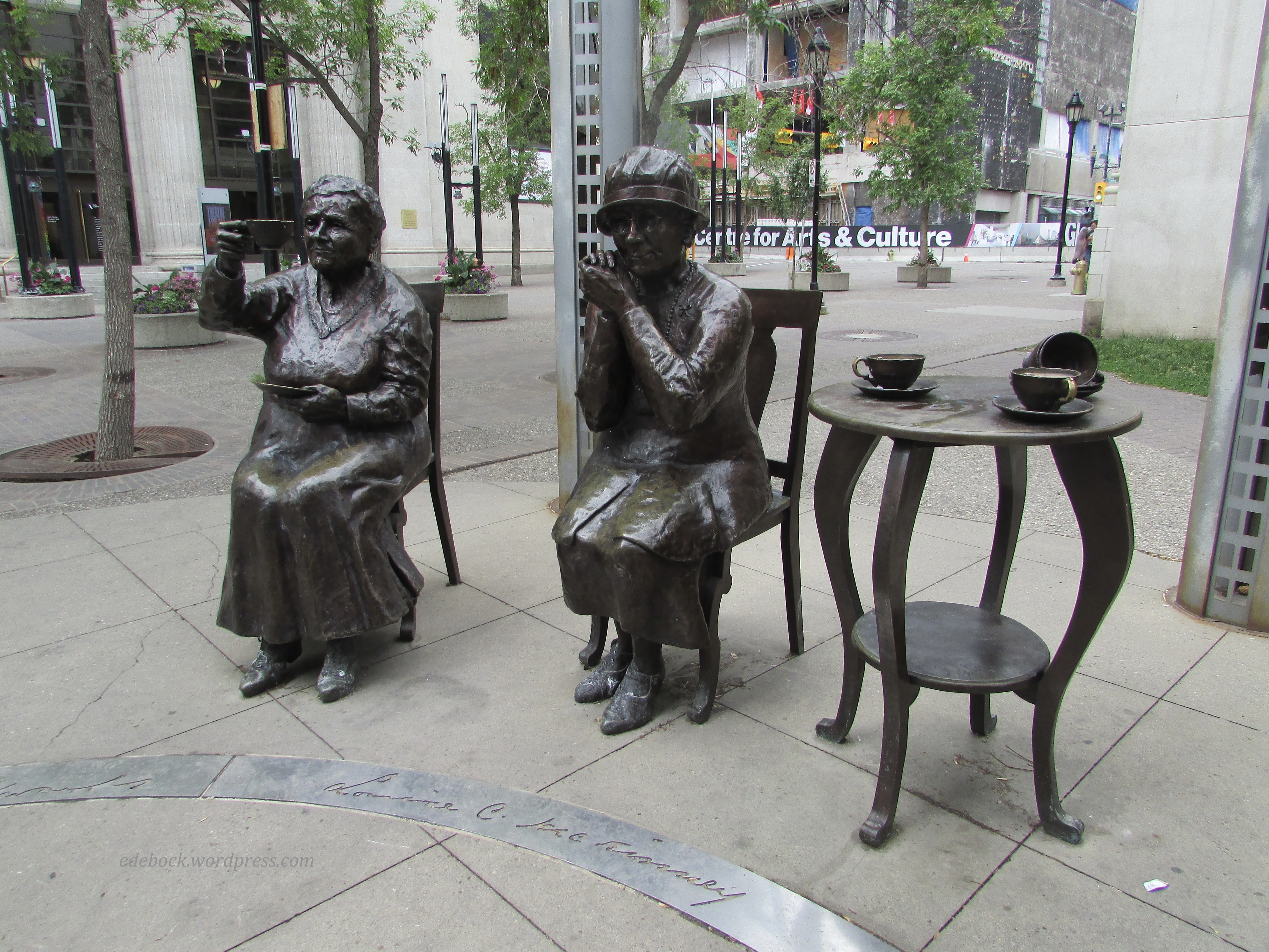
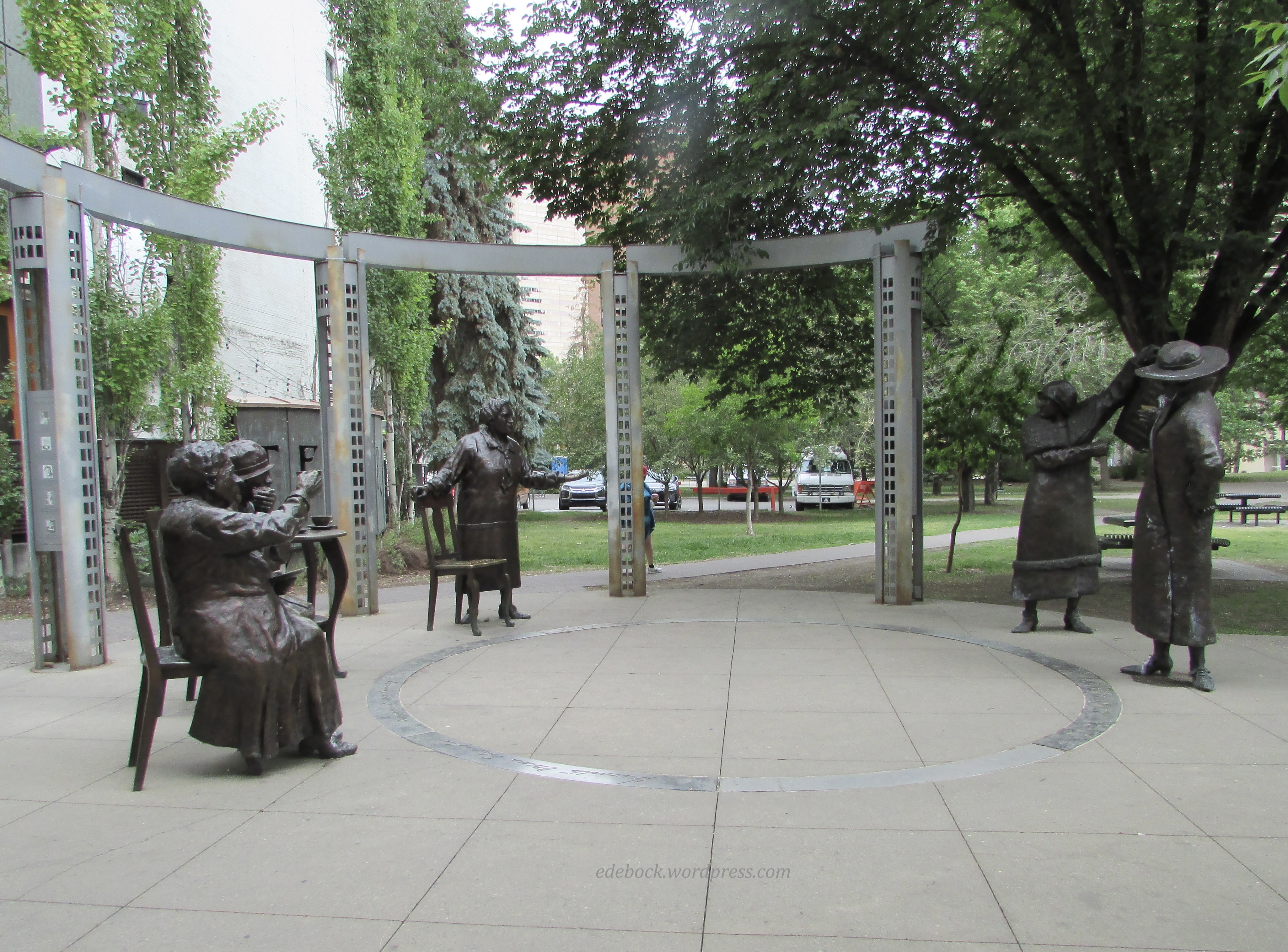
Next, the Women are Persons statues are located at the corner of Olympic Park. The monument recognizes the role played by Canadian women in the growth of the country and specifically honours the Famous Five, five persistent Alberta women — Emily Murphy, Nellie McClung, Irene Parlby, Louise McKinney and Henrietta Muir Edwards. Through their efforts, Canadian women were legally declared persons and given the right to vote on October 18, 1929. Seventy years later, the Calgary monument was unveiled on October 18, 1999 by then Governor General Adrienne Clarkson. Exactly one year later, a similar monument was unveiled on Parliament Hill in Ottawa. 
IMG_5686

IMG_5689

Of course I had to stop and sit with the famous ladies for a bit! 

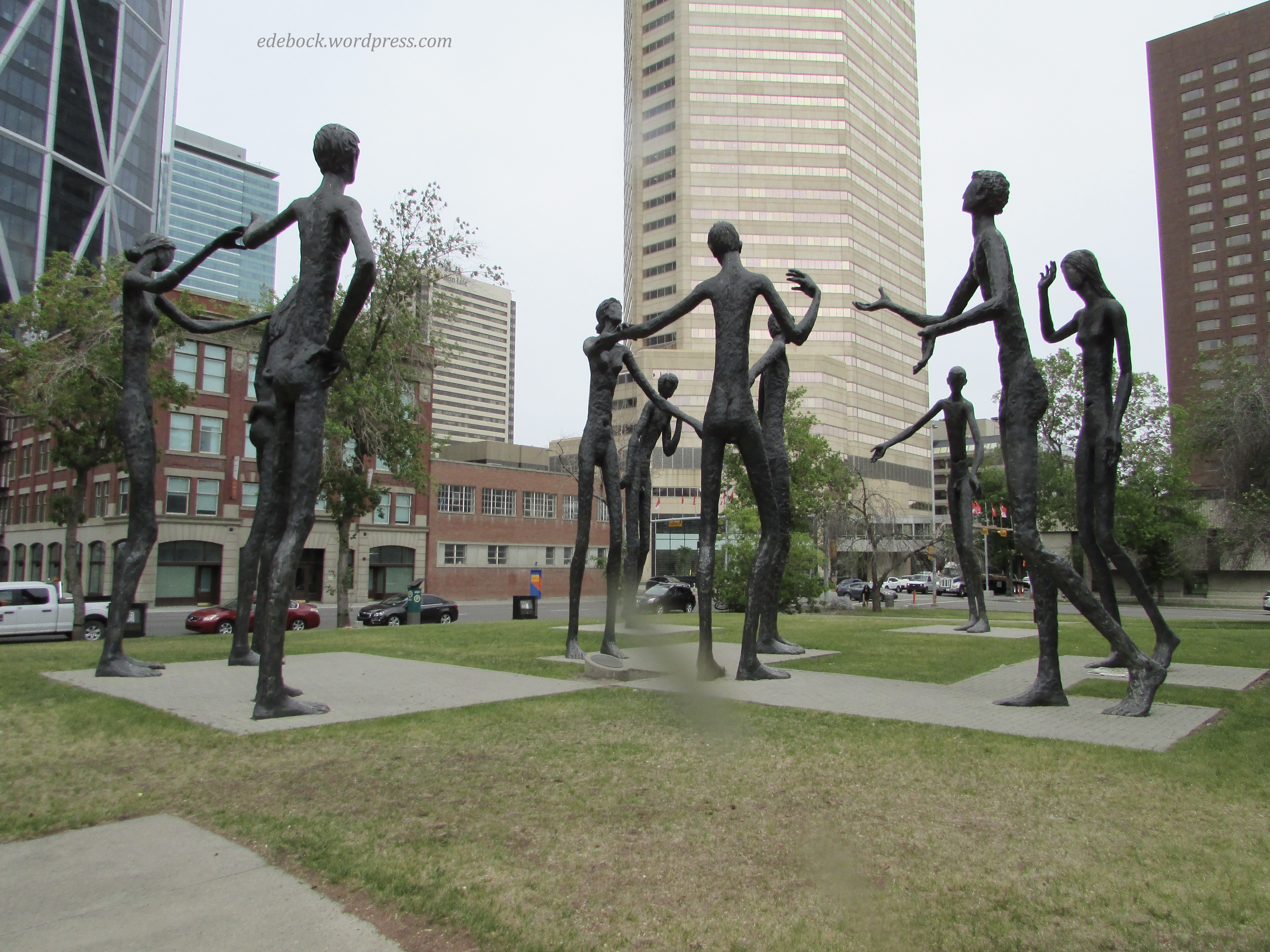
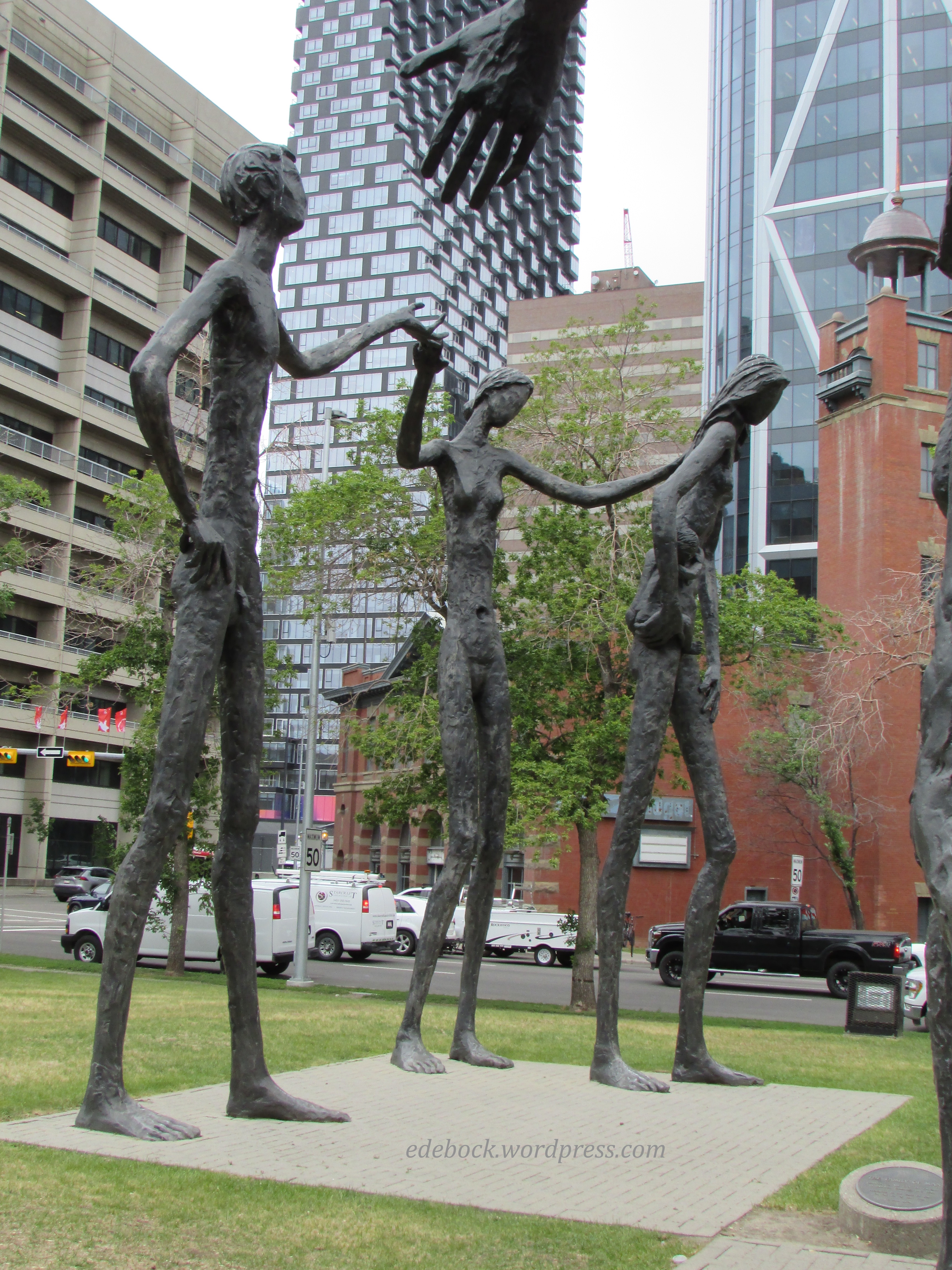
I remembered the 21-foot-tall Family of Man sculptures from my university days in Calgary in the early 1970s. Designed by Mario Armengol to be displayed at the British Pavilions at Expo 67, they were bought on behalf of Maxwell Cummings and Sons by Robert Cummings and later donated to the City of Calgary. The sculptures depict naked and faceless men and women, devoid of expression, but extending their hands in gestures of goodwill and fellowship. I’m sorry about the streak of rain across the first photo! The weather was at its most blustery at this point in our morning.
IMG_5695 

IMG_5697

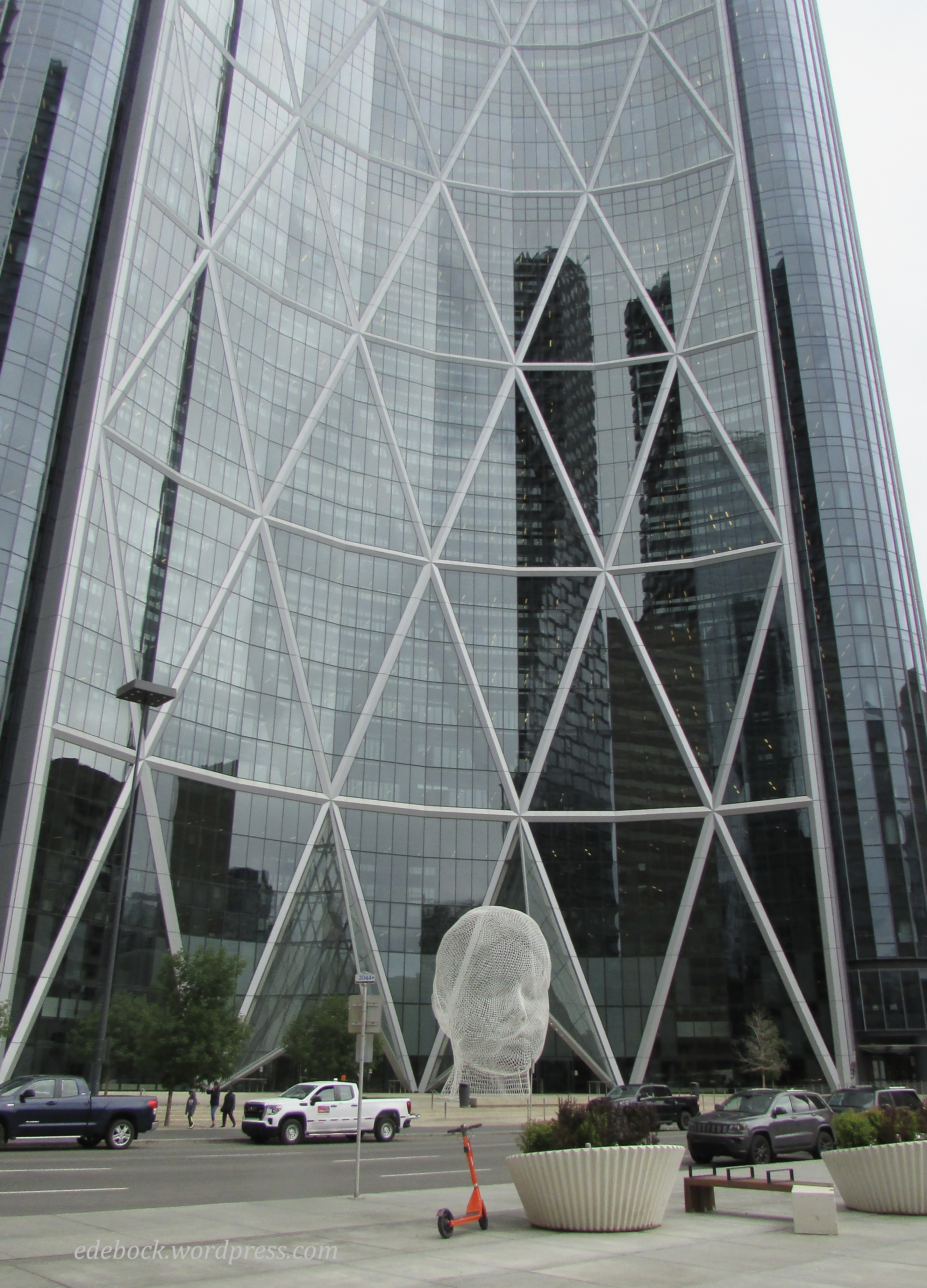
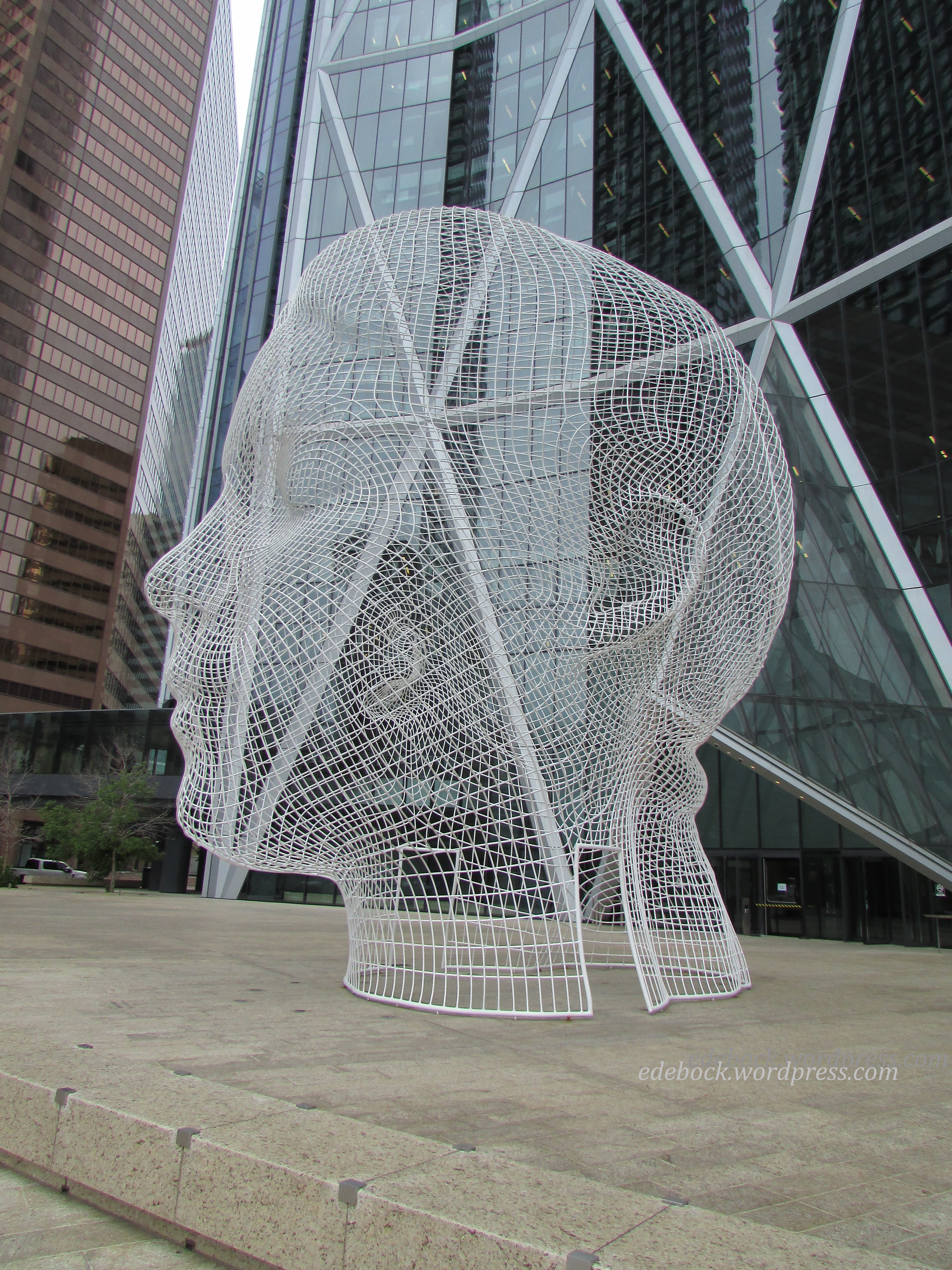
When Wonderland, a 39-foot-tall bent wire sculpture of a young girl’s head came into view, hubby’s comment was, “Look! It’s a giant radiation mask!” It did bear an uncanny resemblance to the fitted mask that I wore for every one of the 30 radiation treatments to my neck and jaw back in the summer of 2015. Thankfully, the statue has a much happier meaning. Located in front of the Bow, a crescent shaped skyscraper, it’s meant to represent the dreams of the young people of the province.
IMG_5704

IMG_5698

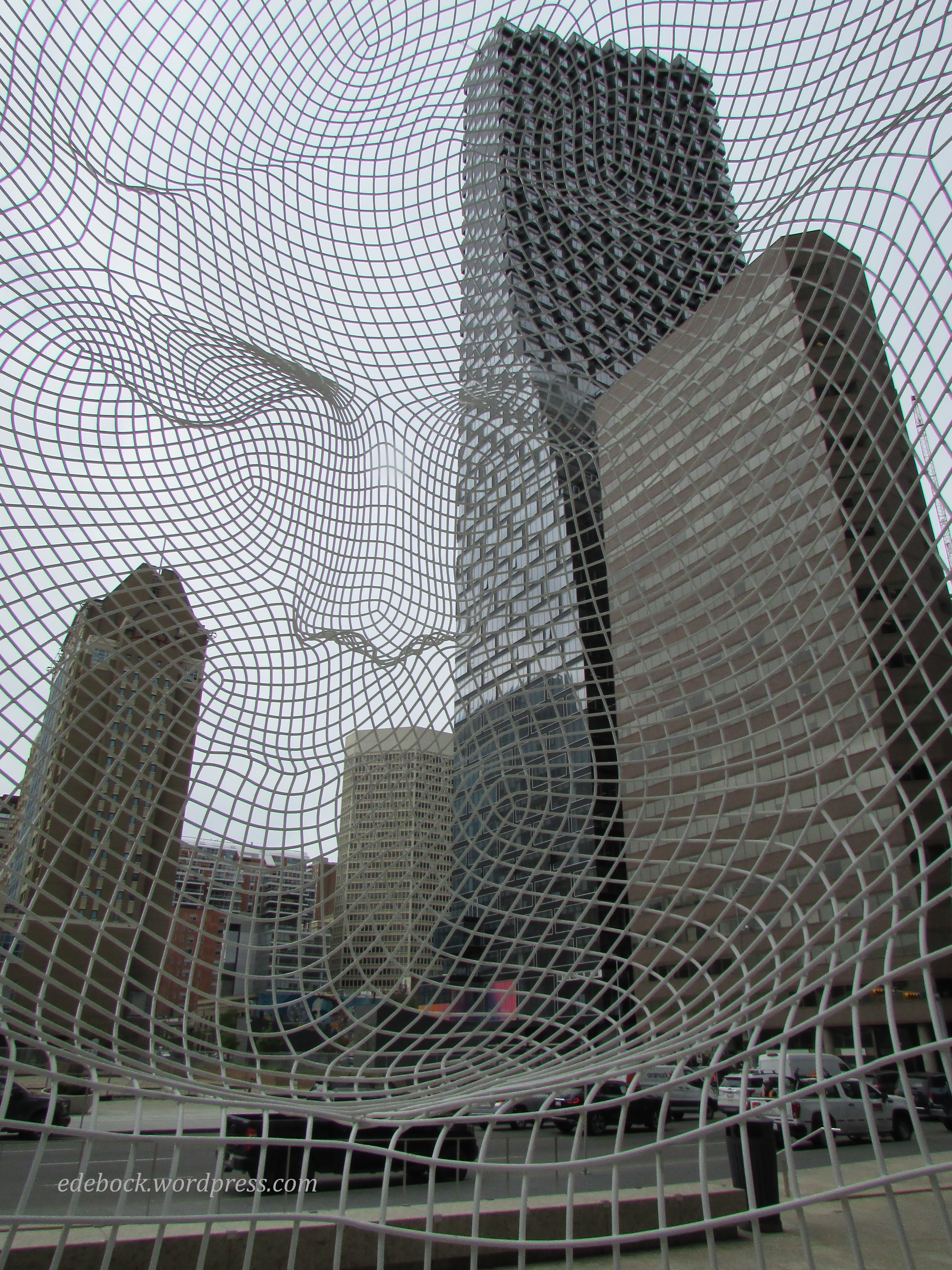
Unlike most sculptures, Wonderland allows visitors to view the artwork from the inside as well as out. This is definitely one of the most interesting looking photos I’ve ever taken! 
IMG_5702

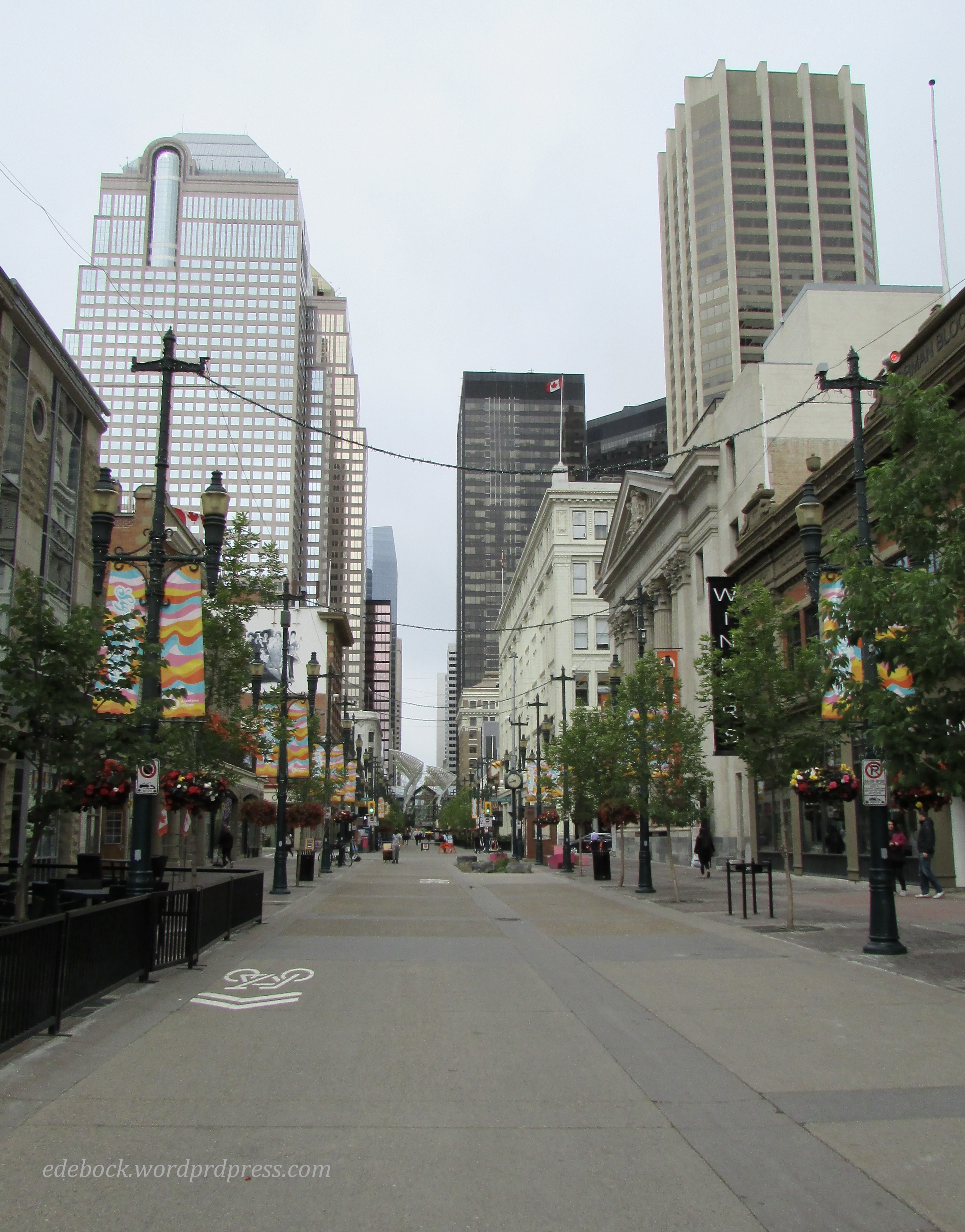
Lined with an eclectic mix of boutiques, high-end retailers, restaurants, cafés, pubs, and bars, as well as two hotels and the Telus Convention Centre, Stephen Avenue is a major pedestrian street stretching along 8th Avenue SW from 4th Street SW to 1st Street SE. 
IMG_5705

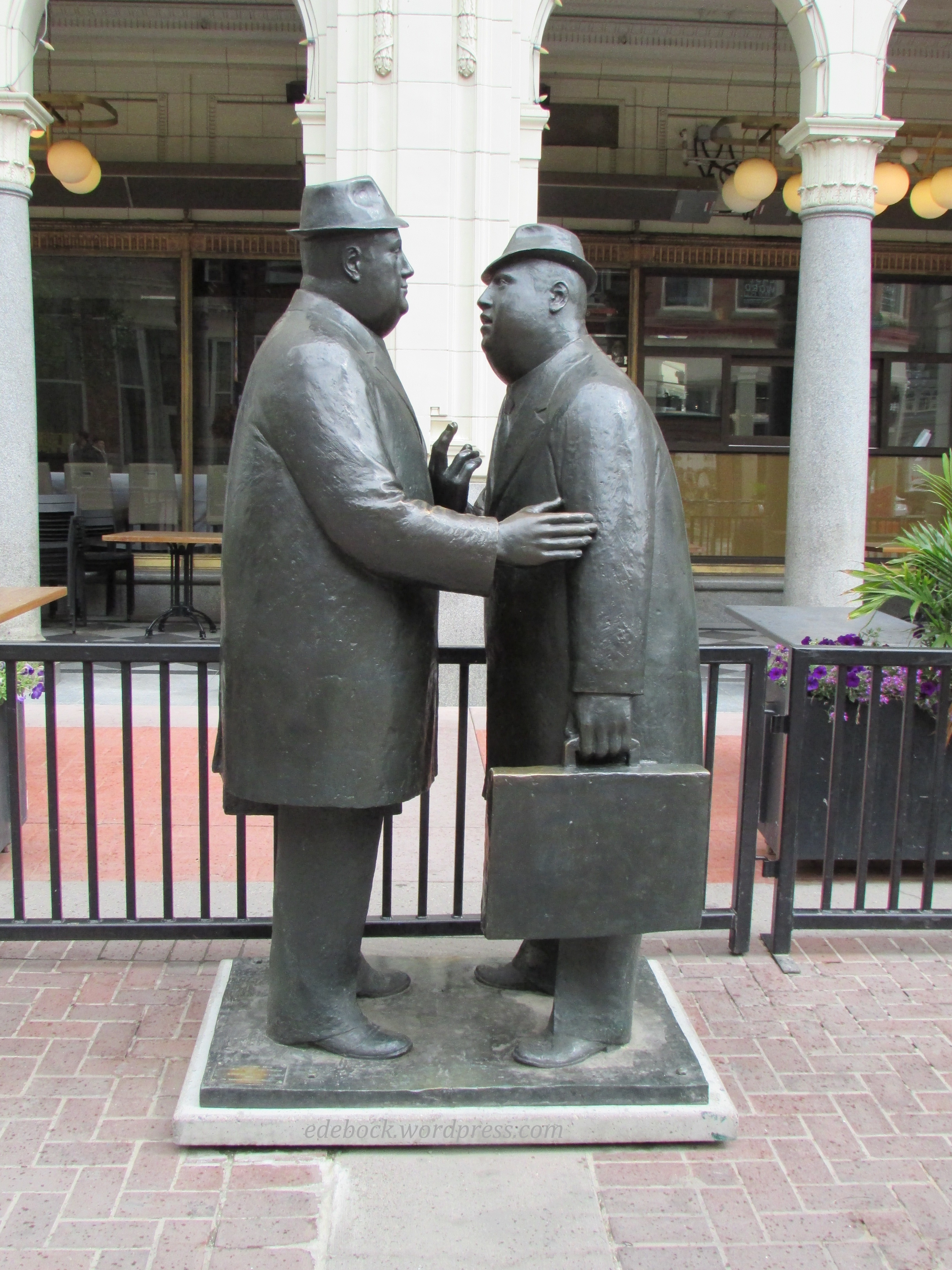
Usually a happening place, the avenue was quiet on a cool morning, but busier close to lunch time when we were headed back to the vehicle. It was along Stephen Avenue that we stopped to see The Conversation, a life-sized bronze statue of two businessmen deep in conversation. Created by William Hodd McElcheran, the popular sculpture originally belonged to Norcen Energy Resources who donated it to the City of Calgary in 1981. It has stood on Stephen Avenue ever since. 
IMG_5708

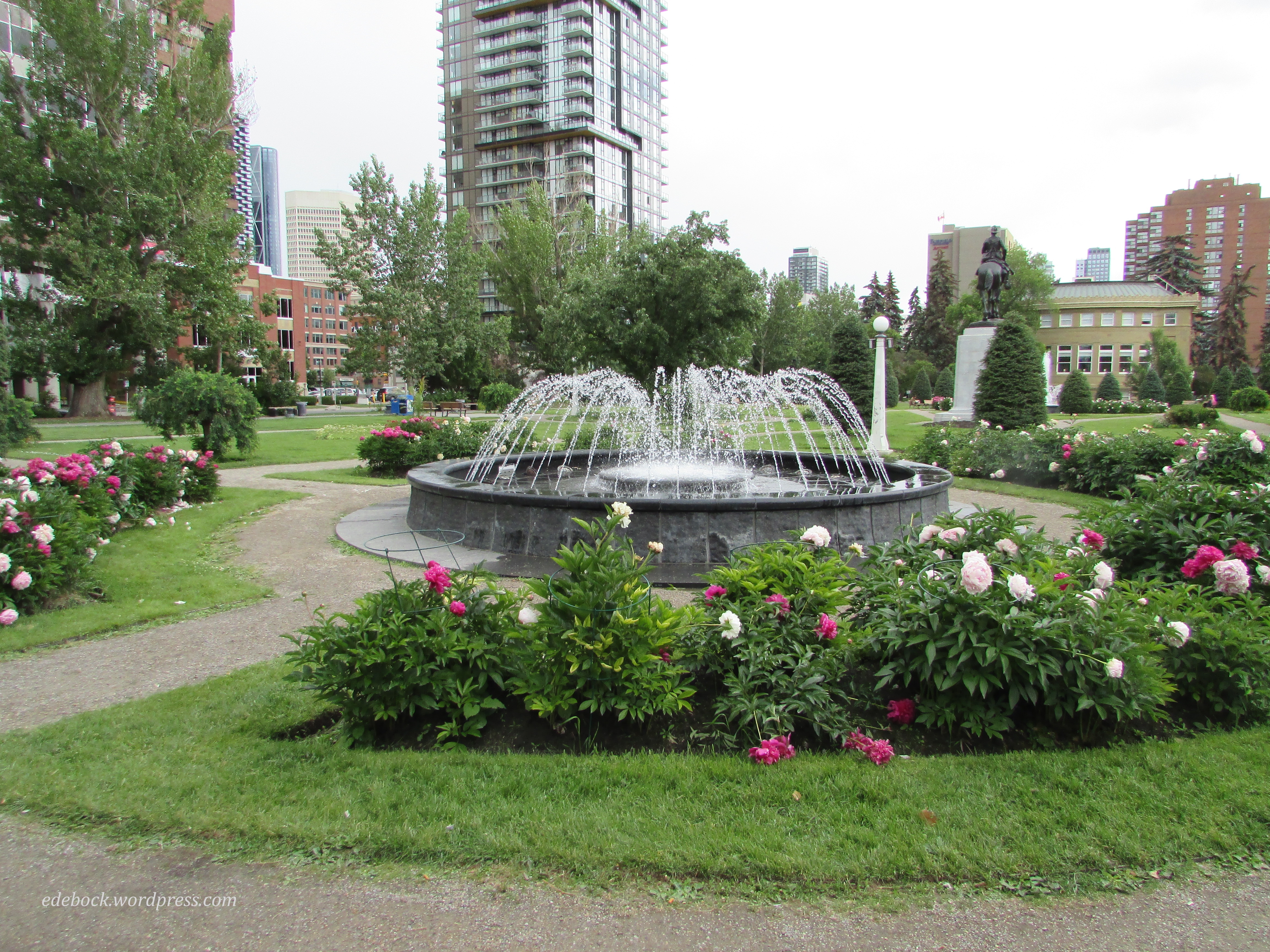
A little further in our walk, we came to Central Memorial Park. With the peonies in full bloom, it was a beautiful and peaceful spot.
IMG_5716

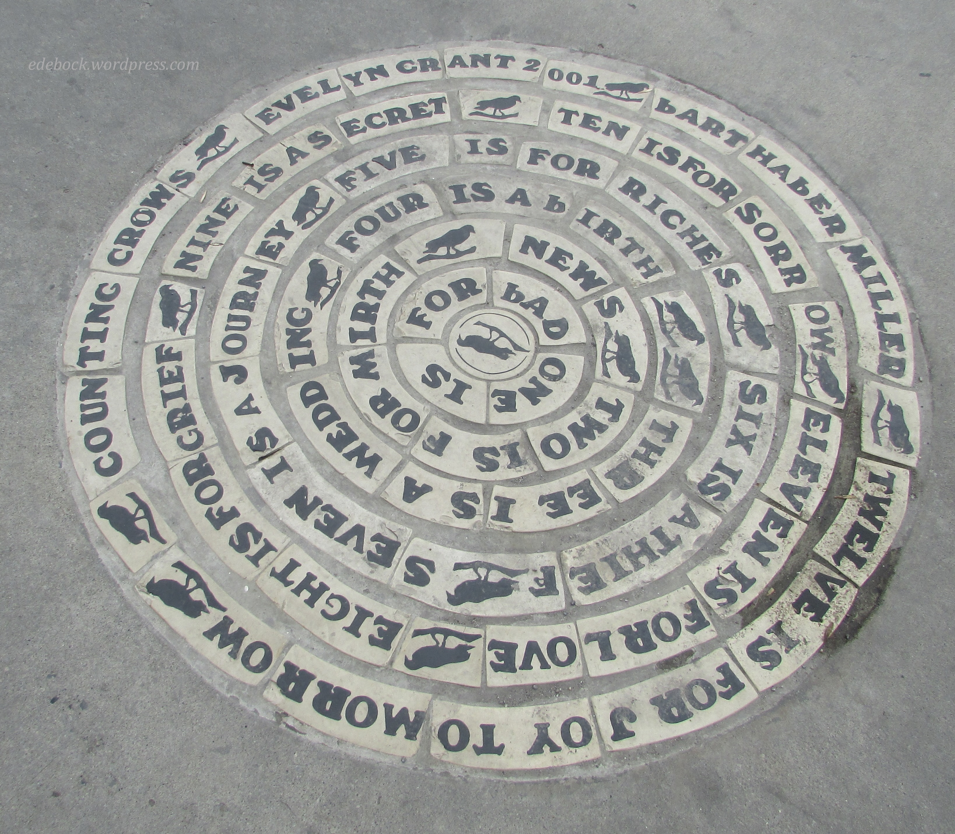
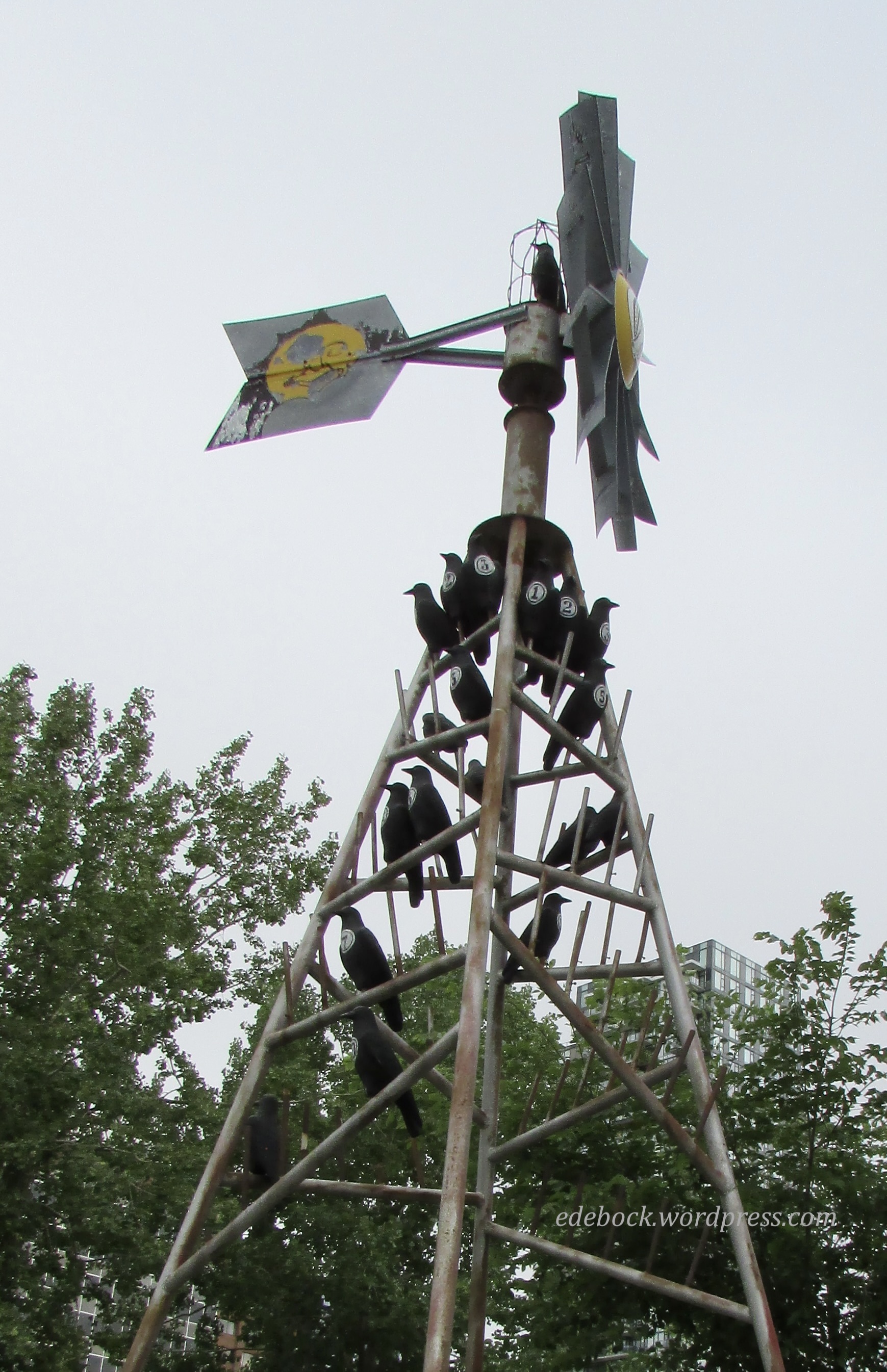
Across the street from the park at the corner of 4th Street SW and 13th Avenue SW stood what was definitely one of the strangest sculptures that we saw. Counting Crows was created by Calgary artist Evelyn Grant who handed it over to the city in 2001. Inspired by a traditional English rhyme that appears on the sidewalk below it, the sculpture resembles a windmill such as those that were once seen across the prairie. If you look closely, you’ll see that each realistic looking crow bears a number on its chest. 
IMG_5720

IMG_5723 2

By this time we realized that we weren’t far from the Calgary Board of Education building where our daughter works, so we stopped in for a very quick visit before beginning the long trek back to our vehicle. Across the Barb Scott Park, next to her building, I spotted the last piece of public art that we’d see. The shape of Chinook Arc drew it’s inspiration from the historic Beltline Streetcar loop that once encircled the neighbourhood, as well as the Chinook arch, a unique cloud formation that occurs along the eastern slopes of the Rocky Mountains. Though we didn’t get close enough to investigate, I’ve since learned that it’s an interactive and illuminated installation that would likely be quite something to see lit up after dark. 
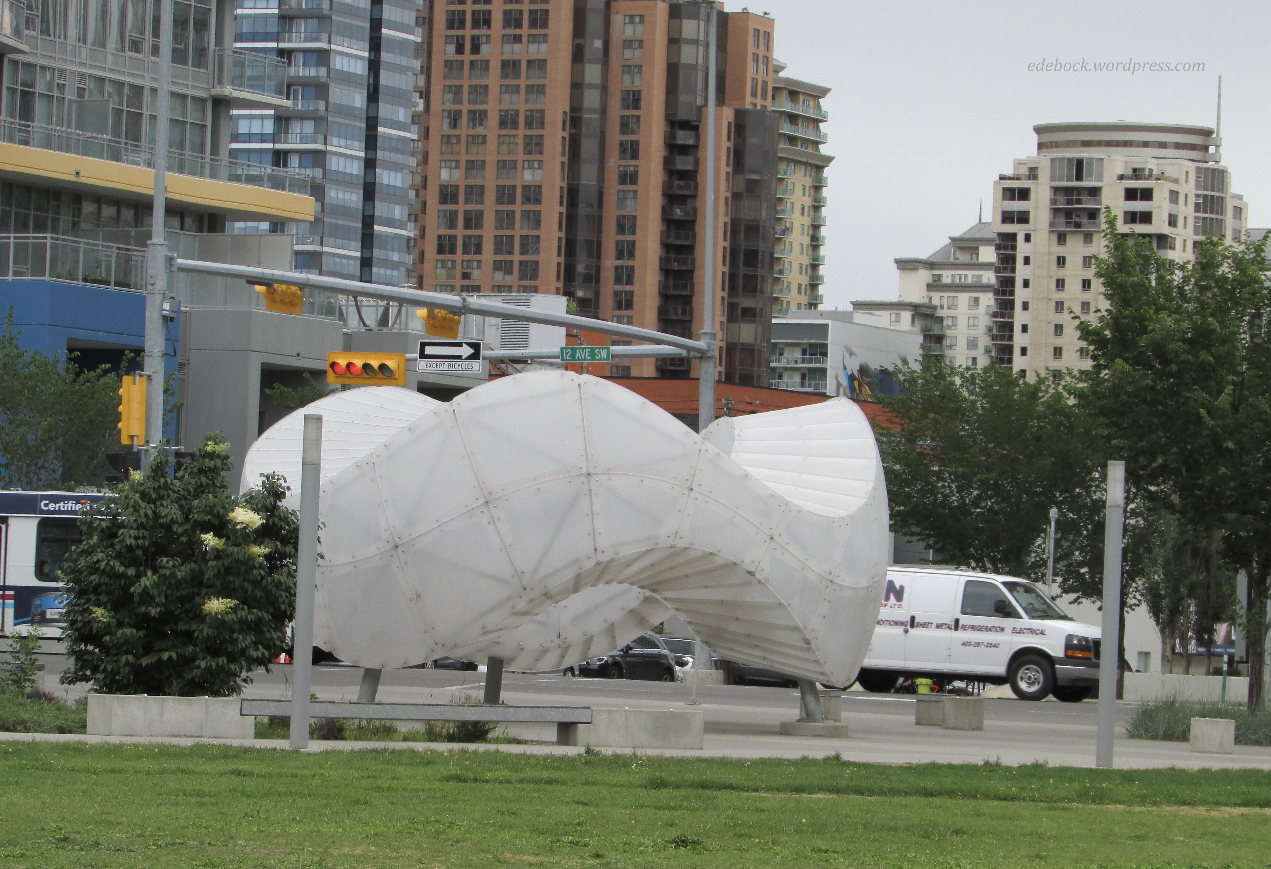
IMG_5731

As it was, we had to hoof it to meet our friend and get back to the parkade before our three hour time limit expired. We walked a total of 8.72 km (5.42 miles) and proved to ourselves once again that walking is the best way to see a city! 
Hiking again!

We’ve tried to go for a walk almost every day since hubby’s prostate surgery. The first was a very slow shuffle to the end of our short block and back, but it wasn’t long before he was able to handle a couple of kilometres. Last week, when we saw the surgeon for his six week check-up, we got the good news that he is cancer-free and that with the exception of very heavy lifting, he could resume his normal activities. Today, exactly seven weeks post surgery, we did a fairly strenuous 6.5 km hike!

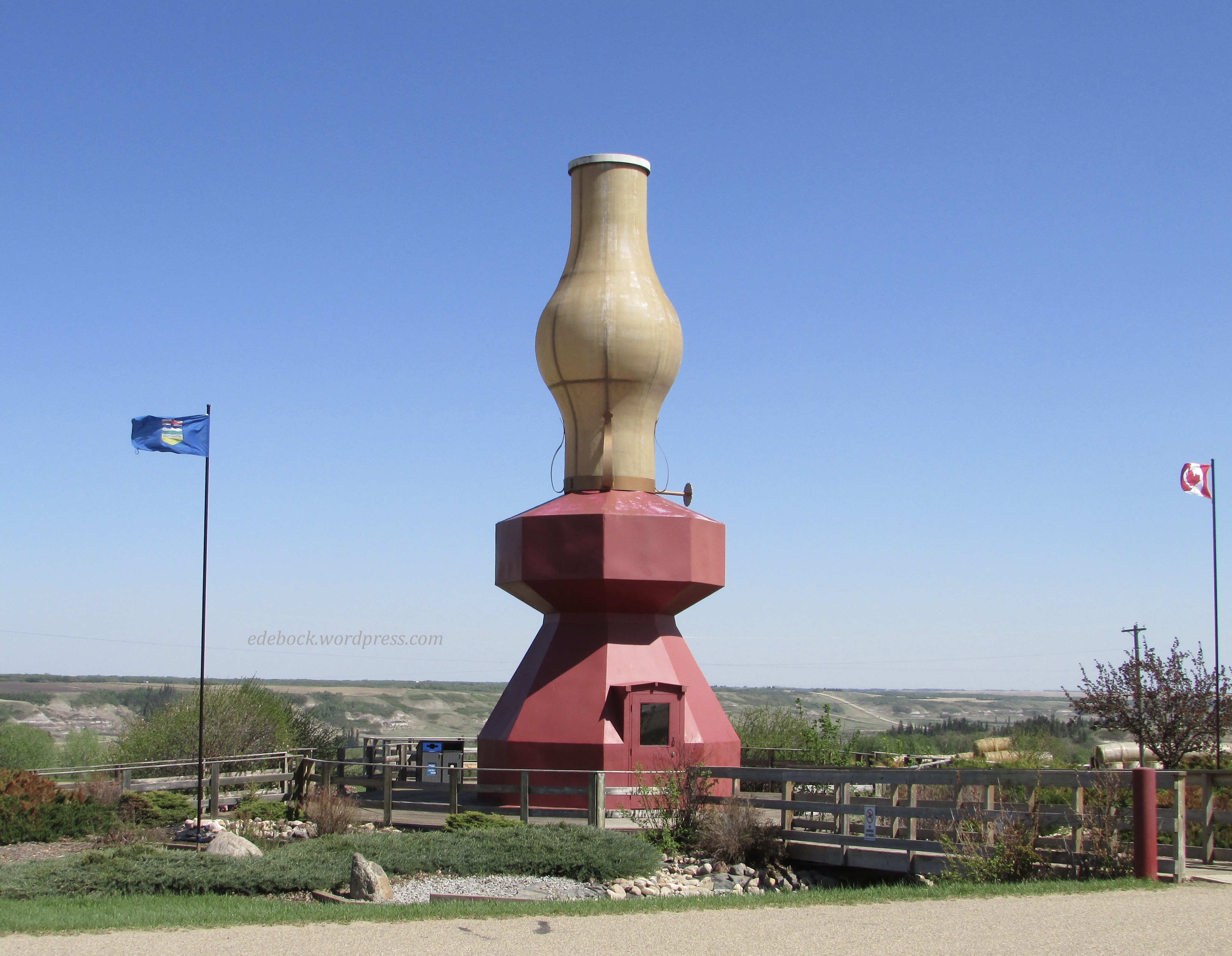
About an hour from home, the Willow Canyon Trail at Donalda, Alberta has become one of our favourite hiking spots. The tiny village of Donalda is perched on the rim of picturesque Meeting Creek Coulee, the northernmost point of the Canadian badlands. It is best known for the 42 foot high replica of an oil lamp that lights up at dusk each day and and sheds its light over the coulee.

IMG_5528

The trailhead is located just north of the lamp and the old restored train station located nearby.

IMG_5526

The hike begins as a woodland trail that passes through private land to access 120 acres of fenced Donalda Ag Society property where visitors are free to leave the marked trails and explore to their hearts content.

IMG_5525

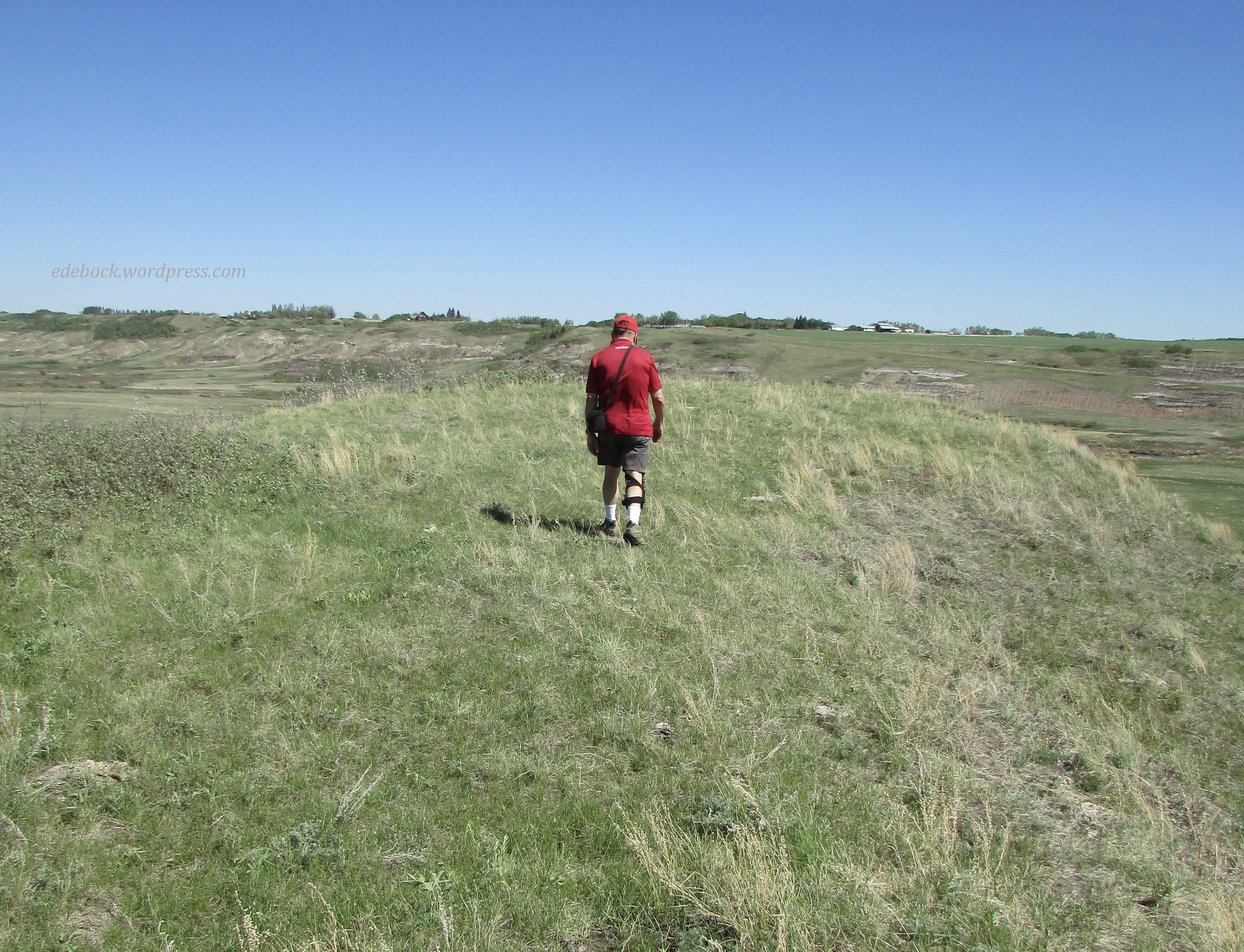
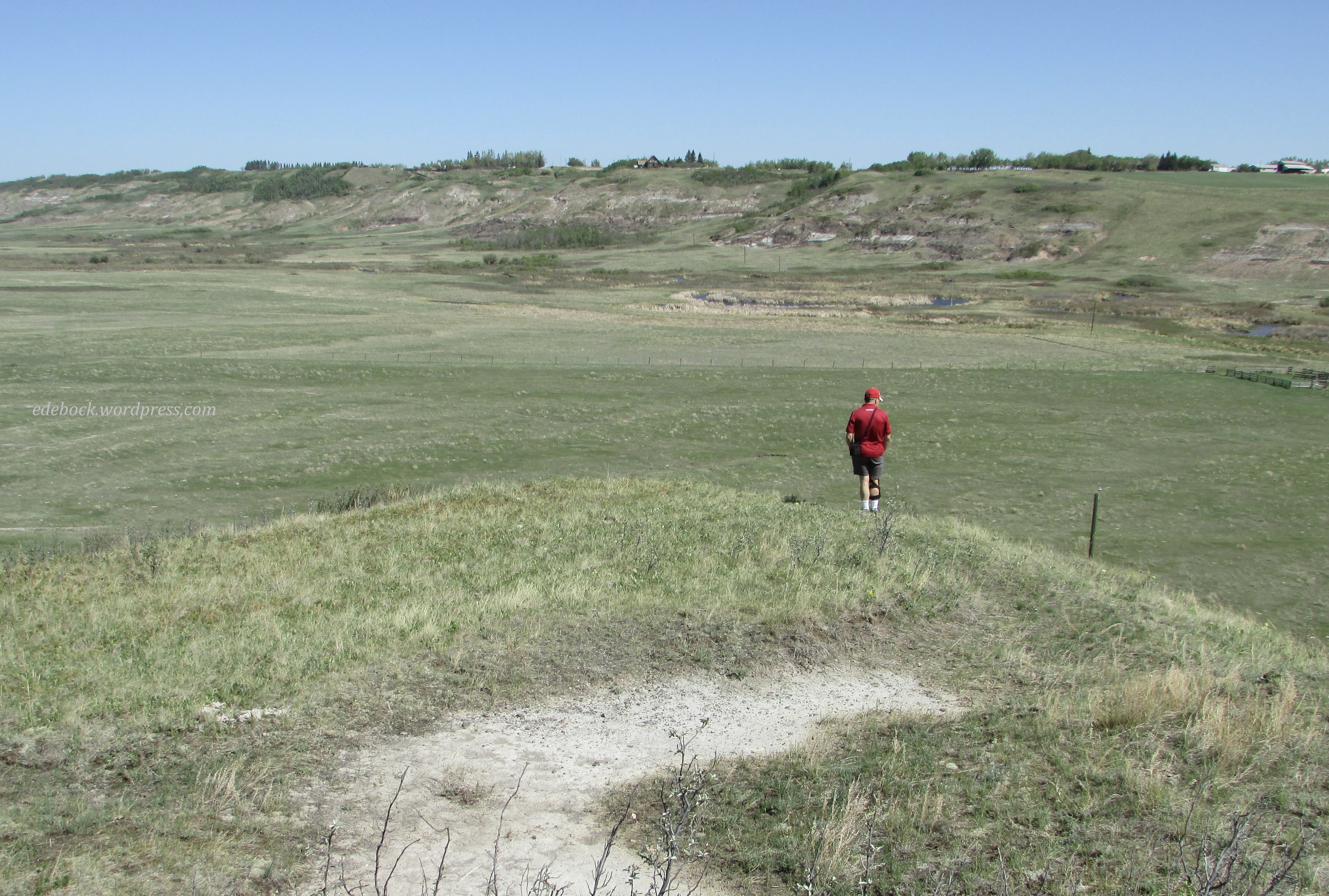
The established trails, which have been enhanced with signage and maps since our last visit, are generally quite easy and stay for the most part along the upper edge of the coulee. We, however, like to leave the beaten track and drop down into the valley wandering up, down, and around the bluffs that form its walls.

IMG_5502

IMG_5507

We climbed to the top of that little knoll because… well, just because we could!

IMG_5508

IMG_5510

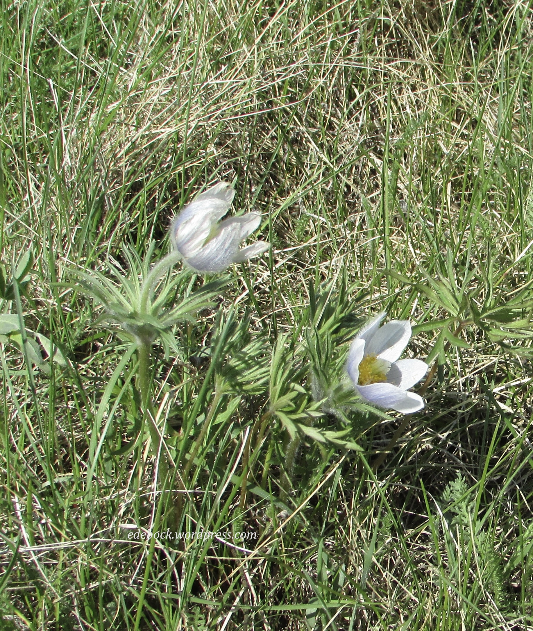
I was delighted to discover that we were early enough in the season to find a few prairie crocuses still in bloom. It was a windy day, but these two were in a slightly sheltered spot where I could get a reasonably good photo.

IMG_5520 2

IMG_5519

IMG_5518

Eventually, after a couple of hours of wandering and eating the picnic lunch that we brought with us, we made our way up out of the canyon and back to town where we enjoyed a treat at the recently reopened Coulee Tea House. Under new management, it’s a delightful little restaurant serving a wide variety of teas as well as other beverages, sandwiches, soup, salads, and wonderful desserts. Since we often pass by Donalda on the highway, we’ll definitely plan to stop in for lunch another day even if we aren’t there to hike!

Centro Histórico, Mexico City

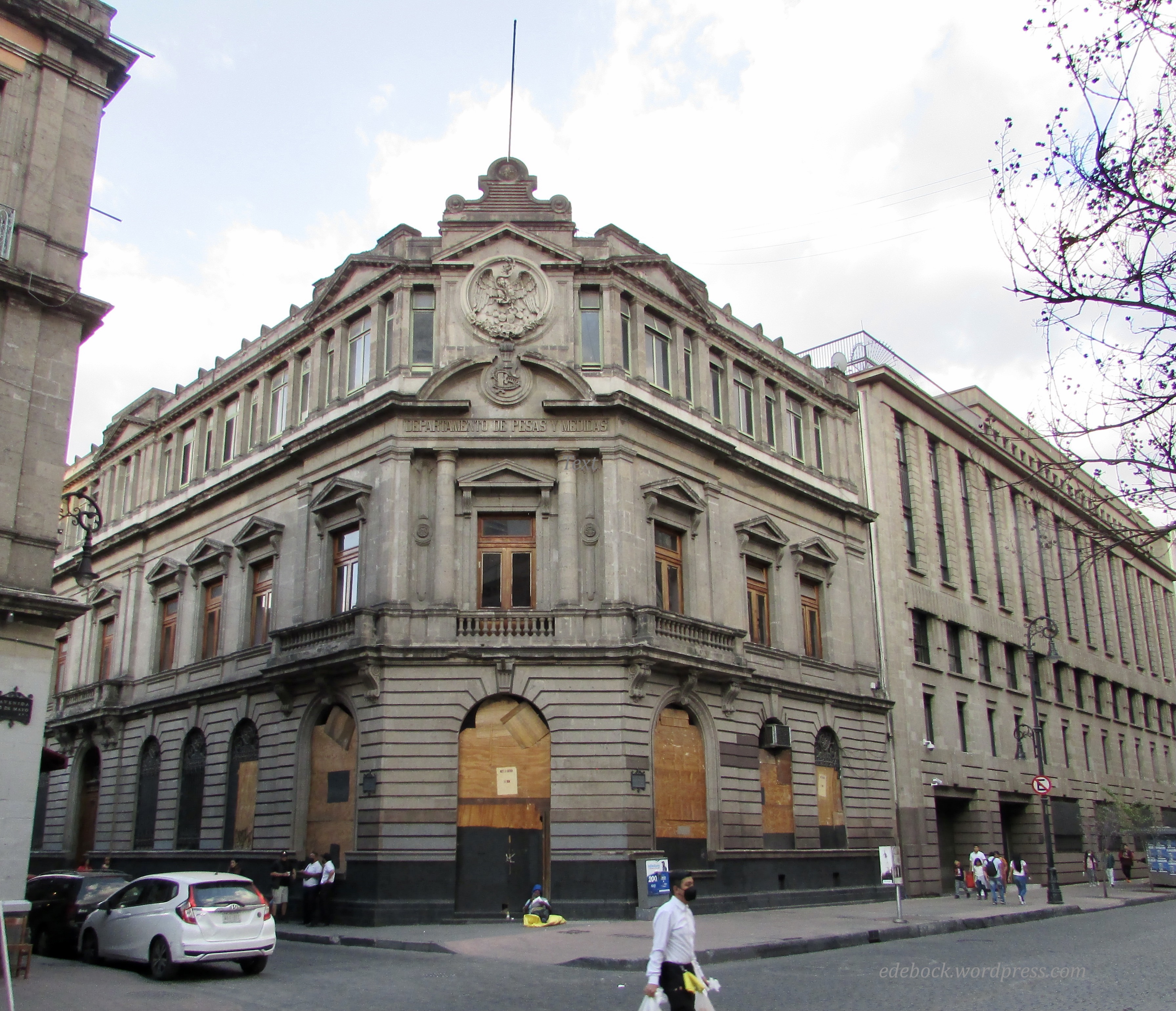
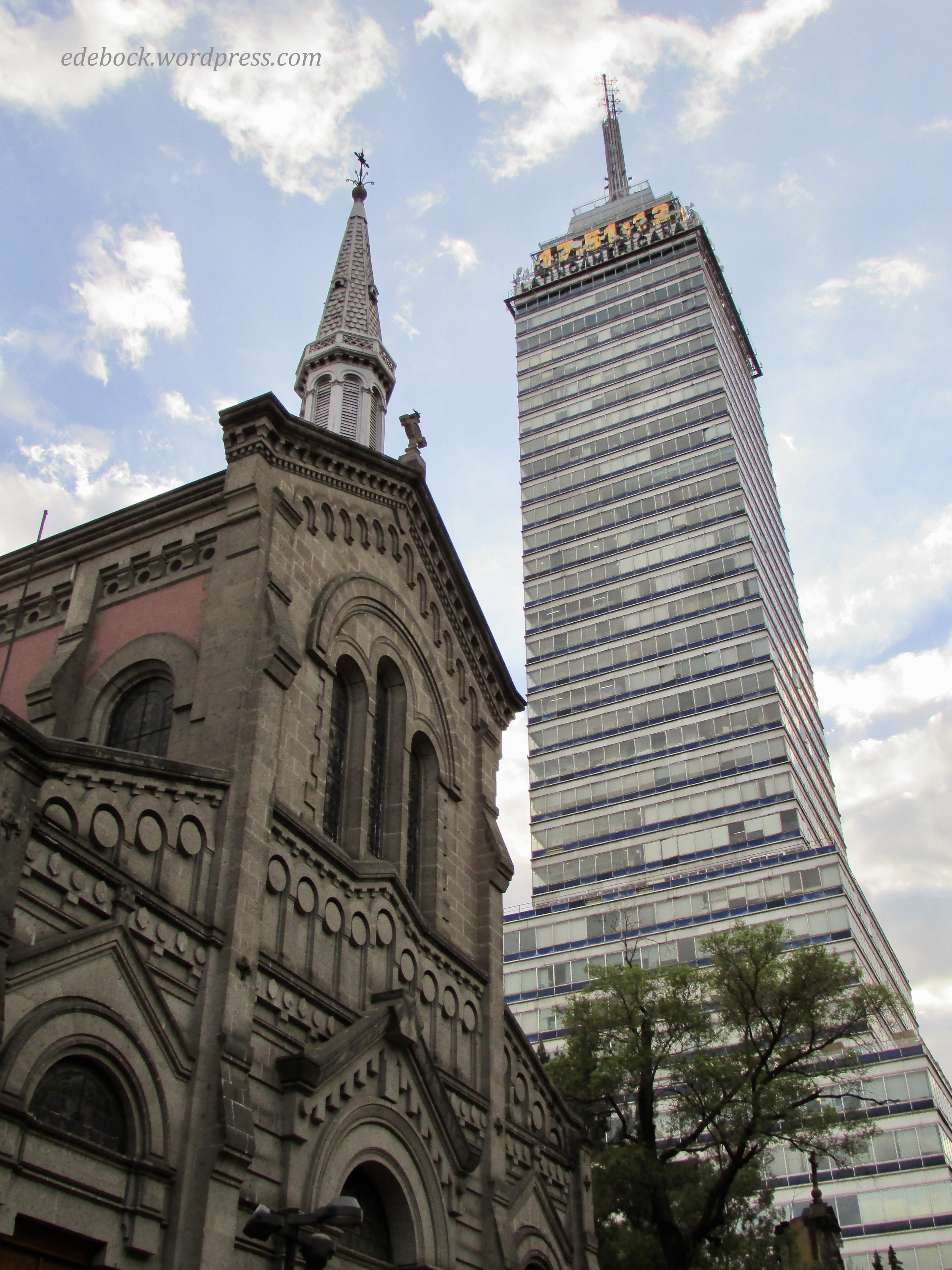
We packed a lot into our final day in Mexico. Much of what we saw and experienced was within walking distance of our hotel in the Centro Histórico, the heart of Mexico City. Come walk with me and I’ll show you some of what we saw.

IMG_5433

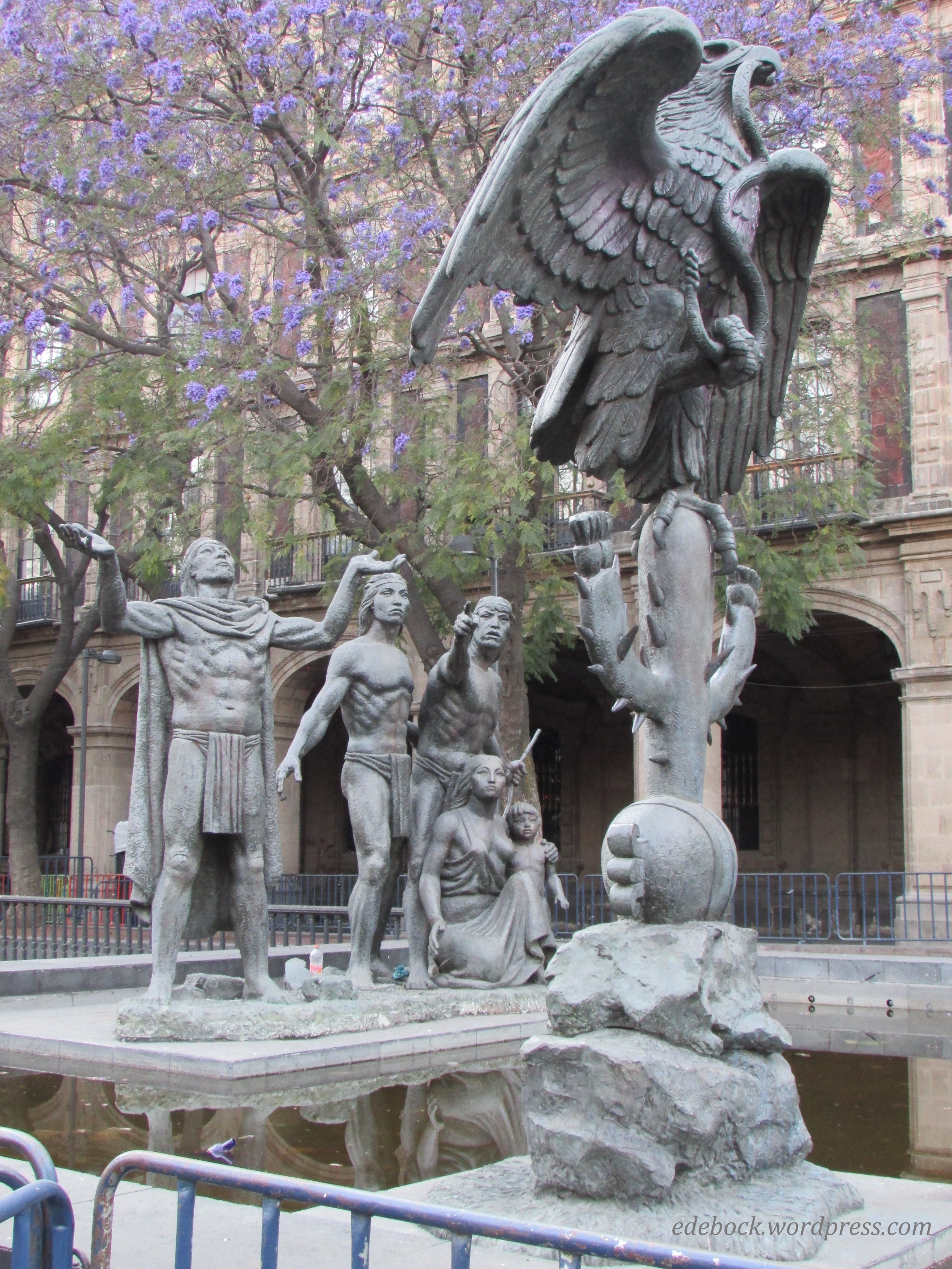
These statues of a wandering group of nomads discovering an eagle perched on a cactus and eating a snake tell the legend of the founding of the Aztec capital, Tenochtitlan. The image of an eagle eating a snake atop a prickly pear cactus also forms part of the coat of arms that is seen in the centre of the Mexican flag. 

Flag-Mexico

Cathedral

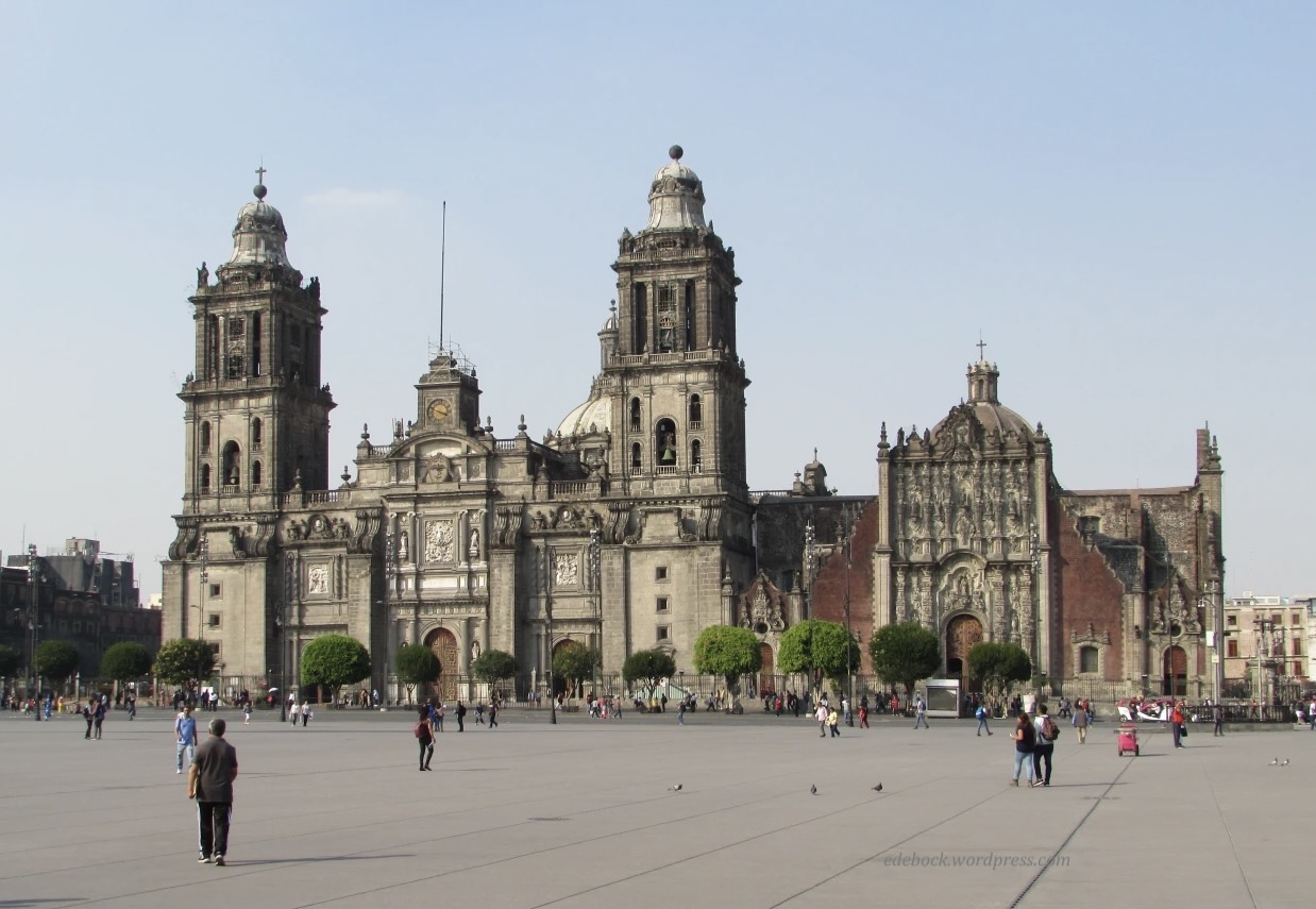
The Metropolitan Cathedral of the Assumption of the Most Blessed Virgin Mary into Heaven, better known as the Catedral Metropolitana, overlooks the Zócalo, a huge city square and is built over what was once part of the Aztec Templo Mayor.

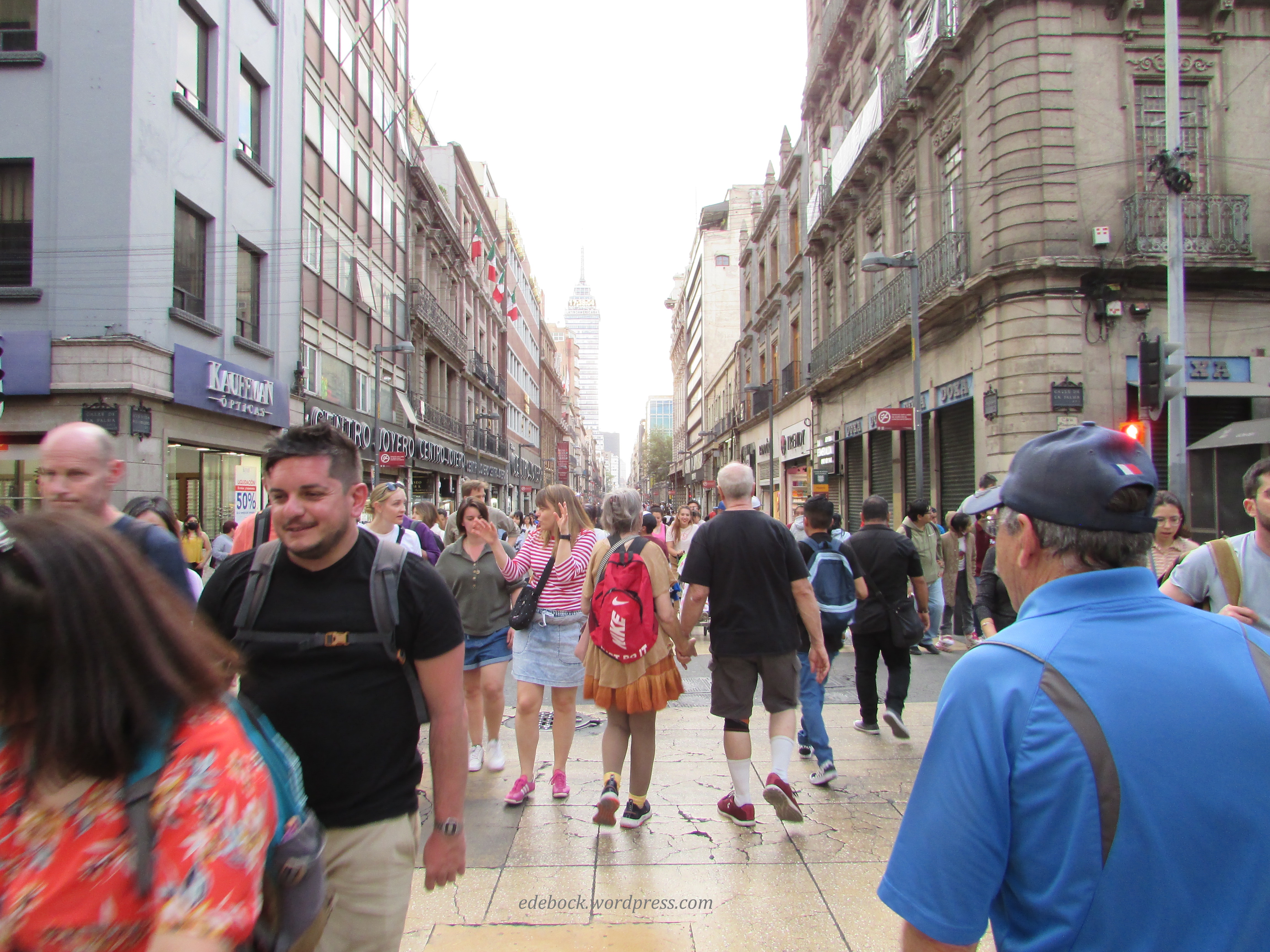
From there, we’ll walk down busy pedestrian-only Avenida Francisco I. Madero which is lined with shops, restaurants, and amazing architecture.

IMG_5325

IMG_5328

IMG_5349

IMG_5330

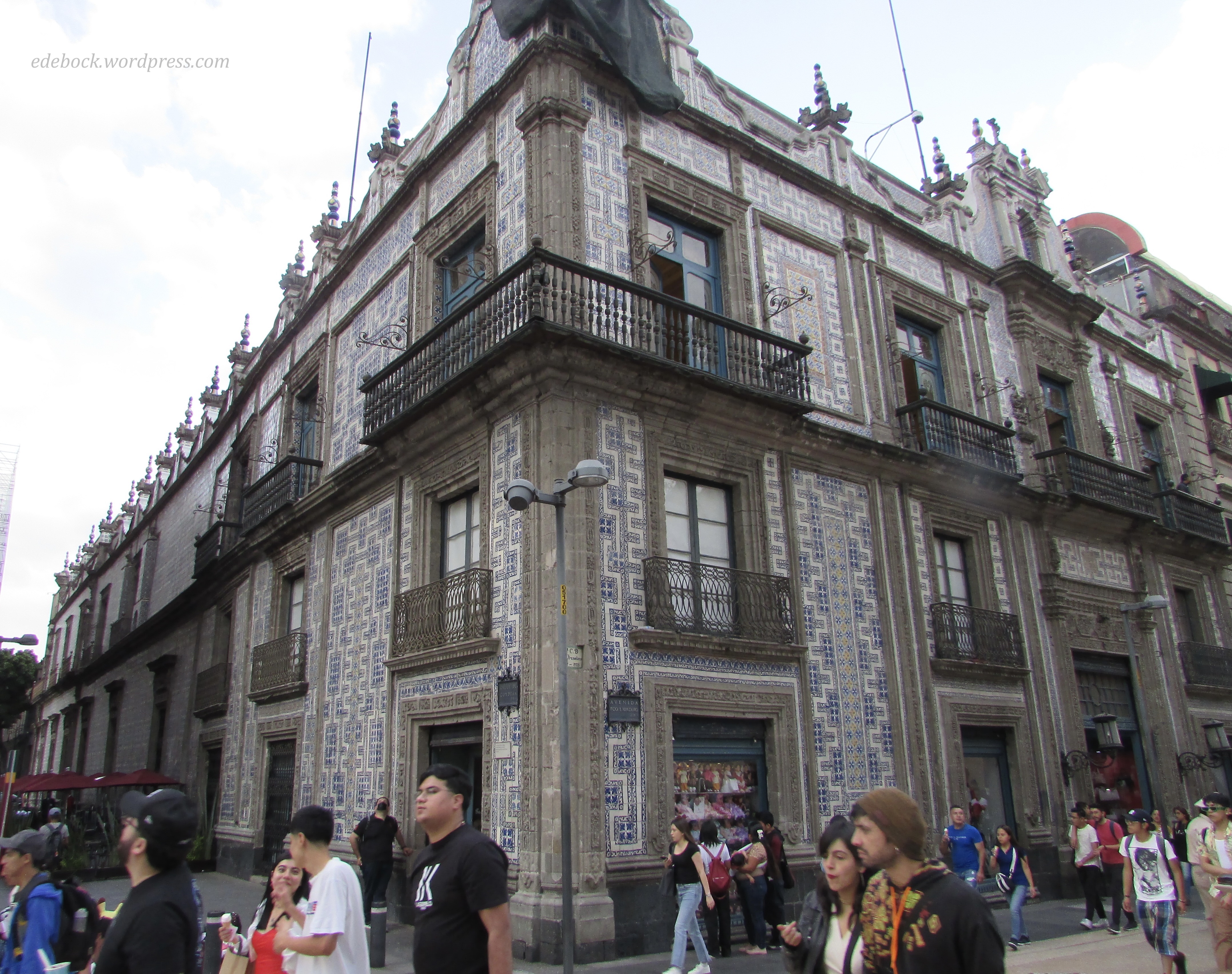
Here, covered on three sides by blue and white Talavera tiles from Puebla, is the famous Casa de los Azulejos (House of Tiles), an 18th-century Baroque palace built by the Count of the Valle de Orizaba family. 

IMG_5337

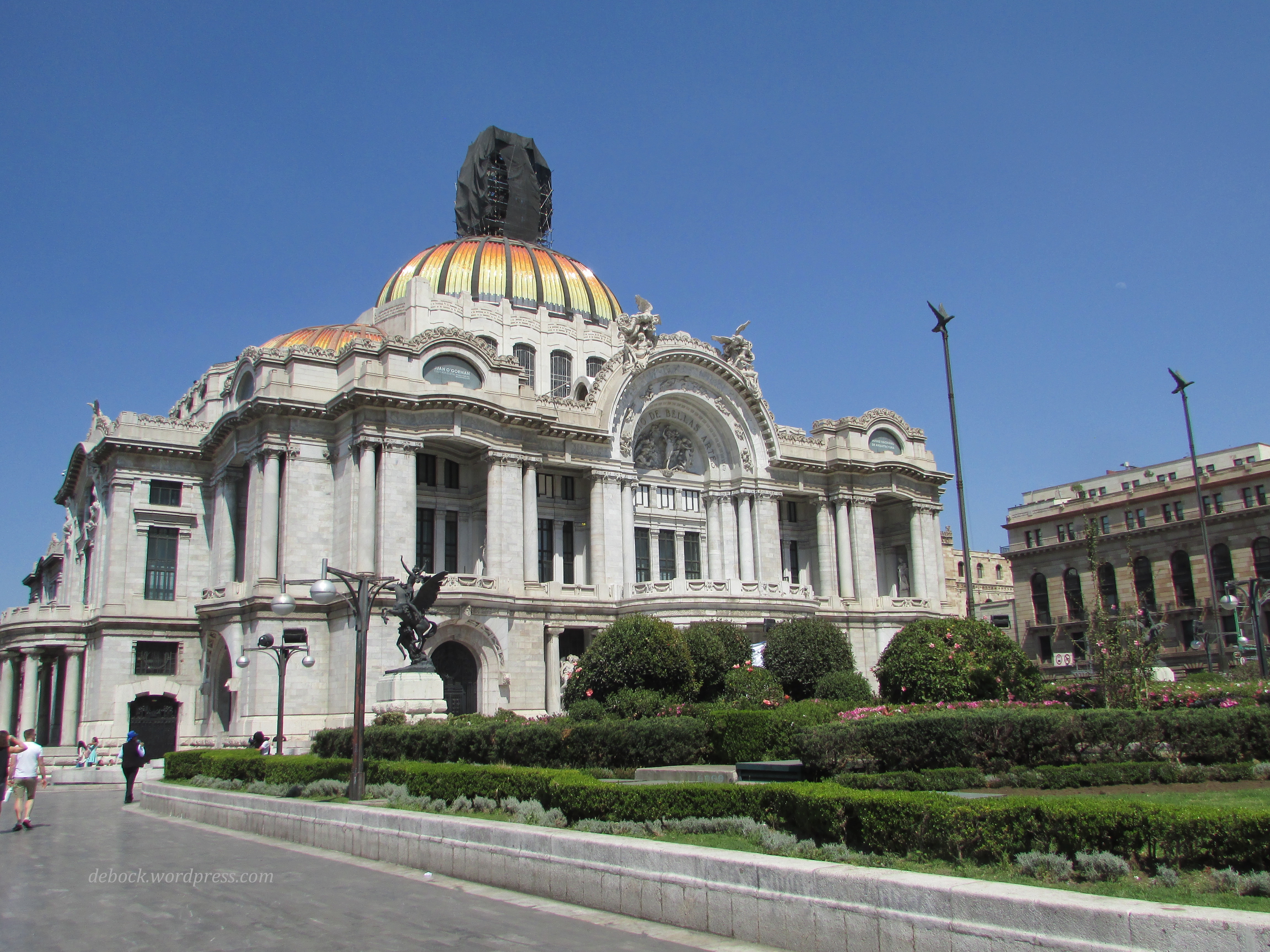
At the end of the pedestrian avenue, we come to the stunning Palacio de Bellas Artes (Palace of Fine Arts), a prominent cultural center that hosts notable events in music, dance, theatre, opera and literature and holds important exhibitions of painting, sculpture and photography. Unfortunately, most museums and cultural centres in Mexico City are closed on Mondays, so we weren’t able to see the inside. Perhaps on our next visit! 

IMG_5394

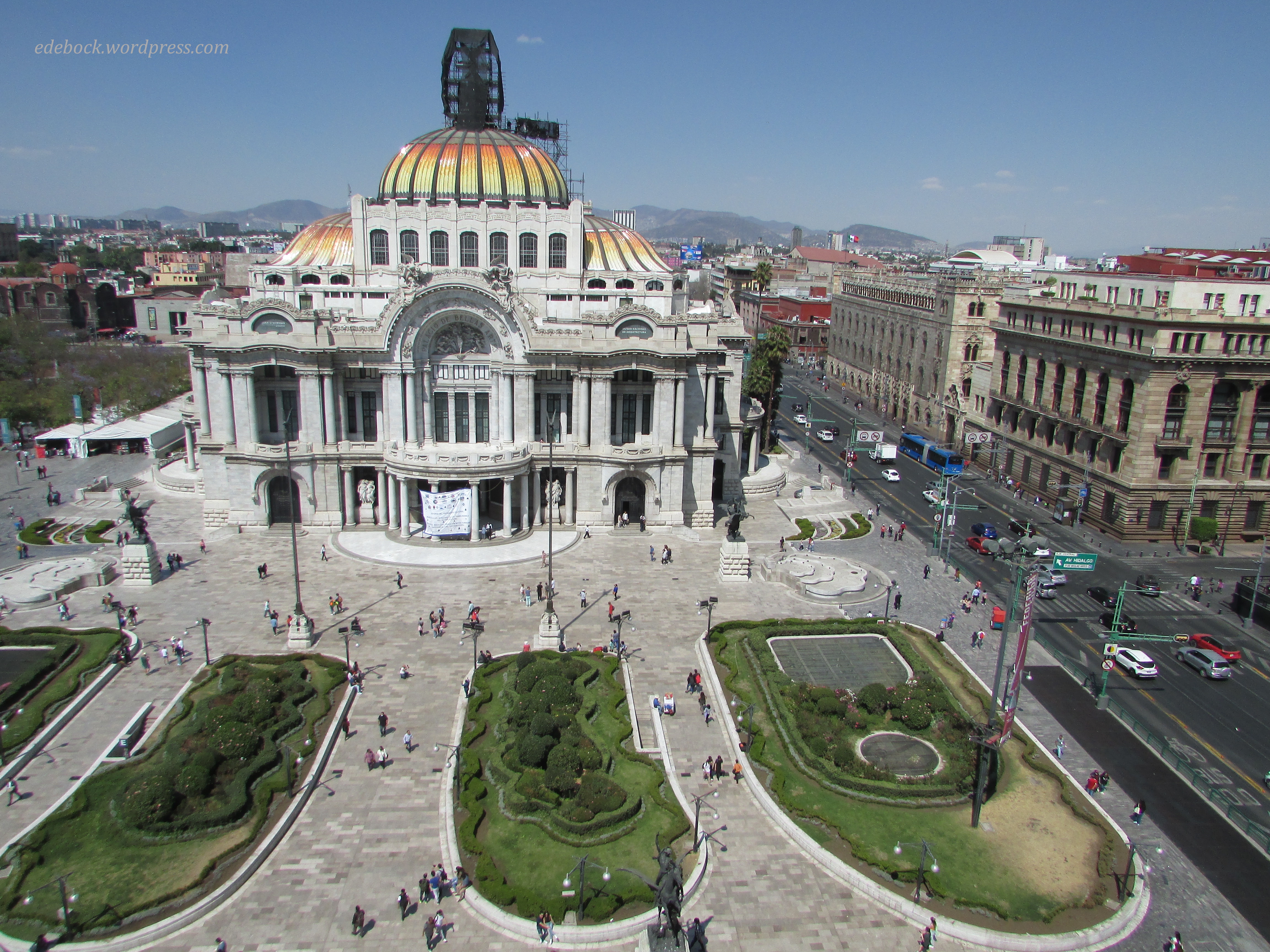
A patio coffee shop on the eighth floor of the Sears department store (yes, Sears is still alive and well in Mexico) offered spectacular views of the Palacio des Belle Artes and much of the city beyond. 

IMG_5398

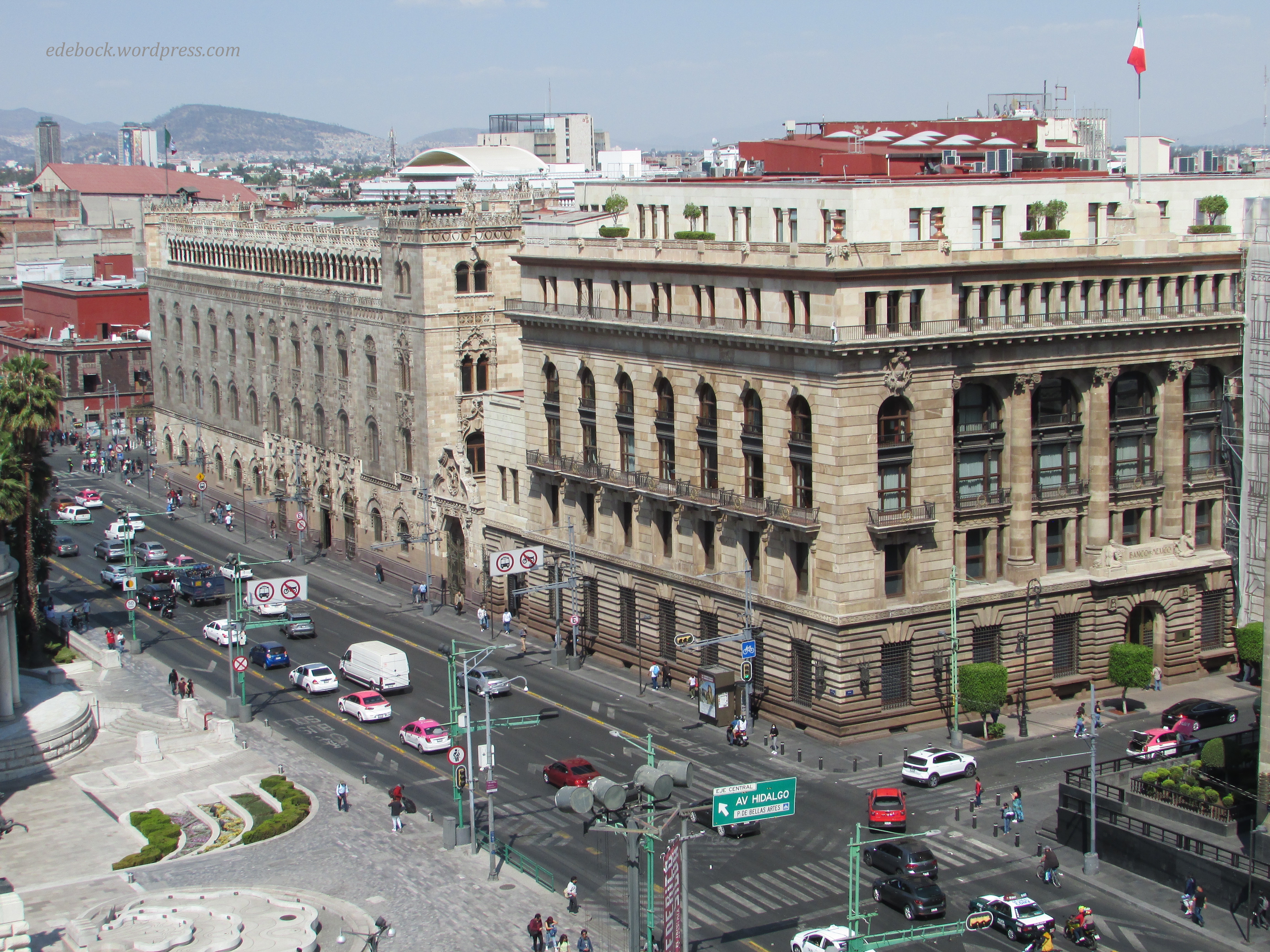
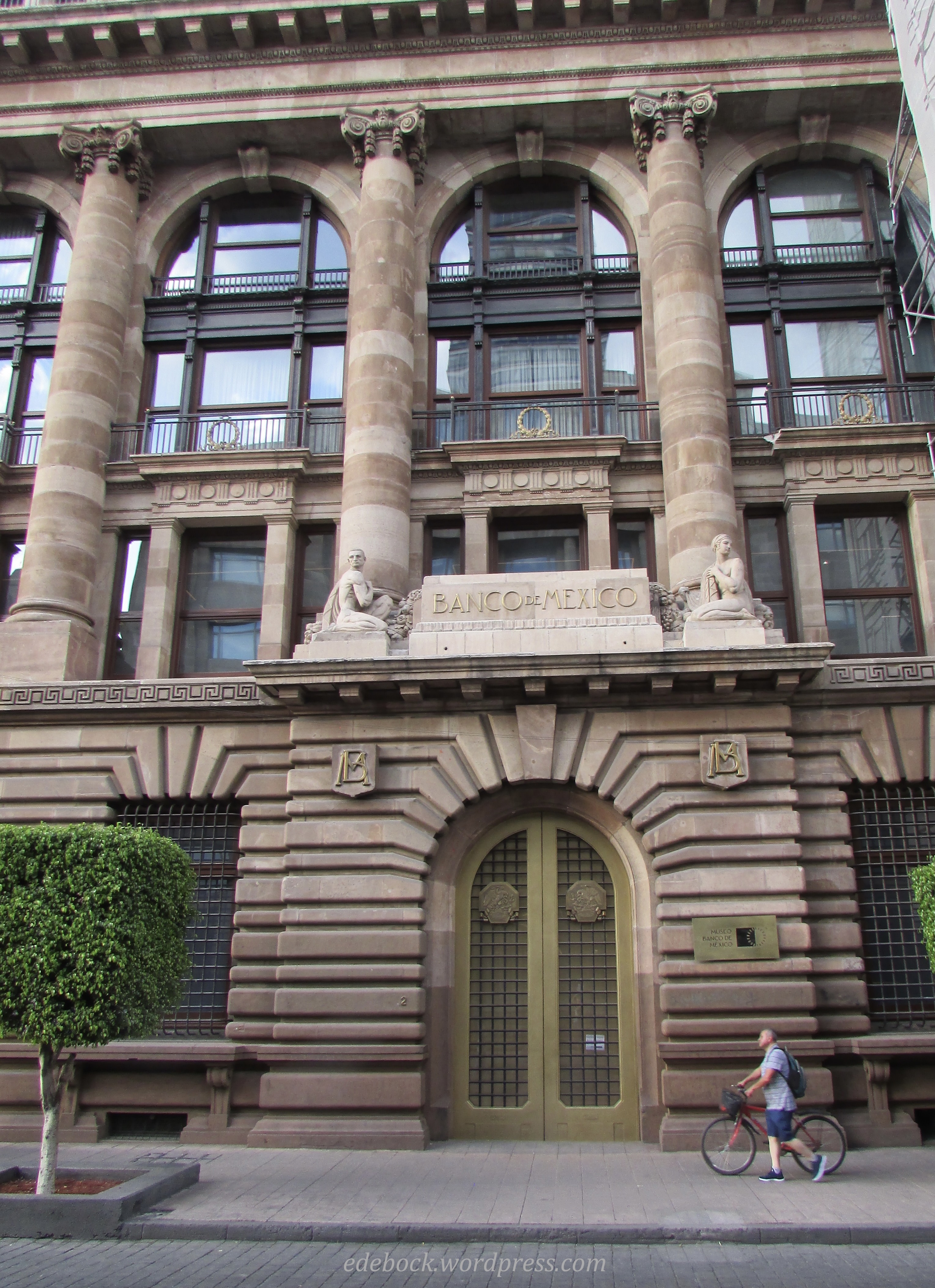
Directly across the street from the Palacio des Belles Artes are the Palacio de Correos (Main Post Office) and Banco de Mexico (Bank of Mexico).

IMG_5399

IMG_5345

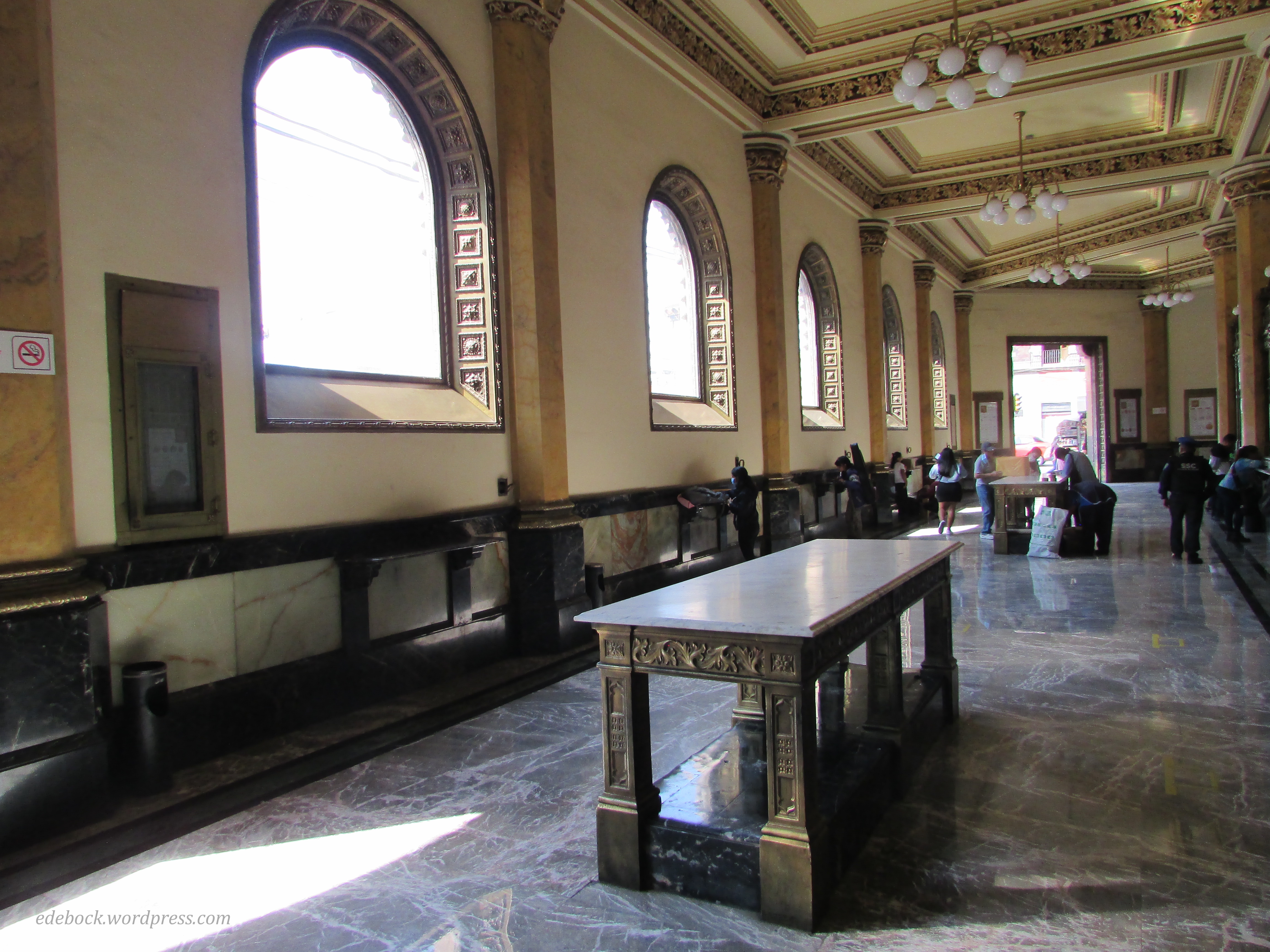
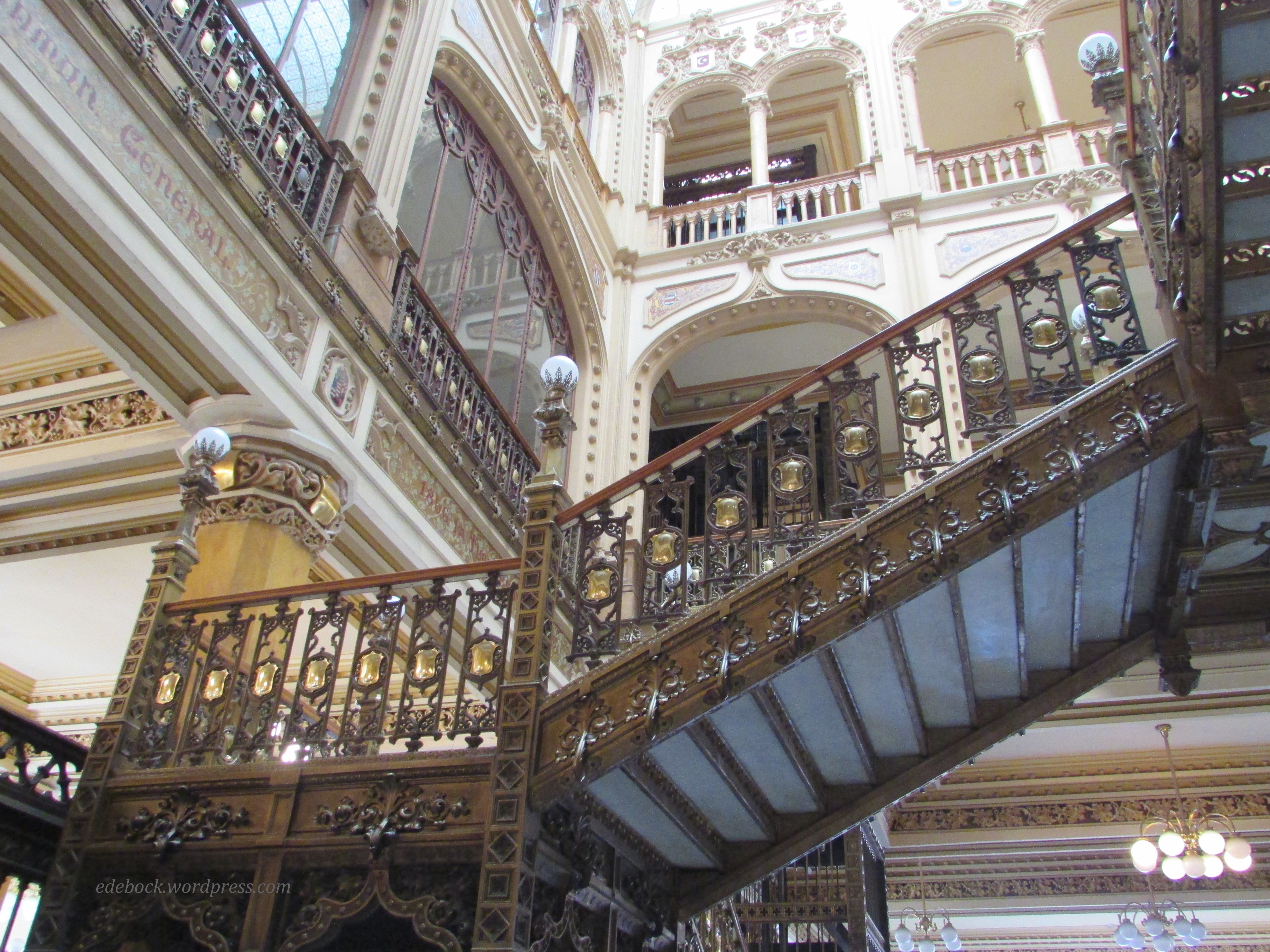
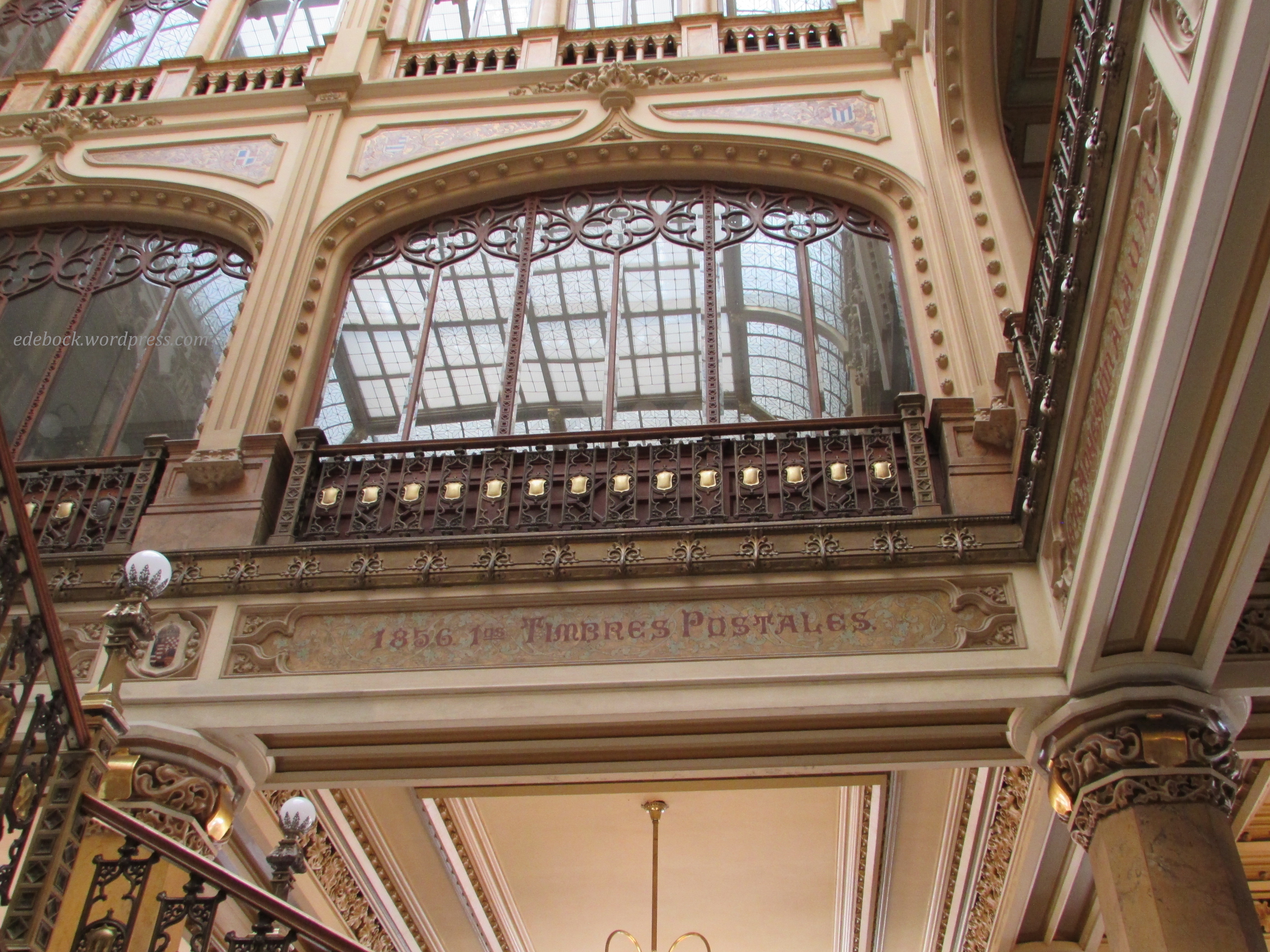
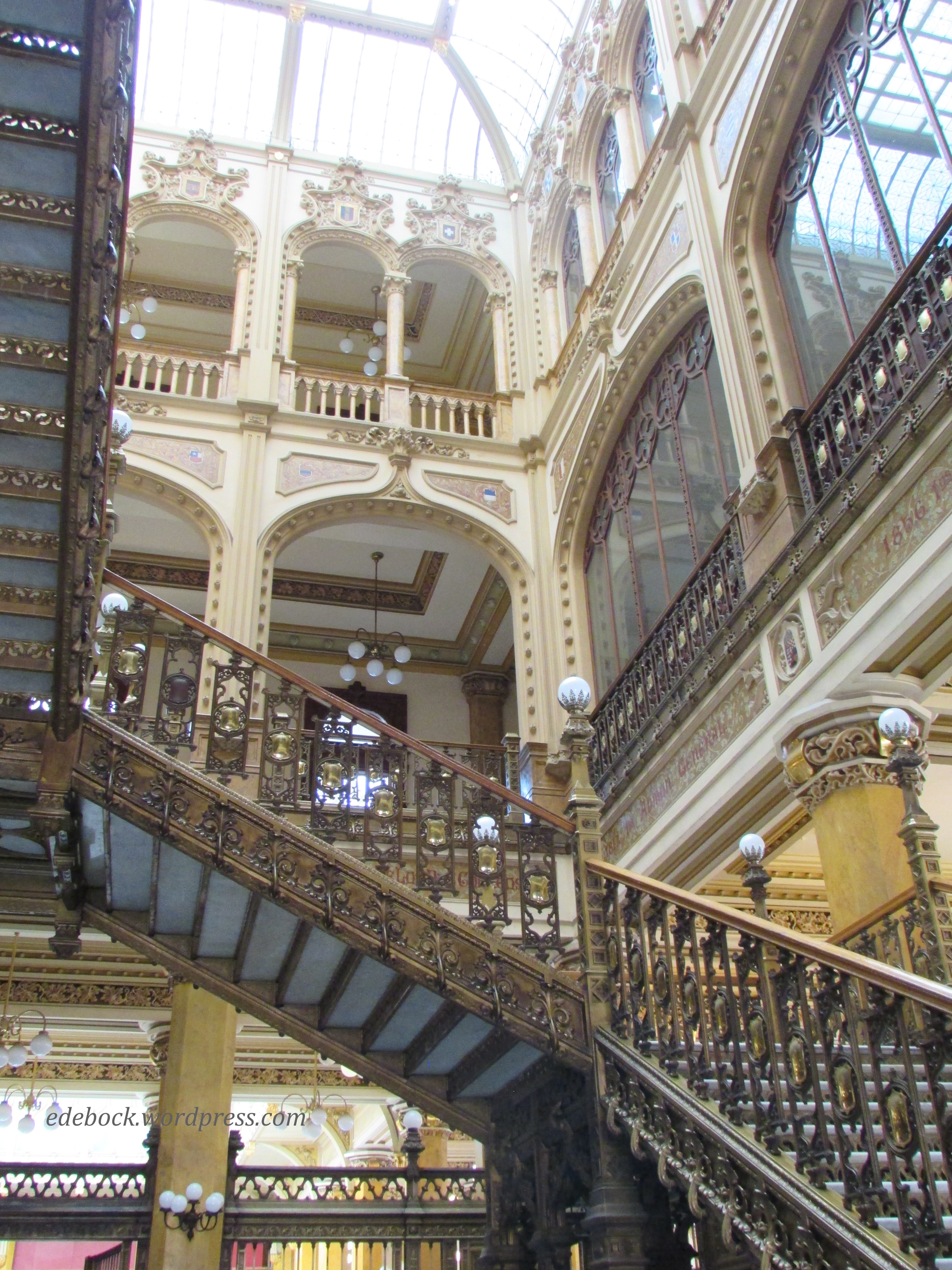
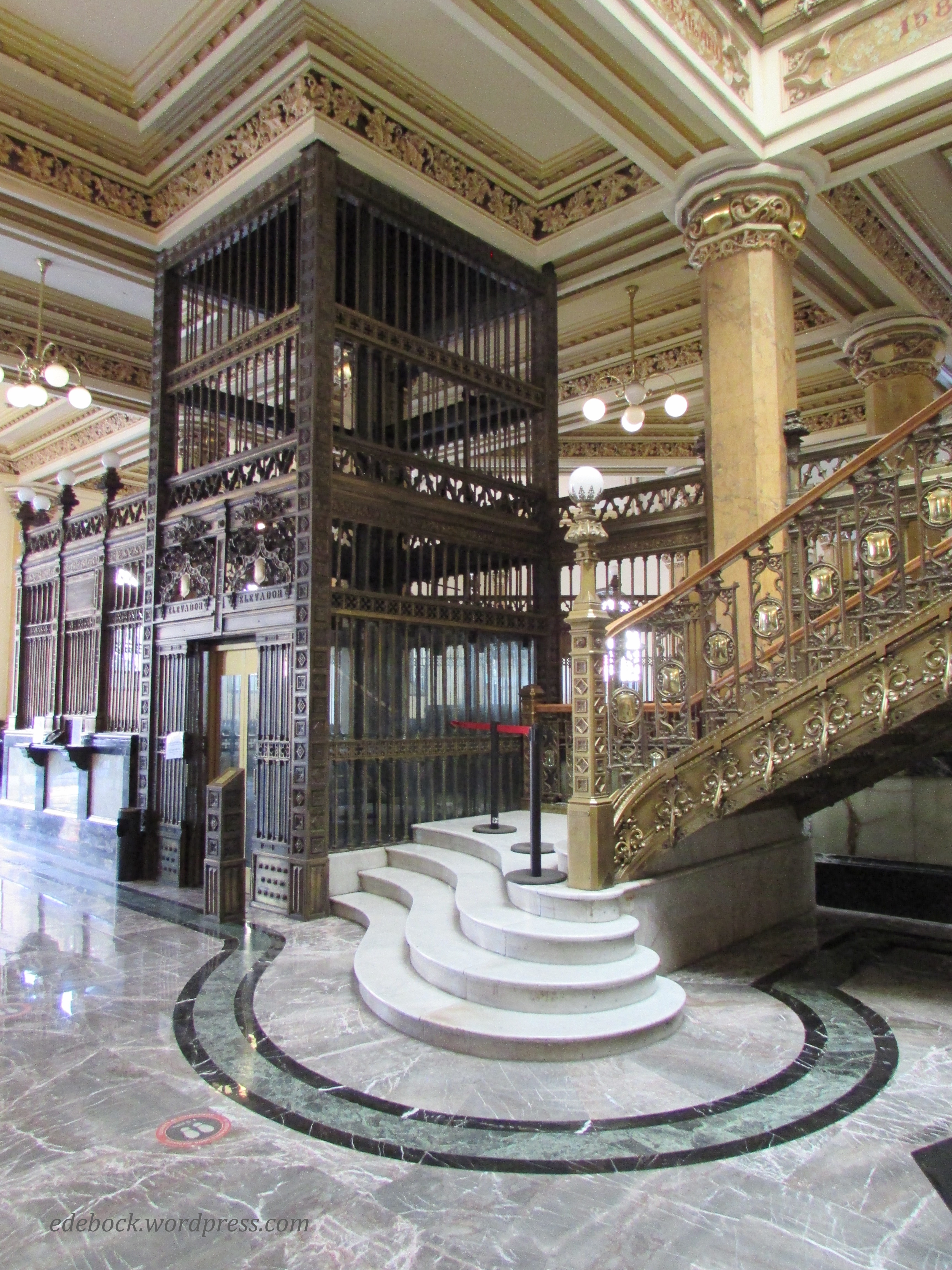
If you’re ever in Mexico City, the interior of the Post Office is definitely a must see! Absolutely stunning, it took five years to build and has been in continuous operation since it opened in 1907.

IMG_5406

IMG_5417

IMG_5416

IMG_5414

IMG_5420

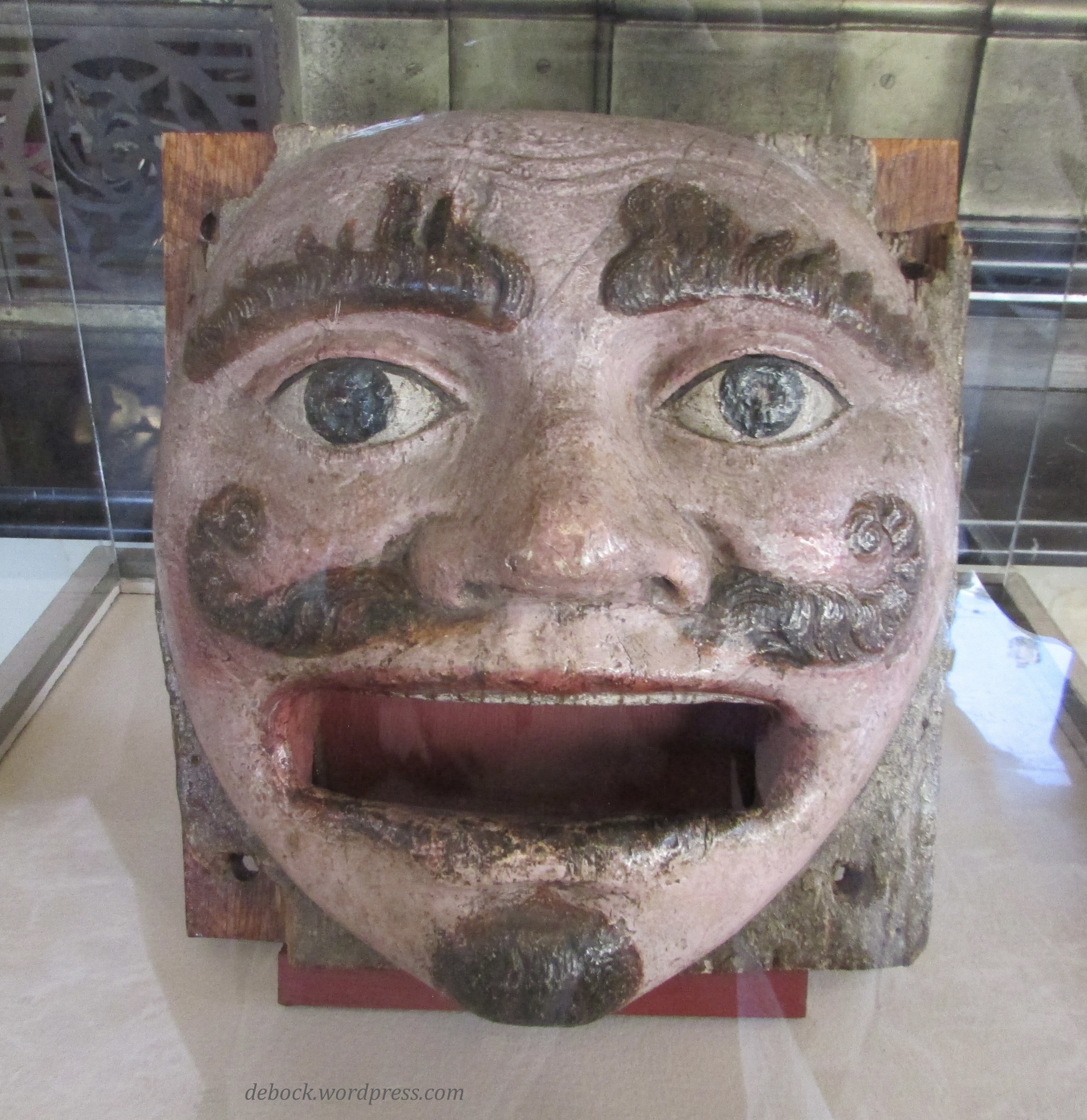
Unfortunately, the antique elevator, though fully operational, wasn’t open to the public. In addition to being an active post office, the building houses a bookstore and a small free museum of postal artifacts. Believe it or not, this handsome fellow is an ancient mailbox! Letters passed through his mouth to be collected and sent to their destination. 

IMG_5425

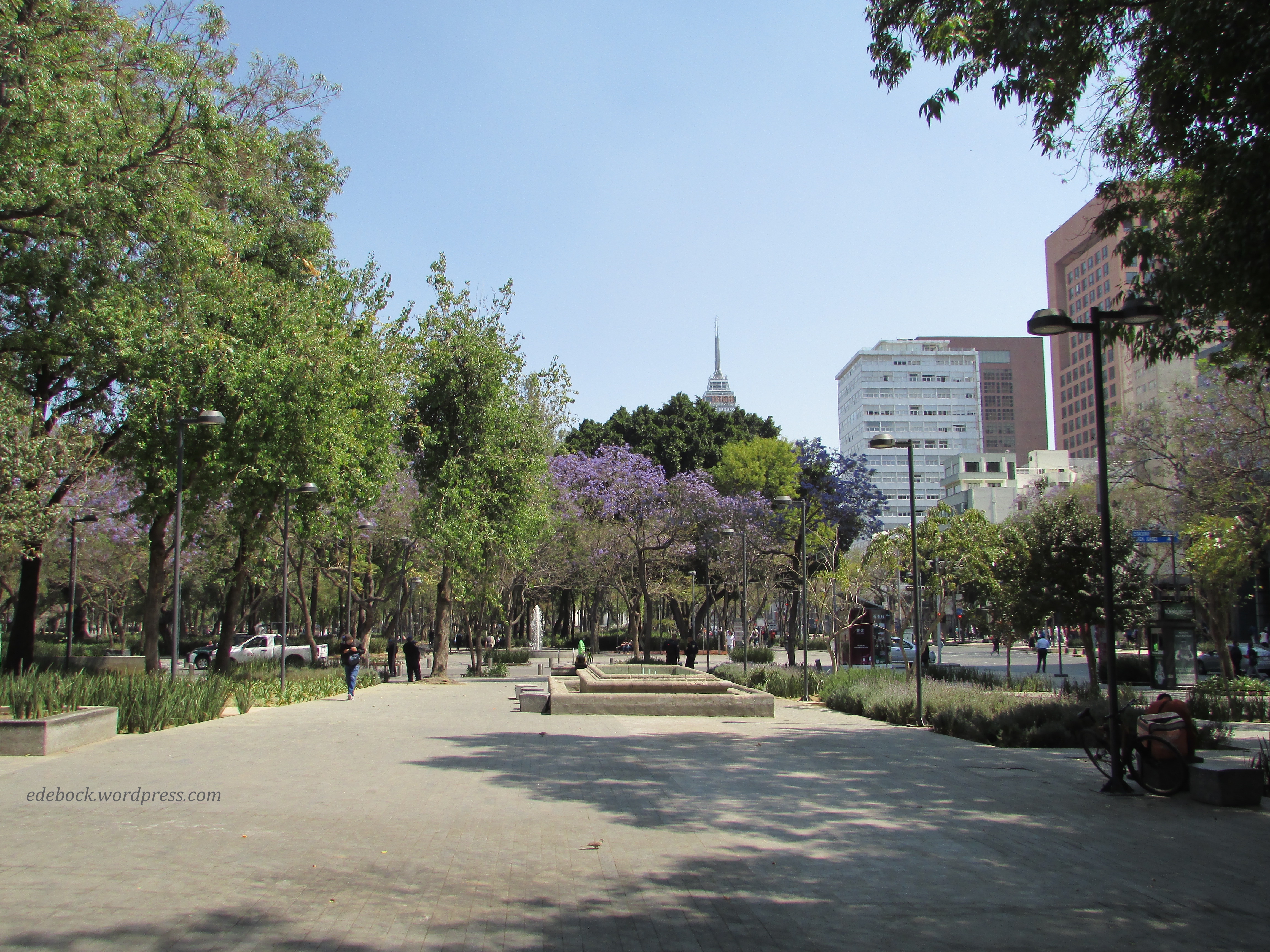
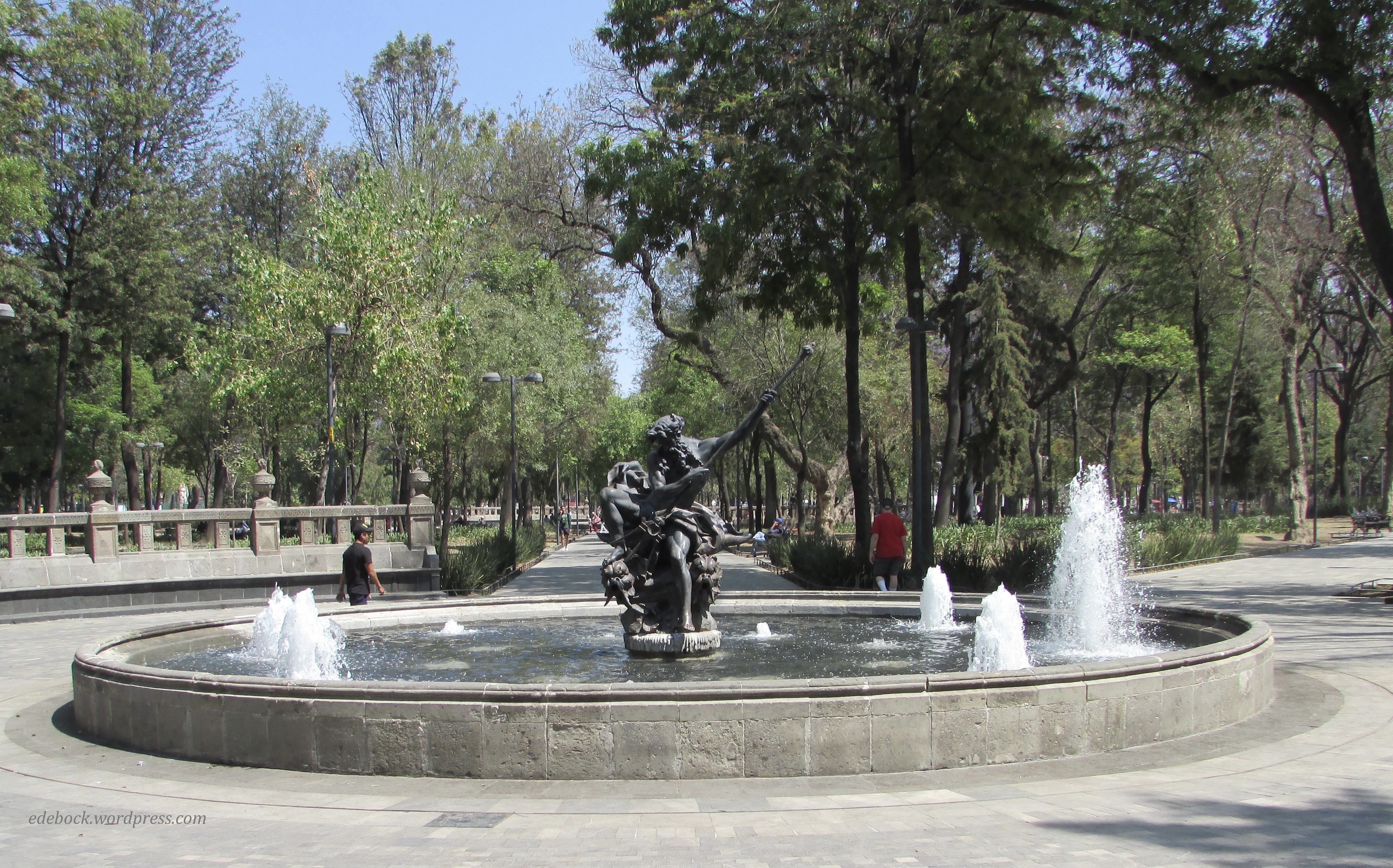
Beyond the Palacio des Belles Artes is beautiful Parque Alameda. What was once an Aztec marketplace is now one of the city’s primary green spaces complete with fountains and statues. Created in 1592, it is the oldest public park in the Americas. 

IMG_5372

IMG_5379

IMG_5381

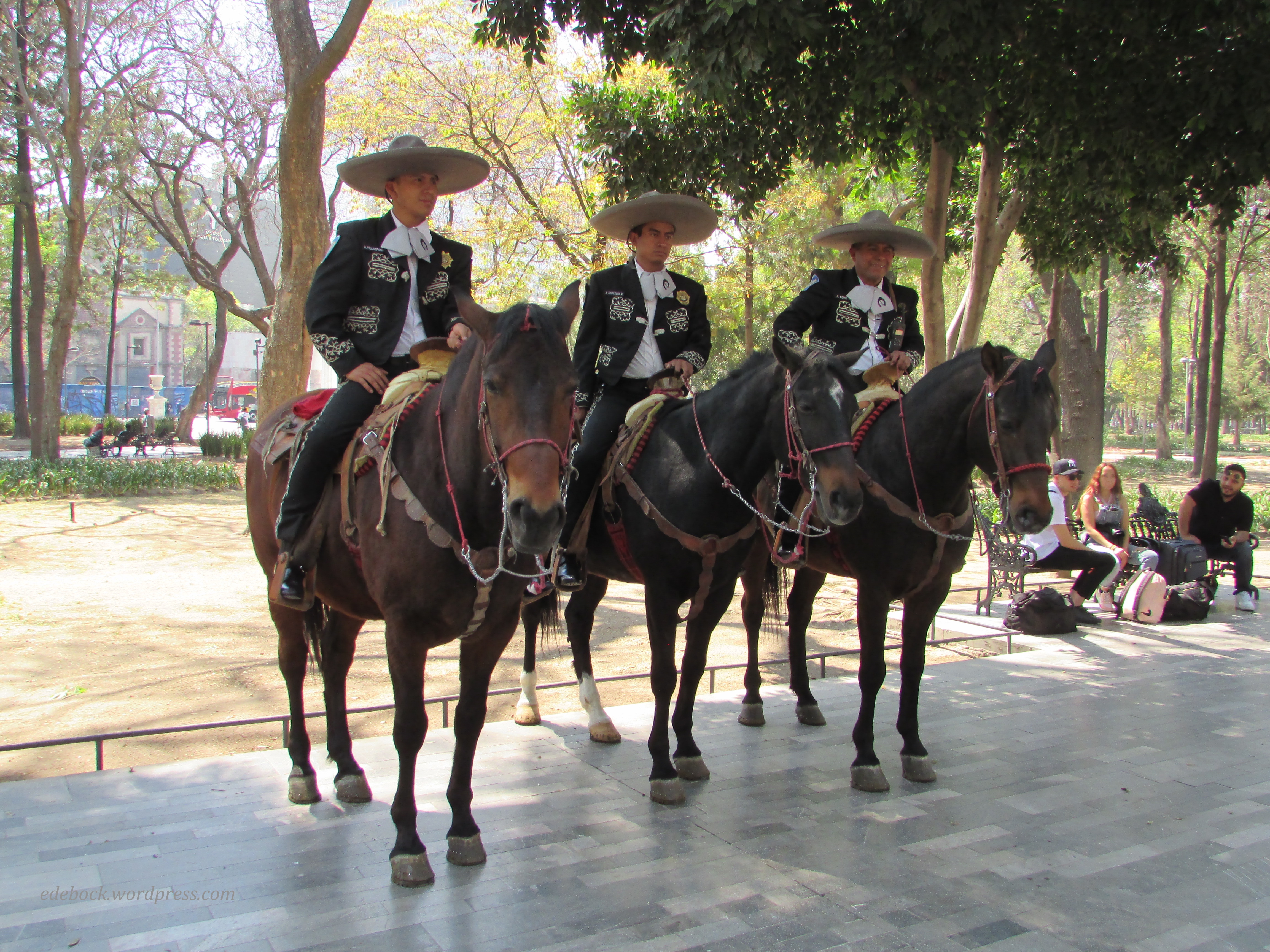
It was in the park that three mounted police officers on horseback donned their sombreros and agreed to have their photo taken. 

IMG_5386

That completes our “walking tour” of Centro Histórico and our most recent trip to Mexico. Now we’re back home in Canada, the land that every Mexican we met referred to as “mucho frio!” (very cold!) I would agree. In fact, I would call it “demasiado frio!” (too cold!).

Ukrainian Cultural Heritage Village

IMG_4420

Prior to the recent influx of refugees from Ukraine, Canada was already home to 1.4 million people of Ukrainian descent, the world’s second largest Ukrainian diaspora after Russia. The Ukrainian Cultural Heritage Village, an open-air museum located approximately 50 km east of Edmonton, Alberta uses costumed interpreters to recreate a pioneer settlement and commemorate the lives of Ukrainian Canadian settlers from the years 1899 to 1930.

Like everywhere else, it seems, the Village is short-staffed this summer, but there were still plenty of interactive activities for us to enjoy when we visited with two of our grandchildren earlier this week.

The one room schoolhouse was a favourite. The teacher gave sample lessons in arithmetic, spelling, and grammar. She also checked to make sure our fingernails were clean and suggested that some of us weren’t dressed appropriately for school!

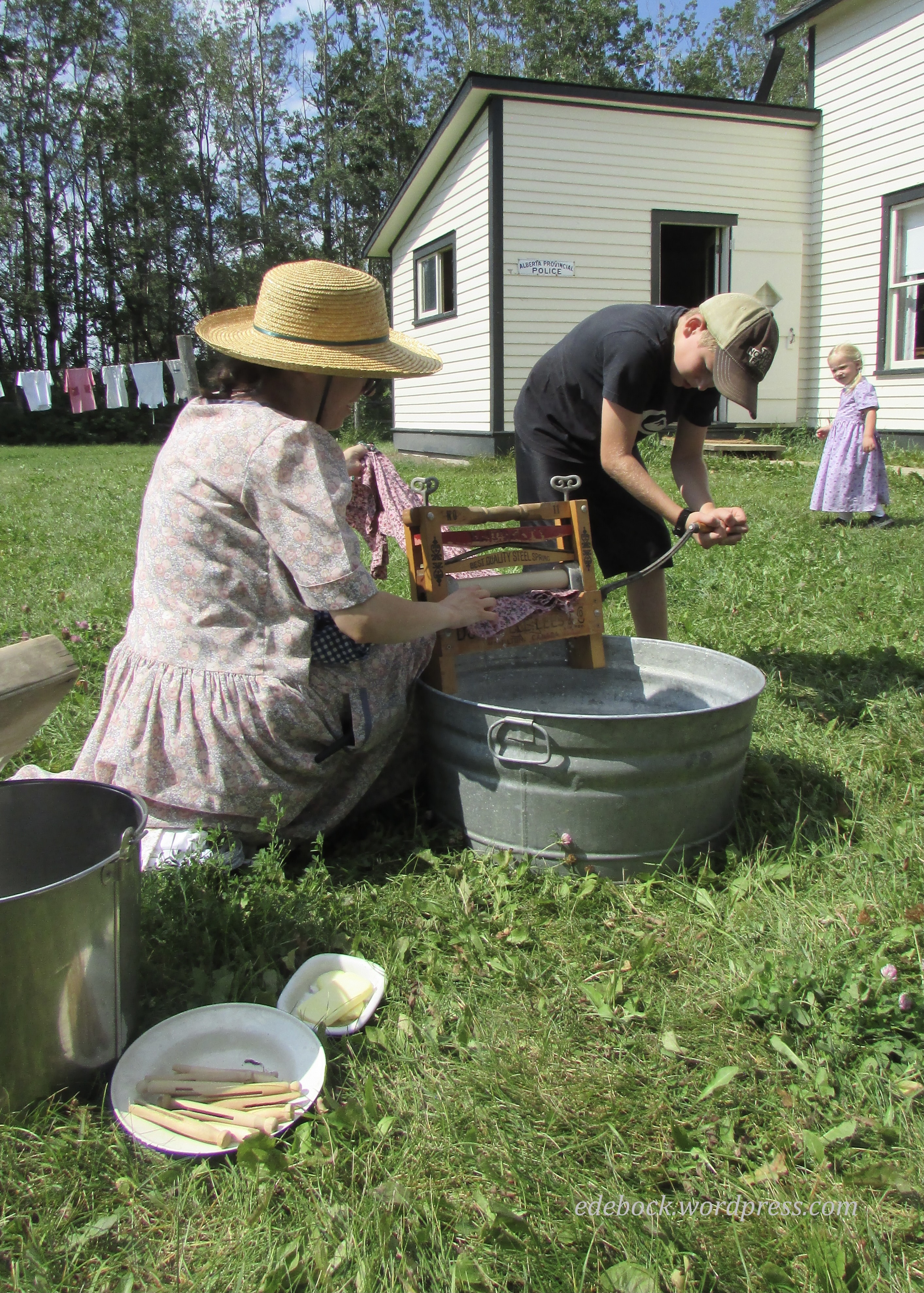
Learning to do laundry the old-fashioned way was also fun for Harlow and Yari.

IMG_4399

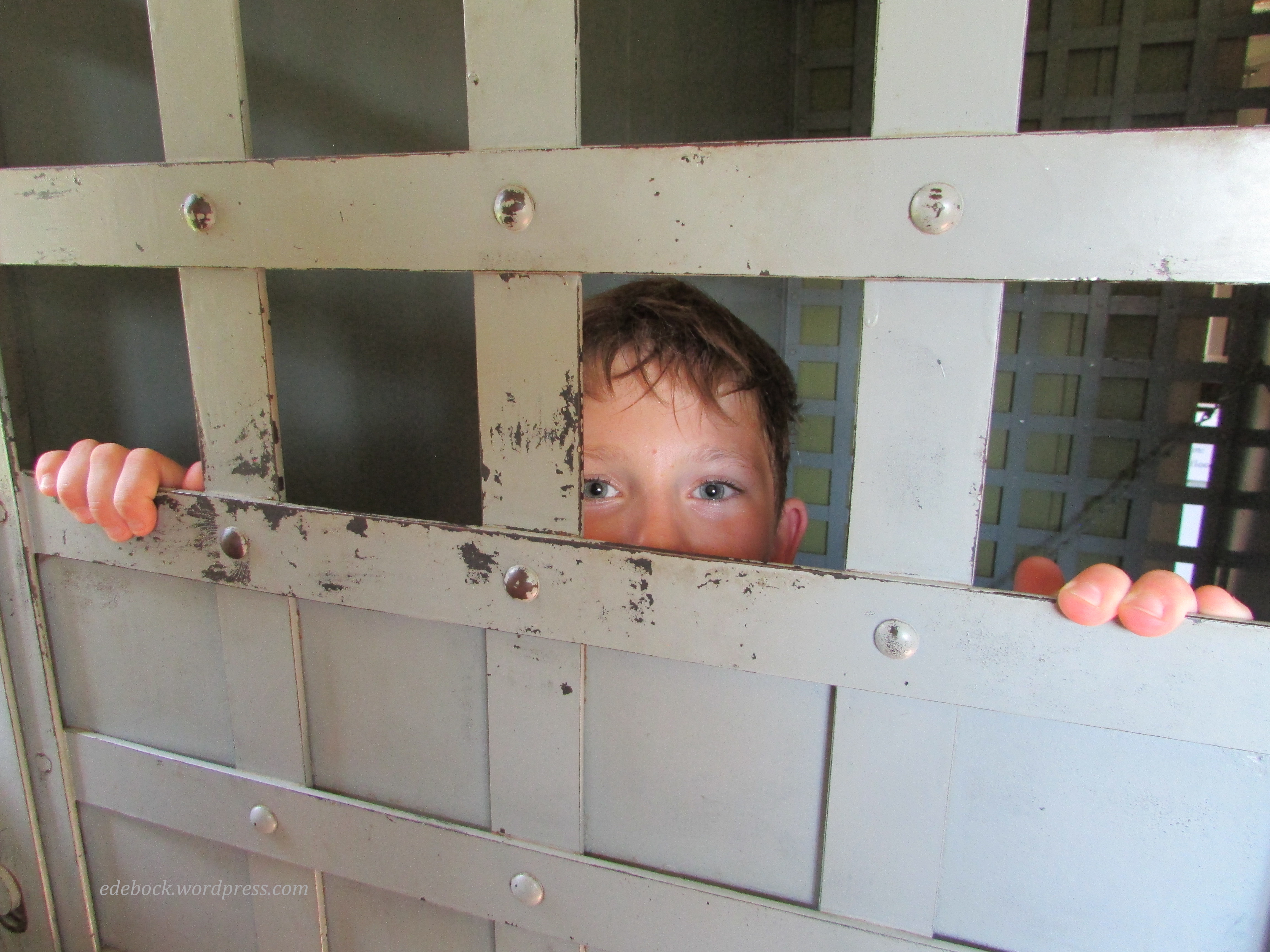
At the Provincial Police Post, we put Yari in jail!

IMG_4403

IMG_4404

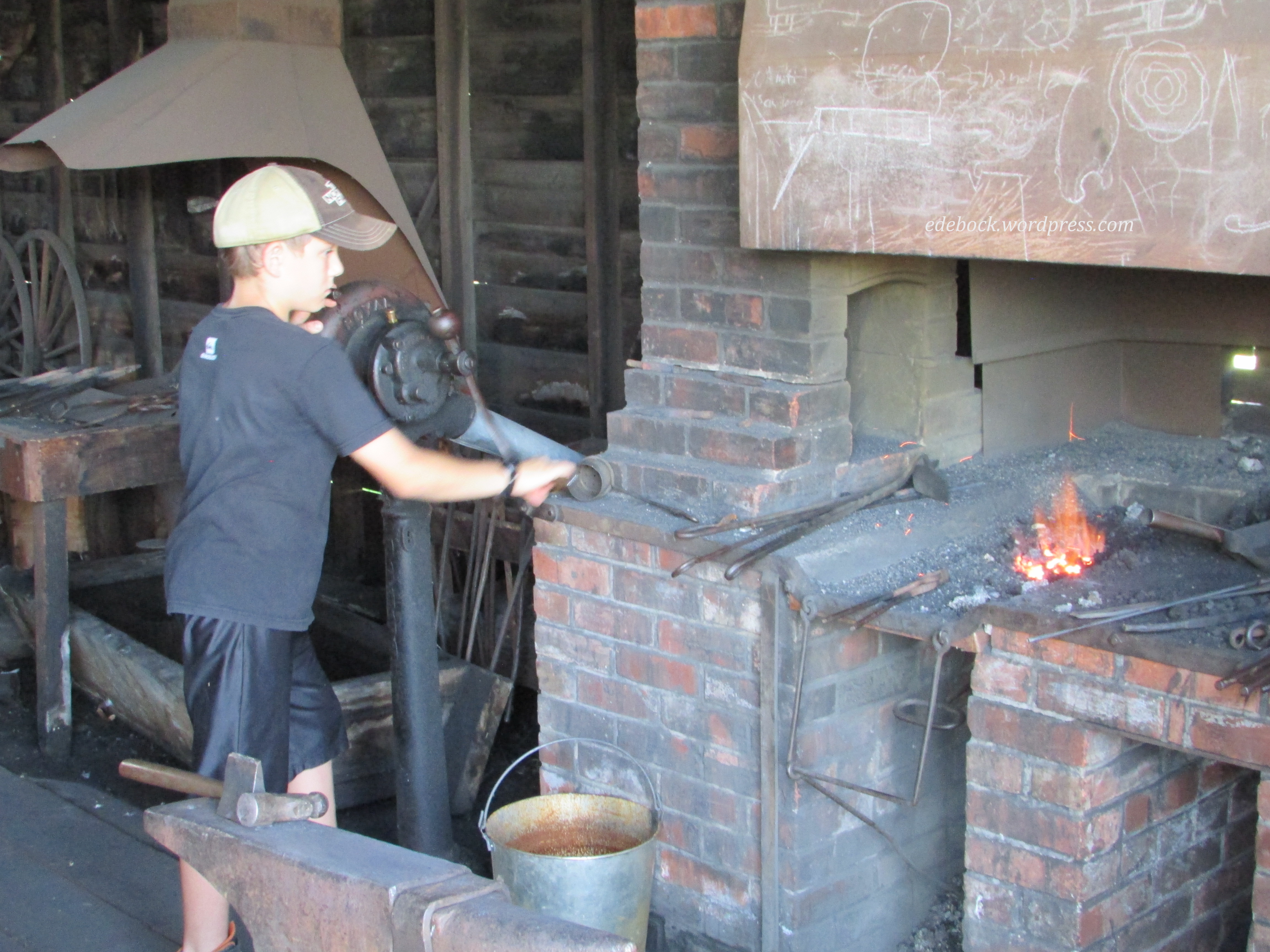
He also got to help the blacksmith.

IMG_4421

For lunch, we sampled a variety of authentic Ukrainian foods including pyrohy (perogies), holubtsi (cabbage rolls), sausage, borshch (beet soup), and somewhat less authentic, but absolutely delicious, pyrohy poutine!

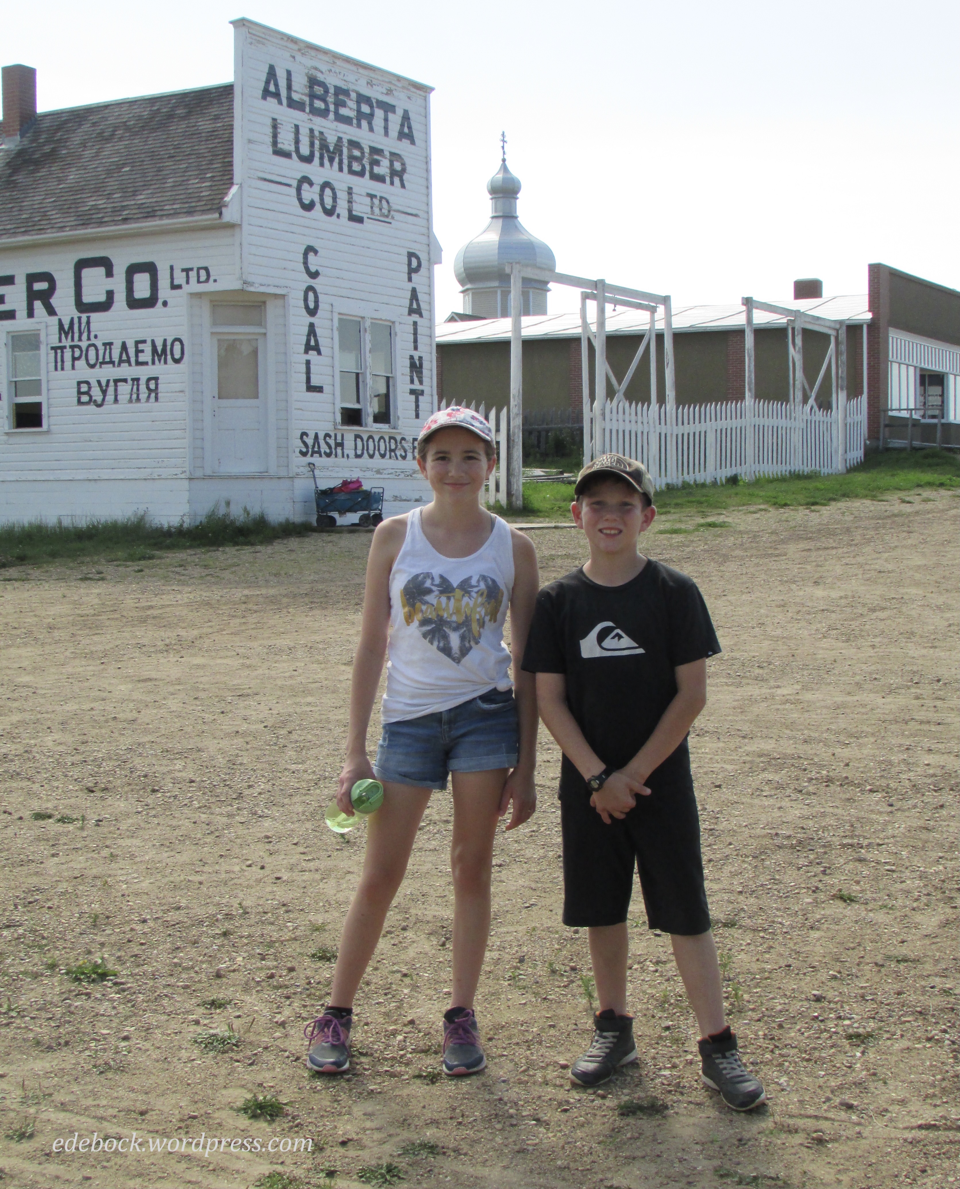
It wasn’t until later when I looked at my pictures that I realized that I’d taken lots of photos of the kids and almost none of the village’s many buildings!

IMG_4425

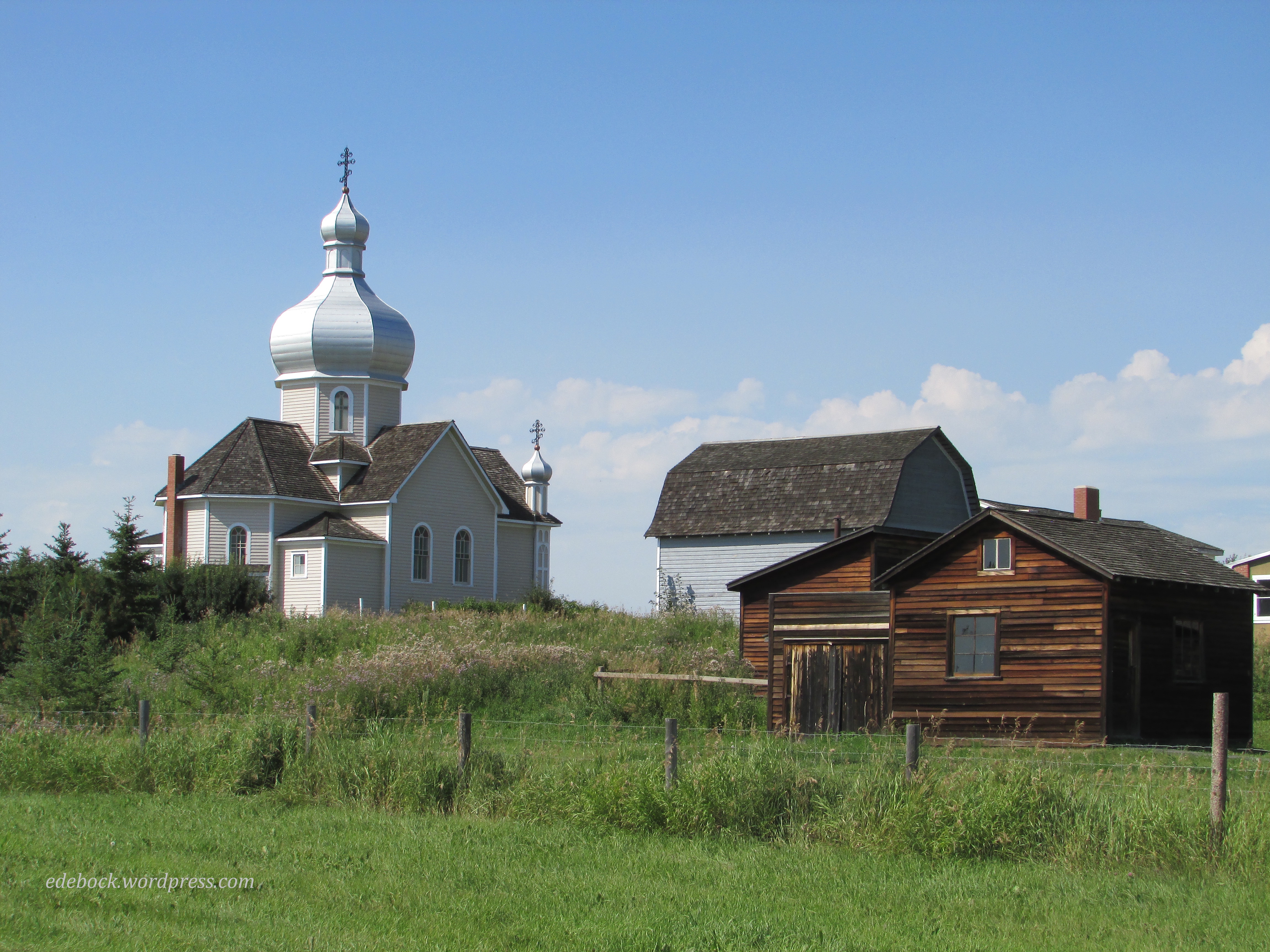
In addition to houses, barns, schools, and various places of business that have been moved to the site from communities across central Alberta, there are three churches that are still active places of worship. As such, they aren’t open to the public.

IMG_4406

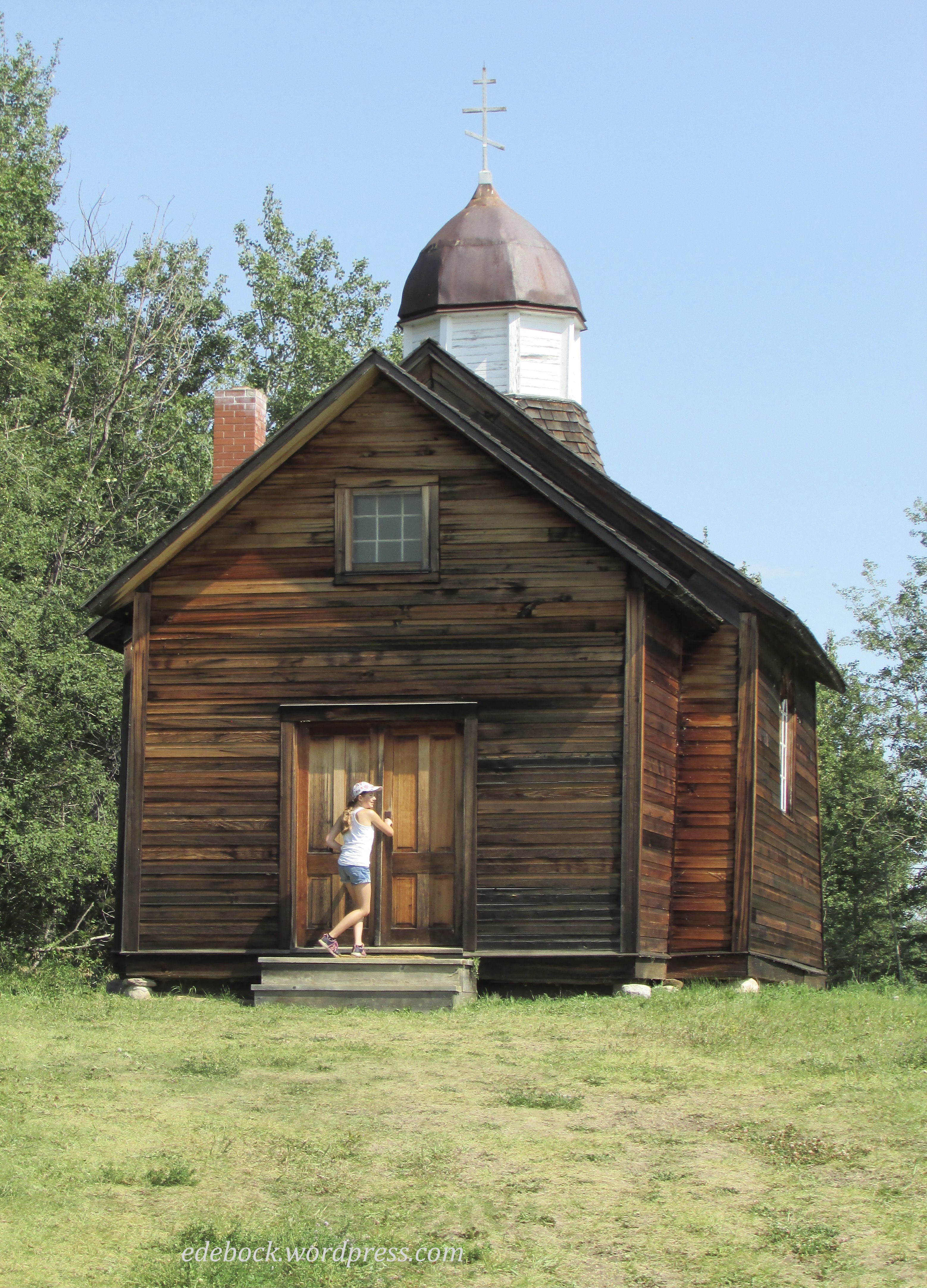
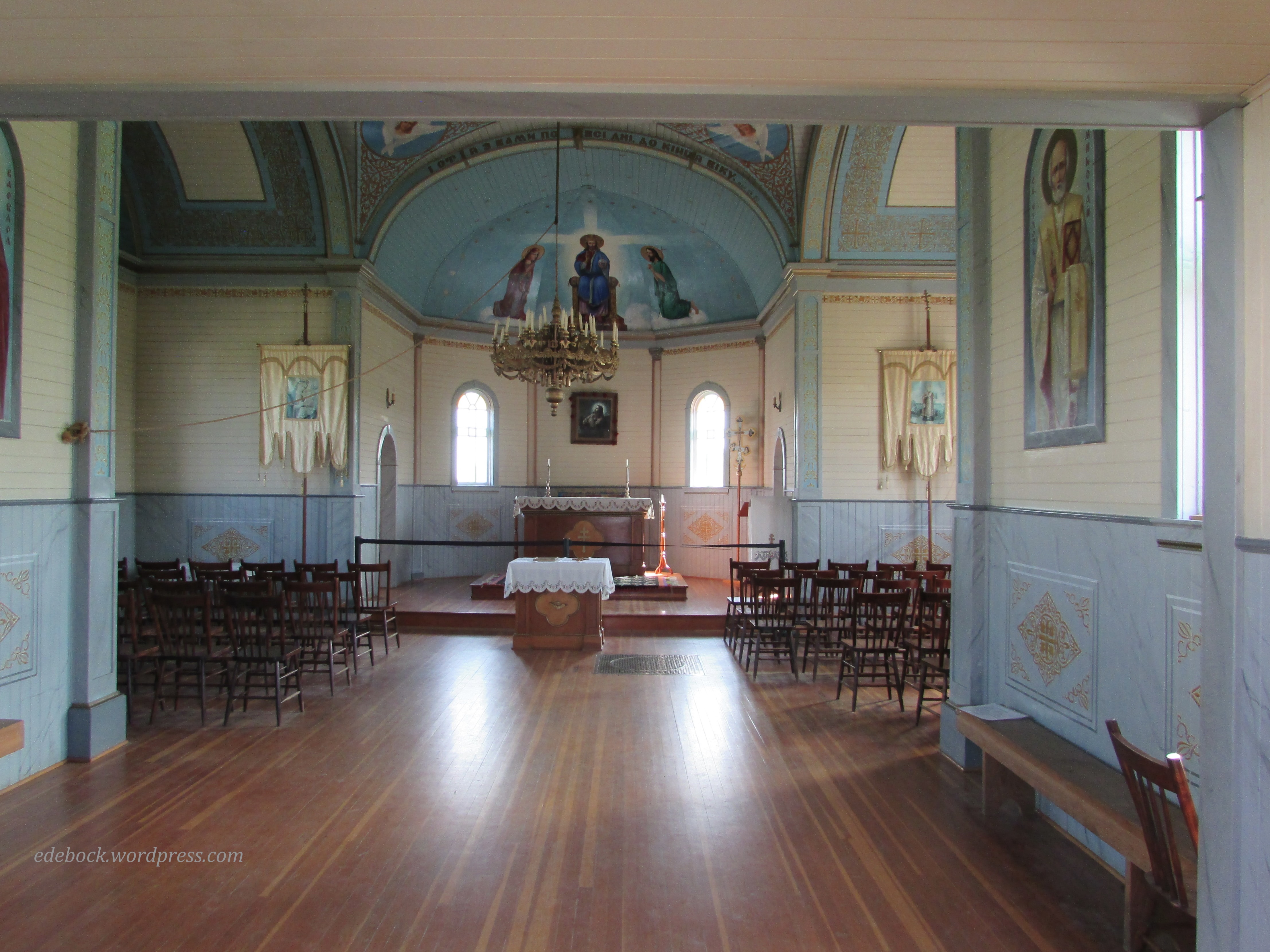
St. Nicholas Russo-Greek Orthodox Church was built in the rural community of Kiew, Alberta, by Ukrainian settlers from Galicia. The more elaborate St. Vladimir’s Ukrainian Greek Orthodox Church, shown in the first photo above, originally stood in Vegreville. Though we weren’t allowed to enter, we were able to view the very traditional interior, with it’s cross-shaped floor plan, from the open doorway. 

IMG_4423

Although the website suggests 2-3 hours to tour the village, we took significantly longer walking the dusty streets and pathways and exploring virtually every nook and cranny that was open to us. We finished our day with a ride around the village in a horse drawn wagon.

Hoodoos and buffalo beans

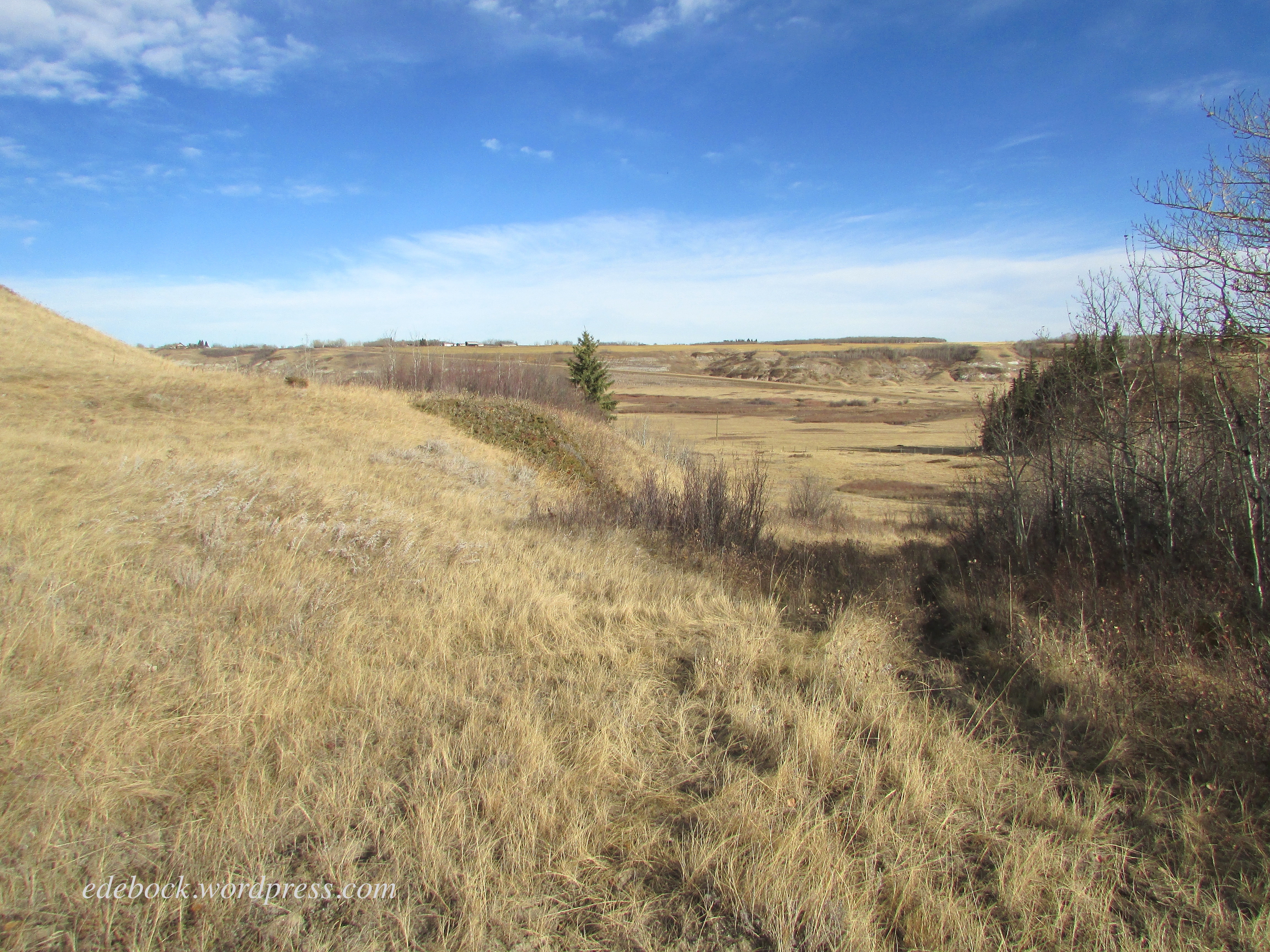
The last time we hiked the Meeting Creek Coulee near the village of Donalda was late in the fall. The trees were bare and the landscape was shades of gold and brown. Today’s hike through the same area was entirely different! 

IMG_1808

IMG_4124

Everything was so green and there were wildflowers everywhere, especially the bright yellow buffalo beans that bloom across the southern half of Alberta and Saskatchewan at this time of year. 

IMG_4119

I’ve always wondered why they were called buffalo beans, so when we got home today I consulted Google and learned that the flowers appear around the same time as the Indigenous people of the prairie used to conduct their spring buffalo hunt. Apparently the plant produces bean-like seed pods later in the season, but they shouldn’t be eaten as the entire plant contains poisonous alkaloids.

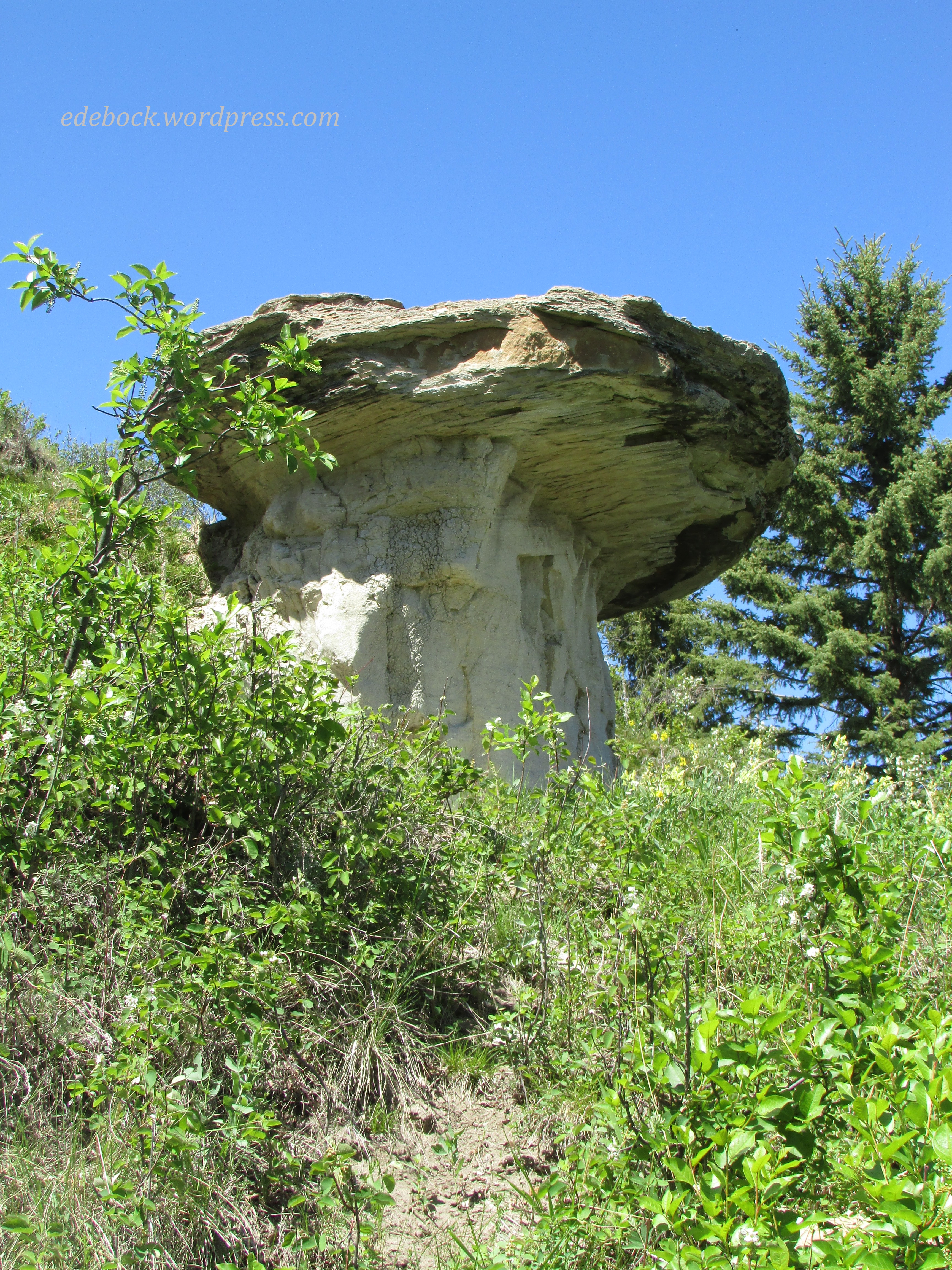
We started today’s hike on the woodland trail that follows the rim of the massive coulee, the northernmost part of the Canadian Badlands, but we soon dropped down into the valley. As we wandered up, down, and around the bluffs that form its walls I spotted an impressive looking hoodoo emerging from the bushes on the hillside above us. Of course, we had to climb up and take a closer look.

IMG_4131

IMG_4125
 We decided to sit and eat our lunch on the hillside where Richard is standing in this photo.

IMG_4126

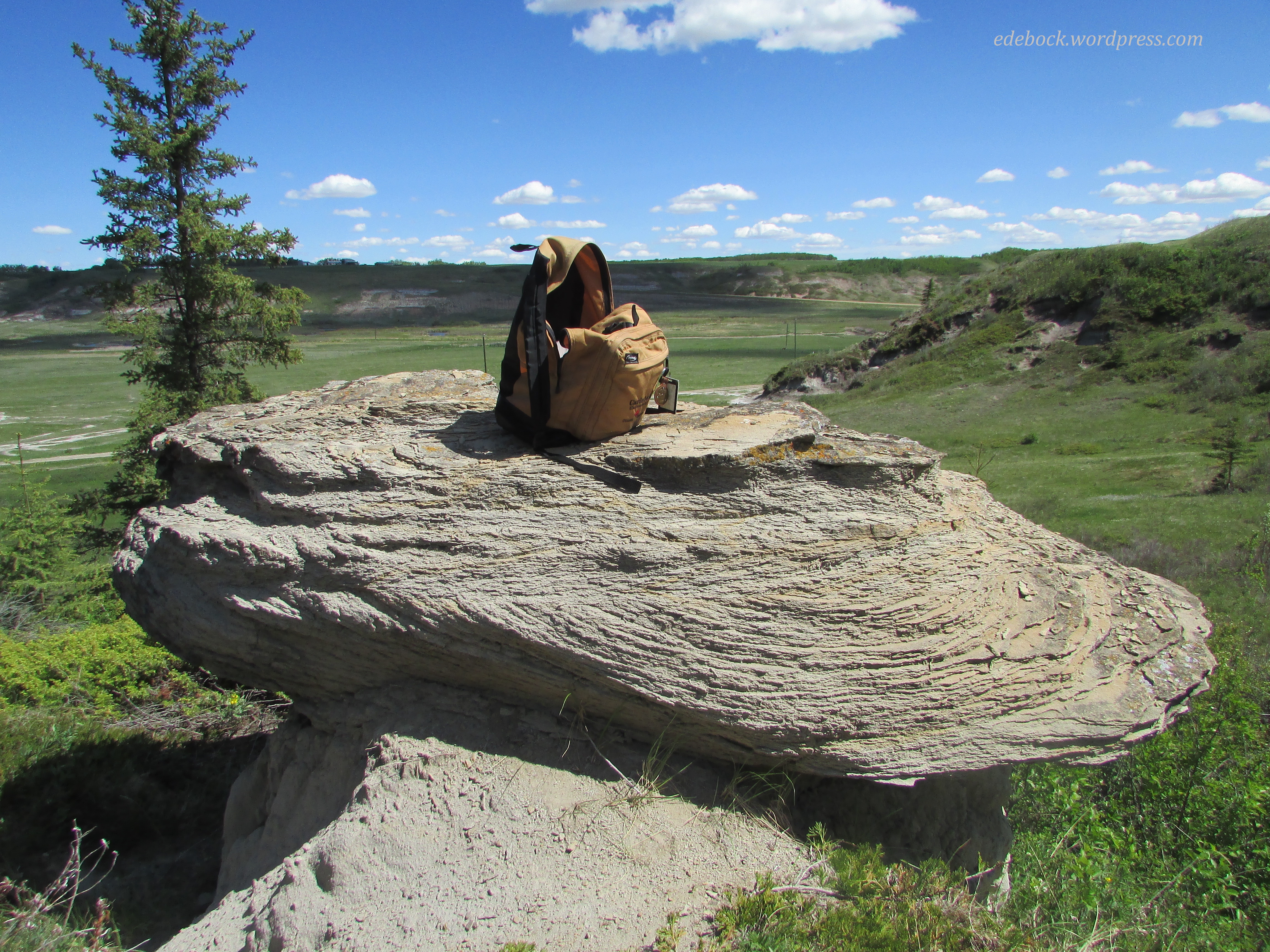
As I looked at our backpack perched on the hoodoo’s capstone, I thought of all the places it’s been with us over the years. It’s even been to the top of Mt Fuji, the highest and most famous mountain in Japan! 

IMG_4127

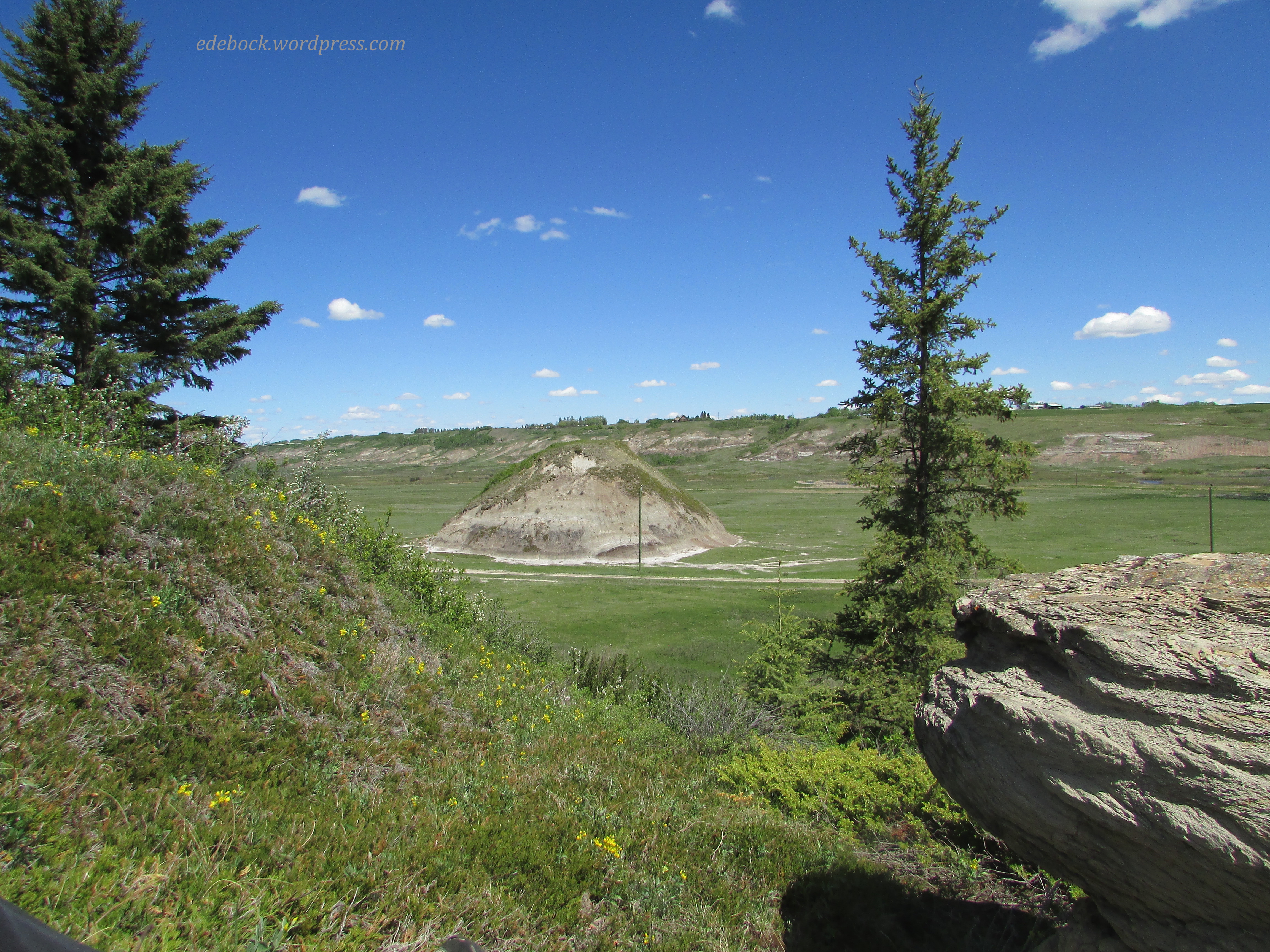
The view from our lunch spot included a perfect mound protruding from the flat valley floor. I decided that when we finished eating, we should hike down and walk around it which we did. We considered climbing it, but it would have been a challenge and since we still had to climb back up out of the valley, we quickly rejected that idea. 

IMG_4132

Eventually, after wandering for awhile longer, we made our way back up the hillside and rejoined the woodland trail that took us back to our vehicle. After a long cold winter, it’s so good to be able to get out on the trails again! I wonder where else our feet will take us this summer. 

The Great Sand Hills

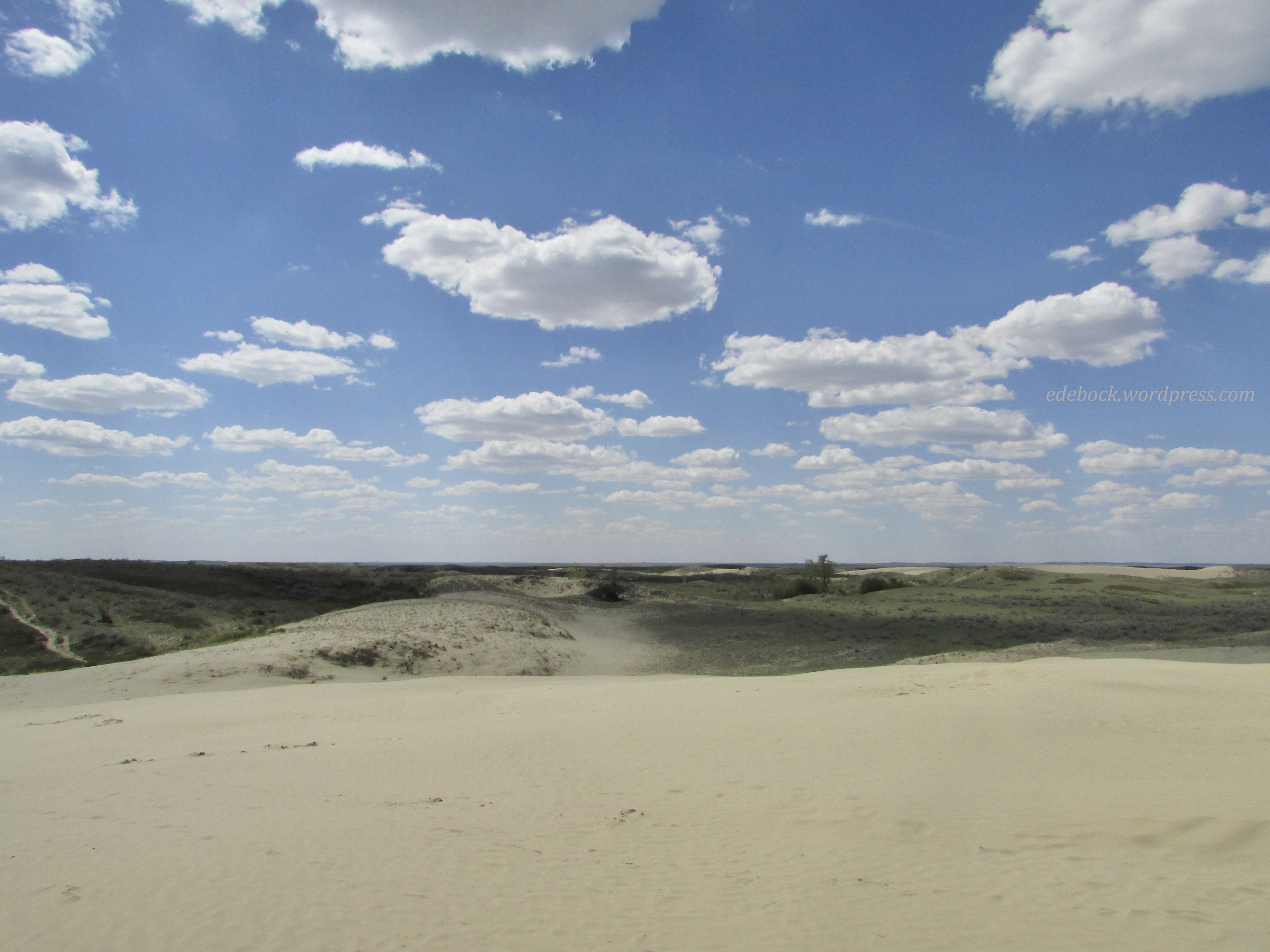
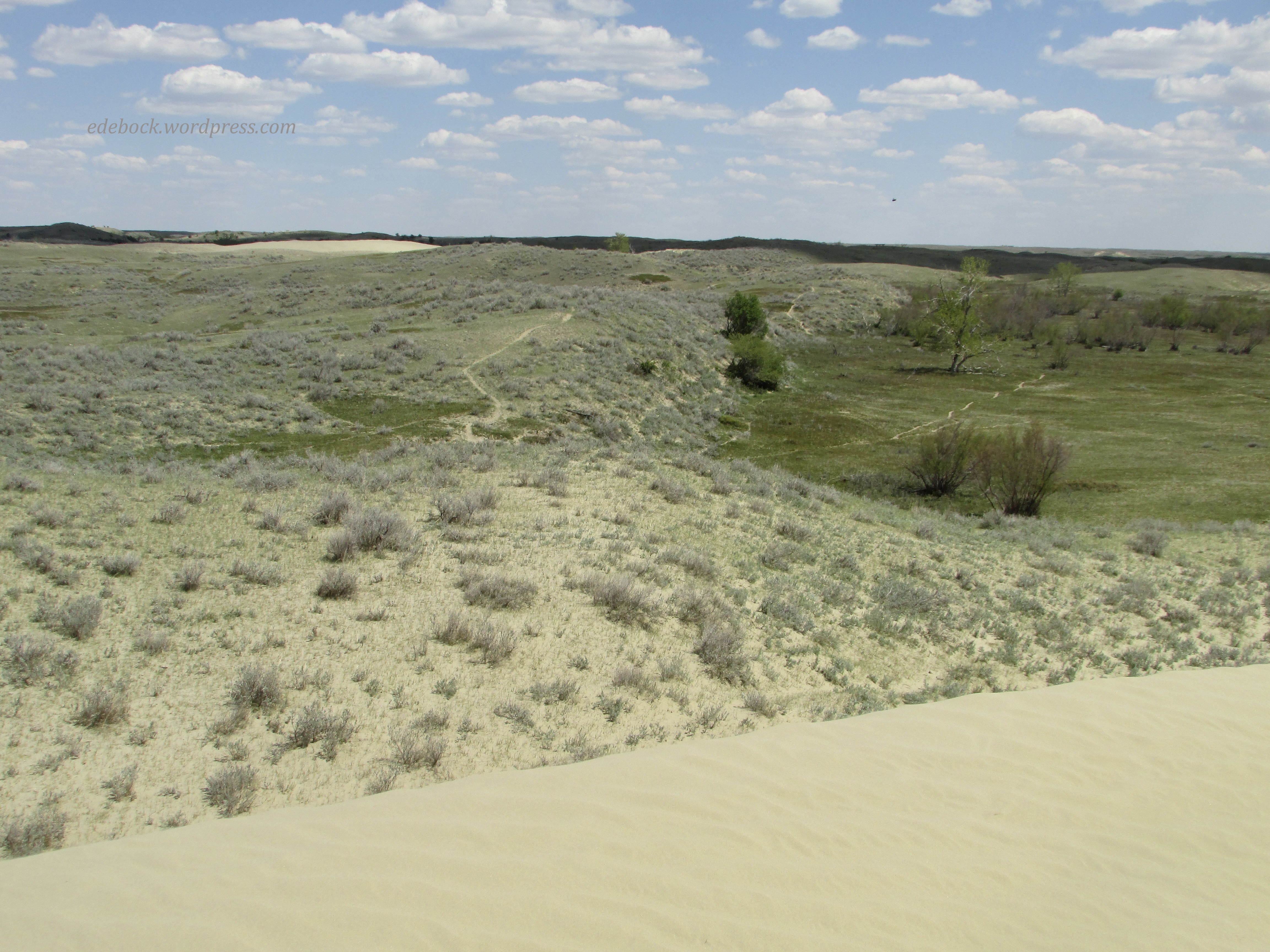
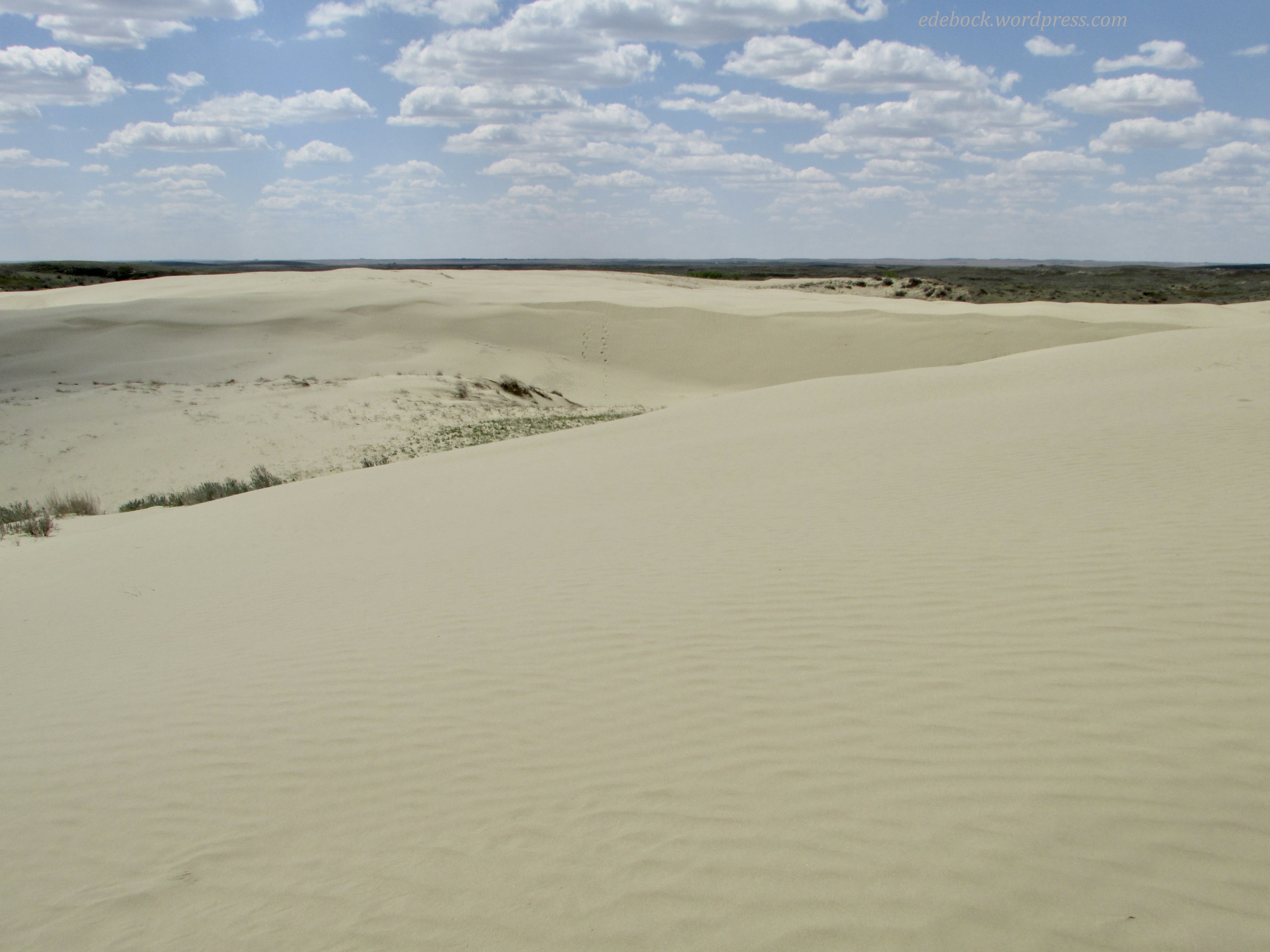
Today’s photos might lead one to believe that we traveled to Morocco or Mongolia, but we were actually exploring a very unique bit of Canada, the Great Sand Hills of southwestern Saskatchewan! 

IMG_4044

The Great Sand Hills is approximately 1,900 square kilometres (730 square miles) of desert-like sand dunes, native grasses, and small trees and shrubs. Sediment deposited by glacial meltwater during the retreat of the Laurentide Ice Sheet approximately 13,000 years ago, then shaped and reshaped by strong winds, created this unique landscape. The first of the giant sand hills is just a short walk from the parking lot. Climbing up the dune, you truly feel like you’ve entered a different world, a world of sand and sky!

IMG_4046

IMG_4047

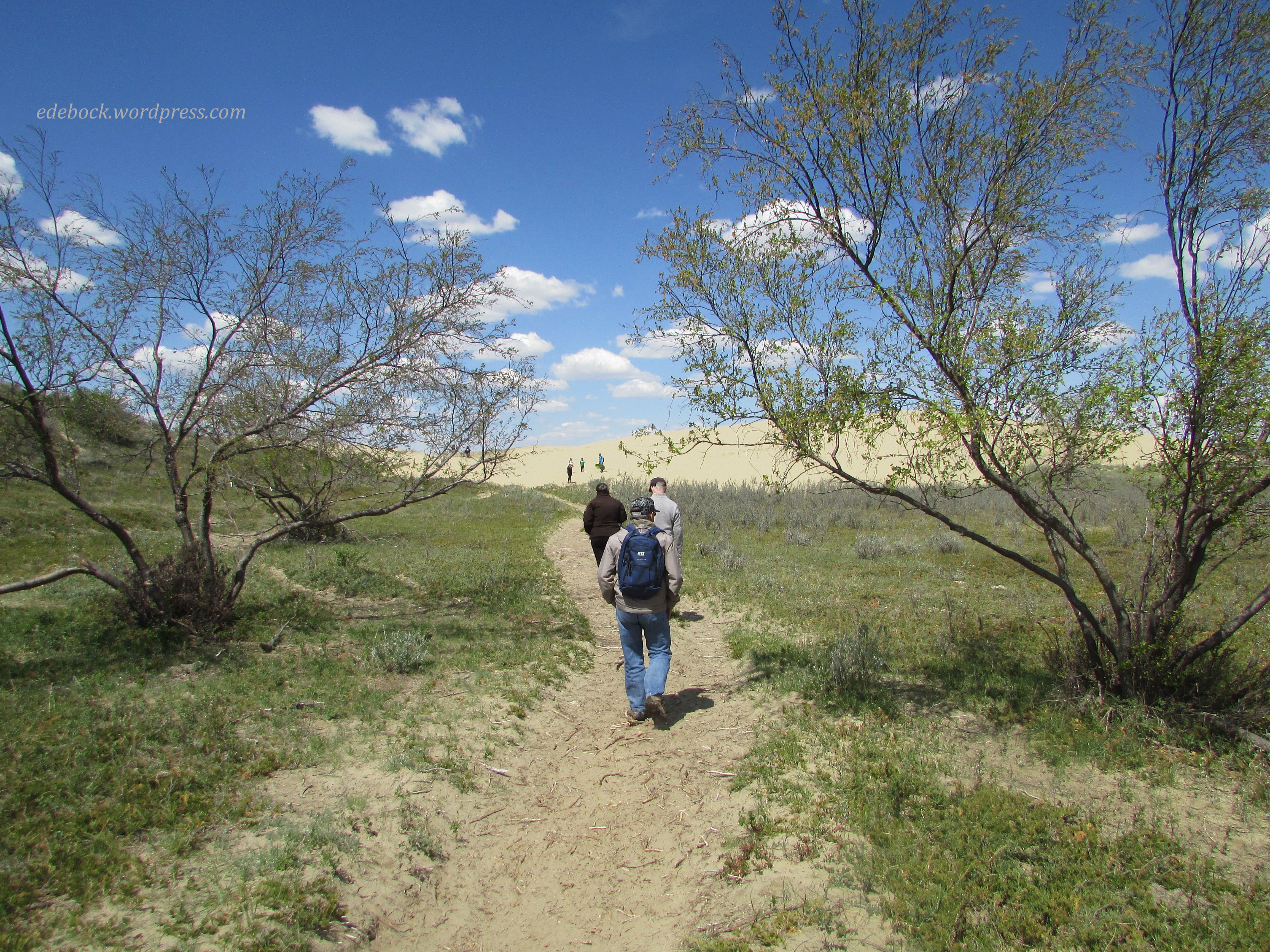
We soon spotted a series of faint trails leading off toward more dunes in the distance, so of course we had to investigate. 

IMG_4059

IMG_4082

IMG_4071

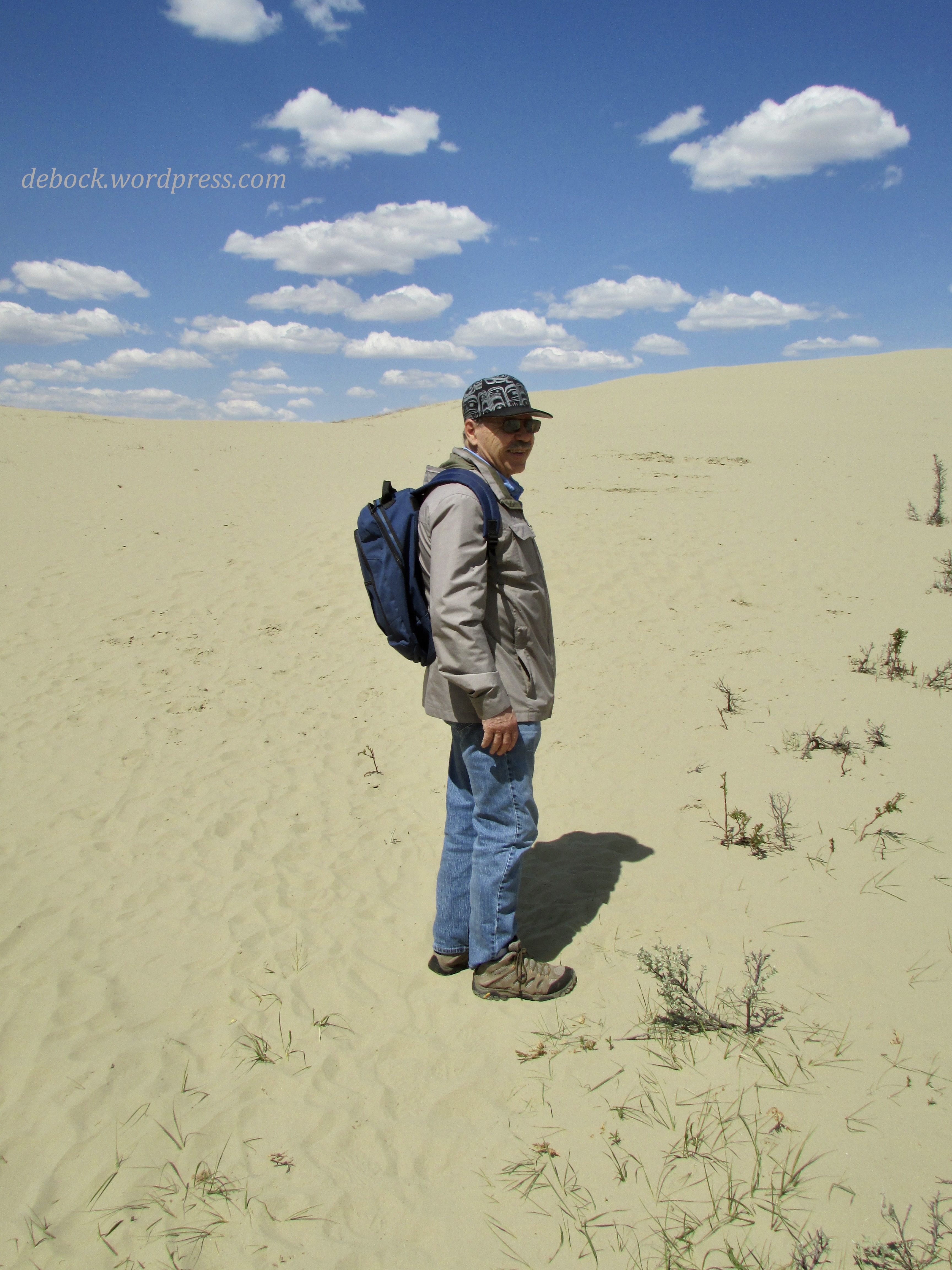
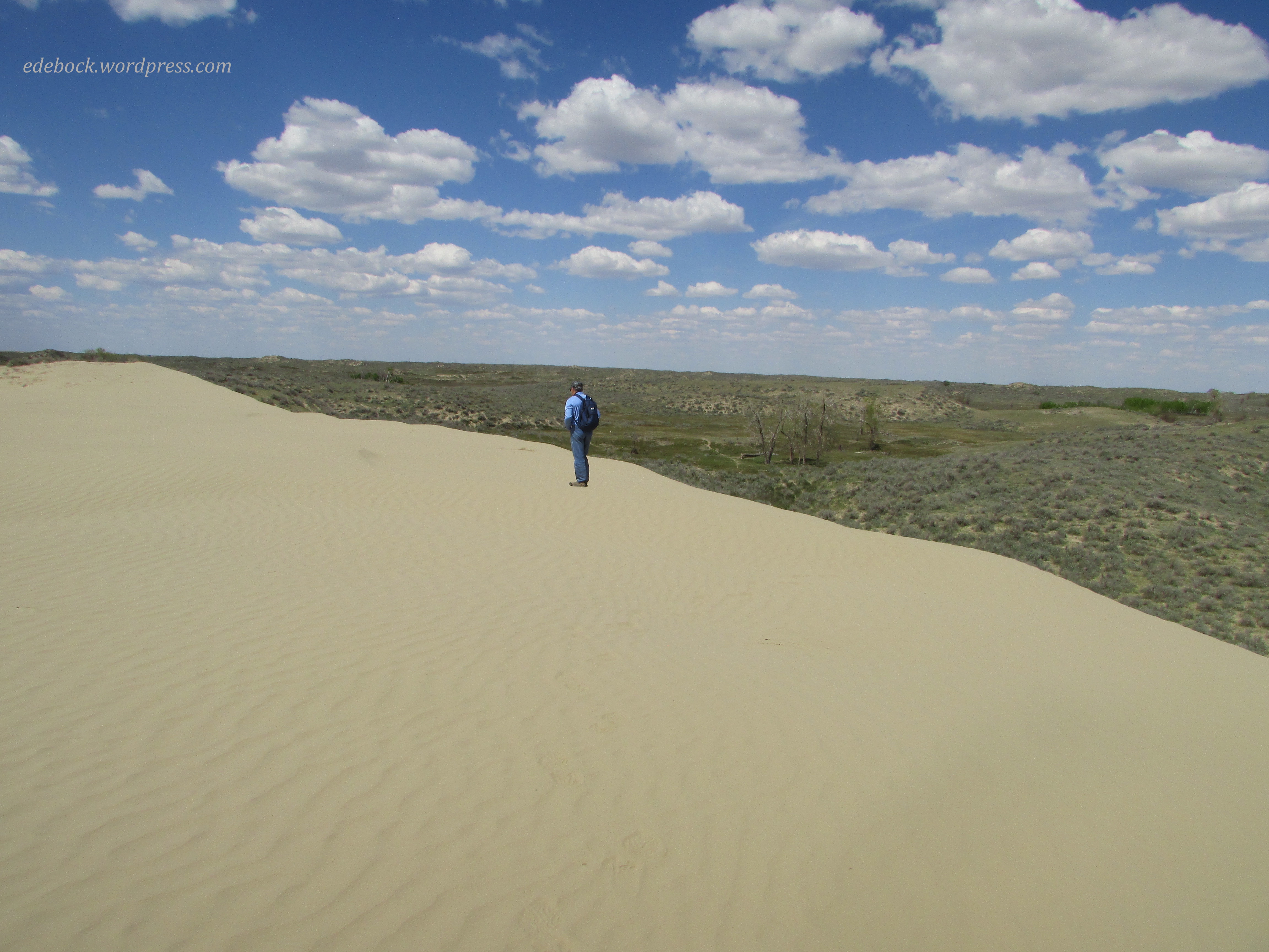
Climbing up the steep side of the dune, we were greeted by another vast expanse of soft, powdery sand. After walking around a bit, I had to take my shoes off and feel its warmth between my toes! 
IMG_4077

IMG_4083

Can you spot Richard on the horizon below? 

IMG_4093

Canada has it all… mountains, prairies, forests, rugged coastlines, rivers, lakes, and even a wee bit of desert! 
Salt water and sea air

On our first day in Victoria, we walked approximately 10 km. Today, our last day before heading toward home, we walked at least 7 more!

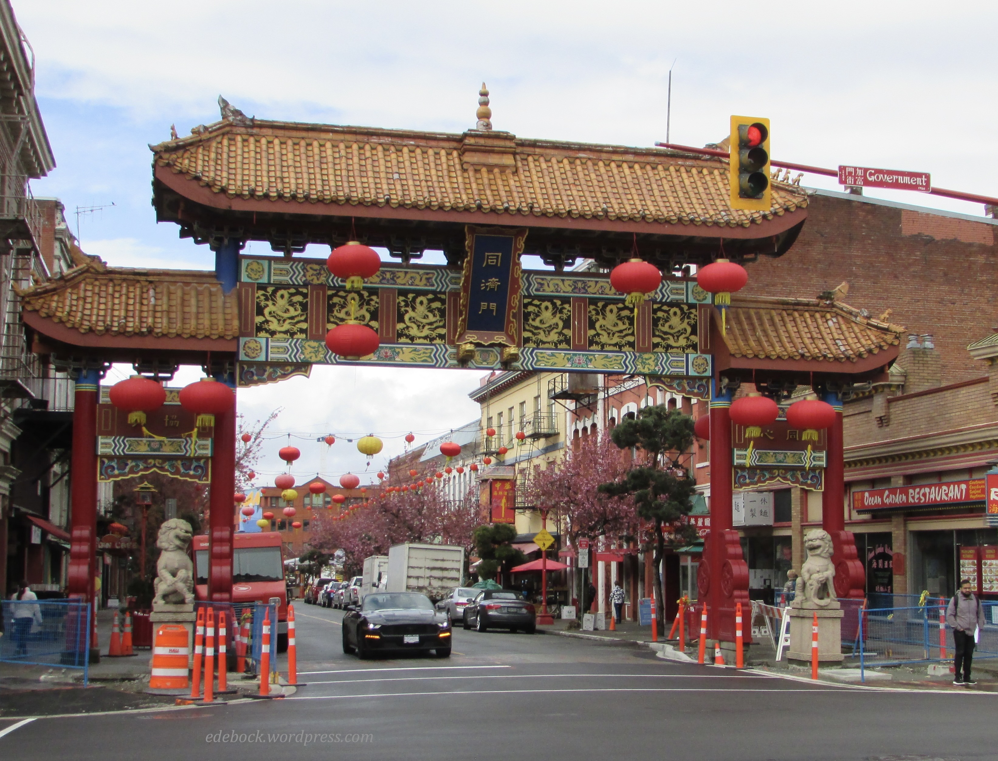
We woke to a chilly, wet morning. In fact, there was even a bit of snow in the air. Thankfully, however, the forecast promised better things to come. After a leisurely breakfast in our hotel and a little while spent relaxing back in our room, the rain stopped and we headed out. Our first destination this time was the oldest Chinatown in Canada and the second oldest in North America after San Francisco.

IMG_3838

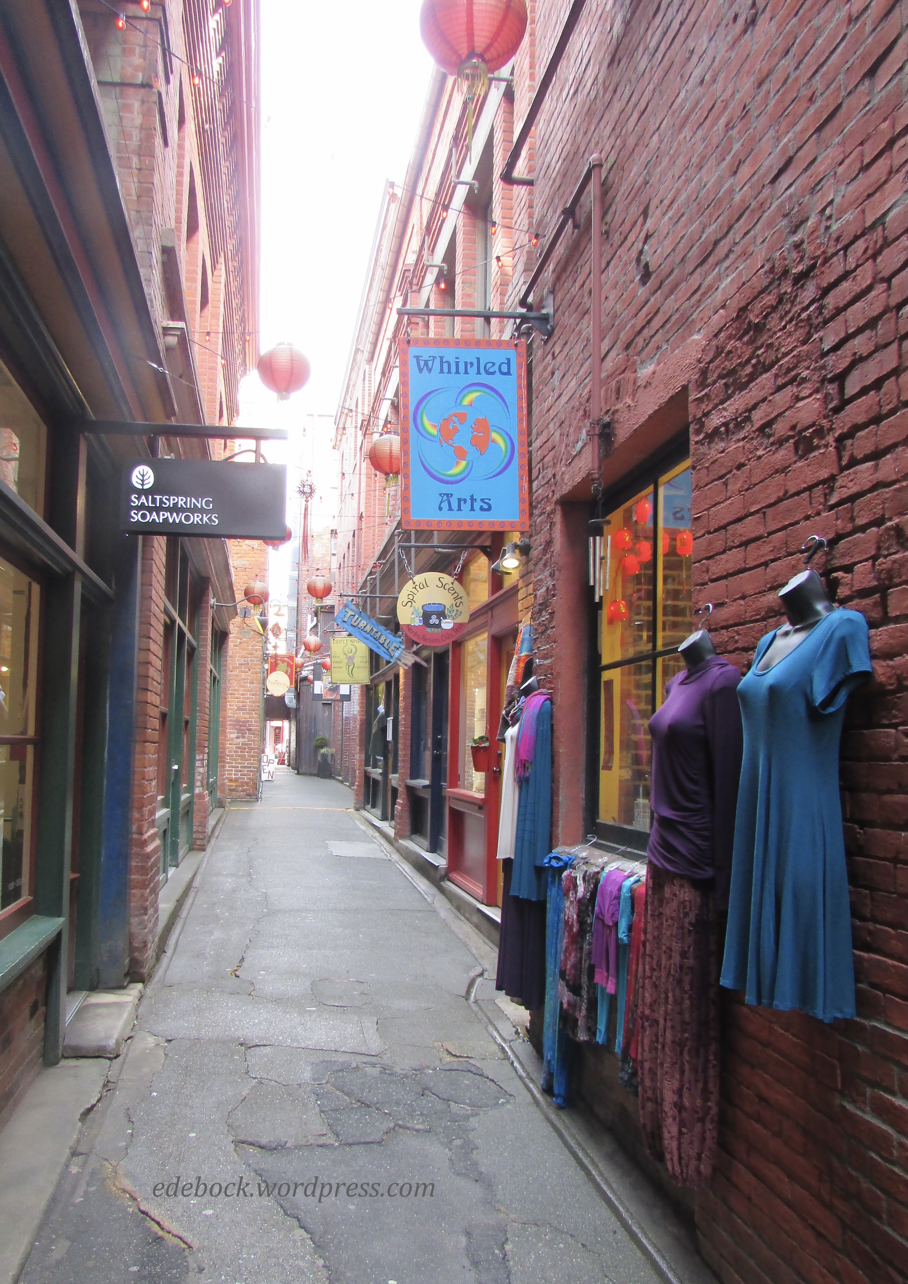
I’m thinking that it must also be one of the smallest. Barely more than two blocks in size, there are a number of authentic Chinese restaurants and businesses, but I was also surprised to see a sushi shop, a schnitzel restaurant, and a taco place! 

Victoria’s Chinatown is perhaps best known for Fan Tan Alley, the narrowest street in Canada. Only 0.9m wide (about 4 feet) at the narrowest point, the alley is filled with boutiques and shops selling clothing, jewelry, music, and other items to both tourists and locals. In its early days, however, it was home to a variety of less savoury places including gambling and opium dens. 

IMG_3837

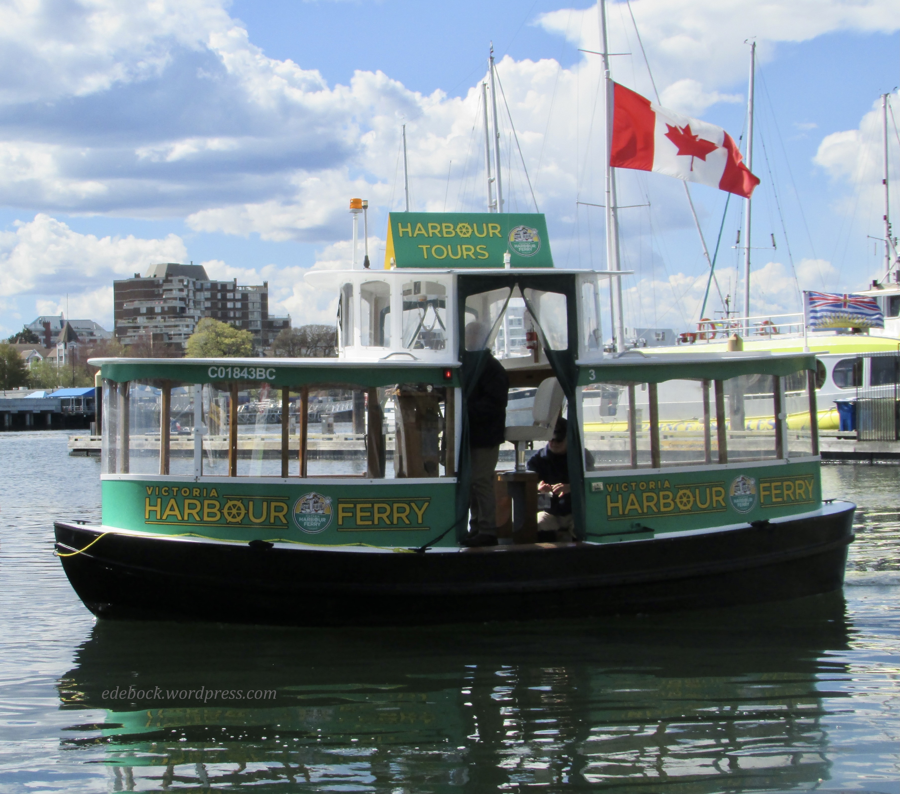
On Sunday, we walked the beach at Cordova Bay and yesterday we did a harbour tour on one of Victoria’s little green “pickle” boats, so-called because of their colour and shape, but I’m a coastal girl at heart and I wanted a bit more of the sea before heading back to the prairie. 

IMG_3827

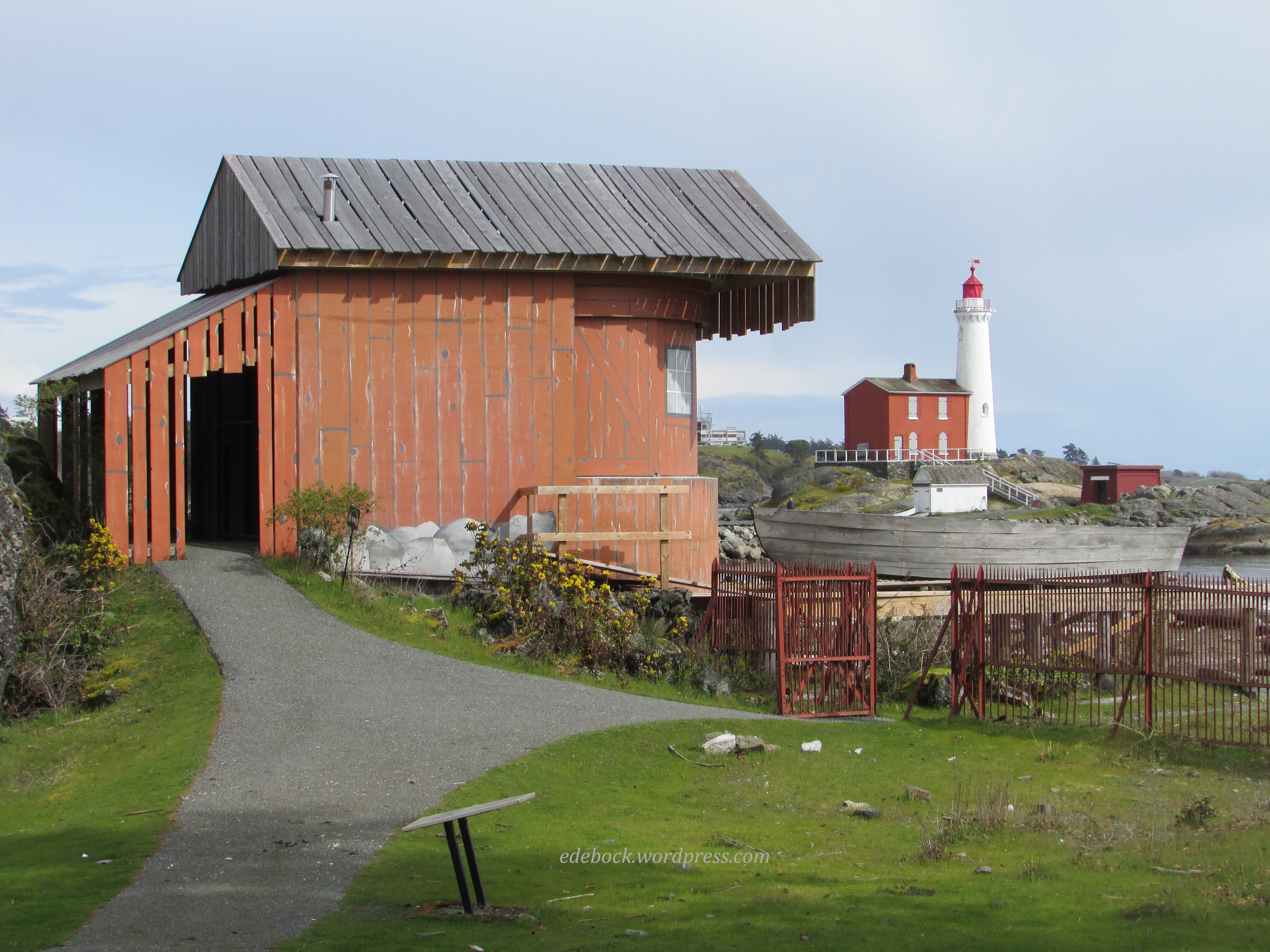
After returning from Chinatown, we drove about 20 minutes to Fort Rodd Hill and Fisgard Lighthouse National Historic Sites. Consisting entirely of original structures, Fort Rodd Hill, a west coast artillery fortress on active duty from 1895 to 1956, is one of the world’s best preserved and most complete examples of its kind. The buildings are closed during the week, but the grounds are open and many interpretive signs make it an interesting place to explore. Until our visit, I had never really thought about how vulnerable the Victoria area must have felt after the attack on Pearl Harbour in 1941. By 1944, 17 powerful searchlights clearly lit up the Victoria-Esquimalt harbour area. One of them was housed in this building, camouflaged to look like a fisherman’s hut, complete with a ramp and boat!

IMG_3873

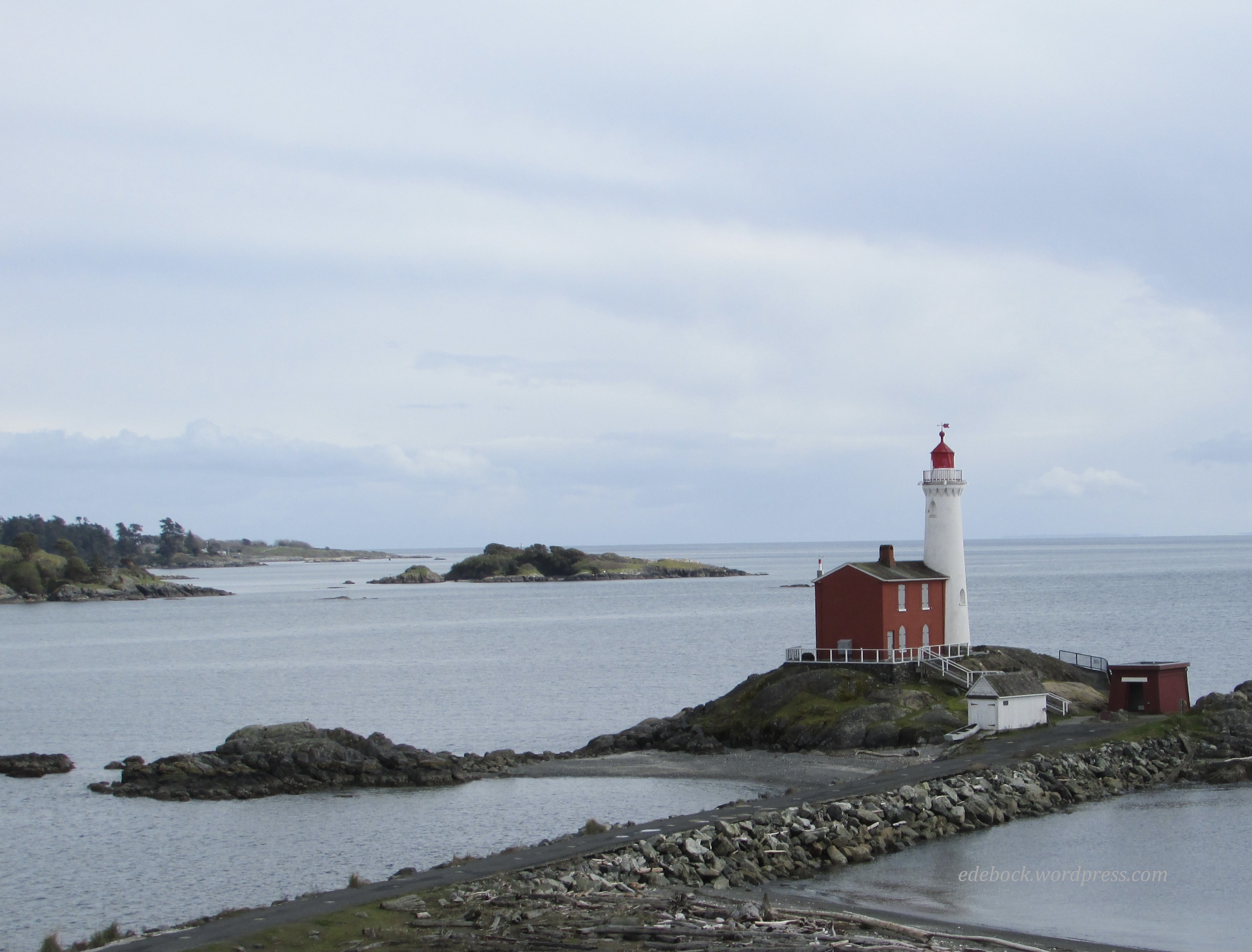
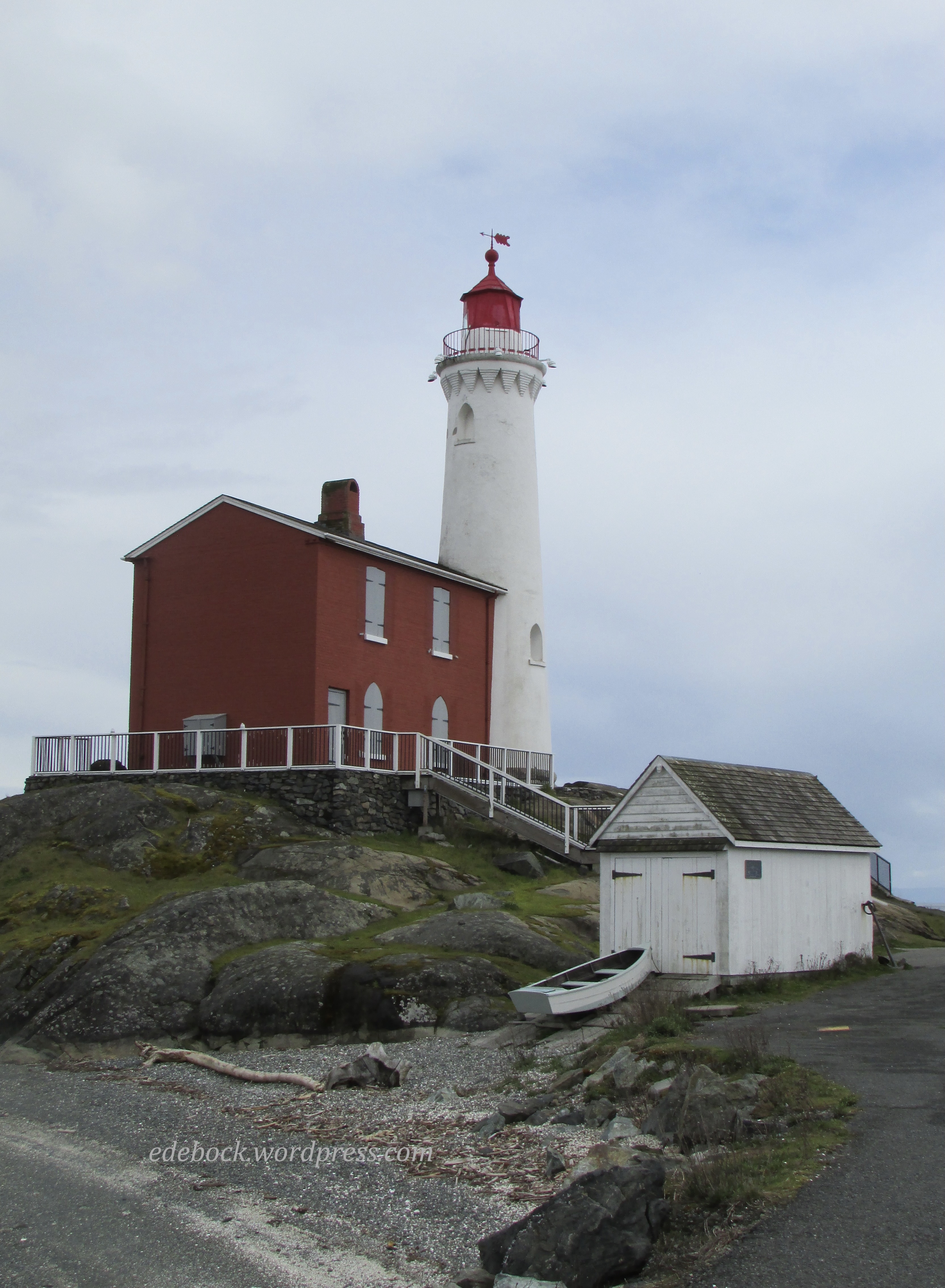
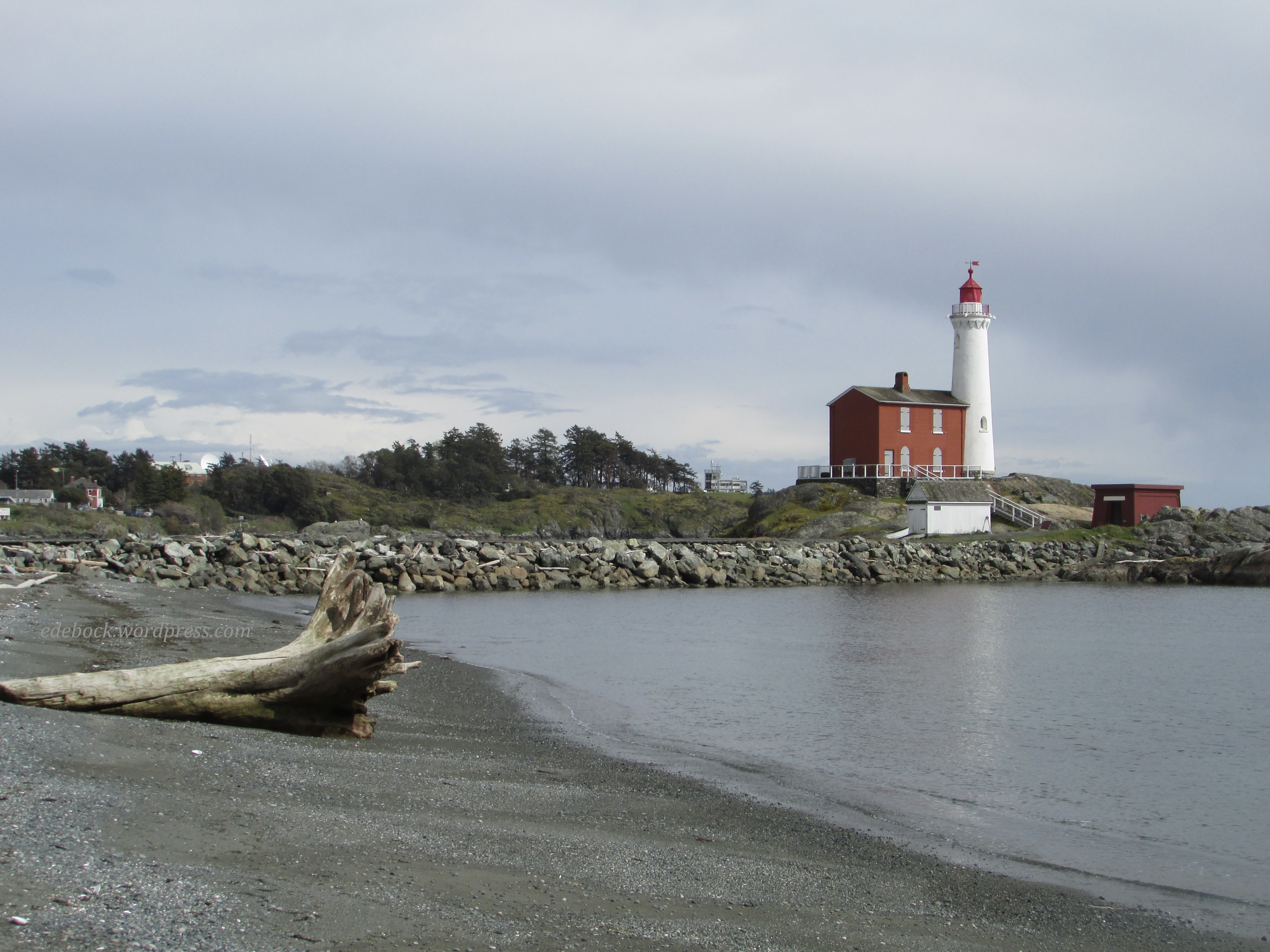
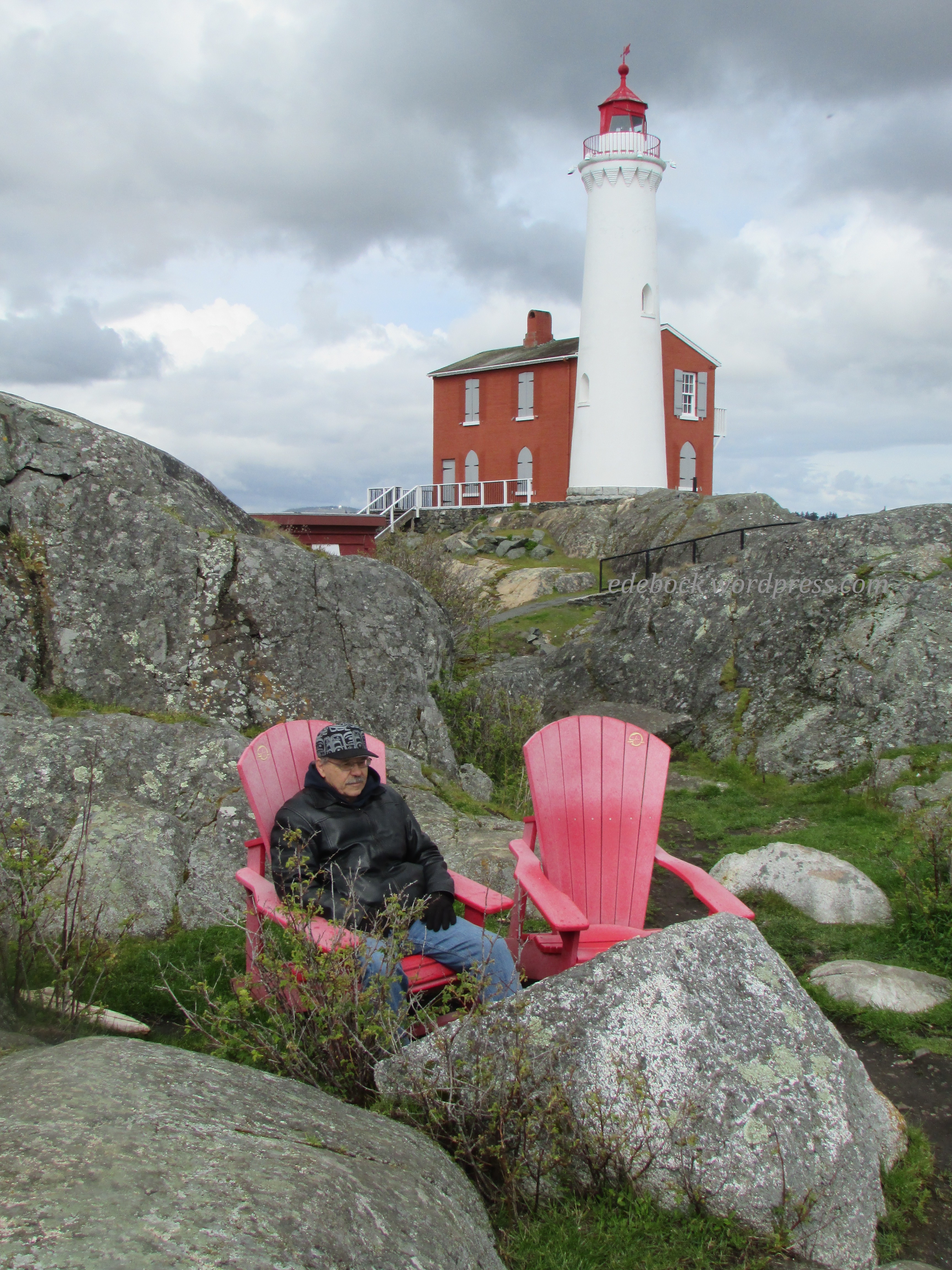
In the background, you can see the Fisgard Lighthouse which was built in 1860 as the first permanent light on the west coast of Canada. Although administered together with Fort Rodd Hill, it is a separate national historic site and there is no historical connection between the two. 

I absolutely love lighthouses, but I won’t subject you to all 24 pictures that I took of this one! I’ll try to restrict myself to just a few favourites. 

IMG_3851

IMG_3856

Though the light has been automatic since 1928, prior to that time it was manned.

IMG_3868

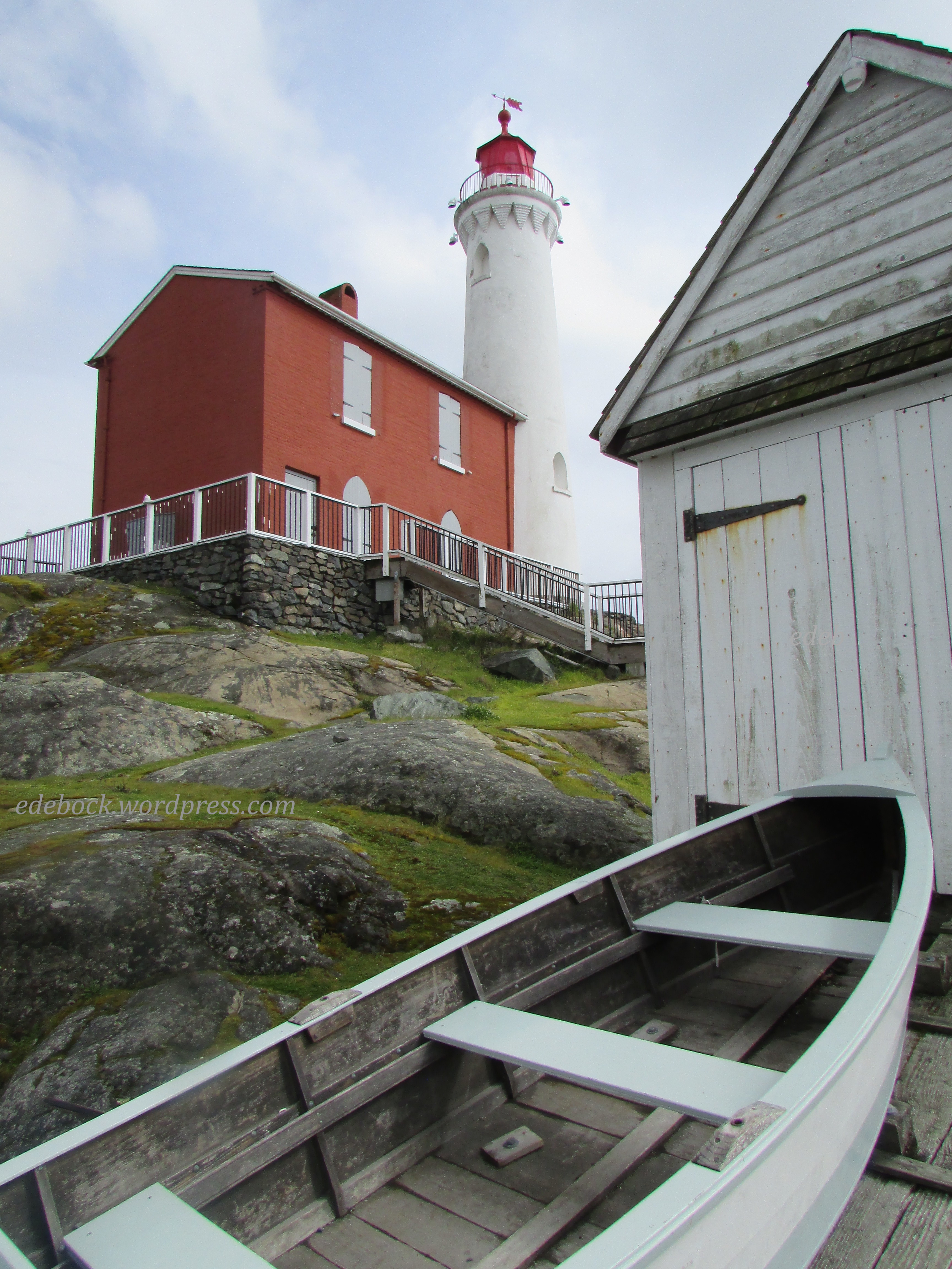
The lighthouse is now connected to land via a manmade causeway, but in those days it stood offshore on a tiny island. The only means of transportation that the lighthouse keeper had was a rowboat like this one. Every item he needed had to be rowed across the bay from Esquimalt. Unfortunately, in 1898, the unoccupied boat was found floating in the bay with just one oar still in it. Joseph Dare, the keeper at that time, had fallen overboard and drowned while trying to retrieve the other oar. Had he been wearing a life jacket, he likely would have survived. 

On the rocky point beyond the lighthouse, we found a pair of the red Adirondack chairs that have been placed in National Parks and Historic Sites across Canada. Of course, we had to sit in them and enjoy the view. 


IMG_3862

After visiting the lighthouse, we walked the long beach in front of Fort Rodd Hill and then returned to the vehicle via a well-kept nature trail. 

IMG_3871

Now that I’ve enjoyed a fix of salt water and sea air, I’m ready to return to the prairie feeling refreshed! 


Victoria on foot

I’ve always said that the best way to see a city is on foot and Victoria is no exception. We purposely chose a hotel in the harbour area so that we’d be able to walk to most of the things we wanted to see. Today, I’d estimate that we walked approximately 10 km (6.2 miles)!

First, we joined the David Foster Harbour Pathway across the street from our hotel and followed it along the waterfront to Fisherman’s Wharf. 

IMG_3731

On the way, we stopped to find a couple of geocaches. For those of you who aren’t familiar with this high-tech adult treasure hunt, you can learn all about it here.

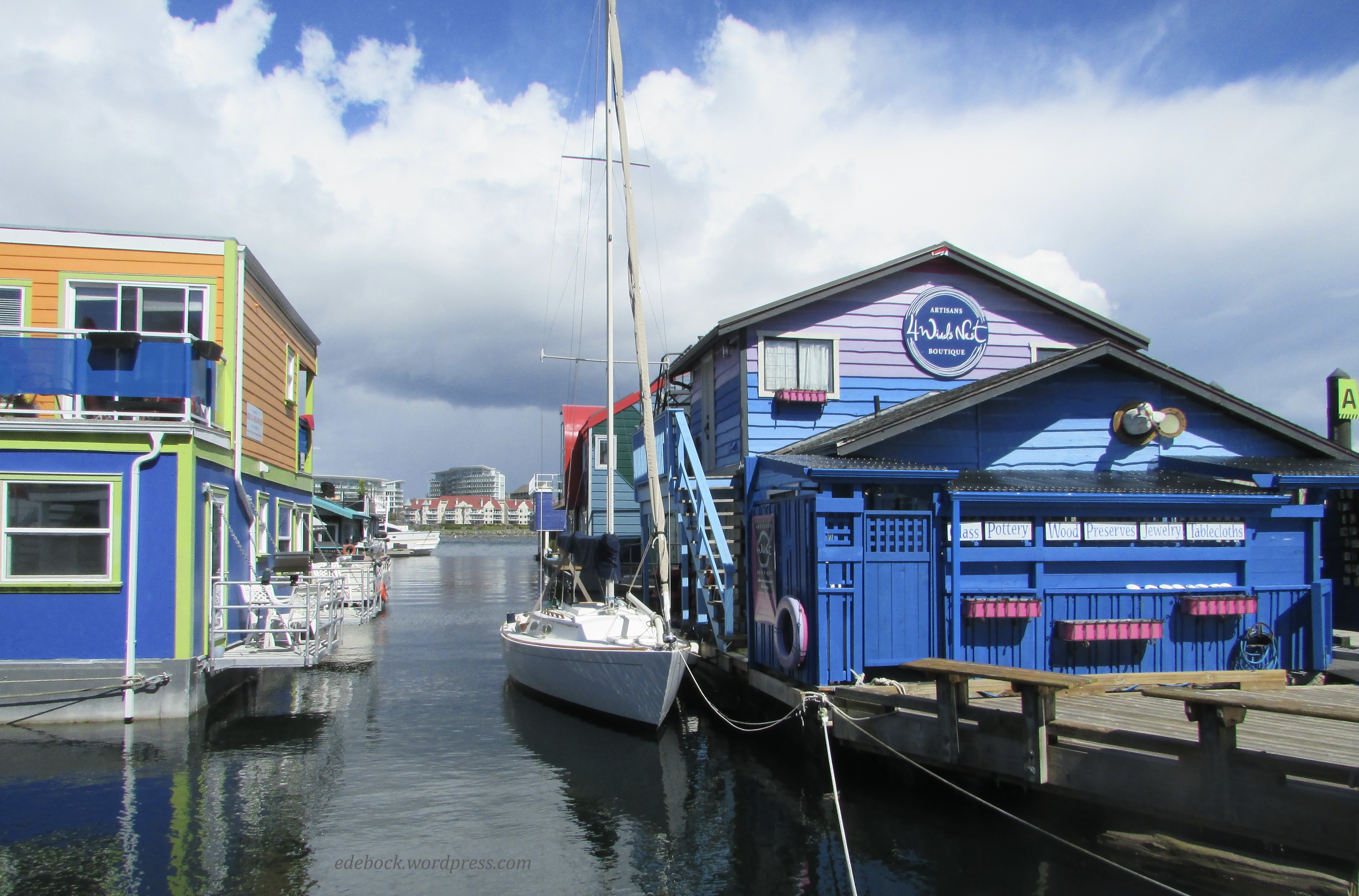
Fisherman’s Wharf is a unique destination with working fishing vessels, pleasure boats with live-aboard residents, float homes, and commercial businesses all moored at the docks. I loved the colourful float homes. Imagine living in a house that gently rocked with the movement of the water! Richard, a lifelong prairie boy, didn’t think he’d like that, but as a displaced coastal girl, I’m pretty sure I’d love it! He did have a point when he commented that there’d be no place to park our golf cart though! 

IMG_3732

IMG_3746

IMG_3748

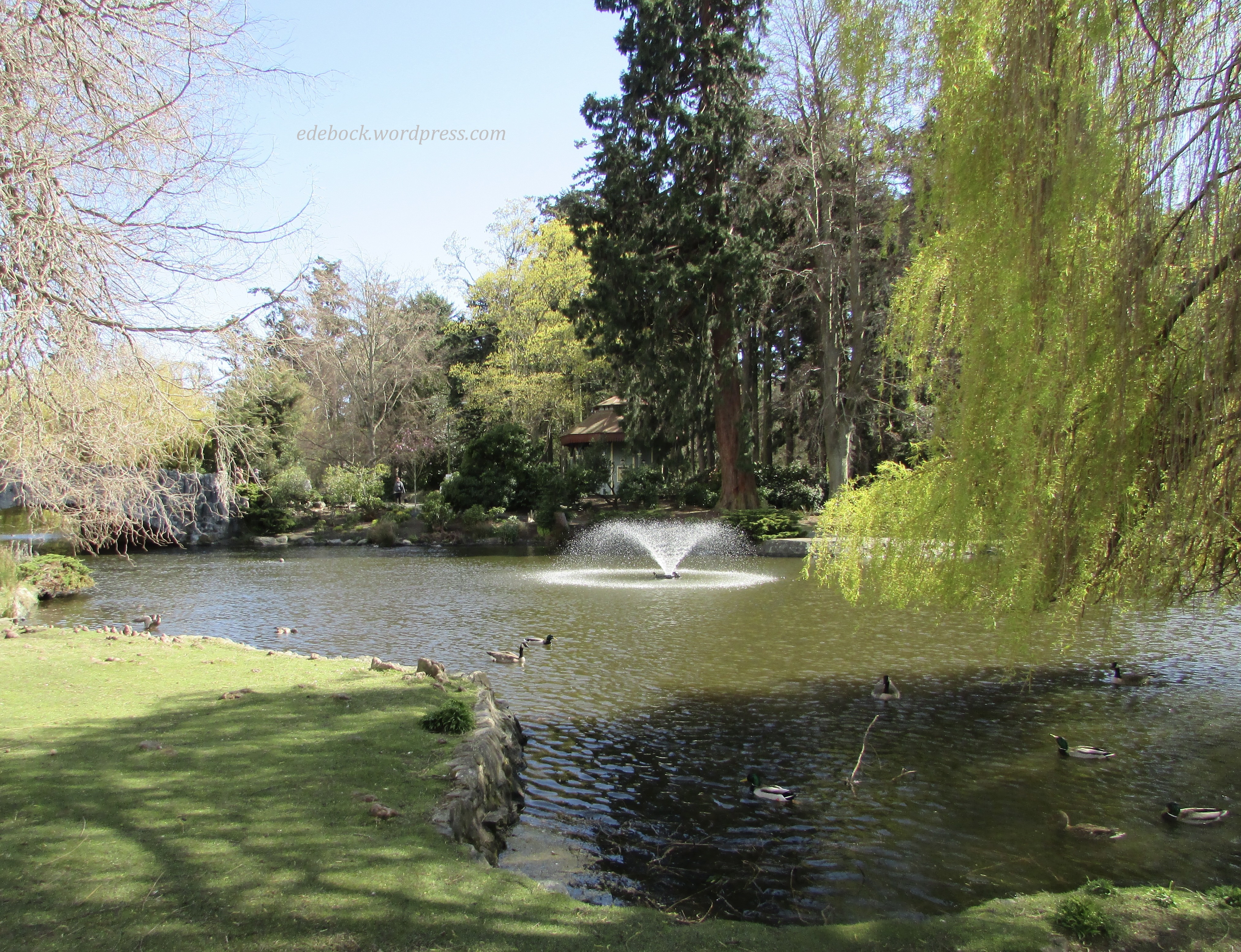
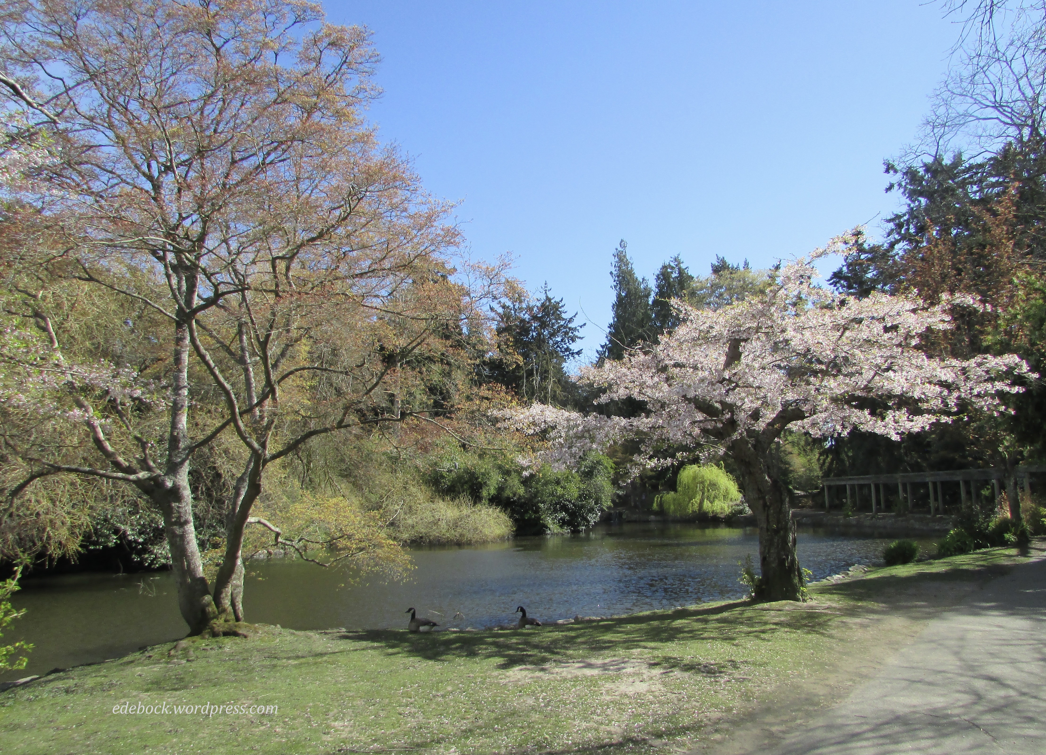
After a delicious lunch of fish and chips on the Wharf, we continued our walk eventually ending up at beautiful Beacon Hill Park, the crown jewel of Victoria’s park system. 

IMG_3770

IMG_3771

IMG_3775

IMG_3778

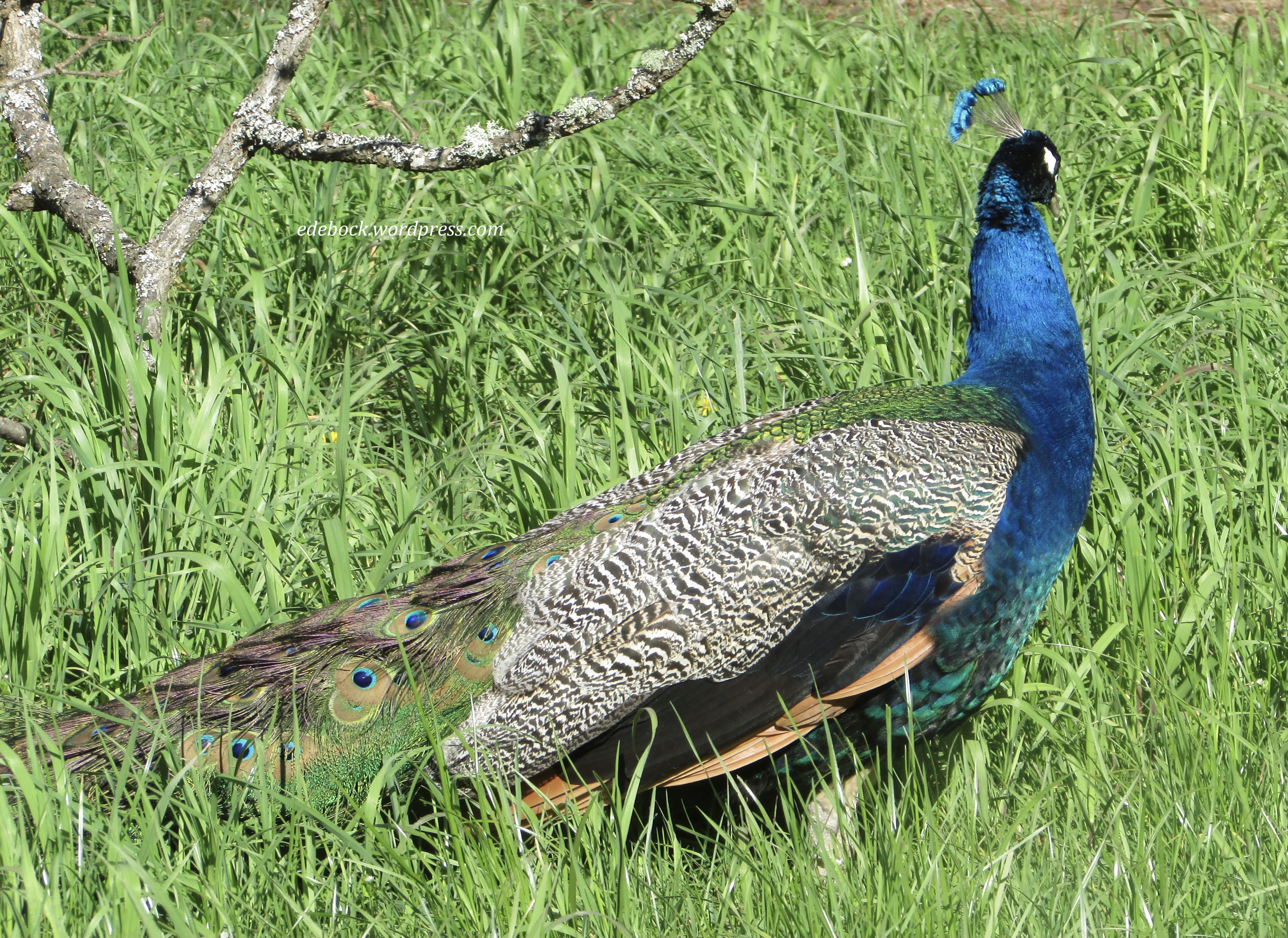
We found several more geocaches while exploring the park. We even had the pleasure of meeting and visiting with another couple who were also hunting for the hidden caches. In addition to the ducks and geese that make the park their home, this gorgeous peacock was just a few feet away from one of the caches and seemed completely unconcerned about our presence. He didn’t oblige us and spread his beautiful tail though. 

IMG_3783

These turtles sunning themselves on a log on one of the park’s ponds appeared to have about as much energy as I have after our very long walk!

IMG_3777

Eventually, we made our way all the way through the park to the oceanside where we could look across the Juan de Fuca Strait to Washington State in the distance. 

IMG_3789

IMG_3792

As you can see, it was a sunny, but very windy day. Perhaps that’s best illustrated by this, one of the windsurfers we saw riding the waves. 

IMG_3791

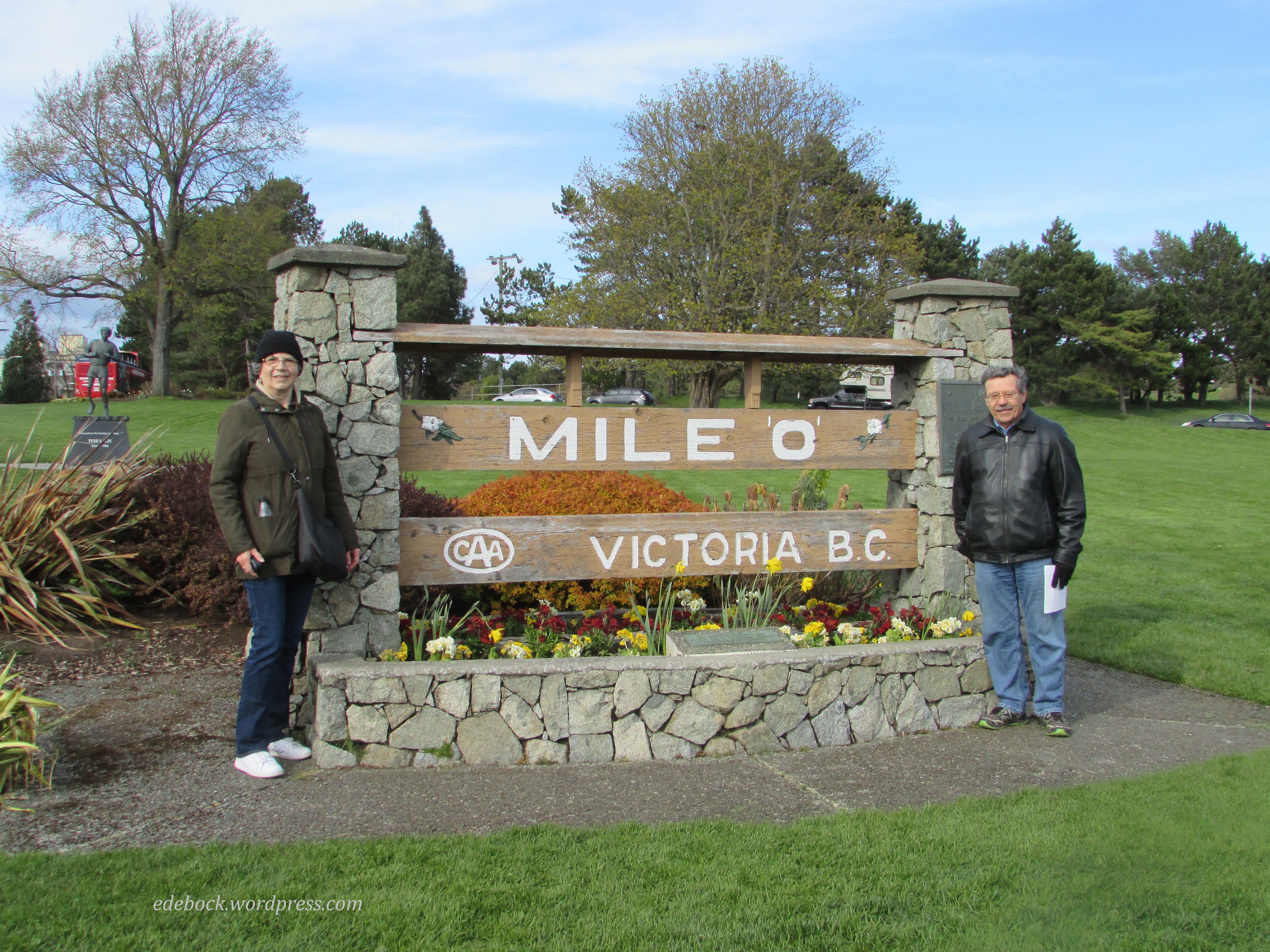
Before beginning the long trek back to our hotel, we stopped at the monument marking Mile 0 on the Trans Canada highway that spans the country from Victoria to St. John’s, Newfoundland. Our geocaching pals offered to take our picture there and I suggested to Richard that perhaps we should visit the other end of the highway this year too. A trip to Newfoundland has been on my mind since acquaintances of ours moved there a few months ago and started posting amazing photographs and videos on Facebook!

IMG_3799

Nearby stands a bronze and granite monument to Canadian hero, Terry Fox, as this was where his Marathon of Hope would have ended if cancer had not returned and claimed his young life before he was able to complete his cross Canada run. 

IMG_3800

And now it’s time to go soak my weary muscles in a hot bath, but do stay tuned. I’ll be back with more of our Victoria visit soon.