Taking time to play tourist

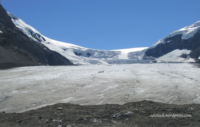
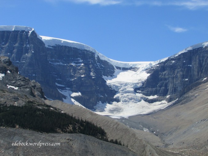
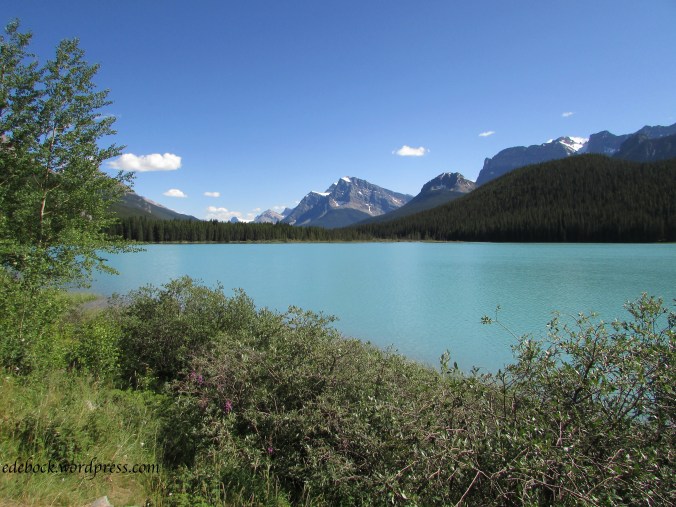
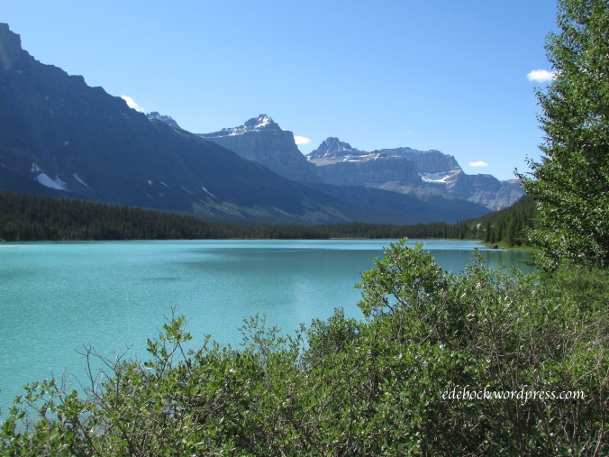
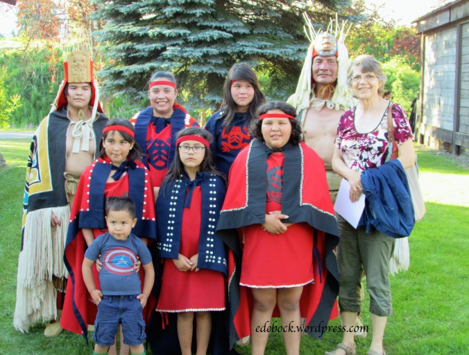
In recent years, whenever we’ve come to Vancouver, it’s been a balancing act trying to spend time with my aging father, my mentally handicapped brother, and our quickly growing grandsons (as well as their parents, of course!) We’ve spent very little time enjoying this beautiful city that was my home many decades ago during my teen years. This time I decided to carve out a little bit of time to play tourist.

IMG_5813

Deep Cove

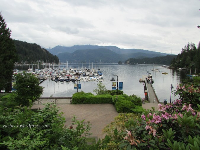
Deep Cove, the easternmost part of the District of North Vancouver, is one of the most scenic spots on the lower mainland. Once a sleepy little village at the end of the road, it has become a major tourist destination. While there are many things to do and see in Deep Cove, the hike to Quarry Rock, which we did with our daughter-in-law and grandsons a little over a year ago, attracts so many people that the District has recently had to introduce more stringent parking regulations and put a cap on the number of hikers allowed on the trail at any one time. Not knowing this, we headed out to Deep Cove late yesterday morning and were lucky to find what might have been the only available parking space in the area! We wandered the two block stretch of Gallant Avenue that forms the community’s commercial core checking out some of the galleries and boutiques before stopping at a tiny bistro for a fish and chips lunch.

—————————————————————————————————————————————-

This morning, we crossed the Lions Gate Bridge and drove through Stanley Park on our way to English Bay Beach, Vancouver’s most densely populated beach area.

IMG_5828

IMG_5851

IMG_5831

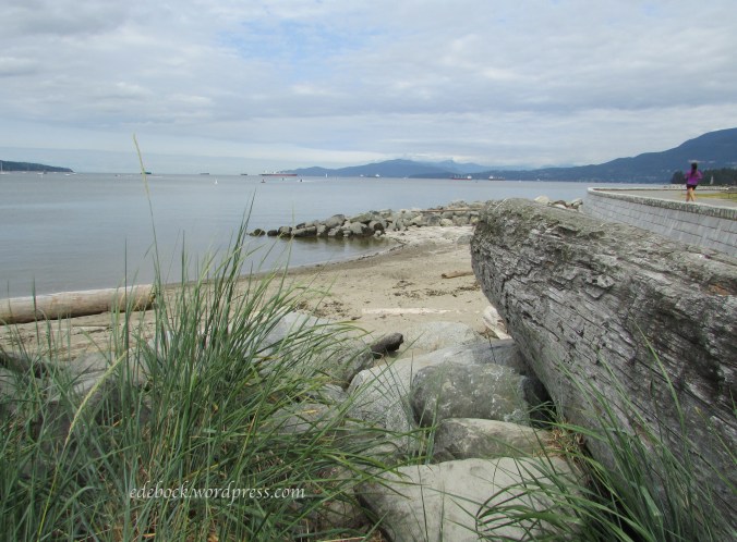
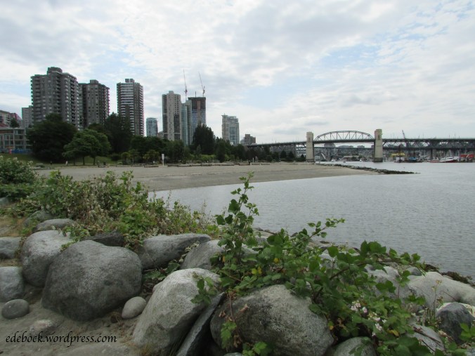
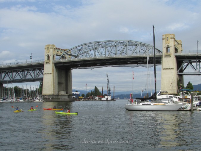
Not far from the hustle and bustle of downtown Vancouver, we walked the long stretch of sandy beach and I breathed deeply of the salty sea air. Continuing on under the Burrard Street Bridge to the foot of Hornby Street, we caught the colourful Aquabus and crossed the narrow inlet to Granville Island.

IMG_5836.JPG

IMG_5837

While a person could easily spend all day on Granville Island, one of Vancouver’s most popular tourist attractions, we only had time for a quick wander through the Public Market and a few of the shops and galleries. After enjoying an outdoor lunch overlooking the water, it was time to cross the inlet again and retrace our steps so that we could spend the afternoon visiting with Dad and get back to North Vancouver in time to watch the boys’ Little League baseball game.

Just before we got back to the car, I had to stop and take several pictures of this Pacific Great Blue Heron near the water’s edge.

Silver and gold!

LogoWhen I was young I wore only gold jewelry. I instinctively knew that it looked better on me than silver did. Sure enough, when I had my colours done in the 1980s, the analyst draped me in a gold metallic cloth and I glowed. Not so with silver. My skin had warm undertones and I was a Spring.

With the passage of time, however, I began to notice a change. As silver streaks began to appear in my hair, I realized that I could wear colours that I hadn’t been able to before, particularly black and white. I also began to add silver jewelry to my collection.

I particularly like pieces that combine both metals. I have several pairs of earrings and a favourite necklace that are part gold and part silver. I’ve always been especially thankful that the watch I received as a retirement gift from my employer is also both gold and silver as I wear it almost all the time.

IMG_5405

Until this Christmas, I wore three rings that I never take off (except when I’m undergoing medical scans that require me to remove all metal).  My engagement ring, my wedding ring, and my family ring are all gold. I’ve always thought that adding a silver ring would look odd, but my Christmas gift from my husband solved that problem! It’s both silver and gold!


IMG_5415

There’s a long story behind this beautiful and very unique ring. Last summer, we were wandering the shops in Jasper, Alberta with our oldest son and his family when I spotted a ring very similar to this one in Our Native Land, a gallery featuring authentic arts and crafts by Canada’s aboriginal artists. I fell in love with the concept; a wide band of sterling silver overlaid with a narrower band of 14kt yellow gold hand carved with a Northwest Coast motif. If you read my post about The Hazeltons last summer, you might remember how much I love the art and culture of the native peoples of the Pacific Northwest.

When our summer vacation was over, I couldn’t get that ring out of my mind. I began to do some research which soon led me to the website for Vancouver’s Douglas Reynolds Gallery. There I found a wide selection of wonderful rings including a couple of the style I had in mind. The website also referred to a book entitled Understanding Northwest Coast Art by Cheryl Shearar which is a detailed guide to the crests, beings and symbols used in Northwest Coast art. I had my local library bring it in and read it from cover to cover to help me decide what motif I wanted on my ring.

A Hummingbird Ring by Haisla artist, Hollie Bear Bartlett, was one of the ones that had caught my eye on the gallery website. The Haisla Nation are a subgroup of the Kwaguilth people, the group that I had focused on during my first anthropology course many years ago at the University of Calgary. According to Shearar’s book, the hummingbird isn’t traditionally a major motif in their art, but “it’s popularity today indicates that it has become a very important symbol of love and beauty.” Perfect!

I told Richard that this was what I wanted for Christmas, but the ring that was advertised wasn’t my size. He contacted the gallery to find out if it was available in other sizes and was told that they could have the artist make one in my size in time for Christmas. Even better! A ring made especially for me by the artist! Richard arranged to pick it up at the gallery on Dec. 23, the day after we planned to arrive in Vancouver for Christmas. By the time we arrived at the gallery, I was as excited as a little child waiting for Santa! After I tried it on, however, it went back in the box to be wrapped and placed under the tree at our son’s house until Christmas morn.

IMG_5410

The ring wasn’t the only piece of jewelry that I received for Christmas. Santa left this silver bangle in my stocking. I think he probably had some help from my daughter-in-law though! After all, she’s the wise young mom who tied a “courage bracelet” around her timid young son’s wrist to remind him that he could be brave and face whatever challenges come his way. My bracelet says “She believed she could, so she did” and I love it!

Please note: The individual ring photos are from the Douglas Reynolds Gallery website. The other photos are my own.


Hello Uniqlo!

LogoI was first introduced to Uniqlo, Japan’s hugely popular casual apparel giant, when we visited our son and daughter-in-law in Japan in 2005. At over six feet tall, it was the one place where Matt was able to find clothing that fit. When we lived in Japan in 2008-2009, I would often jump on my bicycle and ride over to the nearby Uniqlo store (pronounced you-nee-klo) to see what was on sale. I really missed it when we returned to Canada, so I was delighted to find a Uniqlo store an easy bus ride away from our apartment in Dalian, China when we lived there in 2013. I was able to add several basic items to the rather minimalist wardrobe that I’d brought with me. Until this week, the last time I was inside a Uniqlo store was in July of that year!

Uniqlo finally came to Canada in September 2016 with the opening of an outlet in Toronto’s Eaton Centre and I was sure it would only be a matter of time until a store would open in Greater Vancouver. On October 6th of this year, that prediction came to pass with the opening of western Canada’s first Uniqlo in Metropolis at Metrotown. That’s still a two day drive from home for me, but I knew then that I’d be checking it out during our Christmas visit!

I’ve significantly revamped my winter wardrobe over the past couple of years, however, and I’ve decided to declare a moratorium on purchasing new items for awhile, so I wasn’t really looking to buy anything. In spite of my good intentions, I did come away with one item, a pair of light grey fleece-lined wind pants that I’m hoping will work well for cross-country skiing, snowshoeing, and other outdoor pursuits. At almost 70% off their regular price, I simply couldn’t resist! If they aren’t warm enough on their own, they’ll fit comfortably over a pair of leggings.

Unfortunately, I couldn’t find a picture on the Uniqlo website and my photographer has gone to bed! By the time this posts early tomorrow morning, we’ll be up and ready to begin our long drive through the mountains back to Alberta.

I’m planning to be in Vancouver again in the spring or early summer, so I look forward to seeing what Uniqlo has to offer then, but I’m also hoping that one of these days the chain will open a store closer to home in West Edmonton Mall!

Snowshoe adventures

Until this week, the one and only time that I was ever on snowshoes was 43 years ago. While back home in Yellowknife, NWT for my Christmas vacation from university I joined a group of friends for an outing on Pontoon Lake, 34 km from town. The traditional wood-framed snowshoes that we wore that day were much more cumbersome than the sleeker, lightweight versions that are popular today.

wooden snowshoes

The outing was fun and I was glad I went, but it didn’t convince me that snowshoes were something I wanted to invest in and it wasn’t something I ever pursued doing again.

Then came this Christmas and a very special gift from our son, daughter-in-law, and two young grandsons here in Vancouver, an after dark Boxing Day chocolate fondue snowshoe tour on Mount Seymour! With 8 other people and our guide, we set off down moonlit trails through the quiet forest. The night was still, without the slightest breath of wind.  After awhile, we came to an enchanting hand-carved snow lounge in a clearing. Strings of lights twinkled in the trees above as we seated ourselves on the circular snow bench around the round snow table. Our guide provided “butt pads” to keep our rear ends from freezing as we indulged in delicious chocolate fondue featuring a variety of fresh-cut fruit. It was truly a magical experience!

This time, it didn’t take long for me to realize that snowshoeing was definitely something I’d want to do again, so yesterday Matt borrowed a couple of pairs of snowshoes for Richard and I to use and the six of us headed back up Mount Seymour where we snowshoed the First Lake Trail, an easy 2 hour loop. What a delight it was to be sharing a winter trail adventure with the same grandsons that we hiked with in Jasper in July. After a couple of days of heavy rain in the city below, the sun shining through the snow laden trees was absolutely gorgeous!

Snowshoes have now been added to our shopping list!


Magnificent mountain

There’s something about Mount Robson, the highest peak in the Canadian Rockies, that speaks to my soul. It’s a wondrous creation that speaks of beauty, power, and majesty.

Standing alone like a protective sentinel overlooking the Yellowhead Highway just west of the BC/Alberta border, Robson isn’t a distant and inaccessible peak like so many others are. It’s right there, in your face. You can’t miss it, unless it’s shrouded in cloud as it so very often is.

We make the trip to Vancouver at least a couple of times every year and we always hope to see the mountain. We’ve had some excellent views of it in recent years, but yesterday’s topped them all.

Mount Robson in early morning light

We left Jasper early in the morning as the sky was growing light. The highway was covered with packed snow and ice, but the sky was crystal clear. The snow covered trees and the morning light on the mountains were gorgeous.

IMG_5366

The closer we got to Mount Robson, the more hopeful we became that we would get a clear view of it. We’ve been disappointed before, finding it hidden in morning mist, but not this time!

Mount Robson, highest peak in the Canadian Rockies

It was absolutely breathtaking!

Ten years of blogging!

Ten years ago today I published my very first blog post! It was also the shortest post I’ve ever written and the message was very simple:

Richard and I have just accepted positions teaching conversational English in Japan. This is a one year commitment and we’ll be leaving in mid March. The main purpose of this blog is to share our adventure with friends, family and anyone else who’s interested.

Little did I expect to still be blogging ten years later! I anticipated that Following Augustine would only exist for the year that we would be in Asia. In fact, that’s why I chose the title. Augustine BeArce, a Romany Gypsy, was the first of my ancestors to cross the Atlantic Ocean from Europe and make his home in North America. 370 years later when I crossed the Pacific Ocean and settled for a time on the far side of the sea, it only seemed right to give credit to Augustine and the Gypsy blood that I inherited from him!

I’ve always been passionate about writing though and by the time our year in Japan came to an end, I knew that blogging was something I would continue to do indefinitely. What I didn’t know was what it would look like once I was no longer living in a foreign land. For lack of a better definition, I now refer to Following Augustine as a lifestyle, travel, and fashion blog, but one of my readers once called it a great advertisement for retirement!

Over the past decade, life has taken many unusual turns, some delightful and others deeply distressing. Following Augustine has been there through all the ups and downs.

We love to travel and the blog has recorded trips across Canada, into the United States, and to numerous other countries. Never in my wildest dreams did I ever expect to live in the People’s Republic of China though, but our five months there gave me plenty to write about. China’s internet censorship made it a bit more challenging to post from there, but thankfully, with the help of WordPress, I discovered a way to successfully break through or over the “Great Firewall” and continue blogging.

Cancer was never part of my plan either, but when it struck, the blog became a good way to process what was happening and to share it with friends and family. I’ve also used it as a way to raise awareness of NETS (neuroendocrine tumours), the little-known and often misdiagnosed cancer that I continue to deal with. My life is not all about my health, however, so neither is the blog. It’s about living life to the fullest in spite of all its challenges.

A couple of years ago, I became interested in fashion blogging and so the weekly Fashion Friday feature was born, not as a “look what I’m wearing today” narcissistic sort of thing, but as a way to connect with other women and to explore how the ways in which we present ourselves affect our lives. It has had the added benefit of ensuring that I write something at least once a week.

I am a Christ follower and I have fairly strong and not always popular or politically correct opinions on certain issues. I haven’t shied away from sharing those on the blog, but I’m committed to doing so with as much wisdom as God allows me, with integrity and with respect for those whose opinions differ from mine.

When I published that first post ten years ago, our daughter was expecting our first grandchild, so over the years five little people have appeared on the blog from time to time. I’m off to visit three of them this weekend and the other two for Christmas, so it’s possible that they might show up again soon!

What does the future hold for Following Augustine? I have no idea, but I’ve now written 882 posts and I don’t see them coming to an end anytime soon!

3224919

Hidden gems

In addition to world renowned sites like some of the ones in Jasper and Banff National Parks, Canada is home to many hidden gems usually known only to local people. We also found some of those on our recent travels.

After saying good-bye to our son and his family and leaving the mountain parks behind, we spent another week in the nearby foothills where we camped at Bottrel, Alberta with our daughter’s family. There’s actually nothing at Bottrel except a general store and a small unserviced campground, but we heard about it because our son-in-law’s mother lives nearby.

The campground is only 40 minutes from our daughter’s home in northeast Calgary. As soon as we’d set up camp on the bank of the lovely little creek that runs through the campground, we drove into the city to pick up Drew, our oldest grandson, who enjoyed two days of camping with Gram and Grandpa before the rest of the family was able to join us.

One of the things that we wanted to do during that time was introduce Drew to kayaking, but the creek was too small for that and we didn’t know of any lakes in the area. Richard spoke to the storekeeper, who also runs the campground, and learned of a small fishing lake nearby that’s known only to the locals. The highlight of our outing to Winchell Lake was the rare opportunity to watch a loon and her chick close up!

IMG_5018 - Version 2

About 20 minutes from the campground, on our way into Calgary, we had also passed signs for Big Hill Springs Provincial Park. A quick online search revealed that its 2.3 km (1.4 miles) hiking trail with an elevation gain of only 20 metres (66 feet) was popular with young families. Not intending to do the hike until the rest of the family joined us, we decided to take a drive over to the park just to check it out. Drew was so enthusiastic, however, that we ended up hiking the entire trail that day! Of course, as little boys are inclined to do, he put in a few more steps than we did!

IMG_5000

Later in the week, we packed a picnic lunch and returned with the rest of the family. With Drew as our guide, we did the hike again.

An interesting geological feature in this small park, which is located in a beautiful coulee, are the mounds of unusual rock called tufa (too-fah). Apparently tufa forms when water, rich in calcium and carbonate, emerges from the ground. As it comes to the surface, it releases carbon dioxide into the air and forms outcroppings of calcium carbonate rock.

IMG_5026

The first part of the hike was particularly pretty following a stream with lots of little waterfalls.

IMG_4998

IMG_4997

IMG_5001

IMG_5039

I believe this was 3-year-old Simon’s first hike, but he was very keen to go!

IMG_5035

hiking

Later in the afternoon, back at the campground, the creek was a great place to cool off!

IMG_5066

Driving the Icefield Parkway

Though the Icefield Parkway, the highway between Jasper and Banff in the Canadian Rockies, is only 288 km (179 miles) long, it can easily take all day or longer to travel because there are so many amazing places to see along the way. Come along with us and I’ll show you a few of the places that we stopped on our most recent trip.

Athabasca Falls

Approximately 30 km (19 miles) south of the town of Jasper, Athabasca Falls is neither the highest or the widest waterfall in the Canadian Rockies but it is thought to be the most powerful. The falls can be safely viewed and photographed from various viewpoints on both sides of the river. The parking lot is on the north side, but be sure to cross the pedestrian bridge and view the falls from the south side as well. The morning that we were there, the sun was in just the right position to create a vibrant rainbow in the gorge below the crest of the falls when viewed from that side.

IMG_4906

IMG_4918

IMG_4912

IMG_4919

Sunwapta Falls

Another 25 km (15.5 miles) down the Icefield Parkway is beautiful Sunwapta Falls. Sunwapta means “turbulent water” in the language of the Stoney First Nations people.

IMG_4922

IMG_4923

IMG_4925

Columbia Icefield

Another 49 km (30 miles) southward brings you to the Columbia Icefield Discovery Centre at the foot of the Athabasca Glacier. Entering the Discovery Centre was like visiting West Edmonton Mall at Christmas time or a Tokyo subway station at rush hour as tourists from around the world crowded in to purchase tickets to the various tours and adventures in the area! If you visit, however, descend the staircase to the lower level where things are a lot quieter. There you will find a fascinating display of historical photos and a diorama that provides an excellent overview of the entire ice field.

Straddling the Continental Divide along the Alberta/British Columbia border as well as Jasper and Banff National Parks, the Columbia Icefield is the largest ice field in the Rocky Mountains and one of the largest non-polar ice fields in the world. Meltwater drains to three oceans – the Atlantic, the Pacific, and the Arctic via three great river systems – the Saskatchewan, the Columbia, and the Athabasca.

The most accessible part of the Columbia Icefield is the Athabasca Glacier. Even though it has receded significantly in recent times, this six kilometre tongue of ice flows to within one kilometre of the Icefield Parkway. During the summer months, adventurous visitors can hike out onto the glacier with a guide or explore it from the comfort of massive all-terrain vehicles. We chose simply to walk up the trail that leads to within metres of the glacier’s edge.

IMG_4931

IMG_4939

The Athabasca Glacier is only one of many tongues of ice that flow from the massive Columbia Icefield. Right next to it is the Dome Glacier, less accessible, but also impressive. Look at that amazing snow pack atop the ridge! It reminds me of icing on a cake.

IMG_4932

Lower Waterfowl Lake

There are numerous glacier-fed lakes along the Icefield Parkway; too many to stop and photograph each one! Lower Waterfowl Lake struck me as one of the most beautiful.

IMG_4944

IMG_4947

Yes, that truly is the colour of the water! The incredible turquoise colour is the result of glaciers grinding the rock beneath them into a fine powder called rock flour. Meltwater washes this powder into the lakes where it is suspended in the water. These silty waters absorb all the colours of incoming light except the striking turquoise or vivid blue that is reflected back to our eyes.

Lake Louise

If you stopped nowhere else along the Icefield Parkway, world famous Lake Louise is an absolute must! Named for Queen Victoria’s fourth daughter, it is a truly awe-inspiring sight. With Victoria Glacier and an amphitheatre of rugged mountain peaks providing an imposing backdrop, it is a photographer’s delight.

IMG_4953

IMG_4957

IMG_4971


Two great hikes in Jasper National Park

As part of Canada’s 150th anniversary celebration, the country offered free Parks Canada passes to every Canadian and every visitor from around the world who requested one, giving each of us free admission to national parks, national historic sites and national marine conservation areas across the country. We put our pass to good use when we spent a week camping in Jasper and Banff National Parks with our son Matt, daughter-in-law Robin, and grandsons Sam and Nate, who were enjoying their first family vacation in the Beatrice, a newly restored and much loved family heirloom.

Like most mountain parks, both Jasper and Banff abound with hiking trails of varying lengths and degrees of difficulty. While at Jasper, we took advantage of two of these.

Valley of the Five Lakes

We chose this trail on the recommendation of my aunt who has lived in Jasper since 1953 and who continued to hike into her late 80s. The 4.5 km loop, located about 9 km south of Jasper, was an excellent choice. With only 66 m elevation change it was an easy hike for all of us.

The loop takes in all five small lakes, each a different shade of blue or green, but all strikingly beautiful.

First Lake

First Lake

Second Lake

IMG_4812

Second Lake

Third Lake (and in my opinion, the most beautiful)

Third Lake

IMG_4830

IMG_4832

Isn’t that just stunning?

Fourth Lake

Fourth Lake

Fifth Lake

Fifth Lake

While bears are known to frequent the Five Lakes area, especially in berry season, we saw only this frisky little chipmunk who was happy to pose for a photo.

IMG_4828

Maligne Canyon

With a depth of more than 50 metres at some points, Maligne Canyon is one of the deepest in the Canadian Rockies and certainly one of the most spectacular. For our second hike in the Jasper area, we started at the 5th bridge and hiked up the canyon trail to the teahouse at the upper end.

When I first looked at my photos, I was disappointed. Somehow they just didn’t capture the magnitude of what we’d seen. Then I realized that it was the thunderous sound of the water churning through the deep, rocky canyon that was missing! Use your imagination as you follow us up the trail and try to imagine what it sounded like as the canyon walls narrowed and the rushing water echoed below.

IMG_4860

IMG_4864

Where does all that water come from? Located in the Maligne valley, Medicine Lake is formed by the Maligne River. One of the interpretive signs along the hiking trail compares Medicine Lake to a “giant leaky bathtub.” Water from the lake drains into what is thought to be the largest inaccessible cave system in the world and resurfaces downstream through springs along the canyon walls.

IMG_4869

IMG_4874

IMG_4875

The power of the moving water becomes evident when you look at the shapes of the rocky canyon walls that have been whittled away over eons.

IMG_4871

IMG_4873

IMG_4876

In some places, rocks and sand swirling around in the turbulent water wear potholes in the canyon floor or walls. Over time, as the canyon wears deeper these potholes, or bowls as we called them, are left above the water level, reminders of a previous time. You can see a pothole still being formed near the centre of this picture.

IMG_4879

Another interesting feature is the chockstone. Chockstones are giant boulders that have become wedged across portions of the canyon which narrows to only two metres at the top in some places. Over time, erosion slowly reduces the size of the chockstones until they eventually tumble to the canyon floor. There is a chockstone with moss and trees growing on it near the top of this photo.

IMG_4882

The promise of dozens of fossils preserved in the rock beneath our feet was an incentive to keep our young grandsons going as we climbed the last portion of the trail which is a bit steep. They became very good at spotting these reminders that this was once a very different looking world and enjoyed making rubbings of several of them.

IMG_4888

IMG_4889

Though this hike isn’t a long one, if you go, allow yourself lots of time as there are so many interesting things to see and photos to take!

There are many trails in the canyon area and rather than retracing our steps the entire distance, we took a higher trail from the 4th bridge back to the 5th. Though we were above the canyon walls and further from the thundering water, the views were beautiful.

IMG_4892

IMG_4895

IMG_4896


The Hazeltons

After six weeks in the trailer, we are home! Though it was our plan from the beginning to arrive home today, I really wasn’t ready to end our gypsy wandering and I would have happily extended our travels indefinitely. Real life issues beckoned, however, and so it seemed wise to follow through on our original plan. As much as I loved being away from home, I did miss having access to wifi and being able to update the blog on a regular basis. Now that I’m connected again, I’ll do my best to share the remainder of our travels with you over the next few days.

The Hazeltons, a collection of small communities, located around the confluence of the Skeena and Bulkley Rivers in northwestern British Columbia, have been home to the Gitxsan people for centuries. The Gitxsan are a matrilineal society made up of the Frog, Eagle, Wolf, and Fireweed clans. Though their territory is inland, their villages with intriguing names like Kispiox, Gitanmaax, and Hagwillget as well as Hazelton, New Hazelton, and South Hazelton, are a centre of Northwest Coast native culture and, as such, are a place that I’ve long dreamed of visiting. My love for the art and the culture of the native peoples of the Pacific Northwest began as a child growing up on the coast of British Columbia and grew as a student of anthropology during my university years.

After settling into our campsite, we drove a few miles north to Kispiox, best known for the 15 totem poles, some dating back to 1880, that stand in the village alongside the Kispiox River. On the way into the village, we stopped to look at the art work decorating the band office.

IMG_4723

IMG_4732

IMG_4729

IMG_4733

IMG_4730

The following morning, we took a fascinating interpretive tour of the ‘Ksan Historical Village adjacent to our campground. It consists of seven replica cedar longhouses. One of the longhouses contains a small museum and a gift shop that are open to visitors who are also free to enjoy the grounds and photograph the buildings and totem poles. Only the guided tour, available in several languages, allows entrance into the three of the longhouses that contain an abundance of artifacts. The price is nominal and was well worth it! Aside from the Museum of Anthropology at the University of British Columbia in Vancouver, I have not seen such an extensive collection of Northwest Coast history anywhere! Unfortunately, photography was not allowed inside the longhouses, so I’m not able to share that part of the experience with you.

IMG_4774

IMG_4759

IMG_4763

IMG_4762

The small, narrow door in the last photo was designed to prevent enemies from entering in full armour.

As always, the totem poles fascinated me. Here’s a closer look at a few of them.

IMG_4767

IMG_4776

IMG_4761

IMG_4760

We were especially fortunate to be in the area on a Wednesday. Every Wednesday evening during the summer months, a local group offers a traditional song and dance presentation in the Wolf House, one of the historical village’s longhouses. Again, for a nominal fee, I was thrilled to have the unique opportunity to see and experience this aspect of the Northwest Coast culture. I was especially delighted to see that the group included all ages; that the traditional songs and dances are being passed on to the younger generations.

IMG_4799

As we explored the various villages that make up the Hazeltons, we were especially impressed with how welcoming the First Nations residents were. While we were strolling around the historical section of Old Hazelton a local woman stopped to chat and told us about an easy 10 minute hike from New Hazelton to a beautiful waterfall. Had she not been willing to share with us, we would never have known about it!

IMG_4792