The Hazeltons

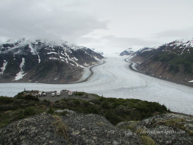
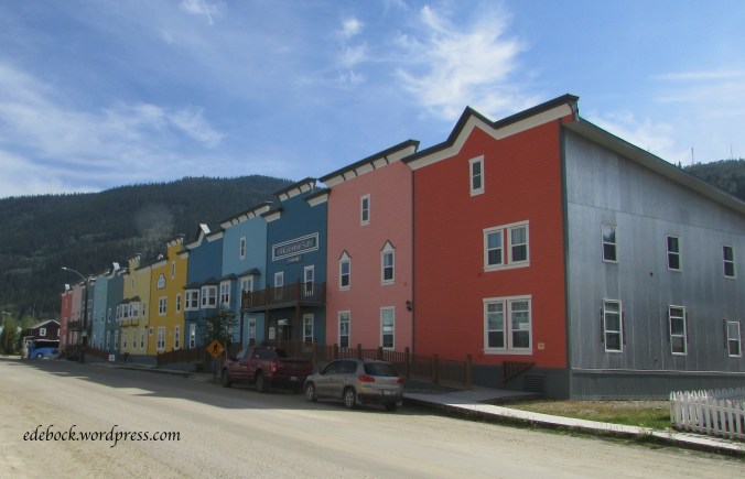
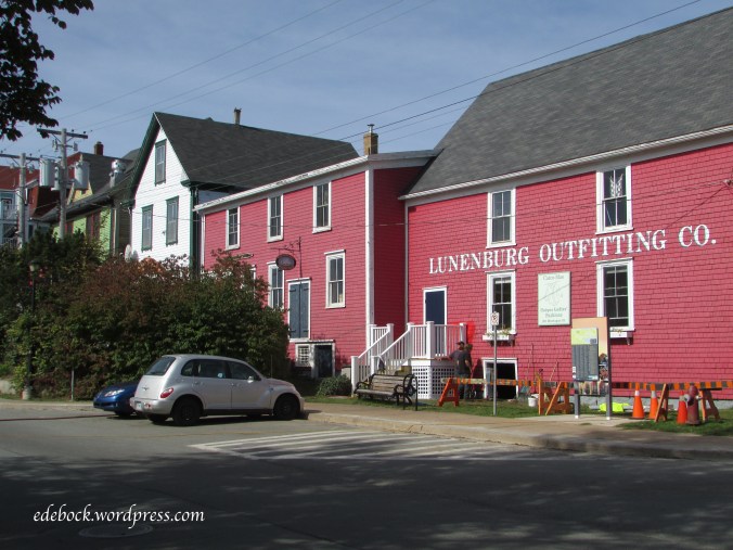
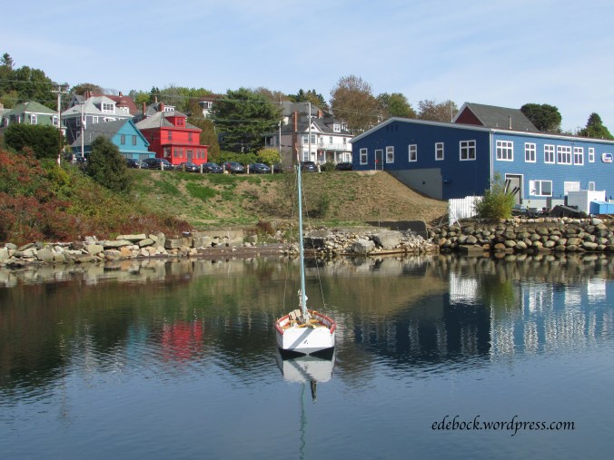
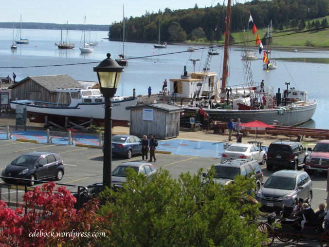
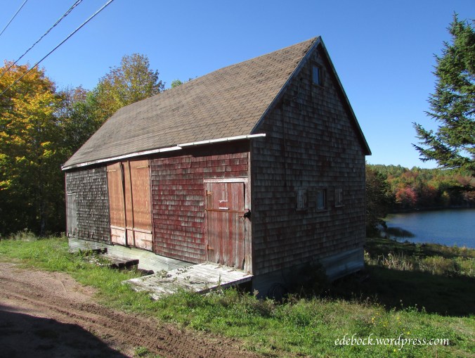
After six weeks in the trailer, we are home! Though it was our plan from the beginning to arrive home today, I really wasn’t ready to end our gypsy wandering and I would have happily extended our travels indefinitely. Real life issues beckoned, however, and so it seemed wise to follow through on our original plan. As much as I loved being away from home, I did miss having access to wifi and being able to update the blog on a regular basis. Now that I’m connected again, I’ll do my best to share the remainder of our travels with you over the next few days.

The Hazeltons, a collection of small communities, located around the confluence of the Skeena and Bulkley Rivers in northwestern British Columbia, have been home to the Gitxsan people for centuries. The Gitxsan are a matrilineal society made up of the Frog, Eagle, Wolf, and Fireweed clans. Though their territory is inland, their villages with intriguing names like Kispiox, Gitanmaax, and Hagwillget as well as Hazelton, New Hazelton, and South Hazelton, are a centre of Northwest Coast native culture and, as such, are a place that I’ve long dreamed of visiting. My love for the art and the culture of the native peoples of the Pacific Northwest began as a child growing up on the coast of British Columbia and grew as a student of anthropology during my university years.

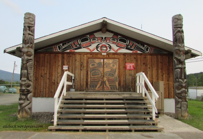
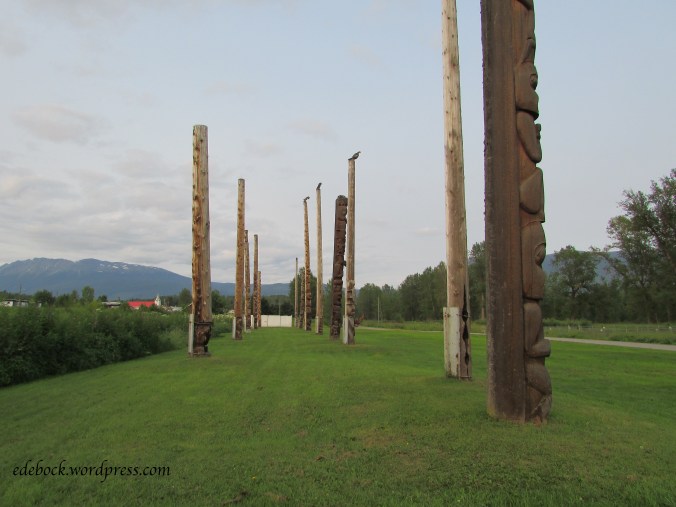
After settling into our campsite, we drove a few miles north to Kispiox, best known for the 15 totem poles, some dating back to 1880, that stand in the village alongside the Kispiox River. On the way into the village, we stopped to look at the art work decorating the band office.

IMG_4723

IMG_4732

IMG_4729

IMG_4733

IMG_4730

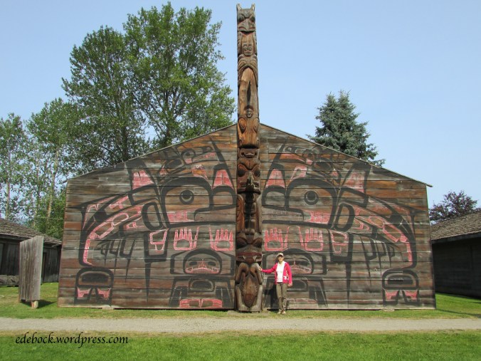
The following morning, we took a fascinating interpretive tour of the ‘Ksan Historical Village adjacent to our campground. It consists of seven replica cedar longhouses. One of the longhouses contains a small museum and a gift shop that are open to visitors who are also free to enjoy the grounds and photograph the buildings and totem poles. Only the guided tour, available in several languages, allows entrance into the three of the longhouses that contain an abundance of artifacts. The price is nominal and was well worth it! Aside from the Museum of Anthropology at the University of British Columbia in Vancouver, I have not seen such an extensive collection of Northwest Coast history anywhere! Unfortunately, photography was not allowed inside the longhouses, so I’m not able to share that part of the experience with you.

IMG_4774

IMG_4759

IMG_4763

IMG_4762

The small, narrow door in the last photo was designed to prevent enemies from entering in full armour.

As always, the totem poles fascinated me. Here’s a closer look at a few of them.

IMG_4767

IMG_4776

IMG_4761

IMG_4760

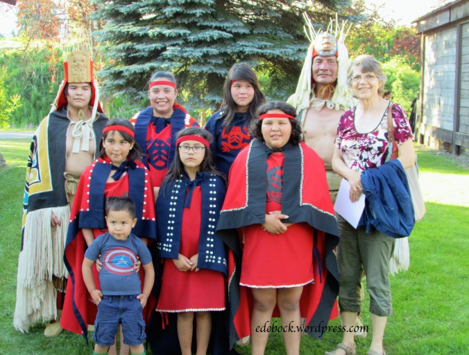
We were especially fortunate to be in the area on a Wednesday. Every Wednesday evening during the summer months, a local group offers a traditional song and dance presentation in the Wolf House, one of the historical village’s longhouses. Again, for a nominal fee, I was thrilled to have the unique opportunity to see and experience this aspect of the Northwest Coast culture. I was especially delighted to see that the group included all ages; that the traditional songs and dances are being passed on to the younger generations.

IMG_4799

As we explored the various villages that make up the Hazeltons, we were especially impressed with how welcoming the First Nations residents were. While we were strolling around the historical section of Old Hazelton a local woman stopped to chat and told us about an easy 10 minute hike from New Hazelton to a beautiful waterfall. Had she not been willing to share with us, we would never have known about it!

IMG_4792

Stewart, Hyder and a river of ice!

As we travelled south on northwestern BC’s Cassiar Highway, a 65 km (40 mile) side trip took us into the tiny town of Stewart located at the head of the Portland Canal, a narrow salt water fjord approximately 145 km (90 miles) long. The fjord, the fourth longest in the world, forms a natural boundary between Canada and Alaska. Stewart boasts that its deep harbour is Canada’s northernmost ice-free port.

IMG_4702

I had to visit this picturesque spot if for no other reason than I was born a Stewart!

IMG_4621 - Version 2

Most tourists come for other reasons though including the Salmon Glacier, the fifth largest glacier in Canada. A self-guided auto tour brochure, available at the Stewart visitor information centre, explains the history and natural surroundings of the area as you drive the 37 km (22.9 miles) to the Summit Viewpoint overlooking the glacier.

Although the Salmon Glacier is located in Canada, accessing it requires crossing the border into Alaska at Hyder, just 3 km (2 miles) from Stewart. If you go, make sure you have your passport with you so you can re-enter Canada after your drive!

IMG_4705

Once a booming mining town, Hyder, with its population of “100 happy Americans” is almost a ghost town. Though there are still a post office, 2 motels and couple of stores, most of its main street is boarded up. This building, a gorgeous reminder of days gone by, was definitely my favourite.

IMG_4699

About 6 km (3.7 miles) after leaving Hyder, we stopped at the Fish Creek Wildlife Viewing Area hoping we might be lucky enough to see some of the bears that come to feed at the creek during the annual salmon run from July to September. Though salmon had been spotted further downstream, they hadn’t made it that far yet and there were no bears to be seen. Further up the road, however, we did see several of these little creatures.

IMG_4630

We weren’t sure what they were until we checked with a wildlife officer at the viewing site on our way back down and learned that they are hoary marmots. They seemed completely oblivious to or unconcerned about human traffic. In fact, at one point, three of them engaged in a playful wrestling match in the middle of the road while we and other motorists waited for them to tire and move on! I was able to walk right up to one of them to take pictures!

The drive to the glacier, some 4300 feet (1300 metres) above sea level, was almost like climbing a mountain by car! The narrow, bumpy road, unpaved after the Wildlife Viewing Area, clung to the mountainside as we climbed higher and higher. Soon we were passing expanses of snow!

IMG_4654

A little further along, the toe or snout of the glacier came into view.

IMG_4643

Continuing onward and upward, we enjoyed many views of the enormous river of ice.

IMG_4648

I was still awe struck when we reached the Summit Viewpoint and realized that there was so much more to the glacier than we had been able to see before that.

IMG_4661

It was chilly, but we ate our lunch overlooking the vast expanse of ice.

IMG_4663

Turning around and noticing the bluff overlooking the parking lot, I realized that it begged to be climbed, so off we went!

IMG_4688

I’m so glad we did. It was an easy scramble and the sights that greeted us were amazing!

IMG_4669

IMG_4674

I think the views of the glacier were even better from the top of the bluff. Looking down on the parking lot and our vehicle on the far left (with our bright red kayak on top) helped put the vastness of the glacier into perspective.

IMG_4682

Miles Canyon

IMG_4536

We didn’t spend much time at Whitehorse on our recent trip to the Yukon, but there was one site we’d been to on a previous trip that I wanted to revisit. Miles Canyon, where the Yukon River has cut its way through a flow of basaltic lava, is probably the most picturesque and dramatic natural feature close to Whitehorse. The narrow channel through the canyon was a serious challenge for miners and gold seekers on their way up the Yukon River to the Klondike gold fields. Hundreds of boats loaded with precious supplies as well as several lives were lost trying to navigate this treacherous stretch of river. Though the hydroelectric dam built in 1959 to supply Whitehorse with power somewhat tamed Miles Canyon, it is still a spectacular spot.

IMG_4538

IMG_4539

My main reason for wanting to revisit the canyon is the fact that since our previous visit in the early 1990s, I’ve conquered my fear of heights. This time I was able to cross the sturdy 85-foot-long suspension bridge over the gorge with confidence and I even managed to walk the narrow trail along the canyon’s rim. Of course, it probably helped that I didn’t have three young children in tow this time and didn’t have to worry about them plunging over the edge into the tumultuous water 50 feet below!

IMG_4553

IMG_4545


Don’t get eaten by a bear!

We have never seen as many bears in the wild as on this trip… 18 so far! We’ve even hesitated to go hiking in some areas due to the risk of meeting a bear on the trail. In spite of the sign, we did do the 9th Avenue Trail at Dawson City though.

IMG_4476

The only wildlife we saw was this curious fellow who stopped munching long enough to watch us go by.

IMG_4464

Well, that’s not entirely true. There were also mosquitoes! Lot’s of mosquitoes! We made two errors that a hiker should never make. First, I forgot my water bottle. I filled it and left it sitting on the counter in the trailer. Fortunately, I’d packed some pop for our lunch, so we were able to stay hydrated. Second, we forgot bug spray, a big mistake, especially in the north! The mosquitoes hadn’t been bad in town, so we didn’t didn’t even think about them until we were out in the bush getting bitten. Luckily, it was a cool day and we were wearing long pants and sleeves, so we didn’t get eaten alive.

Back to the bear sign though. Notice that it says, “BE ALERT MAKE NOISE”. I’ve been giving Richard a hard time lately over the fact that throughout our many years of marriage, he hasn’t been a very open communicator. I know that some of you who know him will find that difficult to believe, but it’s true. I also read that talking works better than carrying bear bells as a way to avoid an encounter with the furry beasts. When we read the sign, I told Richard, “Today you’d better talk to me or you might get eaten by a bear!” In fact, I think a new code phrase has been born. From now on, if I think he’s being particularly uncommunicative, all I’ll have to say is, “Don’t get eaten by a bear!” and he should know what I mean!

Anyway, I digress. Back to the hike…

Beginning in 1898 when the population of Dawson City swelled with thousands of people hungry for gold, tents and then log homes were built up the steep hillside behind the present day town. Today, the uppermost avenue is 8th, hence the name of the 9th Avenue Trail that follows the perimeter of the town, but further up the hill. As the gold rush came to an end and the population dwindled, the hillside homes were eventually abandoned, but there are glimpses all along the trail that there were once people living there. The homes were often built on flat platforms with stone retaining walls. Most of these wooden structures are long gone, but a few signs of them can still be seen.

IMG_4462

IMG_4466

There was no garbage collection in Dawson’s early days. Broken and discarded items were often piled up outside the buildings. Rusty remnants can still be seen along the trail offering archaeologists plenty of information about life in early Dawson.

IMG_4478

I’m not even sure what that was, but the bed springs were obvious. I wonder who slept on them and what their story was?

IMG_4477

The hike was not a long or strenuous one. The 9th Avenue Trail itself is only about 2.5 km in length. We made it a little longer by adding the connecting Crocus Bluff Nature Trail which leads out to a viewing platform perched on a rocky bluff overlooking the highway entering Dawson and the confluence of the Klondike and Yukon Rivers.

IMG_4473

IMG_4470

Dawson City, heart of the Klondike

On August 16, 1896 gold was discovered on Rabbit Creek (later called Bonanza), a tributary of the Klondike River. When news of the strike reached the outside world the following summer, the Klondike gold rush was on! 100 000 people set off for the Klondike and approximately 30 000 of them made it. By the summer of 1898, Dawson City, at the confluence of the Klondike and Yukon Rivers, had become the biggest city north of Seattle and west of Winnipeg!

We thoroughly explored Dawson’s gold rush history on previous visits, but this time we were there for our nephew’s wedding. Richard and his five siblings were all together for the first time since 2012, so much of our time was spent visiting with family.

With a present population of less than 2000 people, however, the town is small and easy to see. Come take a look around with me.

Built by Arizona Charlie Meadows in 1899, in its heyday The Palace Grand Theatre saw everything from vaudeville to silent movies. Eventually, however, it fell into disrepair. In 1992, the then condemned structure was given to Parks Canada by the Klondike Visitors Association and underwent complete renovation. For many years, it was home to the Gaslight Follies, a high energy musical comedy that played nightly from May to September. Sadly, once more in need of refurbishing, the theatre is presently closed again. Plans to have it reopen in time for Canada’s 150th birthday and the 75 anniversary of the building of the Alaska Highway this summer fell through when asbestos was discovered and progress on the project slowed significantly.

IMG_4422

From 1896 to the mid 1950s, more than 250 sternwheelers plied the waters of the Yukon River. At one time, as many as 70 of these majestic riverboats carried passengers and supplies from Whitehorse to Dawson City. Now the stately SS Keno sits on Dawson’s riverbank welcoming visitors to come aboard for a step back in time.

IMG_4444

The streets of Dawson offer a mix of old and new, often side by side.

IMG_4427

Many buildings remain from Dawson’s early days, some still in use and others reminders of days gone by.

IMG_4426

IMG_4428

IMG_4435

Even modern structures retain the look and character of historic Dawson.

IMG_4424

IMG_4431

Permafrost, a thick layer of permanently frozen soil below the surface of the ground, underlies this northern community and requires special building techniques to keep it from melting. Old buildings like these ones, hastily constructed during the gold rush, show what happens when the frozen sublayer softens.

IMG_4434

No visit to Dawson would be complete without at least strolling by Robert Service’s cabin. It was here that the poet who penned The Cremation of Sam McGee and numerous other northern tales lived from 1909 to 1912.  A costumed actor playing the role of Robert Service offers readings there every afternoon during the summer months.

IMG_4481

The Cremation of Sam McGee begins with the words “There are strange things done in the midnight sun by the men who moil for gold”. The midnight sun is one of the things that I love best about northern Canada in the summertime. Here’s a photo taken at 11:30 PM. As you can see, the sun has dipped behind the hill overlooking Dawson, but it never gets any darker than this!

IMG_4513

The final stop on our virtual tour of Dawson City, the Commissioner’s Residence, built 1901 as to house the government leader of the newly formed Yukon territory, now has a permanent place in our family history. It was on those steps that our nephew and his beautiful bride were married on Saturday, July 8th!

IMG_4438

Wearing the poppy

logo

Today is supposed to be Fashion Friday here on Following Augustine, but publishing a typical fashion post on Remembrance Day seems frivolous, almost disrespectful. Instead, let’s take a look at how and why we wear the iconic symbol of this sombre occasion, the little red poppy.

For some of my readers, a bit of explanation may be needed. Here in Canada, as well as in the UK and other Commonwealth countries, November 11 is known as Remembrance Day. It is a solemn day for remembering and honouring those who have given their lives in war, more like Memorial Day in the US than Veterans Day.

Inspired by the World War I poem “In Flanders Fields” written by Canadian physician, Lieutenant Colonel John McCrae, the Remembrance Day poppy is an artificial flower that has been worn since 1921. Though some say that its red colour represents blood shed in war, more truthfully, it is simply the colour of the common field poppies that were the first flowers to grow on the disturbed earth of the battlefields of northern France and Belgium and on the graves of countless soldiers.

remembrance-day-poppyIn Canada, millions of poppies are distributed freely in the days leading up to Remembrance Day. Donations received by the Canadian Legion Poppy Fund are used to support veterans and their families in need. Prior to 1996, our poppies were made by veterans with disabilities in workshops in Montreal and Toronto and served as a small source of income for them and their families. In 1996, the Legion awarded a contract to a Canadian company to produce the poppies but it maintains strict control over their production .

There are many questions about how the poppy should be worn. According to Canadian tradition, the poppy is worn on the left breast or lapel symbolizing that you keep those who died close to your heart, but in Britain many say that men should wear it on the left and women on the right. This year I’ve decided to wear mine on the right because, like most right-handed women, I carry my handbag over my left shoulder. It seems to me that knocking my poppy off and leaving it lying in the dirt or covering it with my purse strap would be much more disrespectful than wearing it on the wrong side. Queen Elizabeth II, who isn’t usually hindered by a purse, wears hers on the left. Unlike most of us who wear a single poppy, she also chooses to wear a cluster of them.

queen

The British poppy has a small green leaf that is often positioned at 11 o’clock representing the eleventh hour of the eleventh day of the eleventh month, the time that World War I formally ended. The leafless Scottish poppy, like our Canadian one, is more botanically accurate and also less expensive to produce.

In spite of the fact that I have tried to convince my husband that he shouldn’t replace the pin on his poppy with something else to make it more secure, he insists on using a tiny Canadian flag or maple leaf pin to hold his in place. The Canadian Legion’s position is that nothing should be substituted for the poppy’s original straight pin. Unfortunately, redesigning the poppy to better secure it to clothing would increase production costs. There are ways to prevent it from falling off, however. The tiny plastic sleeve that is often used as a pierced earring back works perfectly. If you don’t have such a thing available, a bit of clear tape also works well.

I like what the Royal British Legion says: “There is no right or wrong way to wear a poppy. It is a matter of personal choice whether an individual chooses to wear a poppy and also how they choose to wear it. The best way to wear a poppy is to wear it with pride.”

in-flanders-fields

Colourful Lunenburg

Old Town Lunenburg, Nova Scotia is one of only two urban communities in North America to have been designated a UNESCO World Heritage site. It’s also considered to be the best surviving planned British colonial town in North America. Its harbour-side streets are lined with well preserved and colourfully painted historic buildings.

This colourful section of King Street is known as the UNESCO Fresco!

img_2848

Canada’s Maritime provinces are dotted with old wooden churches, none more beautiful than St. John’s Anglican Church in Lunenburg.

img_2830

Visible for miles around, Lunenburg Academy, built in 1895, dominates the hilltop. Imagine going to school there!

img_2836

This stately giant stand nearby.

img_2834

Though we’d visited before, we thoroughly enjoyed wandering the streets and busy harbour front again.

img_2847

img_2849

img_2856

img_2854

I loved the name on this fishing boat!

img_2857

img_2867

Searching for colour and finding history

img_2873-version-2

We knew from our previous visit with Ronnie and Myrna, the dear pen pal that I inherited from my mother-in-law, that they enjoy sightseeing drives through the lovely countryside around Mahone Bay. Like my own father, however, Ronnie has macular degeneration and is legally blind. He still has some sight, but not enough to drive. When we suggested taking them for a drive to look at the fall colours that Nova Scotia is famous for at this time of year, they jumped at the opportunity and off we went!

img_2788

With Richard behind the wheel and Myrna navigating, we headed inland toward New Ross. Sure enough, though many of the trees were still green, others were aflame. For those of you who are accustomed to the wide range of reds, oranges and golds of autumn, our delight might seem odd, but where we live in Alberta, we don’t experience the same array of colours in the fall. Most of our trees just turn shades of yellow.

We saw much more than trees, however. Soon Myrna was pointing out the house where she grew up. It was here that she wrote the first letters to my mom-in-law over 75 years ago! Obviously well cared for, it has new shutters, windows and front door since the last time she saw it.

img_2791

Along the same road, we saw her uncle’s old horse barn

img_2802

and the one room schoolhouse that she attended.

img_2805

At 16 years of age, with a grade 11 education, Myrna became a teacher in a similar school! She taught for five years before she and Ronnie married.

Nova Scotia has been changing before our very eyes with more colour every day. Here are just a few more sights from that day’s drive.

img_2792

Halifax Seaport

img_2611

We spent most of our weekend in Halifax exploring the harbour area. Our first stop was the newly renovated Canadian Museum of Immigration at Pier 21, Canada’s last standing ocean immigration terminal. It was here that a great many of the immigrants who arrived in our country between 1928 and 1971 first stepped onto Canadian soil. As well as offering a fascinating step into the past to experience what it was like to immigrate through Pier 21, the museum showcases the vast contributions that newcomers have made to Canada’s culture, economy and way of life. I was particularly touched by the wall of testimonies written by previous visitors to the museum. Here are just a few of them.

img_2610


img_2607

img_2605

As we explored the Halifax Seaport, a vibrant waterfront area and a popular destination for both locals and tourists, we passed “The Emigrant”, a beautiful bronze and marble monument depicting an emigrant leaving his home country to start a new life in Canada. The piece was designed, sculpted and donated by artist, Armando Barbon, himself an immigrant who wanted to say thank you to his adopted country.

img_2615-version-2

In addition to being the place where many new Canadians first stepped onto our shore, the Halifax harbour was also the location where thousands of First World War soldiers last stood on Canadian soil. A trail of footprints burned into the wooden boardwalk traces the path of the long-gone fighters to a memorial arch bearing the words “The Last Steps”.

img_2631

The Seaport is also home to the Maritime Museum of the Atlantic. There, I found the exhibit devoted to the 1917 Halifax Explosion most interesting. On that darkest day in Halifax’s history, at 9:06 a.m. on December 6,  a dreadful miscommunication between two ships in the harbour resulted in an explosion of cataclysmic proportions. 2,000 people were killed and 9,000 more injured. It was the largest man-made explosion in history prior to the first nuclear blast.

In addition to exploring local history, I loved just walking the boardwalk and enjoying the harbour sights.

img_2636

img_2626

img_2630

img_2635

img_2637

Fore!

Screen Shot 2016-03-18 at 11.07.24 PM 3 Today seems like a perfect time to write about what I wear to play my favourite sport. After all, I won the ladies side of the Viking Golf Club seniors tournament yesterday!

Let’s ignore the fact that there were only four ladies entered in the tournament, shall we?

Weather permitting, my golf attire usually consists of a sleeveless, collared golf shirt worn with either capri pants or long shorts.

IMG_2134

Though my wardrobe is made up largely of neutrals, golfing is a fun time to add a splash of colour, so I have several bright shirts to choose from.

I always wear a ball cap when I’m golfing to shade my eyes and keep my often unruly hair under control. I have a variety of them in several different colours to coordinate with my shirts.


IMG_2147

Though I most often golf in a comfortable and supportive pair of golf shoes, I also have a pair of golf sandals that are especially nice on hot days.

Regardless of what I wear, I’ll never look as elegant on the golf course as my Mom did! Here she is back in the 1940s. I doubt if there’s a course anywhere in the world today that would let you on the greens in those shoes, but aren’t they adorable?

Scan