Searching for the sea

Dalian is known for its impressive coastline and many beaches. Though I’ve lived on the Alberta prairie for well over 30 years, I’m still a coastal girl at heart and I’ve been looking forward to warmer weather so that we could begin exploring that part of the city.

When the temperature climbed to at least 15ºC each of the past two afternoons, I decided that today might finally be the day to visit the shore. The day dawned bright and sunny and though it was a little cooler, the wind wasn’t blowing. I couldn’t wait any longer!

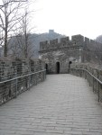
Our Lonely Planet guidebook suggested taking the bus to Fujiazhuang Beach. From there, we could walk a combination of sidewalks and boardwalks that run along the coast to Xinghai Square, a distance of 4 or 5 km. If we wanted to, we could continue further along the seaside but we haven’t been to Xinghai Square, the biggest city square in Asia, yet so we thought we’d probably spend some time there instead.

The guidebook told us to catch bus 5 on Jiefang Lu not far from the railway station. We know that area fairly well now but we couldn’t find bus 5! After walking along Jiefang checking the various bus stops, which fortunately have signage in English as well as Chinese, we discovered that bus 22 went to Xinghai Beach so we decided to take that one and see where we ended up. As it turns out, we were about 2 km from Xinghai Square but in the opposite direction from where we intended to be. Since we don’t have a city map, we didn’t know that until after we got back to the apartment and I looked it up on Google Maps!

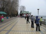
In the meantime, we were on a beach which was all that really mattered to me! The sound of the waves lapping the shore and the smell of the sea was exactly what I was looking for even if there was no boardwalk to stroll on. For a crisp April day, Xinghai Beach was a happening place. While not as crowded as I’m sure it will be when summer comes, there were plenty of people walking the pebbly beach, sitting in the sunshine or flying kites. While I picked up bits of sea glass to add to my collection, many of them were picking up seaweed to take home and cook for dinner! Others were fishing.

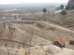
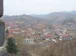
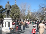
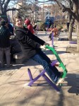
We walked the full length of the beach then wandered through an amusement park that’s located at one end. There we rode the rather squeaky and dilapidated ferris wheel in order to get a better view of the area but the windows were so badly scratched that my pictures didn’t turn out very well!

Heading back toward the bus stop hoping to retrace our route and find our way home, we noticed that the tram also ran by and stopped there. There are only three tram routes in Dalian and we hadn’t ridden one yet so when we saw that one was coming and heading in the right direction, we ran for the stop and jumped on. We didn’t know for sure where it went but we knew that it would eventually end up in the city centre. As it turned out, it was a much shorter and quicker ride than the bus would have been.

I’m still determined to do the seaside walk but it will have to wait for another day!

One step from North Korea

According to our Lonely Planet guidebook, after traversing the Great Wall we had two choices for returning to the parking area where we’d catch a ride back to Dandong. We could either follow the river on a narrow dirt path or choose a hiking trail along the cliff face. The couple we were travelling with expressed a preference for the easier riverside trail but I was secretly delighted when we couldn’t locate it and had to set off along the more challenging route instead! We shared it with many other people and didn’t actually see anyone below us so I’m assuming that the easier path isn’t there anymore. Instead, we looked down on the fence that ran along our side of the river and separated us from North Korea.

Even though I’ve pretty much managed to overcome my lifelong fear of heights, as we went along I was very thankful for the sturdy metal fence that provided both protection from falling and a handrail when it was needed. In places, the hike was an easy one but we also scrambled up, down and over some rocky faces that were quite challenging. Then, as we neared the end of the path, we came upon a suspension bridge! In the past, that would have finished me off but instead I was able to enjoy it and even provide encouragement for one of our companions whose fear was written all over his face.

Shortly before we reached the end of our journey, we reached the spot known as Yibukua or ‘one step across’, a particularly narrow part of the river between the two countries. Perhaps the water is high at this time of year because it would have taken more than one giant step to cross it but regardless, the barbed wire fence made it impossible for anyone foolish enough to try. Signs also made it very clear that we shouldn’t attempt to cross and if that wasn’t enough deterrent, the gun-toting North Korean soldiers patrolling in the distance definitely would be.

At no point did we feel that we were in any danger though. Chinese tourists do visit North Korea and we probably could too but I doubt that we ever will. I do feel like I should have a stamp on my passport that says that I was one step away though!

Views from the Wall

Can you imagine having the Great Wall of China in your own backyard? We were amazed to look over the edge of a lower portion of the wall and see a small farm nestled below. Chickens scratched the bare ground, small fields waited for seed and trees grew on the terraced hillside while the wall towered above. That’s some windbreak!

As we began to climb, we could see a small Chinese village nearby, its red roofs standing out against the brown of early spring, and when we reached the peak, a narrow branch of the Yalu River wound its way across the landscape spread out below. On the North Korean side of the river, flat agricultural land disappeared into the distant haze. The scene was deceptively peaceful considering the tension that that country is visiting on the world stage today.

Great Wall, fantastic experience!

How can I possibly put the Great Wall of China, the most enormous construction project in human history, into words that truly do it justice? For most of my life I couldn’t possibly have imagined that I would one day stand on this historic structure but that’s exactly what I did on Friday morning!

Known as Tiger Mountain Great Wall, the segment of the wall located about 12 km northeast of Dandong sees far fewer tourists than the sections that are closer to Beijing. Built during the Ming Dynasty (1368-1664), it runs parallel to the North Korean border and is the easternmost section of the Great Wall. Buffeted by wind and rain for more than 500 years, the wall had fallen into ruin until a large scale restoration project was begun in 1992. Now fully restored, it snakes its way up the steep mountainside to a height of 146.3 metres. One of three watchtowers stands like a beacon at the peak and provides a panoramic view across the Yalu River and into North Korea. From the peak, the wall makes a quick descent down the back side of the mountain ending near a narrow branch of the river.

As we left our bus and walked up the road toward it, seeing the Great Wall winding its way up the hillside in the morning mist was an absolute thrill. Of course, we couldn’t help wondering how well our old knees would handle the climb but I think the sheer exhilaration of being there helped carry us up the steep incline.

The forecast called for rain on Friday but Colleen (the redhead in one of the photos) and I are convinced that the umbrellas in my backpack and the rain cape in her bag were good luck charms as the weather was great; not too warm or too cold, no wind and not a drop of rain all day!

Since it was a holiday in China, we shared the wall with many other people but it wasn’t overly crowded and there was a wonderful sense of camaraderie as we shared this incredible experience with one another. We only heard a few words of English all day but plenty of delighted laughter as people huffed and puffed their way up the steep cement stairs that made up much of the climb. There were also high fives given as well as the universal thumbs up sign.

After reaching the far end of the wall, we enjoyed a fairly challenging hike back to our starting point but I’ll tell you more about that in a future post. For now though, I’m happy to say that our knees survived both the wall and the hike and we weren’t even sore afterward. Obviously, climbing the 67 stairs up to our apartment more than once a day for the past six weeks was excellent preparation!

Dandong, gateway to North Korea

Friday’s anticipated four hour bus trip to Dandong turned into more than five when it took an hour and a half for the bus to wend it’s way through congested holiday traffic and get out of Dalian! We were riding on a modern long distance bus, however, so it wasn’t too gruelling. Once outside the city, the four lane highway was in great shape all the way so it was a comfortable ride. Signs along the highway were posted in both Chinese characters and Pinyin (the system used to transcribe Chinese characters into Roman script) with occasional signs in English as well. I found it cute that the right hand lane was labelled Carriage Way and the left, Overtaking Lane but the sign that we enjoyed the most was the one warning drivers Do not drive tiredly!

Liaoning Province is largely agricultural so we rode by many orchards, fields, rice paddies and a vast number of greenhouses. Work has just begun in the fields and everything that we saw happening was being done by hand. With the exception of one donkey and two horse-drawn carts, we didn’t see any livestock.

When we arrived in Dandong, it took awhile to figure out where and how to purchase our return tickets. It’s a good thing we did that right away though as many of yesterday’s buses were already sold out and the earliest one we could get on didn’t depart until 3:15 in the afternoon. The language barrier was a hindrance, of course, but as always, people were extremely helpful, particularly the young security guard at the bus station who, when we asked for directions to our hotel, walked us all the way there, a distance of 3 or 4 blocks!

After settling in and having a late lunch in the hotel restaurant, we set off on foot for the Yalu River which separates Dandong’s lively riverfront promenade from the more desolate looking city of Sinuiju, North Korea on the other side.

China is North Korea’s only major economic supporter and Dandong, a city of about 750 000 people and the principal gateway between the two countries, thrives on trade with North Korea. We watched trucks rumble slowly across the Sino-Korean Friendship bridge which is the official border crossing.

Pedestrians are not allowed on the bridge and we actually saw Chinese soldiers escort a couple back to the Chinese side of the bridge. Perhaps they were simply on the wrong bridge. In 1950, during the Korean War, American troops bombed the older bridge between the two countries in an attempt to cut off Chinese supplies to North Korea. The North Koreans dismantled the mangled end of the bridge leaving only a row of support columns standing in the river. The Broken Bridge stands next to the Friendship Bridge and is open to the public who want a closer view of North Korea. Admission to the bridge is normally 27 yuan but when we noticed that seniors over the age of 60 with an ID card qualify for a lower price, I decided that we should show the ticket agent our resident permits to see if they would give us the reduced rate. Sure enough, we were admitted for only 10 yuan each or approximately $1.60 Canadian!

The Broken Bridge wasn’t the nearest that we got to North Korea nor was Dandong itself our main reason for heading north on our three day break from school. Rather than making this post too long, however, I’ll be breaking it into a series. Come back tomorrow to find out the biggest reason we chose Dandong as our destination. For the moment though, let’s just say that it was Great and truly unforgettable!

Sunday afternoon in Zhongshan Park

Our students are encouraged to spend time with us outside class so that they can practice using their English in a variety of different situations. One of my classes has taken this to heart and we’ve already been out for several meals and activities with some of them. Last night I taught one of the girls the expression “win-win situation” because it is exactly that. They have the opportunity to develop their language skills while we get to experience things we’d otherwise having difficulty accessing because of our lack of knowledge of the language and the culture.

Yesterday was a perfect example. We met Vicky, a native of Dalian, for lunch at a restaurant near her home and experienced spring pancakes for the first time. Spring pancakes are essentially small, thin tortillas that you wrap a variety of stir fried foods in. A little bit messy but very delicious.

Afterward, we walked to Zhongshan Park together. The focal point of the park is an old Buddhist temple. Having seen many of these in other Asian countries we could easily imagine its original splendour but unfortunately, it’s in a sad state of disrepair and people were scattered about the steps and plaza selling a variety of rather junky looking wares.

Behind the temple is what could easily be a beautiful park. Vicky was embarrassed by its unkempt appearance but I could easily imagine how much better it will look when the bare trees burst out in leaf. It was the vibrancy of the many people enjoying the park that delighted me however! Clusters of men gathered around poker games while one group played a form of checkers. Musicians playing a variety of traditional and modern instruments played in different spots throughout the park and on a wide open plaza overlooked by a bronze statue of Sun Yat-Sen, a revolutionary leader of the early 1900s who became known as the founding father of Nationalist China, people were dancing! We stopped to watch and particularly admired one very graceful couple. When the man noticed us watching, he left his partner and approached us. Extending his hand, he asked me to dance and dance I did! The steps were new to me but he was a skilled leader and I soon picked up on the routine. What fun! Richard and I love to dance so on Vicky’s urging, we took to the dance floor together when my Chinese partner returned to his lady.

Moving on, we came upon what at first appeared to be a children’s playground. Upon looking more closely, however, we realized that it was actually a collection of exercise equipment for adults. Of course, I had to try out a few pieces! We also enjoyed watching a man working out on the parallel bars. His routine made my 20+ push ups each morning look quite pathetic!

After leaving the park, we took a bus to a shopping mall where we’d arranged to meet a fellow teacher and a couple more students. We relaxed and chatted for an hour or more in a lovely coffee shop before walking to another restaurant for supper. Three more students joined us there. There were now nine of us and seated in a private room around a circular table, we enjoyed another feast and more visiting before finally making our way home.

It was definitely a winning day!

Barkerville

Like the miners of old, our destination as we travelled British Columbia’s gold rush trail was Barkerville situated high on the western edge of the Cariboo Mountains. Billy Barker found gold in nearby William’s Creek in 1862 triggering a stampede of thousands hoping to strike it rich. Barkerville soon had the largest population north of San Francisco and west of Chicago. Hungry for gold, men came from around the world and businesses of every description sprang into existence to provide for their needs and to profit from their earnings. Barkerville burned to the ground in September 1868 but it was quickly rebuilt.

As time went by and the gold supply dwindled, Barkerville became little more than a ghost town. In the late 1950s, the government of British Columbia decided that the town should be restored and operated as a tourist attraction. A great deal of effort went into ensuring its authenticity. Interestingly, as restoration began much was learned about life in Barkerville during its heyday from newspapers found stuffed behind walls to provide insulation from winter’s bitter cold.

When we walked through the doors of the Visitor’s Centre onto the streets of Barkerville, we stepped back in time. If you’ve been reading this blog for very long, you know that we are fascinated by old abandoned houses and the stories of the people who lived in them. Now imagine us surrounded by a whole town with more than 125 historical buildings, some original and some reconstructed! Boardwalks and dirt streets preserve the look of the original town and attendants in period costume add to the ambiance and entertain visitors with Barkerville’s stories.


Over the years, we’ve visited a number of similar sites; Fort Edmonton, Calgary’s Heritage Park, Nova Scotia’s Fortress of Louisbourg and Upper Canada Village near Morrisburg, Ontario. The latter is probably still my favourite because of its working lumber mill, textile mill and flour mill but unlike Barkerville, most of these are compilations of buildings brought from various different locations. Barkerville is unique in that it existed as a living town exactly where it stands today. The people whose stories we heard were real people. They came from around the world in search of gold and stayed to form a community. As we wandered the cemetery just outside town, we saw their names on the headstones. I wondered what it must be like for those who are still alive today who grew up in Barkerville and who saw their hometown become first a ghost town and then a tourist attraction. I wonder how many of them ever go back.

We easily spent a day and a half at Barkerville. We did the guided town tour and the historical tour of Chinatown, we took in the Cornish Waterwheel demonstration and ate at the Goldfield Bakery and at Wake-Up Jake’s Restaurant and Coffee Saloon, we saw a live show at the Theatre Royal and we browsed through the various shops.

Why not come and tour with us?

Someone’s waiting to take you for a ride

St. Saviours Anglican Church at the head of main street

The schoolhouse

Notice the sign for Dr. Jones’ dental office in the top left hand corner. Painless tooth extraction and cheap too!

The Wendle house and the William Bowron house, a couple of the posher homes in town

These are more typical

Inside a typical miner’s cabin

Someone had indoor plumbing… sort of!

When I saw the lawyer’s office I thought of our son, Matt. I haven’t seen his new office yet but I suspect it’s a bit more modern!

That’s really odd!

Every once in awhile we come across something really odd or out of place; something that doesn’t seem to make any sense at all, something like the expiry date on my dental floss! I’m really tempted to leave an open package on the shelf long past its best before date just to see what happens!

Sometimes things seem odd only because we don’t understand them. On our recent trip to Anahim Lake, we came across such a thing, the abandoned Canadian Coast Guard site, Loran C. It was the sign on the gate that left me most baffled.

The protection of life and property at sea? We must have been 300 km or more from the coast! It made absolutely no sense to me. There had to be an explanation for this one. I realize that governments are known for wasting money but surely they wouldn’t build a coast guard installation in the interior for no reason at all, or would they? That’s what I love about the internet; answers at my fingertips, but I had to wait until we got home to search for this one.

It turns out that the Loran (Long Range Navigation) C station west of Williams Lake was one of a series throughout both Canada and the US. It was part of a radio navigation system which enabled ships and aircraft to determine their position and speed using low frequency radio signals transmitted by fixed land based radio beacons. With the advent of the satellite based Global Positioning System (GPS) the Loran C became obsolete and last year the decision was made to decommission it and dismantle the 183m (600 feet) radio tower because it was deemed to be a hazard to both public safety and aviation in the area once the station was no longer manned.

I’m glad to have found an explanation for the Loran C but that still doesn’t answer my burning question… what happens to dental floss that isn’t used up before it’s expiry date?

Memories remade

I don’t think many tourists go to Anahim Lake, BC. I’m sure that even fewer go a second time. There’s not much about the remote community of 360, located 316 km (198 miles) west of Williams Lake, to attract visitors. With its scattered homes and rough unpaved roads, it’s really quite sad looking.

Someone taking the BC Ferries Discovery Coast Passage between Port Hardy on Vancouver Island and Bella Coola on the mainland, might stop there for gas (142.9/litre when we were there). Others might come for the year-round outdoor adventure opportunities in nearby Tweedsmuir Provincial Park and the surrounding area; activities including fishing, canoeing, hiking, horseback riding, and bird watching in the summer or cross-country skiing and snowmobiling in the winter but they wouldn’t find meals or accommodation available at Anahim Lake.

When we decided to leave the trailer in Williams Lake and take a day trip to the west, we didn’t know how far we’d go but as the day progressed Anahim Lake became our destination, our turn around point. I remembered nothing of the community itself from my first visit on a family vacation in the mid 1960s. What I did remember was attending the Anahim Lake rodeo, still an annual event. For a horse mad city girl, a genuine small town rodeo was big excitement! Huge!

Ever since my mother’s diagnosis with Alzheimer’s disease, memory and how it works has fascinated me. Over the years as I’ve thought back on childhood trips through central BC, I remembered the wide open rolling ranchland of the Chilcotin region. As we drove out to Anahim Lake this summer, I was surprised to see much less of that than I expected to. Much of our time was spent driving through forest. Logging trucks with heavy loads lumbered past us all day long but I remembered nothing of that. I suspect that that’s because I was growing up at the coast surrounded by forest and forestry. It wasn’t unusual. It didn’t stand out. Ranching, however, was something brand new and interesting. At that point in my life, I’d never been to the prairies and had never seen vast expanses of wide open land.

I did remember bumping over cattle guards and sharing the road with cows and horses. That hasn’t changed. You definitely know you’re in ranching country when open range livestock have the right of way and you stop beside the highway to wait while a lone cowgirl drives a herd of cattle down the road!

I loved the rustic fences that are still in use throughout the area.

Hell’s Gate

Travelling the gold rush trail included a stop at Hell’s Gate, one of British Columbia’s prime tourist spots. Here, at the narrowest and deepest spot on the Fraser River, towering rock walls plunge toward each other forcing the water through a gorge that’s only 35 metres (110 feet wide).

“We had to travel where no human being should venture for surely we have encountered the gates of hell.”

Today, the river is even narrower at Hell’s Gate than it was in 1808 when the explorer, Simon Fraser, penned those words. During the construction of the Canadian National Railway through the canyon in 1913, blasting triggered a rock slide that partially blocked the river’s path.

We enjoyed breathtaking views as we descended 153 metres (502 feet) into the canyon on the 25-passenger airtram that crosses the river at its narrowest point. Had I not overcome my fear of heights in recent years, I don’t know if I could have done it.

our destination

Though it’s very stable and the side rails are high, I certainly couldn’t have walked across the suspension bridge with it’s open grate floor in my younger days but that’s my shoe, proof that I really did it!


Hell’s Gate is more than just a tourist attraction. The 1913 rock slide resulted in a dramatic drop in the salmon run up the river at spawning time. It took 30 years of work by dedicated scientists and several years of construction to repair the damage. Now, Hell’s Gate fishways, built by a joint Canadian – United States Commission stands as monument to man’s dedication and ingenuity and once again allows the salmon to migrate upstream to their spawning grounds.

Just upriver from Hell’s Gate, we stopped at the small community of Boston Bar to photograph a different sort of aerial tram. Dangling high above the mighty Fraser River on cables that were 366 metres (1200 feet) long, the North Bend Aerial Ferry transported passengers and vehicles across the river for 45 years. I remember watching my family cross on this contraption in the mid 1960s. I thought they were crazy and refused to go with them. I still remember standing on solid ground convinced that I was about to become an orphan! Fortunately, my family lived to tell the tale and the aerial ferry continued to operate without incident until a bridge was built in 1985.