Book of the month – August 2025

The Girl in the Red Coat: A Memoir

Roma Ligocka

The book opens with an elderly Jewish woman sitting in the elegant dining room of a posh hotel on the French Riviera. Suddenly and quite seamlessly it transitions to the dark Ghetto of Kraków, Poland during World War II and I was hooked!

Roma Ligocka was born to Jewish parents in Poland in November 1938, less than a year before the beginning of World War II. Told through the eyes of a child, the story of her early years living in the Jewish Ghetto of Kraków is a harrowing account of uniformed men in shiny black boots with snarling dogs, people being shot indiscriminately, her mother’s tears, and from her hiding place under a table, seeing her own grandmother seized by SS officers. After her father is arrested and taken to Auschwitz, Roma and her mother, with their hair dyed blonde and carrying falsified documents, escape the Ghetto and are taken in by a non-Jewish family who pass them off as visiting cousins. Sometime later, when her father escapes the concentration camp and is reunited with his family, she fails to recognize the haggard spectre that he has become.

Roma is just short of her seventh birthday when the war comes to an end, but her life continues to be marked by severe hardship. Within two years her father dies and the communists take control of Poland.

As her adult life unfolds, we see the results of the trauma that she endured as a child. Although she studied art and costume design at the prestigious Academy of the Arts and became a successful costume and set designer, she continued to confront her frightful memories and her adult life is characterized by anxiety, eating disorders, substance abuse and the inability to maintain lasting relationships.

Finally, at the age of 55, on March 2, 1994, Roma reluctantly attended the première of Steven Spielberg’s epic movie “Schindler’s List” in Kraków. The Academy Award-winning movie was shot entirely in black and white except for the image of a little girl in a red coat. Seeing something of herself in that little girl, Roma, who had had a bright red coat of her own as a wee child, finally felt inspired and strong enough to tell the story of her own experiences.

Interestingly, although I suspected it early on, until late in the book, Ligocka doesn’t reveal the fact that her cousin, Roman, with whom she had a close relationship, was none other than the famous director, producer, writer and actor, Roman Polanski.

A Scenic Journey on the White Pass & Yukon Route

I first rode the narrow gauge White Pass & Yukon Route railway on a family holiday in the summer of 1967. I was 14 at the time. In those days, there was no road between Whitehorse in the Yukon and Skagway in southeast Alaska. We drove to Haines, Alaska, took a ferry to Skagway, and then, with our vehicle loaded on a flat car, rode the train to Whitehorse.


The White Pass & Yukon Route has a fascinating history. When gold was found in the Yukon in 1897, the news spread like wildfire and tens of thousands of fortune seekers steamed up the Inside Passage waterway to Skagway and Dyea to begin the treacherous overland trek to the Klondike. Each person was required to carry a ton of supplies. Some chose the shorter, but steeper Chilkoot Trail that started at Dyea while others chose the longer, less steep White Pass Trail from Skagway. Both led to the interior lake country where the stampeders could begin a 550 mile (885 km) journey through the lake systems to the Yukon River and the gold fields. 

On May 28, 1898 construction began on a railway over the coastal mountains from Skagway to Whitehorse. Thirty-five thousand men worked on the $10 million dollar project.  In just 20 miles, the track climbs from sea level at Skagway to almost 3000 feet (914 metres) at the summit! It features steep grades of almost 3.9%. Tight cliff-hanging curves required a narrow gauge railroad with tracks just 3 feet apart as well as the construction of two tunnels and numerous bridges and trestles. Against all odds, working through the dead of a northern winter, the 110 mile (177 km) project was completed in just 14 months. 

For decades following the gold rush, the White Pass & Yukon Route carried significant amounts of ore and concentrates to tidewater to be loaded onto ships, but with the opening of the Klondike Highway from Whitehorse to Skagway in 1978 followed by plummeting world metal prices, the railroad suspended operations in 1982. Six years later, it reinvented itself as a tourist attraction. 

When we looked at possible shore excursions to add to our recent Alaska cruise, the scenic railway was the one that caught our attention and I looked forward to riding the train again! For the most part, the photos will speak for themselves, but I’ll add a few details as you ride along with us. 

In the next photo, the line across the hillside on the far side of the gully is the Klondike Highway. 

In the early days and when I rode the train in 1967, it was pulled by a steam locomotive. While the railroad still has two of those vintage engines in their fleet, most of the excursions now use diesel engines like this one that passed us going down as we were still climbing. 

That’s the shadow of our train crossing a bridge at the bottom of the next picture. 

If you look very closely at the next photo, you’ll see a tiny slice of blue in front of the distant mountains and in the V between the hillsides. That’s the Skagway harbour far below. 

As the train approaches this broken trestle, it looks like it’s going to cross it, but it hasn’t actually been in use since 1969 and began to fall apart many years after that. It was a bit strange to look across at it and realize that I crossed it back in 1967. 

If you look very closely at this final photo taken near the summit, you can see one of the few remaining bits of the White Pass Trail that was traversed by thousands of gold seekers before the construction of the railway. 

If an Alaska cruise is in your future, I highly recommend the White Pass & Yukon Route shore excursion. You won’t be disappointed! 


Alaska cruise: Exploring Juneau, Skagway, and Ketchikan

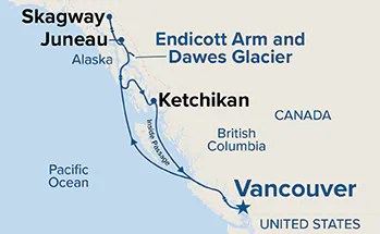
As I mentioned in my last post, our 7-Day round trip Alaska cruise from Vancouver stopped at Juneau, Skagway, and Ketchikan and also included a side trip up Endicott Arm to see Dawe’s Glacier.

There were a vast number of possible shore excursions to choose from at each location, but we chose only one, the White Pass Scenic Railway at Skagway. Rather than purchasing other shore excursions, I did what I usually do when we travel. I researched each location and planned our own self-guided tour.

Juneau, Skagway, and Ketchikan all depend heavily on tourism in the summer and each has what my sister-in-law refers to as “trinket alley”, a street close to the cruise ship wharf that’s lined with shops selling souvenirs. We wanted to go beyond those areas to see more of each community.

Juneau  

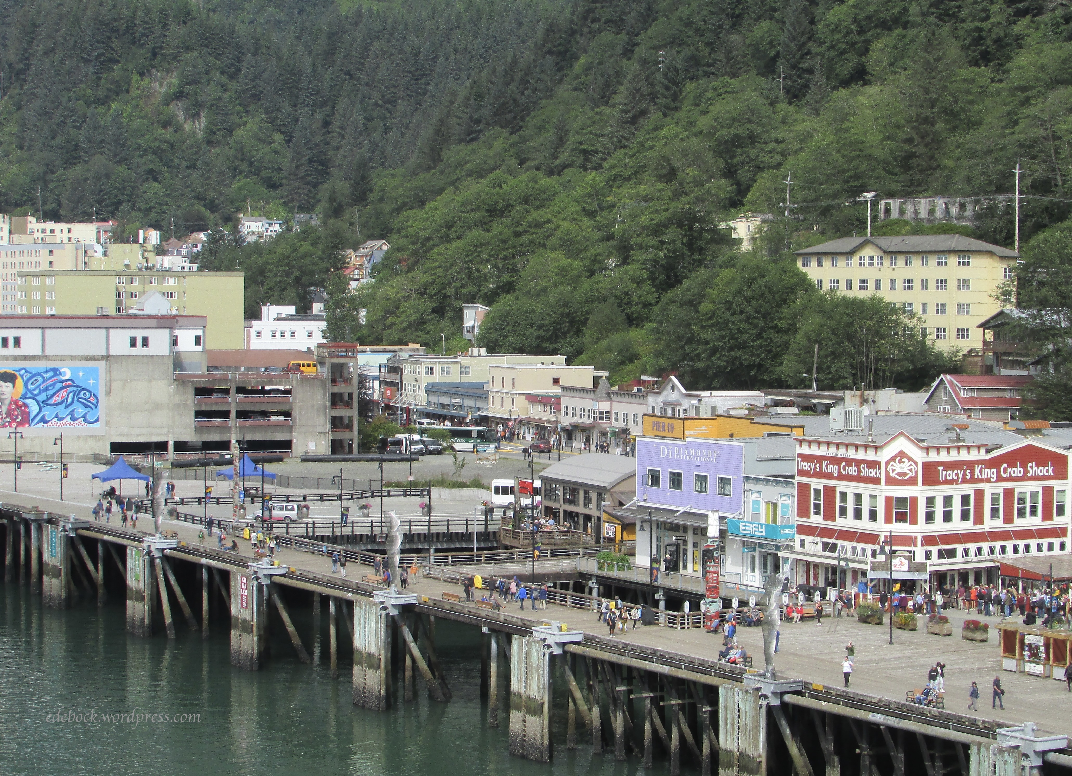
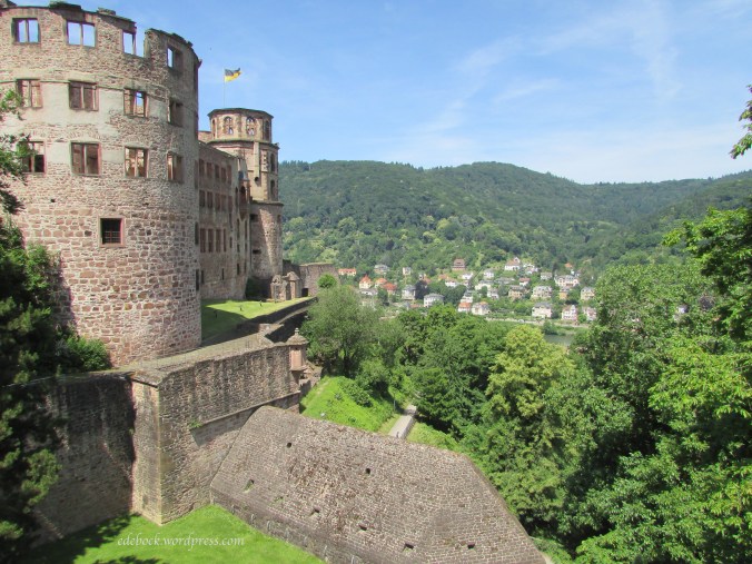
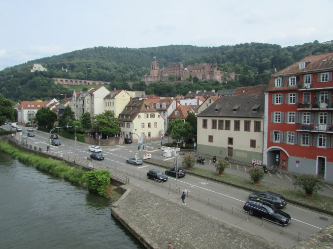
After 48 hours at sea, we docked at Juneau, the capital city of Alaska. As soon as we disembarked, we headed for the Goldbelt Tram, just steps from the cruise ship dock and took a six minute ride up Mount Roberts to a height of about 550 metres (1800 feet).

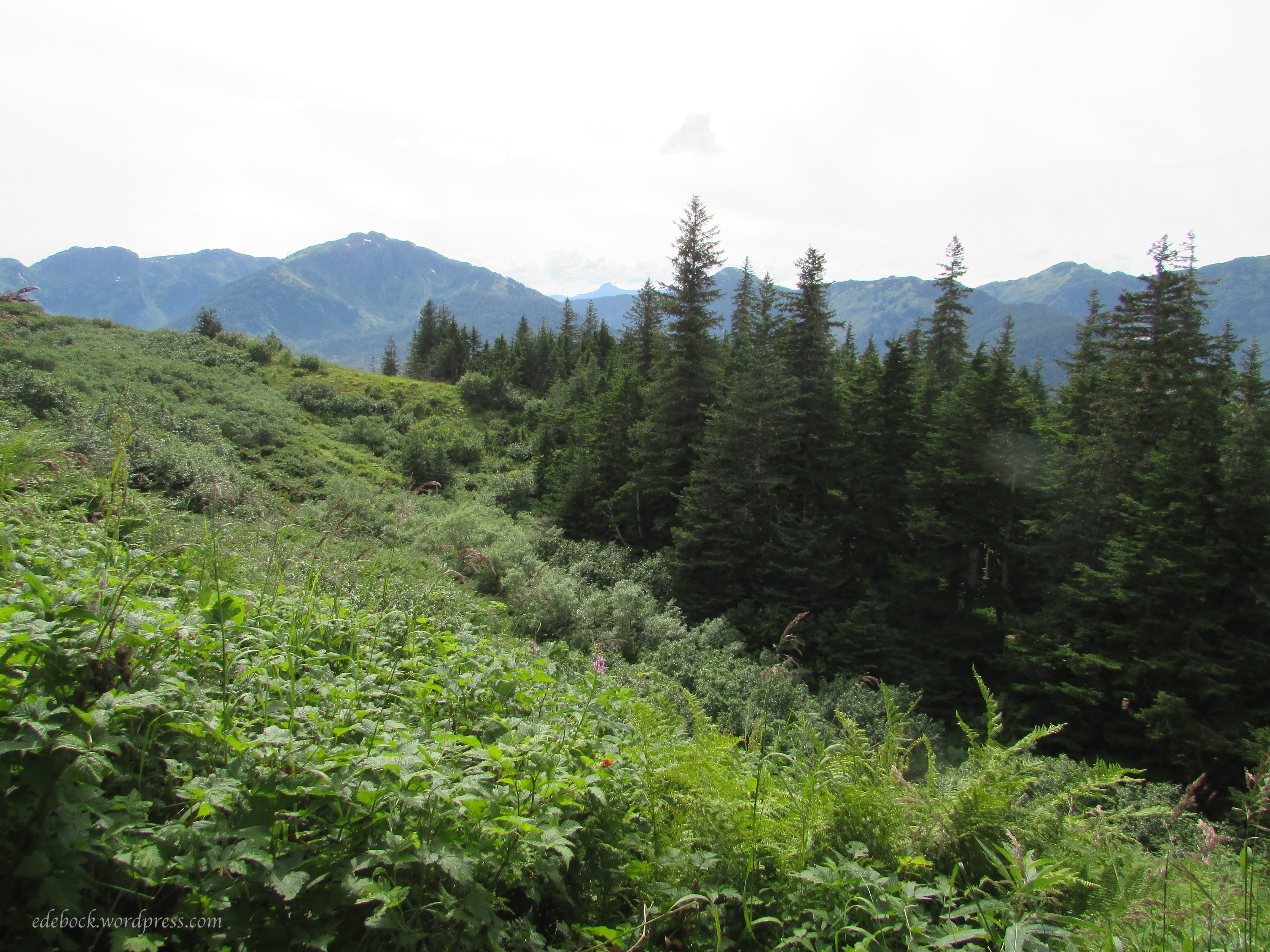
There we did a short hike and enjoyed the spectacular views. That’s our cruise ship, the Grand Princess, in the bottom left corner of the first photo. She didn’t look as big from up there!

Before descending and beginning to explore the town, we watched Seeing Daylight, an 18-minute award-winning film on Tlingit history and culture, in the Chilkat theatre. The Tlingit are one of three Indigenous people groups living in Southeast Alaska. The other two are the Tsimshian and the Haida. I was particularly interested in the fact that these groups are matrilineal societies. 

In the heart of downtown Juneau, we visited the Sealaska Heritage Institute. Dedicated to perpetuating and showcasing the Tlingit, Tsimshian, and Haida cultures, it houses a cedar clan house and an exhibit gallery. I love Northwest Coast Indigenous art and was amazed by the stunning glass screen at the front of the clan house. Made by Tlingit glass artist Preston Singletary, it is apparently the largest glass screen in the world. 

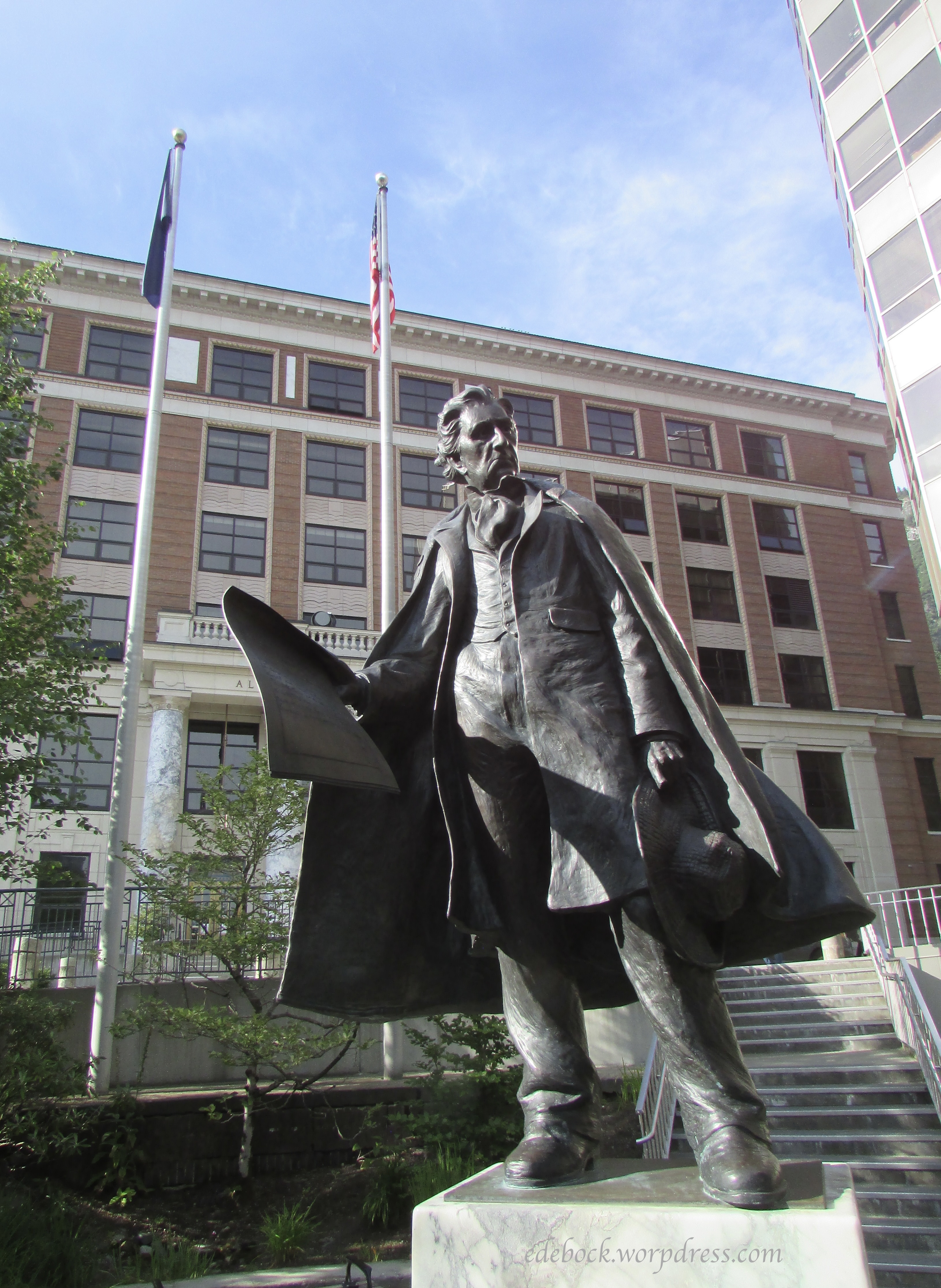
Like most coastal towns, Juneau is built on a hillside. We walked up a few steep blocks to see the Alaska State Capital building and the nearby statue of U.S. Secretary of State William Henry Seward who orchestrated the purchase of Alaska from Russia in 1867.

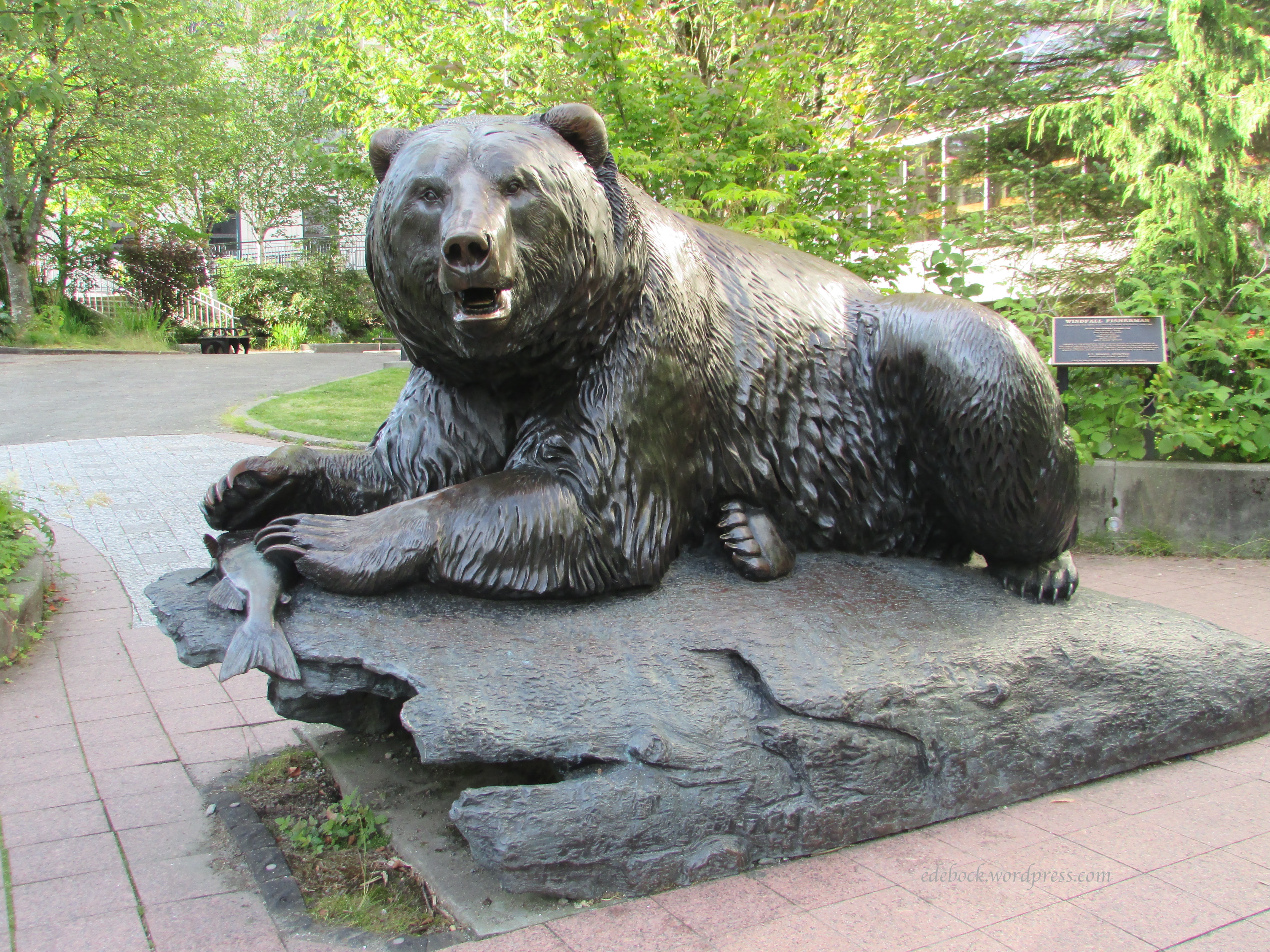
Close by was another bronze statue called Windfall Fisherman, a life-sized and very realistic brown bear by artist R.T. Wallen. 

Hubby’s feet were getting sore by this point, so we headed back downhill toward the waterfront and the seawalk where many of the city’s totem poles are found. Here’s just one example, the Ishkahittaan pole by Tlingit carver, Jon Rowan. At the top is Raven with the Box of Daylight. According to oral tradition, Raven opened the box and released the sun, bringing daylight to the world. Below Raven, you can see Frog and Sea Lion. 

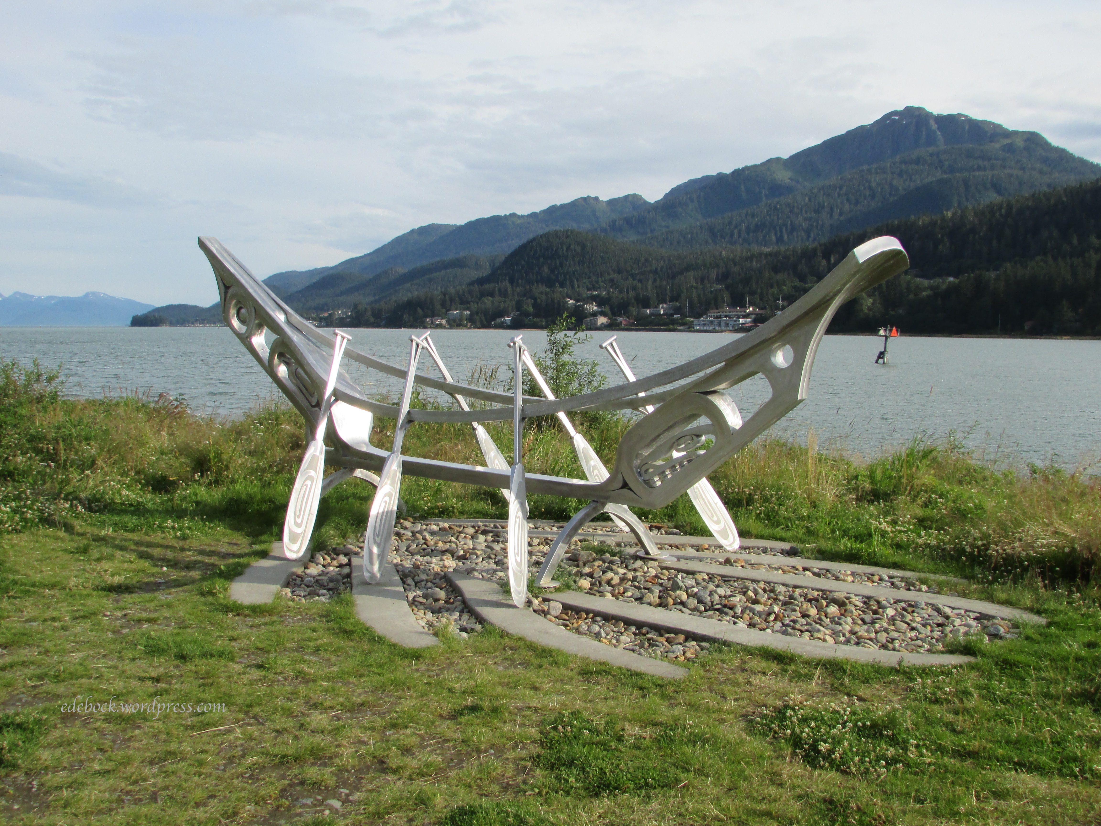
I loved the aluminum sculpture of a 20-foot 9-inch canoe, Yaadachoon, by native artist Robert Mills. The name means “straight ahead” in the language of the Tlingit. 

Although we didn’t see any whales close up while on our cruise, we did see Tahku, the life-sized bronze sculpture depicting a breaching humpback whale, also by artist R.T. Wallen, at the end of the seawalk. 
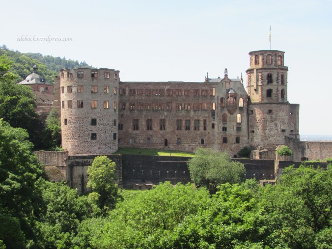
Skagway

I awoke very early the next morning to the haunting sound of the ship’s horn warning others of our presence. Standing on our stateroom balcony breathing in the heavy fog that surrounded us, I was transported back to my childhood on the waterfront. Crawling back into bed I fell back to sleep to the familiar sound of the foghorn. Later, when I woke again, the sky had cleared, the sun was shining, and we were docking at Skagway. 

Skagway is rich in Klondike Gold Rush history. 1897 and early 1898 saw tens of thousands of fortune-seekers pile off steamships, eager to head overland to the Yukon gold fields via the White Pass Trail from Skagway or the Chilkoot Trail from nearby Dyea.

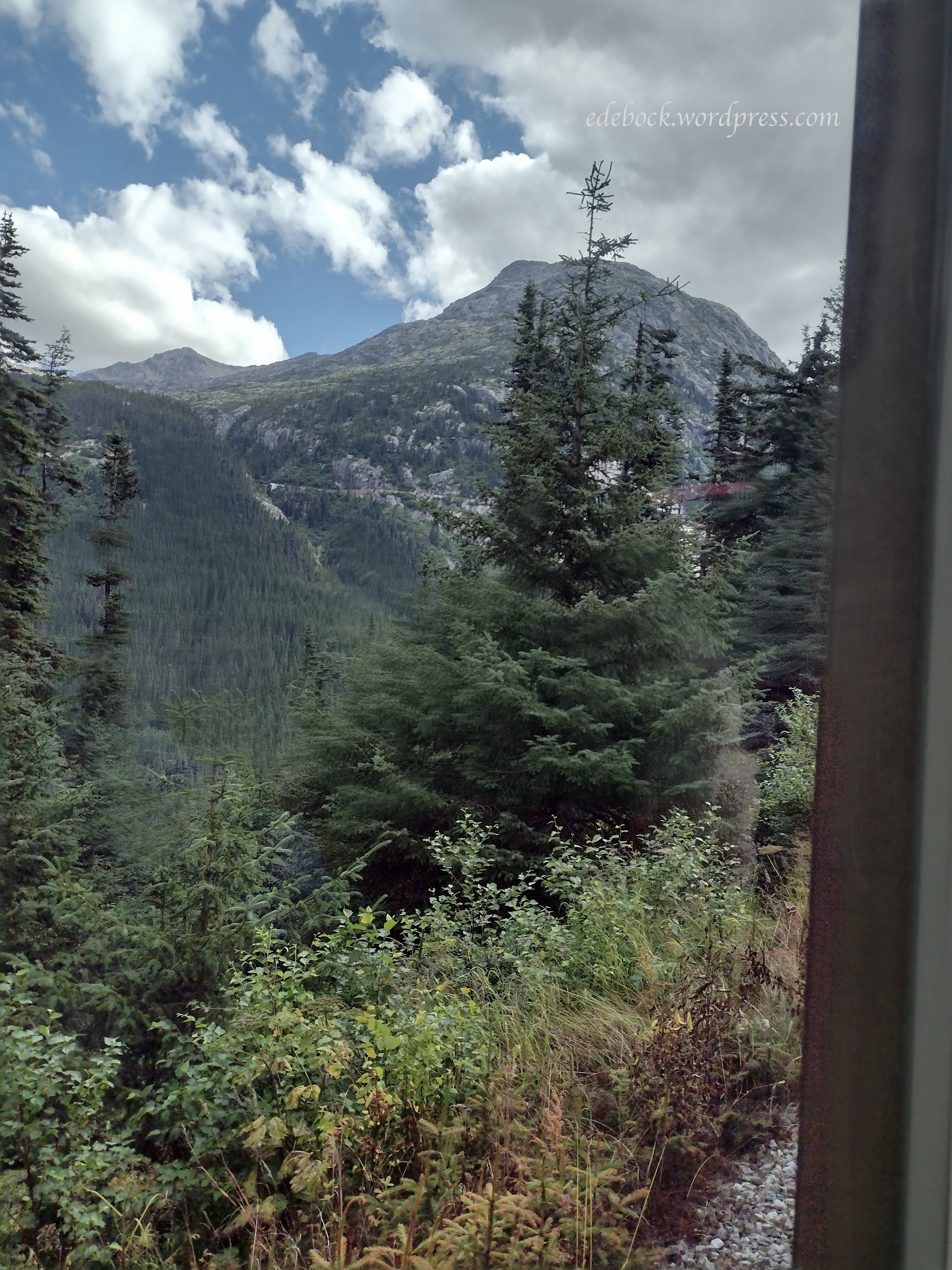
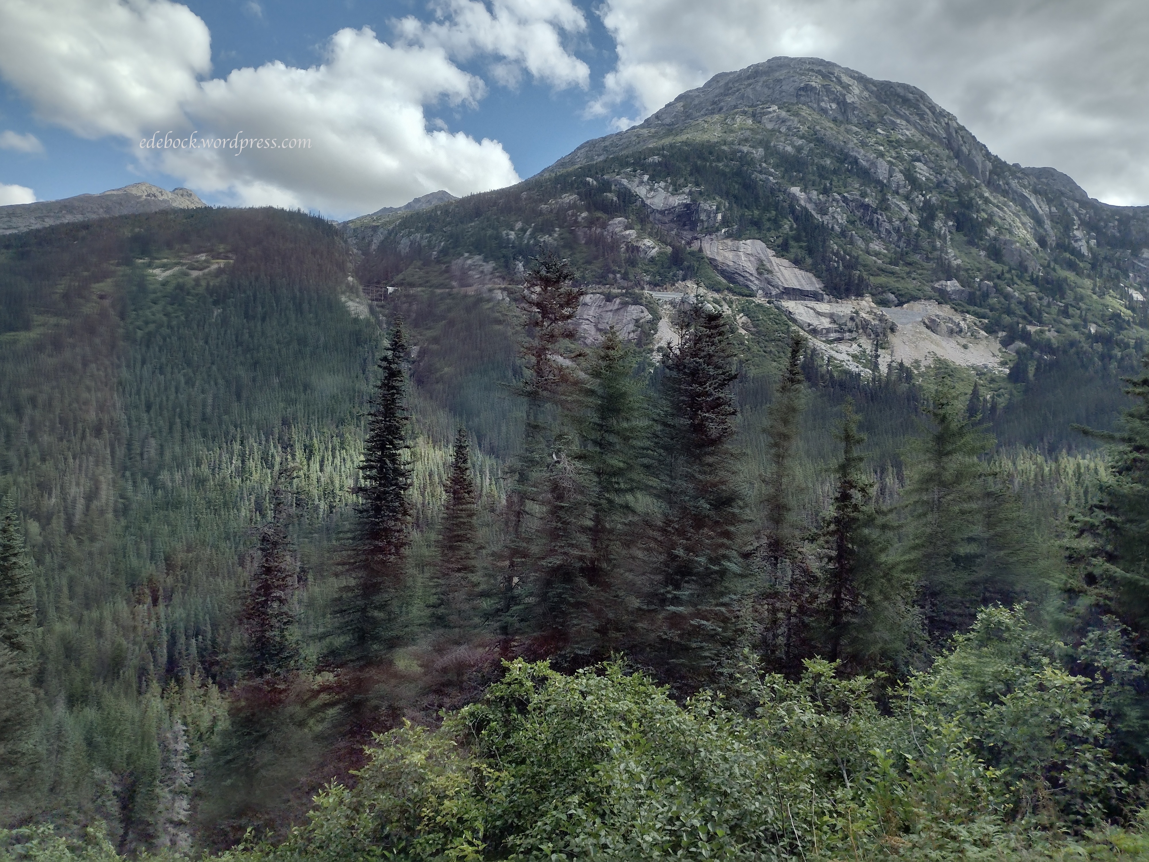
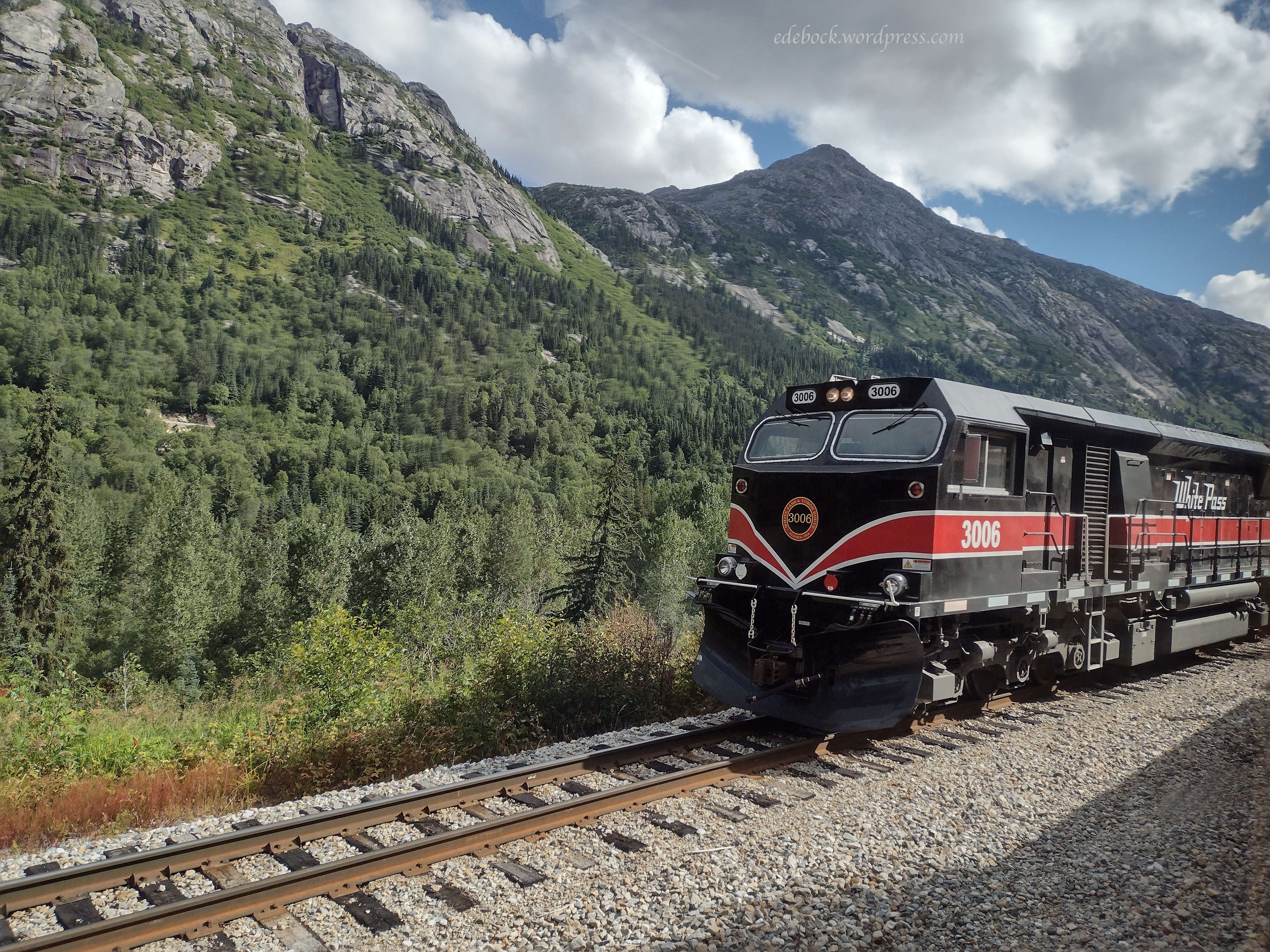
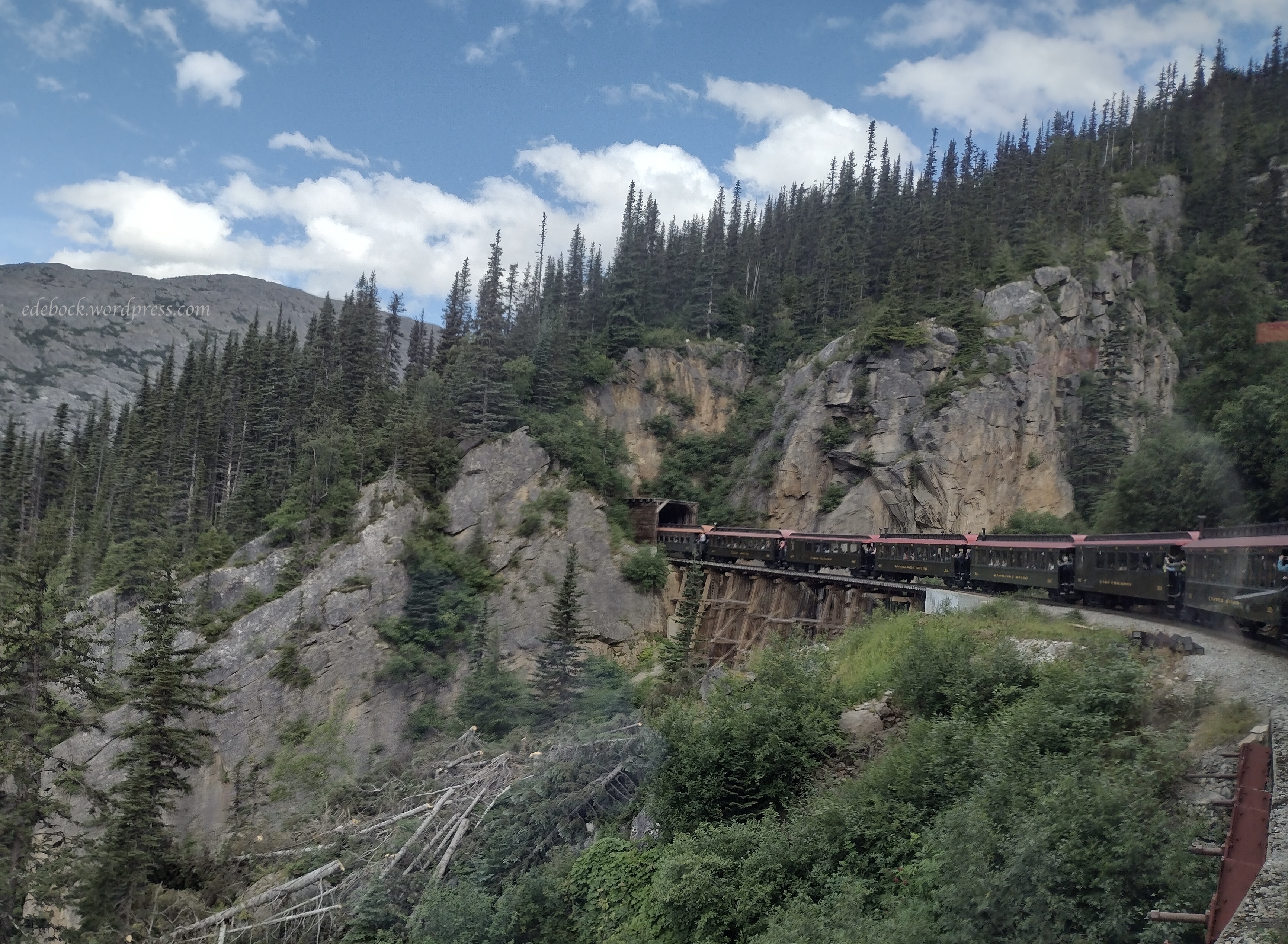
It was from Skagway that we took the scenic White Pass rail excursion, a 40 mile, 2 hour and 45 minute round trip to the White Pass summit. Considering how long this post is becoming and how much I still have to share, I’m going to save that for a separate post. 

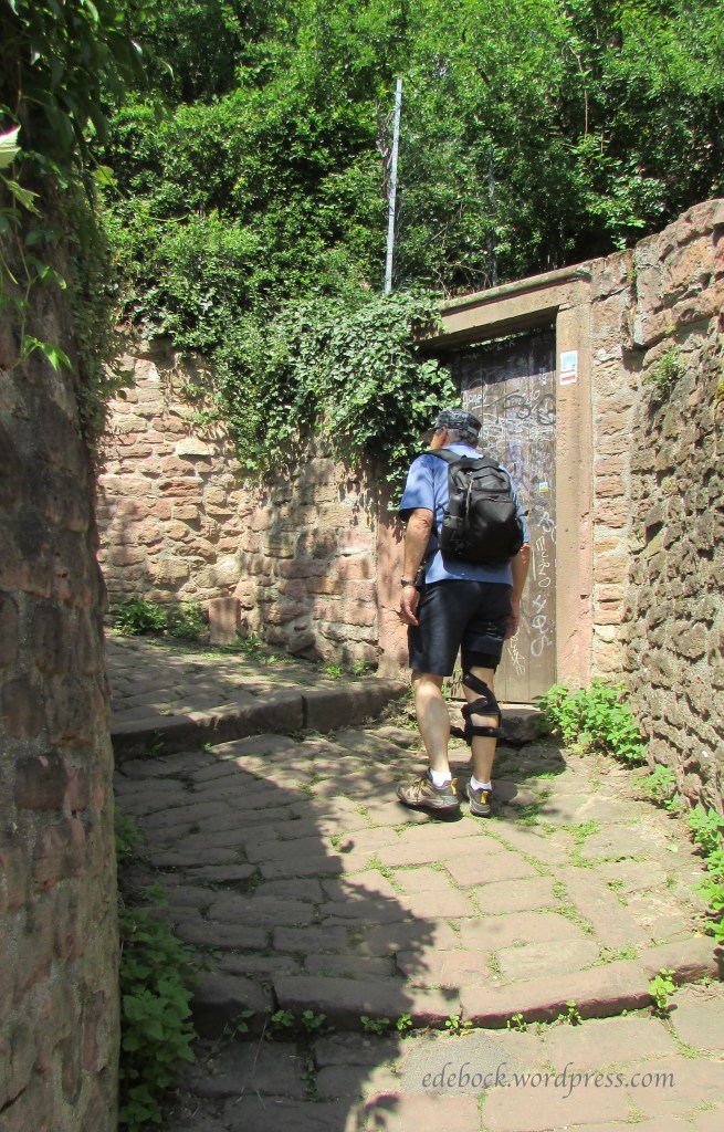
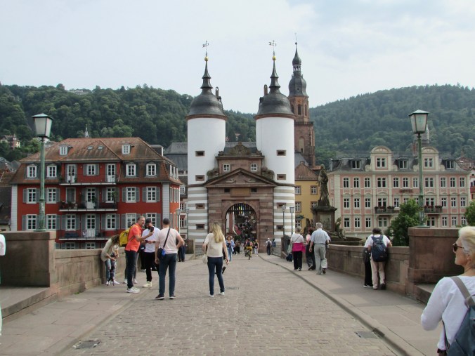
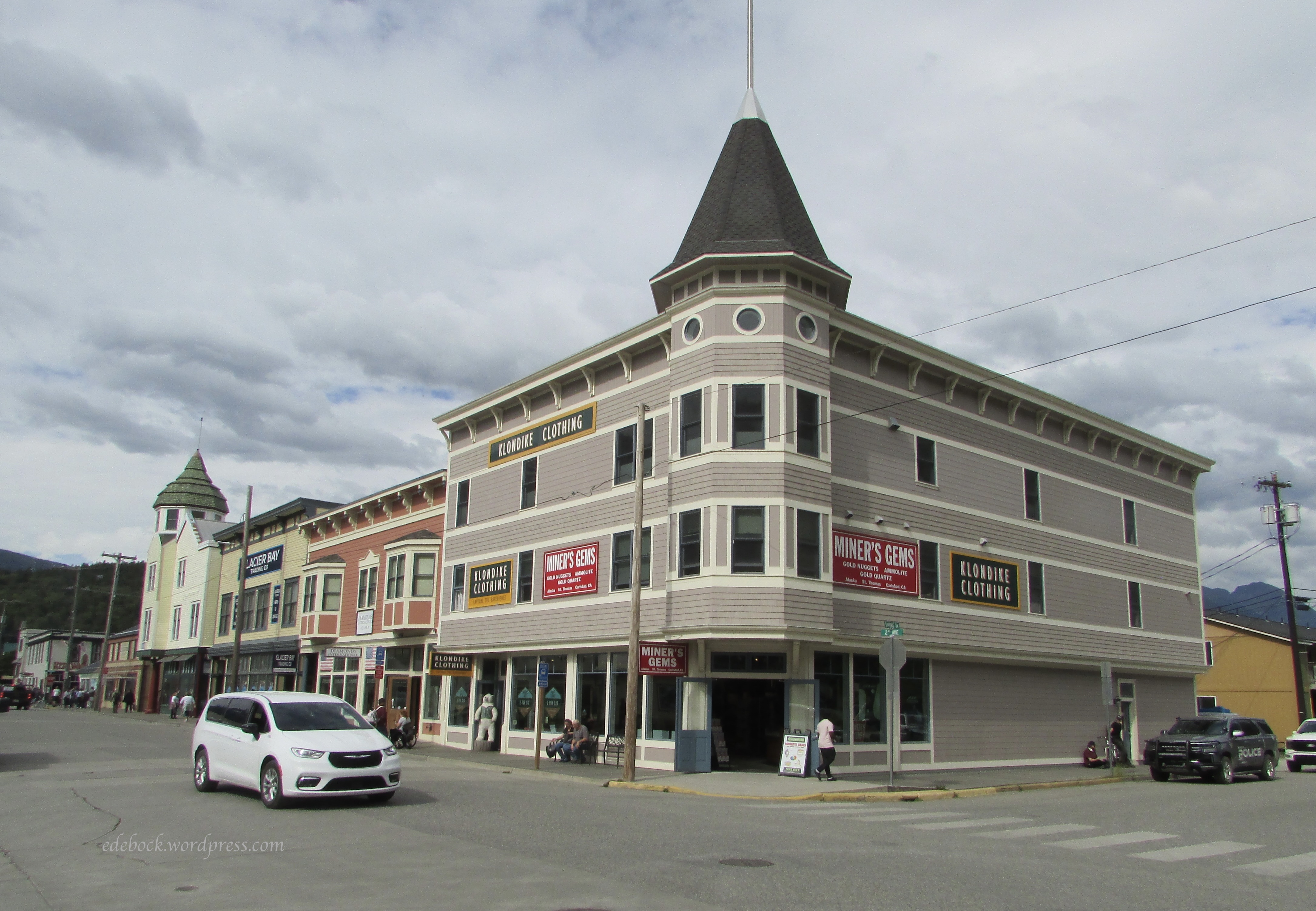
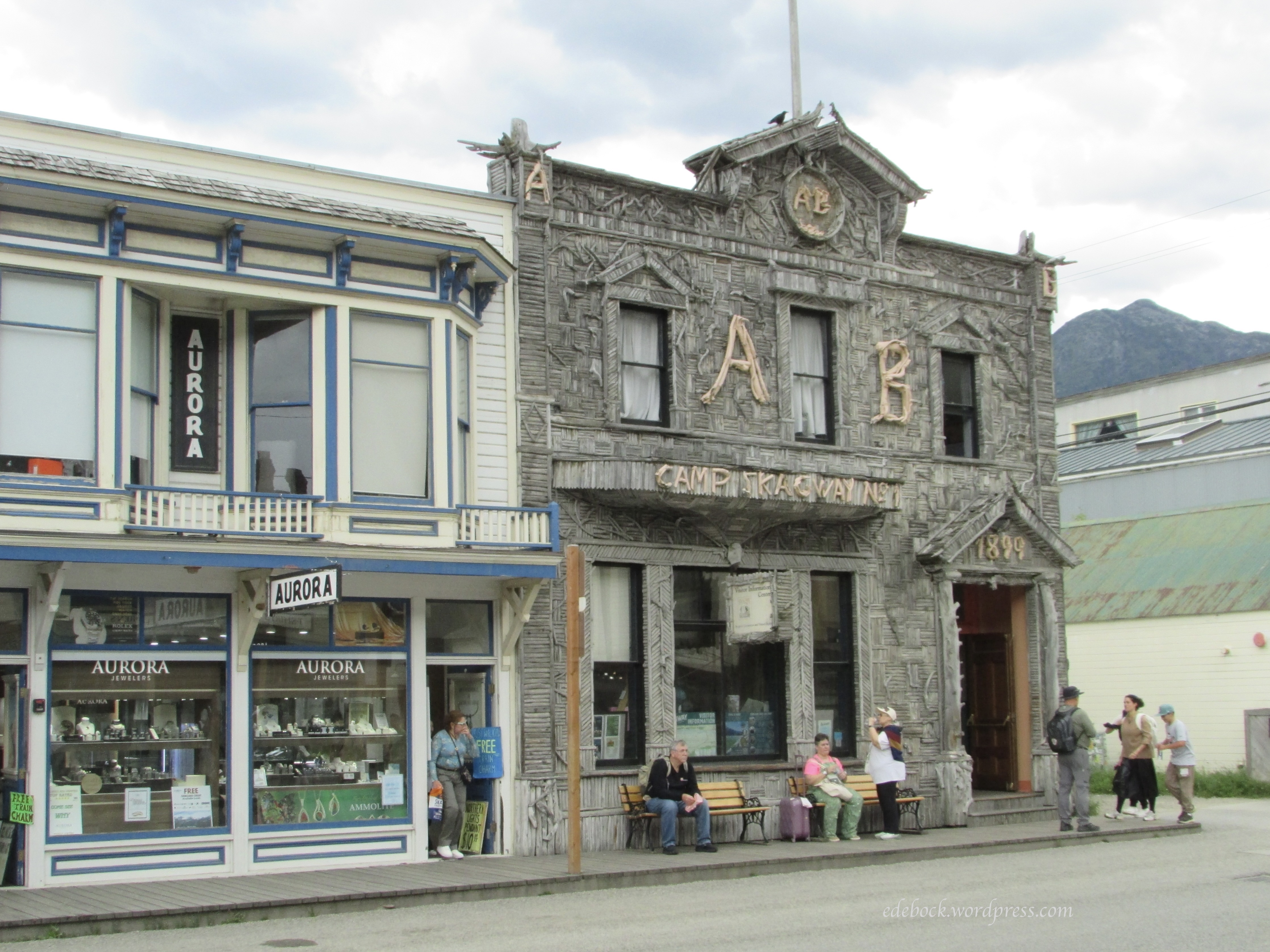
When we disembarked from the train, we were met by hubby’s sister and her husband who live across the Canadian border near Whitehorse in the Yukon. They drove about two hours each way to spend the afternoon with us. They took us to their favourite fish and chips restaurant for lunch and then we just walked around town while we visited. Hubby and I had been to Skagway by road many years ago and were well versed in gold rush history from our previous visits to the Yukon, so I didn’t take very many photos. Here are just a few to show you what the town, which has a year round population of about 1200, looks like. Most of the shops that cater to tourists are closed during the winter months. 

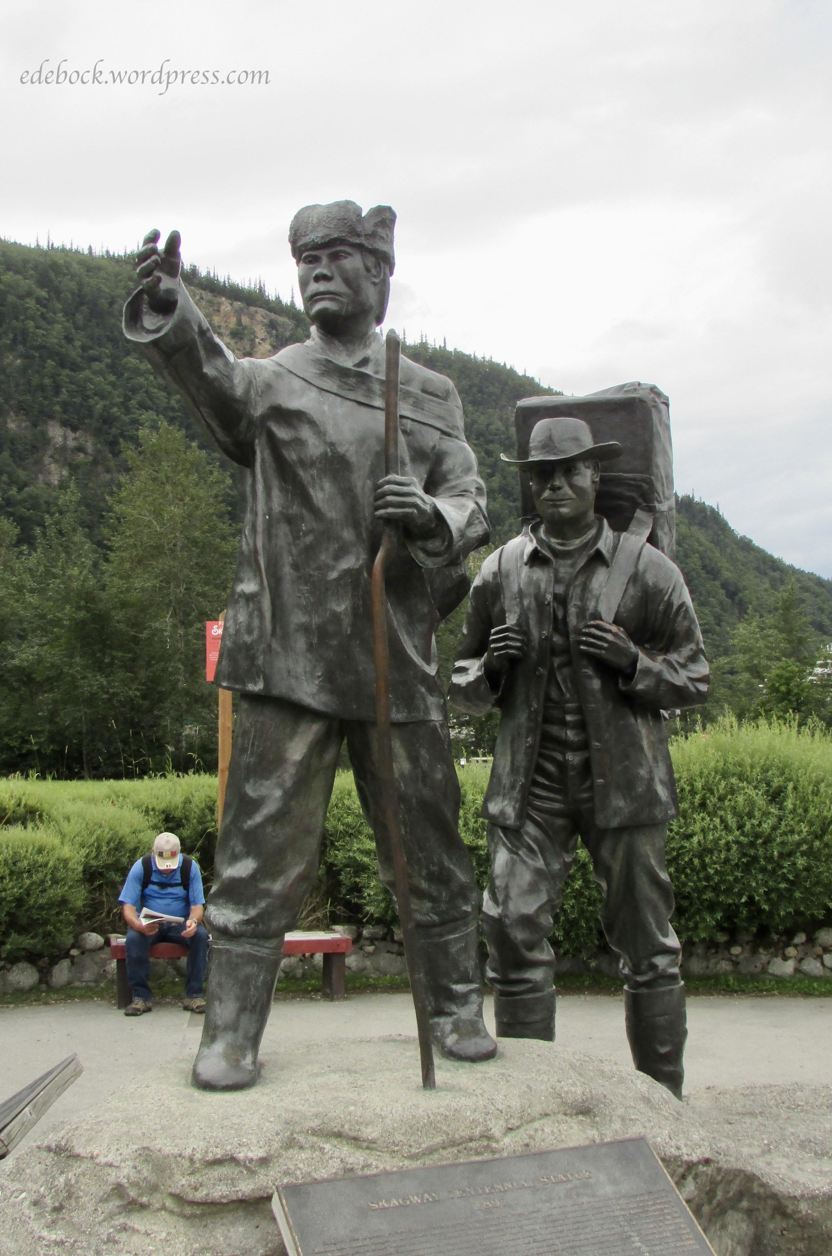
Here’s hubby hanging out with an exhausted gold seeker and his dog. 

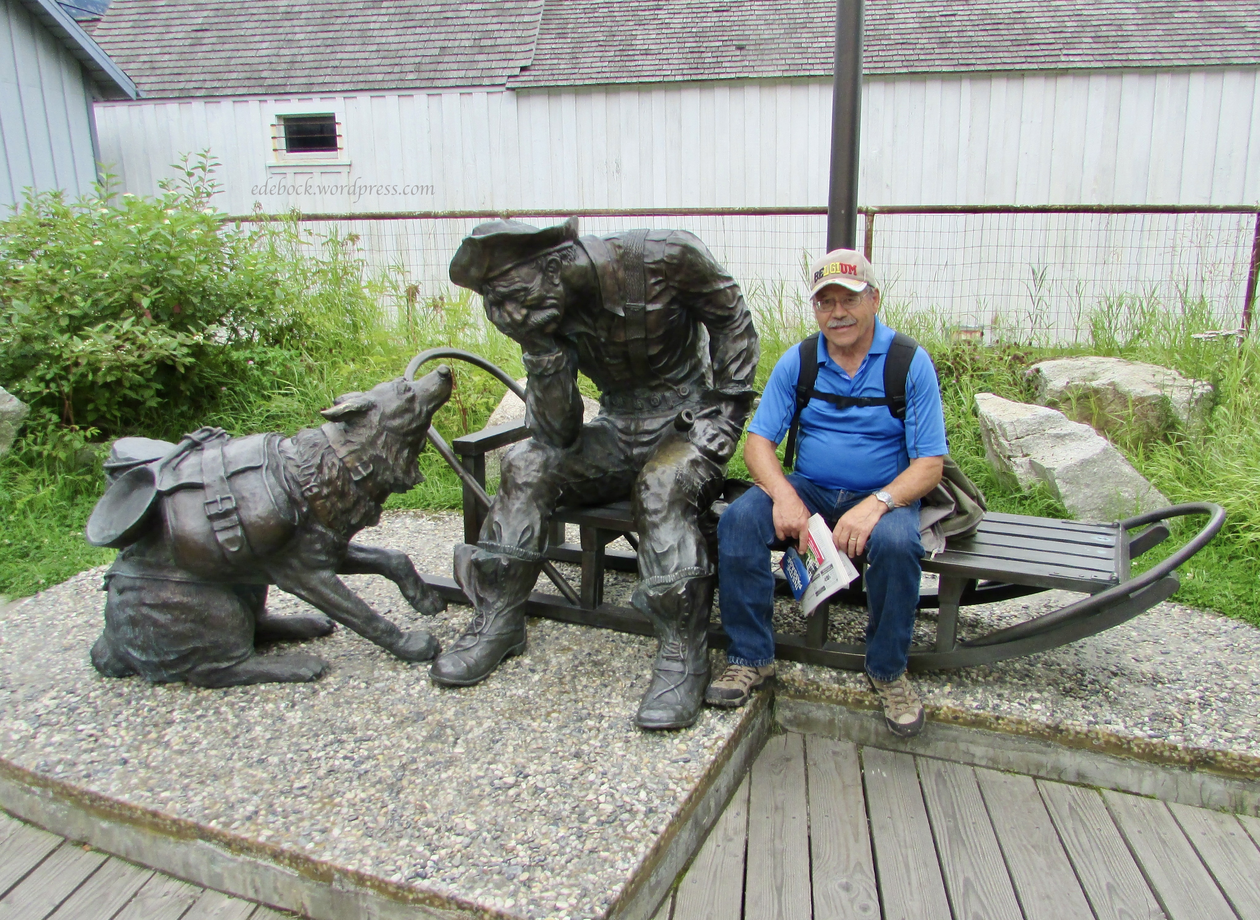
And perhaps you can spot him in this photo too. This is the Skagway Centennial Statue erected in 1997 in a park close to the train station.  

Endicott Arm and Dawes Glacier

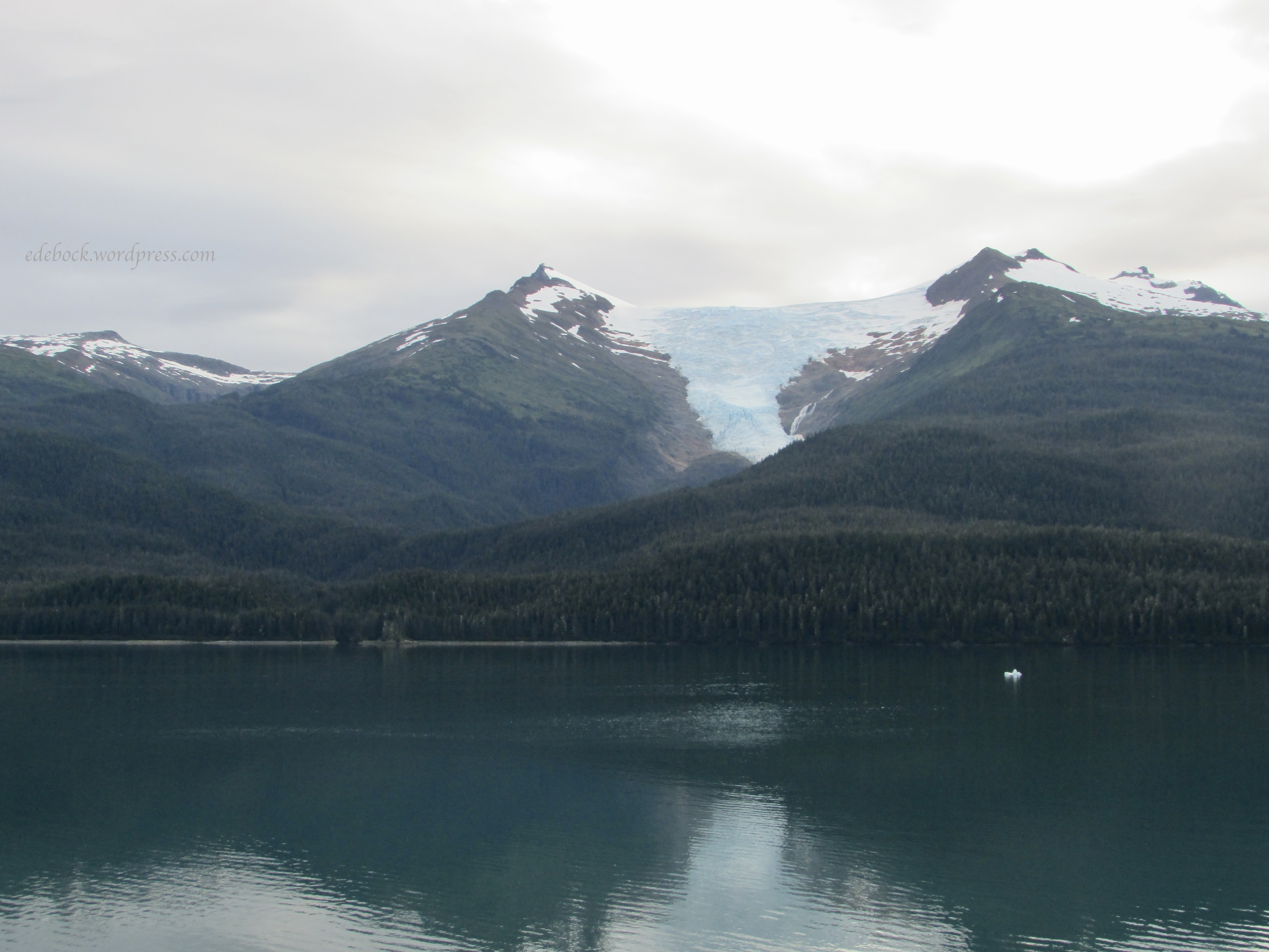
Next on our itinerary was a scenic cruise up Endicott Arm to view the Dawes Glacier. The further up the beautiful Arm we cruised, the more and bigger chunks of ice we began to see in the water. 

There were other glaciers like this one along the way, but they were high in the mountains and far from the shore. 

Eventually Dawes came into view. 

Because of the enormous size of our ship, we couldn’t get as close to the glacier as smaller ones could, so this was one of the times that we were very happy to have binoculars with us. The captain turned the ship in a complete slow circle so that everyone on either side could get a good view and lots of photos. 

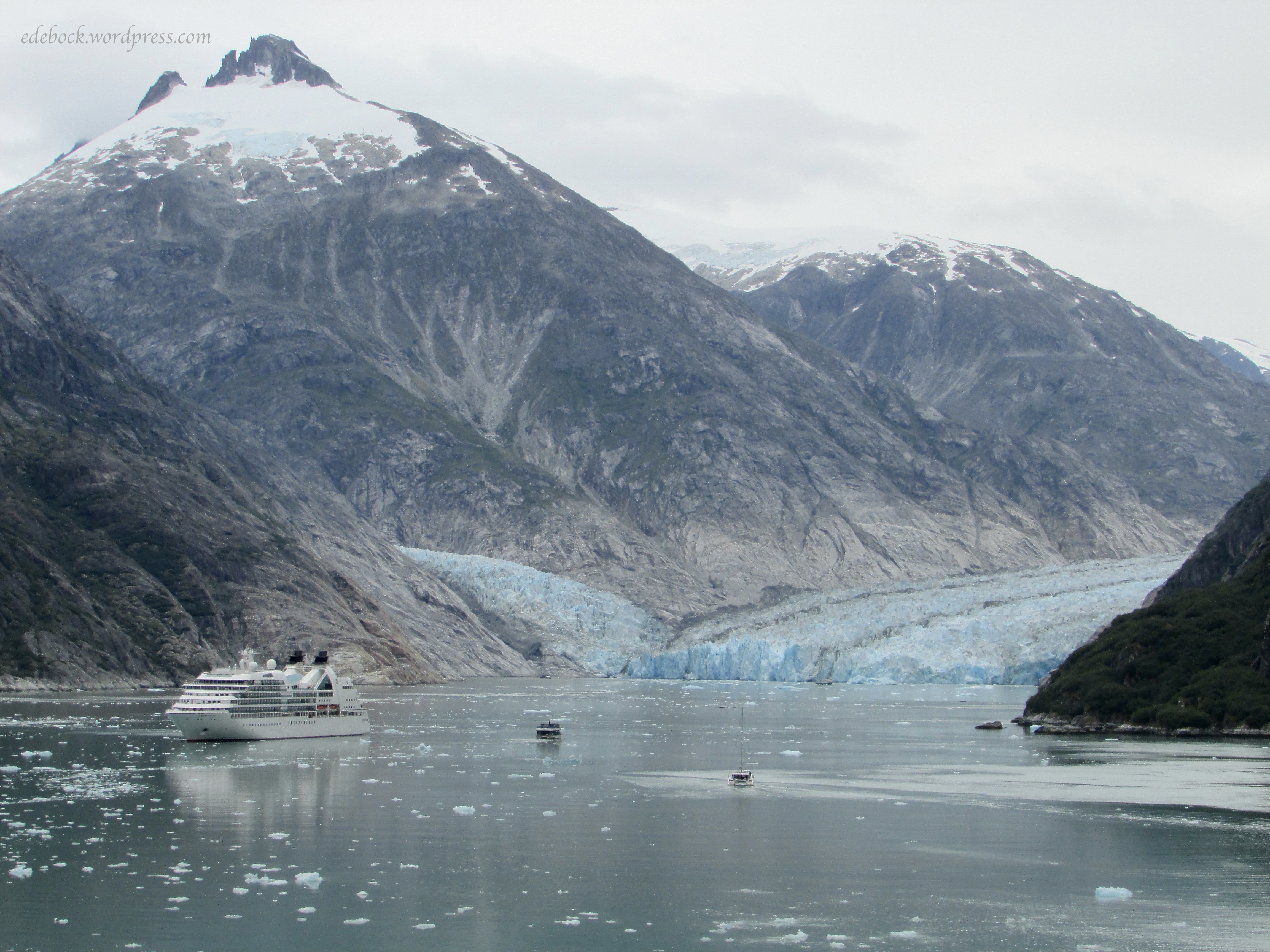
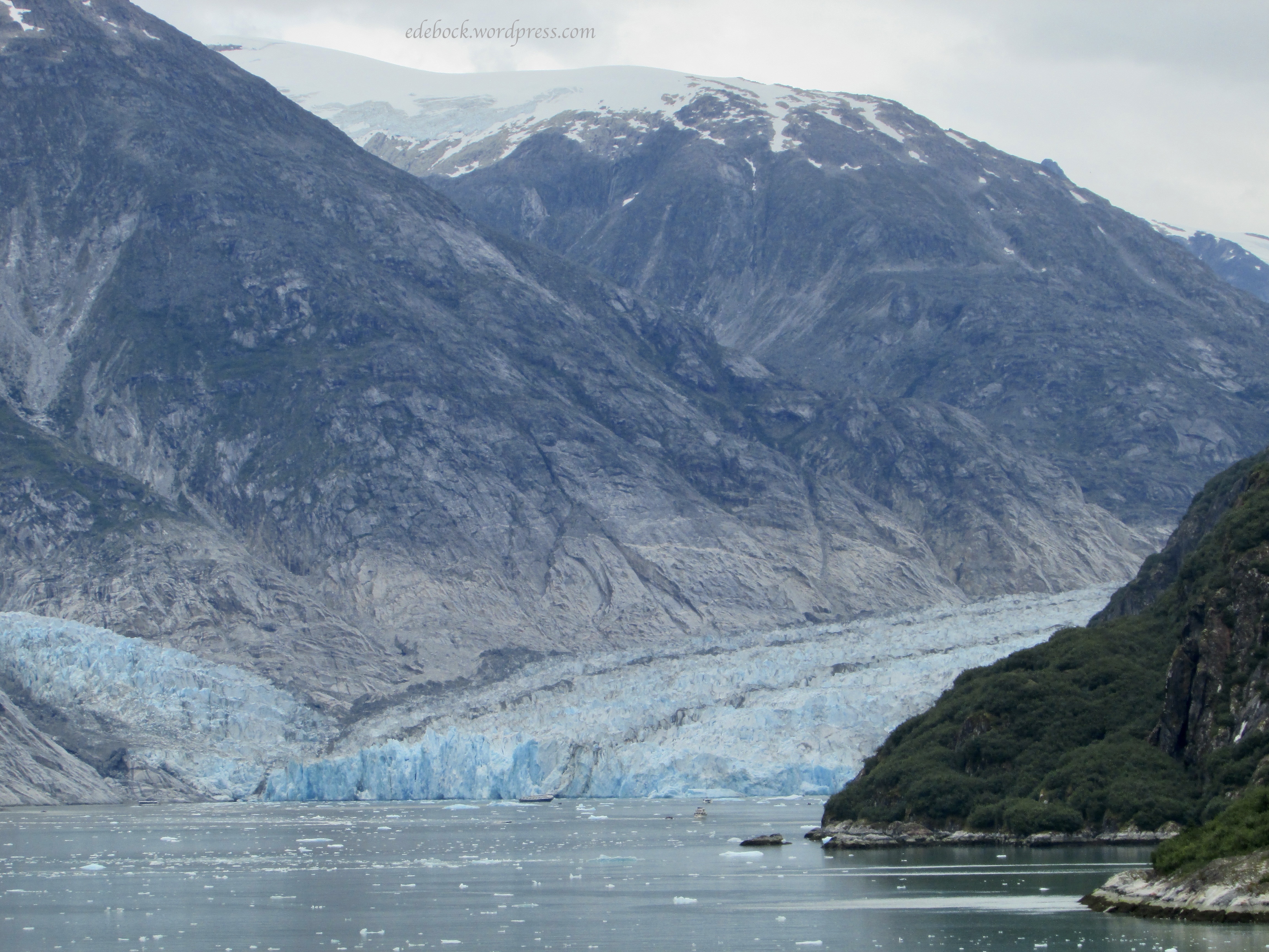
Why is the glacier blue, you ask? The naturalist on board explained that that’s because the ice is incredibly dense, having lost almost all of its air over time due to the immense weight of snow that compacted it. This dense ice absorbs most of the long-wavelength colours of white light, such as red and green, while allowing the short-wavelength blue light to pass through or scatter, which is what we see.

Ketchikan

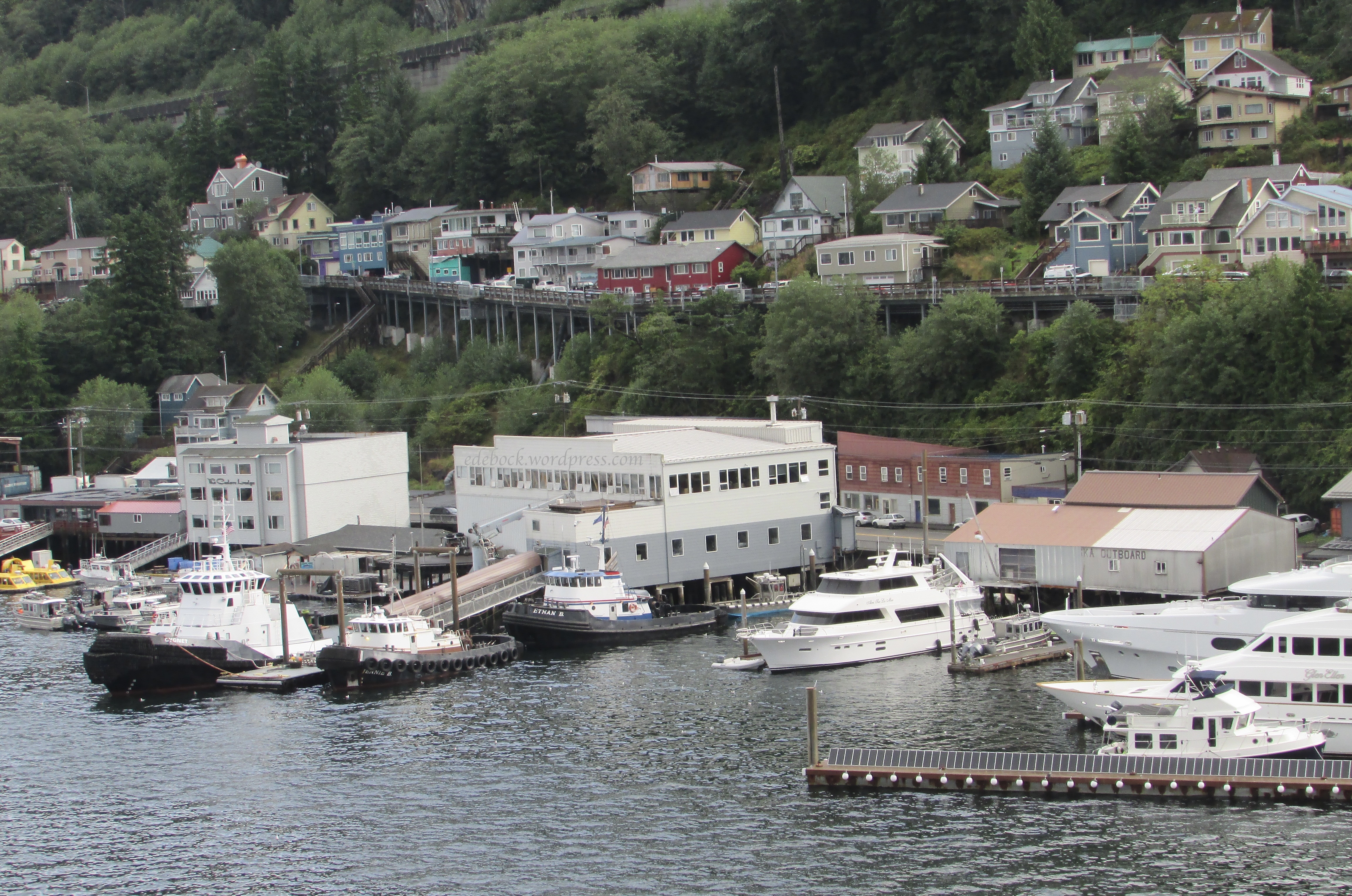
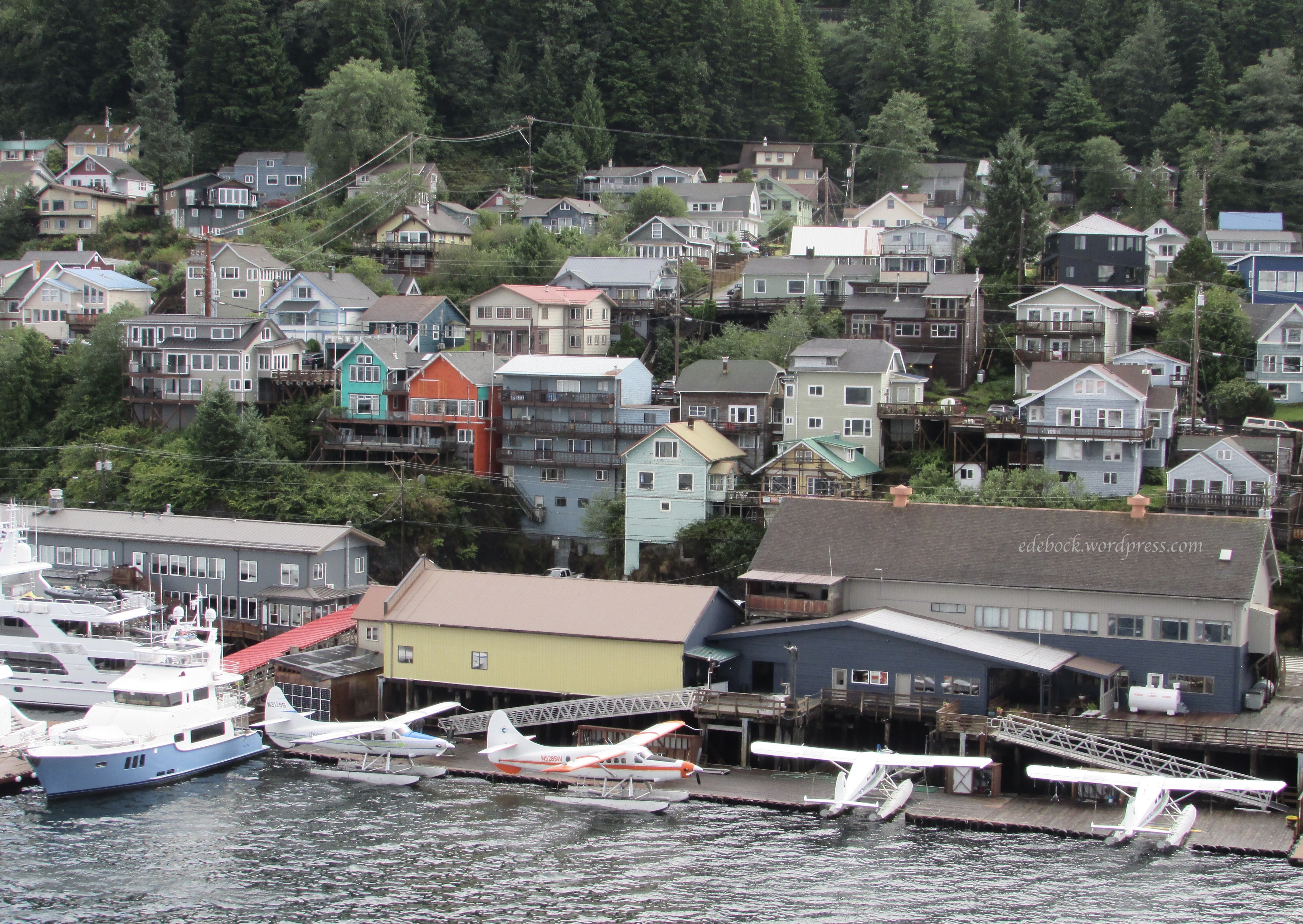
Ketchikan, with a permanent population of about 8000, was our last port of call. Like Juneau, it is inaccessible by road. It receives an average of approximately 150 inches of rainfall a year. Some of that fell while we were there, but we didn’t let that put a damper (pun intended) on our once in a lifetime opportunity to be there and see the sights.

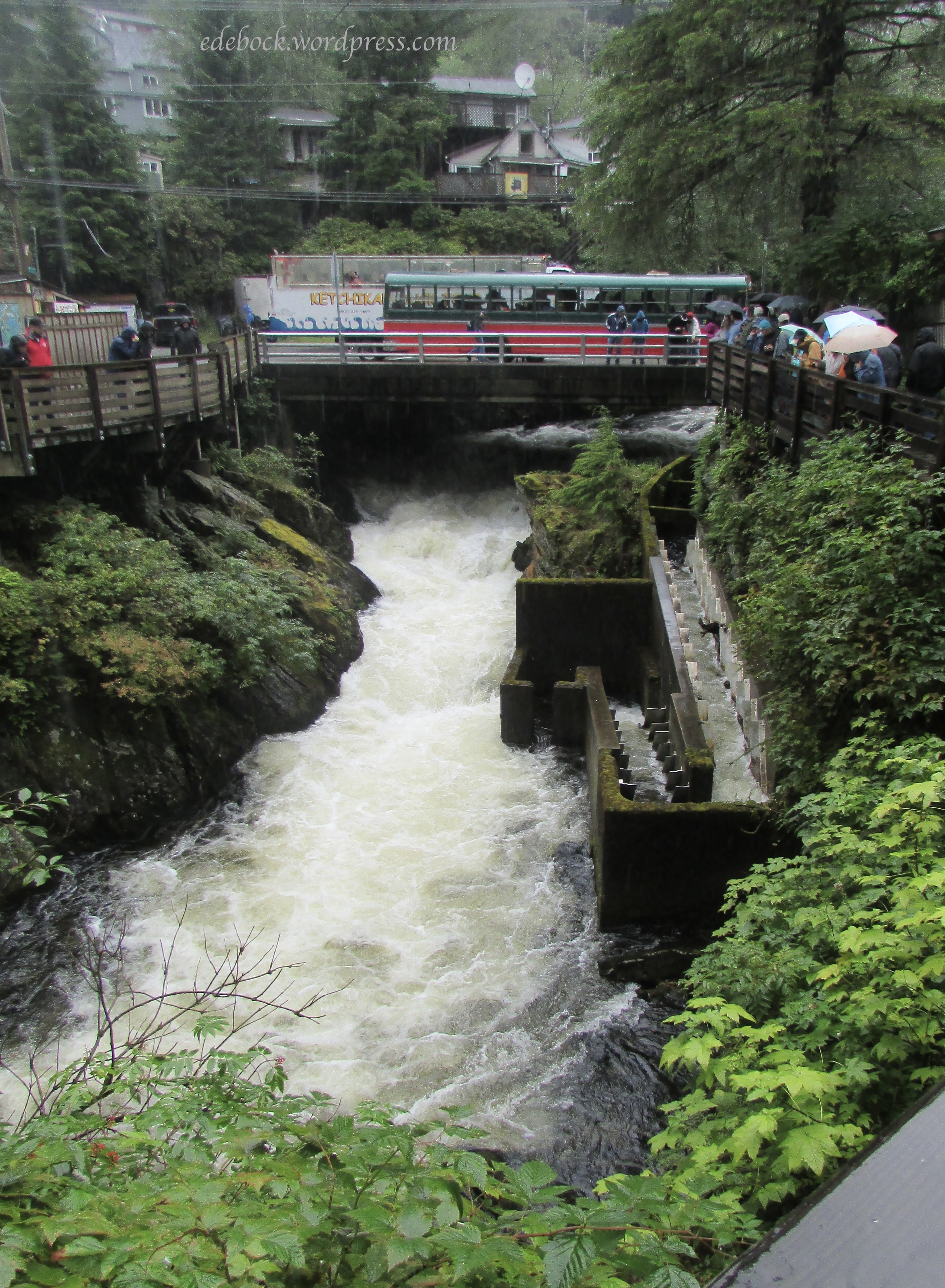
We started by walking the 1.5 mile (2.4 km) Salmon Walk which is dedicated to the importance of salmon to the area and to encouraging good stewardship of the fish and their habitat. The walk upstream along Ketchikan Creek  in the direction that the salmon swim took us past a fish ladder and a hatchery, then along a forest trail before continuing back into the downtown area. 

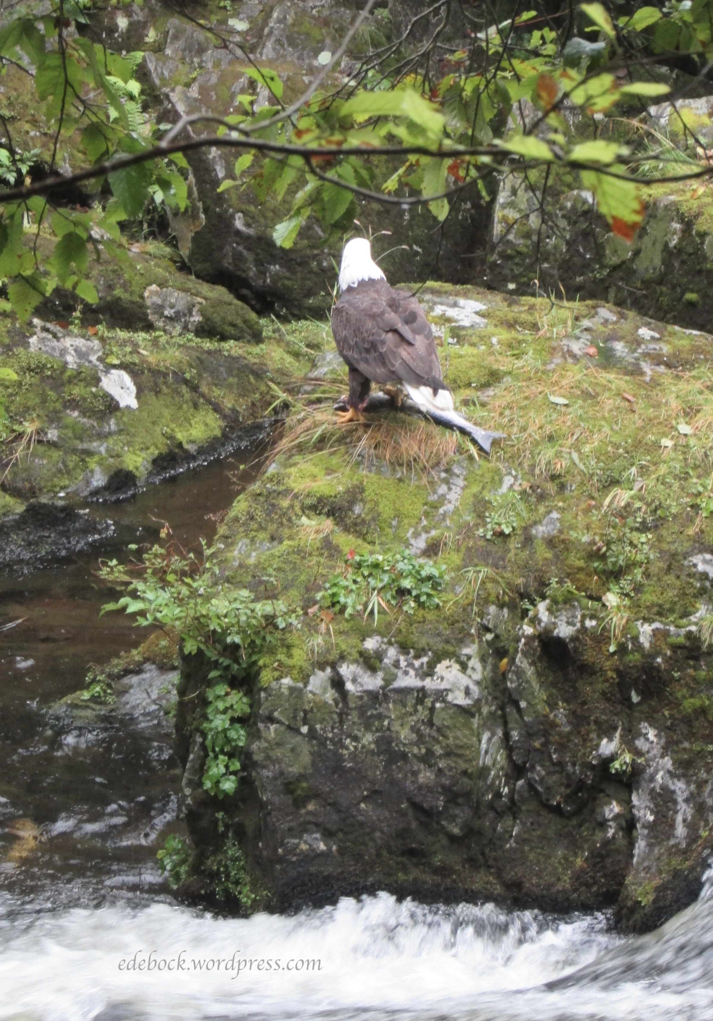
Along the way, we stopped to watch a bald eagle eating a freshly caught salmon. Unfortunately, it wouldn’t turn around and pose for me!

Halfway through the walk, we stopped at the Totem Heritage Center which houses an invaluable collection of 19th century poles retrieved in the 1970s from some of the nearby islands. It was a good place to escape the rain for a little while! 

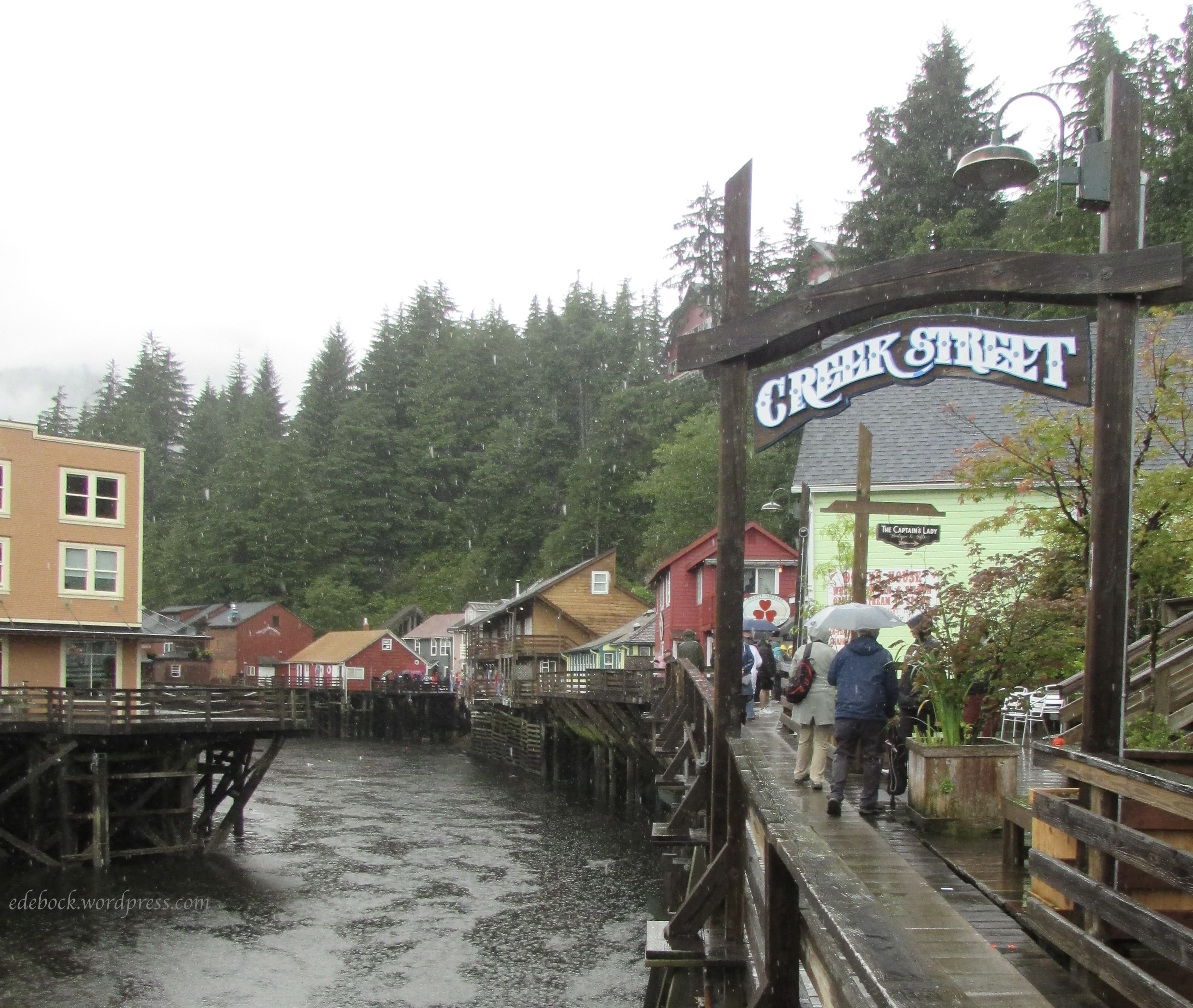
Our walk ended with a stroll along Creek Street, once the town’s red light district, but now a charming historic area known for it’s picturesque boardwalk built over the creek. We watched a couple of seals cavorting in the water there. 

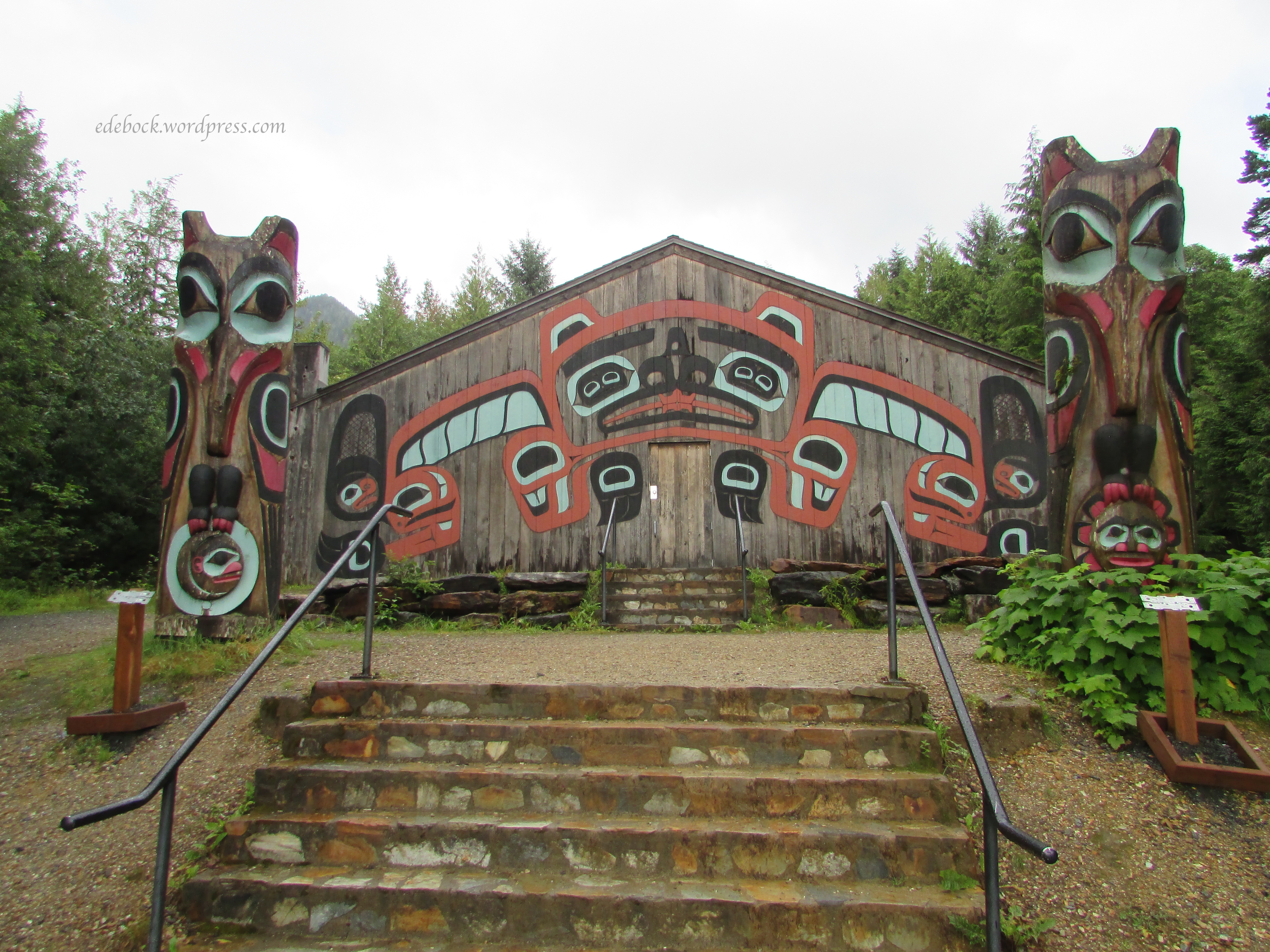
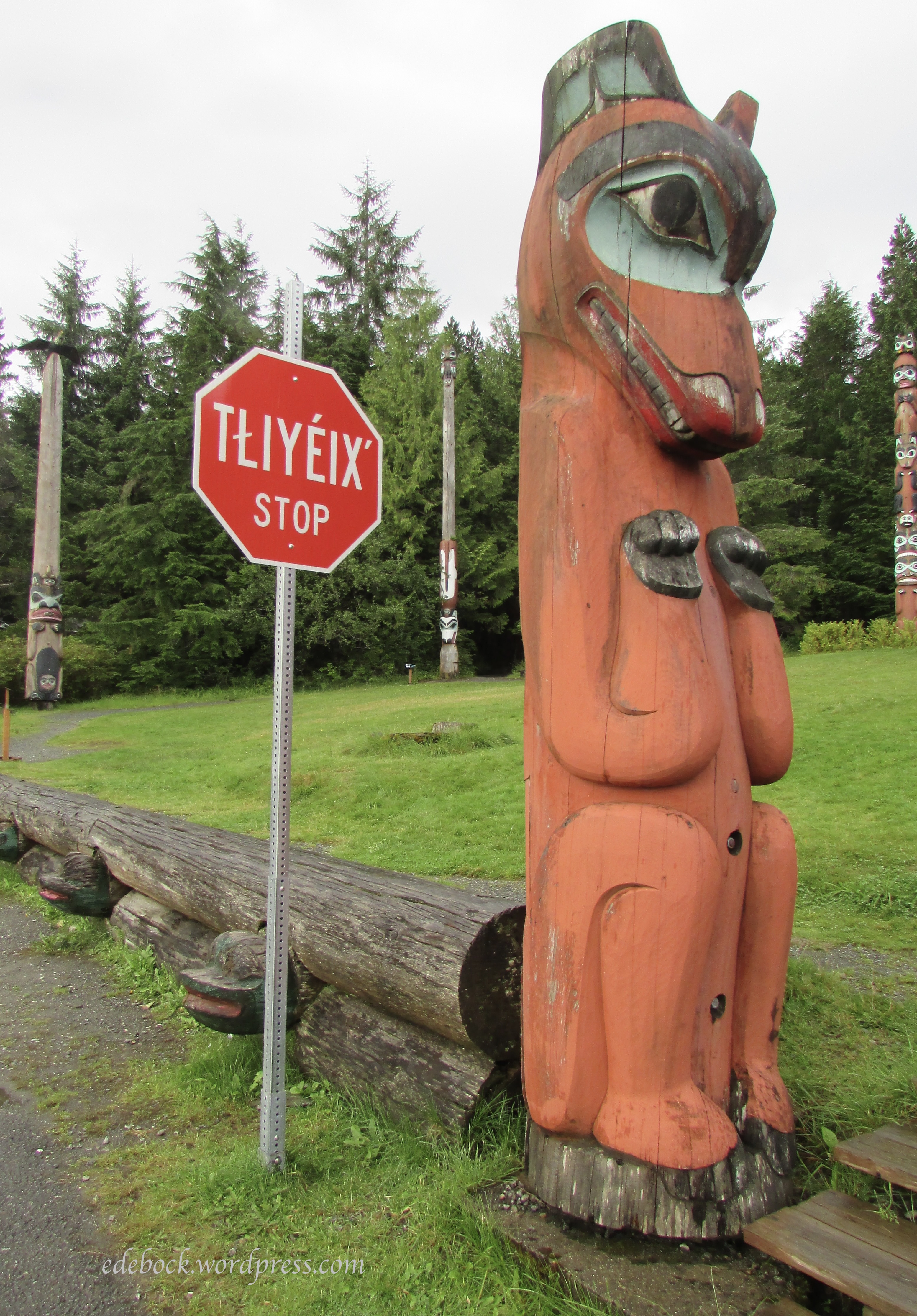
After returning to the ship for lunch, we took a taxi to Saxman Totem Park about 2.5 miles (4 km) south of Ketchikan because we didn’t want to walk that far in the rain and the city bus only goes once an hour. Of all the things we saw and did on this this trip, Saxman was the only one that we considered to be a bit of a rip off. We were charged $8 USD apiece to walk around and look at the collection of totem poles, authentic replicas of original poles that were left in abandoned villages in the past. There was no map available to guide us and most of the descriptive signs were missing. The traditional clan house and the carving centre were closed and all that was open was the gift shop!  We did manage to tag along with a tour group that made a very quick stop there and heard the stories of a few of the poles from their guide. 

And that brings this very long post to a full STOP. If you’ve stuck with it and read this far, you are to be commended! 


Last day in Germany

Today was our last day in Germany. As much as I’ve enjoyed the last week, I’m tired with a capital T and I’m ready to go home. Even though it was just over three weeks, it seems like forever ago that we set out on this big adventure.

We walked a lot again today, but at a very leisurely pace. It was 31ºC (88ºF) this afternoon and we had plenty of time to see Mainzer Alstadt, the old town centre of Mainz. There are many historic churches throughout the city, but three stand out and are worth a mention here. Because of the narrow, crowded streets, it isn’t always easy to get good photos of the exteriors, but I’ll share the interiors of the two that we were in today.

St. Stephan’s is located high on a hill overlooking the old town. We arrived just as the doors were being opened and were delighted to find a musical performance happening inside. The acoustics, as is true in so many of these old stone churches, were amazing.

St.Stephan’s is known for it’s brilliant blue stain glass windows created by Jewish artist Marc Chagall (1887 – 1985). They cast a mystical light throughout the interior of the church and reminded me of flowing water.

Only the three long panels at the front of the church contain figures like these ones.

Even though my blog takes it’s name from one of my ancestors, not St. Augustine, the church that bears his name was something I had to see. St. Augustine Church is tucked into a narrow pedestrian street.

The inside is absolutely spectacular. I have trouble wrapping my head around so much money being spent on a place of worship in a world where people go hungry, but at the same time, I can’t help but appreciate the beauty.

By far the most imposing structure in the old section of Mainz is the enormous St. Martin’s Cathedral. Photos simply don’t capture how massive the 1000 year old structure is.

Friday is market day in the main square next to the cathedral and if I lived in Mainz, this is where I’d be doing my weekly grocery shop. Fruit, vegetables, cheese, meat, baked goods, eggs, honey, wine, and even flowers can all be found in the giant outdoor market. It reminded me of shopping in Mexico and in China when we lived there.

After our stroll around the old town and through the market, we returned to the nearby river and walked along the promenade again.

Embedded in the largest wine-growing region in Germany, Mainz is known as the country’s wine capital, so we ended our self-guided tour with a glass of wine by the Rhine!

Now our suitcases are packed and we’re ready to leave. We’ll catch a train to the Frankfurt airport early tomorrow morning and fly out at noon. The blog will probably be silent for a few days while I recover from jet lag and get back into routine, but we have more travel plans for later this summer , so don’t go away!

We made it to Mainz!

We had a bit of misadventure on the way to our final destination for this trip this morning. We were supposed to change trains in Ludwigshafen, but somehow missed our stop. We were the only passengers to get off at the next stop, a small deserted station with no one on duty to provide assistance. Thankfully, a kind gentleman who spoke perfect English (a rare thing in this part of Germany) happened to be passing by and stopped to ask if we needed help. Since we knew that we’d be too late getting back to Ludwigshafen to make our connection to Mainz, he suggested that we go back two more stops to Mannheim, a much bigger centre where we’d have a better chance of catching a different train to Mainz. That worked perfectly and we were only about an hour later arriving than originally planned. In the words of Shakespeare, “all’s well that ends well!”

Our hotel here in Mainz is directly across from the train station. After checking in, we walked about 15 minutes to the riverfront promenade. On the way, we passed Christuskirche (Christ Church), a prominent Protestant landmark. Built between 1897 and 1903, it was destroyed during World War II, and rebuilt between 1952 and 1954.

After walking the riverfront promenade and dipping our feet in the Rhine River, we headed for the Gutenberg Museum.

We haven’t spent a lot of time in museums on this trip, but one that is devoted to the history of books, printing, and writing captured my interest and I was particularly interested in seeing the Gutenberg Bibles. The Gutenberg Bible was the first European book published on a printing press using moveable metal type. Only 49 of the approximately 180 that were printed right here in Mainz in the mid 1400s have survived and the museum owns two of them. Well, technically, one and a half. The huge Bibles were printed in two volumes, Old Testament and New Testament. Previously owned by the British Baronet Shuckburgh, the complete two-volume Bible was added to the museum’s collection in 1978. The second Bible, which was previously owned by the Solms-Laubach family, is incomplete, with only the second volume surviving.

The Bibles were only printed in black ink as two or more colours would have been too expensive and time-consuming. Spaces for coloured ornamentation were left empty and the books handed over to an illumination workshop. As a result, each surviving edition is different in its ornamentation.

Heidelberg Castle and the Philosopher’s Walk

Every year, the ruins of Heidelberg Castle attract approximately one million visitors from around the world making it by far the most visited site in the area. This morning, we caught a bus in front of our hotel and then rode the funicular up the north side of Königstuhl hill to the imposing structure that overlooks the city’s Old Town. An hour long English tour with a delightful and extremely knowledgeable guide was an excellent way to begin exploring the site. He managed to fit hundreds of years of history into a very short time!

The earliest castle structure dated back to the 13th century, but in the 1600s when it became home to Prince-Elector Friedrich V and his wife, Elizabeth Stuart, daughter of King James I of England, it underwent major expansion and became one of the grandest palaces of the Renaissance period. In the late 17th century, it was repeatedly attacked and severely damaged by the French. Later, the local populace began to rebuild it, but in 1794, two devastating lightning strikes caused further damage and the once majestic residence was almost completely burned out. Citizens of Heidelberg used stones from the ruins to build their homes until Count Charles de Graimberg began an effort in 1800 to conserve what remained. Had he not done that, there might not be much left for visitors to enjoy today!  

In addition to all that he added to the castle, Friedrich V commissioned a great garden to be built on the hillside above the castle. Gunpowder was used to carve out terraces to accommodate ornamental flower beds, labyrinths, pergolas, and water features. While the gardens were never completed, the area provides visitors today with amazing views of the castle and the town below. 

A walk on the once fortified wall in front of the castle also offers spectacular views of the Old Town. The prominent building in the top left quadrant of the second photo is the Church of the Holy Spirit. Constructed between 1398 and 1441, it’s still in use today over 600 years later!

After exploring the castle and its grounds, we took the funicular back down the hill and walked through town to the Old Bridge. Hubby wasn’t too keen about climbing the steep hillside on the other side of the river to the Philosopher’s Walk, given that name during the 18th century because of the many Heidelberg professors and philosophers who enjoyed the path for its solitude, natural beauty, and great views. Perhaps I should have listened to him, but it was on my list of things to do in Heidelberg and I didn’t want to miss it. Although I’d been warned, the climb was longer and steeper than I had imagined! Once we reached the path, we only walked a fairly short segment of it, but the views of the river and the town below were worth it. 

Exploring Old Heidelberg

My first impression of Heidelberg was that it’s cleaner and quieter than Frankfurt. It’s also much smaller. There’s less English on signs, maps, and menus which makes me wish I’d managed to keep up my high school German! It’s also much more historically authentic because, unlike Frankfurt, it was almost completely spared during World War II. Since it wasn’t an industrial centre or a transport hub, it wasn’t a target for Allied bombing.

We arrived by train shortly before noon yesterday, dropped our suitcases at our hotel, and headed for the Altstadt (Old Town) where we enjoyed wandering the narrow streets.

We saw several ancient churches including St. Peter’s, the oldest church in the city. Parts of the tower date back to the 12th century.

The Alstadt is also home to Heidelberg University, the oldest university in Germany. The building on the right in the next photo is the University Museum.

One building of particular interest is the former student prison, used to detain unruly students from 1778 to 1914! Part of the stone interior is now a shop selling university t-shirts, hats, and other memorabilia.

The imposing Rathaus, or City Hall, with the fountain of Hercules in front, overlooks Market Square and has appeared as it does today since 1701.

A short walk from the Market Square took us to the Old Bridge across the Neckar River.

The bridge offers a great view of Heidelberg Castle on the hillside above town. We’ll be exploring that today!

Walking  back along the river toward our hotel, we discovered a bit of serendipity. Looking over the balustrade, we spotted a short stretch of white sand complete with beach chairs and a kiosk selling beverages. Our tired feet took us down the stairs to investigate further and we ended up taking a wonderful and unexpected break there!

I can’t begin to imagine how many miles we’ve put on these feet over the past few days, but they were very happy to take a break! We’ve always said that walking is the best way to see a city and it’s moments like this one that we’d miss if we always depended on transit to get around.

We are going to take a bus to the castle this morning though as it would involve retracing a lot of the steps that we took yesterday and our legs could use the rest!

Frankfurt Am Main

Although we commonly refer to it as Frankfurt, the city’s full name is Frankfurt Am Main which means “Frankfurt on the Main” (pronounced mine). The Main River, the longest tributary of the Rhine, figured prominently in our day today.

We love the way that the city has preserved green spaces along both sides of the river and we’ve spent some time walking by the water each day since our arrival.

This morning, we walked about a kilometre from our hotel to Hobeinsteg, a suspension bridge built in 1990 that is one of two footbridges that span the river.

After crossing, we enjoyed a leisurely stroll along the south side of the river eventually crossing back over on Eiserner Steg, the other much older pedestrian bridge that is famous for the thousands of locks of love that adorn its iron rails.

We had hoped to spend some time in Kleinmarkthalle, a huge indoor market featuring more than 60 stalls selling fruit, vegetables, meat, fish, cheese, baked goods, and international delicacies, but when we arrived, we discovered that it was closed. That’s when we realized that today is a holiday in Germany! It wasn’t until we returned to the hotel and I checked online that we learned that it’s Whit Monday or Pentecost Monday which is celebrated the day after Pentecost.

Since we couldn’t visit the market, we took a look at our tourist information to find out what else of interest might be in the area and discovered that Hauptwache was less than half a kilometre away. Built in 1730 as Frankfurt’s main guardhouse or police station, the baroque-style building is now a popular café where we enjoyed lunch at an outdoor table in the sun.

Walking just a little further, we spotted something that absolutely had to be checked out. I almost expected to see Rapunzel at one of the tower windows!

Upon investingating, we discovered that the 47 metre (154 feet) high Eschenheimer Turm, erected in the early 1400s, was the northern tower of the wall that surrounded the then fortified town of Frankfurt Am Main.

Returning to the river, we embarked on a 100 minute cruise with the Primus Line. After all the walking we’ve been doing, it was very nice to sit and watch the city glide by.

Exploring Frankfurt

Our time in ministry came to an end late Friday night and we headed for the nearest airport almost immediately afterward. Saying goodbye was hard, but flights in and out of that part of the world all seem to go at bizarre hours of the night. We arrived in Frankfurt, Germany early Saturday morning tired in mind and body, but buoyed in spirit by all that we had been experiencing.

Since we had to fly through Frankfurt, it only made sense to the wanderer in me to spend some time exploring a bit of Germany before we head for home. After making our way through passport control, grabbing a quick breakfast at the airport, and figuring out how to catch the train into the city, we located our hotel just around the corner from the central station. As it was several hours before our room would be ready, we left our two little suitcases (yes, we’re traveling carry-on only again) in a locker in the lobby and set off on foot to explore our surroundings.

Approximately 25% of Frankfurt’s population are immigrants who don’t hold a German passport and another 10% are naturalized German citizens. Along with recent refugees from Ukraine, the city is home to a vast number of Syrian asylum seekers as well as expats from many other locations around the world. The multi-cultural nature of the city was clearly evident as we explored the area near our hotel. In fact, we had a hard time finding a traditional German meal!

Later, we walked some more to see the Old Opera House which was constructed during the 19th century, destroyed during World War II, and rebuilt in 1981.

After a good night’s sleep and a hearty breakfast in a restaurant in the corner of the train station, our feet hit the pavement again and we headed for historic Alstadt (Old Town) about 1.6 km (1 mile) from our hotel. It was a cool, cloudy day with occasional light showers, so my photos aren’t as clear and bright as they might otherwise have been, but I took almost 100 and will share just a few of them here.

We entered the area through the arched bridge that connects the north and south buildings that make up the Altes Rathaus or Old Town Hall.

St. Paul’s Church, consecrated in 1833, was the seat of the first freely elected German parliament and is now used by the City of Frankfurt as a special events venue.

A two minute walk took us to colourful Römerberg Square, a post war reconstruction of the old city plaza that was used for hundreds of years to hold markets, fairs, tournaments, festivals, and even executions.

The Fountain of Justice stands at the centre of the square.

With its three gabled roof, the 15th century Town Hall or Römer dominates one side of the square.

Römerberg Square is also home to a monument that might be easily overlooked by many visitors as they focus on the colourful historic buildings surrounding them. Set into the pavement, the large memorial plaque reads “At this place on May 10, 1933 National Socialist students burnt books by authors, scientists and publicists.” Records show that these Nazi sympathizers burned more than 25,000 books that were deemed to be “un-German.” A quote by German-Jewish writer Heinrich Heine stating, “That was just the beginning. Where one burns books, in the end, people are burnt as well.” encircles the memorial.

Nearby, the gothic style Frankfurt Cathedral, dedicated to St. Bartholomew, is the largest religious building in the city. It’s so big, in fact, that I couldn’t find a good vantage point to fit it all in a photo!

The 95 metre (312 feet) tall cathedral tower is by far the most magnificent part of the structure.

328 stairs took us to the top for some spectacular views of the city! Is it any wonder that our legs are telling us that they’ve been overworked?

Now I’d best get some sleep as we intend to put on many more miles tomorrow!

Geghard Monastery

Geghard Monastery, declared a World Heritage Site in 2000, is nestled into the dramatic Azat River Gorge, approximately 35 km (22 miles) east of Yerevan, the capital city of Armenia. Can you spot it in this photo taken from the open air restaurant where we stopped for a delicious lunch.

Here’s a closer look.

Views of the gorge from the restaurant were absolutely spectacular. We could hear the river in the bottom of the canyon, but lush growth obscured our view of it.

One of the oldest Christian monasteries in the world, Geghard is one of the country’s most visited tourist destinations. It is believed to have been founded in the 4th century by Saint Gregory the Illuminator, following Armenia’s adoption of Christianity in 301 AD. Until the 13th century, the monastery consisted of churches, chapels, and chambers cut into the rock. 

The main cathedral was built during the 13th century and is an exceptionally well-preserved example of medieval Armenian architecture. The entire complex blends seamlessly into the surrounding mountainous terrain.  

Geghard Monastery was an important spiritual and cultural hub during the Middle Ages housing numerous monks and scholars. It also became a destination for pilgrimages because it was believed that the spear that pierced the side of Christ during His crucifixion was stored there for a period of time. Geghard means “spear” or “spearhead” in Armenian. 

A unique feature of monastery is a spring flowing from the rock inside the church. Believed to be holy water, it has worn a groove into the rocky floor over many hundreds of years. Outside, a very short walk from the main church takes one to a stream tumbling down the rocky mountainside. 

Tomorrow we depart for an undisclosed location where we will engage in the ministry that is the main reason for this trip. The blog will continue when we complete that work and resume travelling as tourists.