Victoria on foot

I’ve always said that the best way to see a city is on foot and Victoria is no exception. We purposely chose a hotel in the harbour area so that we’d be able to walk to most of the things we wanted to see. Today, I’d estimate that we walked approximately 10 km (6.2 miles)!

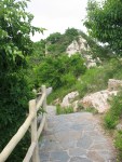
First, we joined the David Foster Harbour Pathway across the street from our hotel and followed it along the waterfront to Fisherman’s Wharf. 

IMG_3731

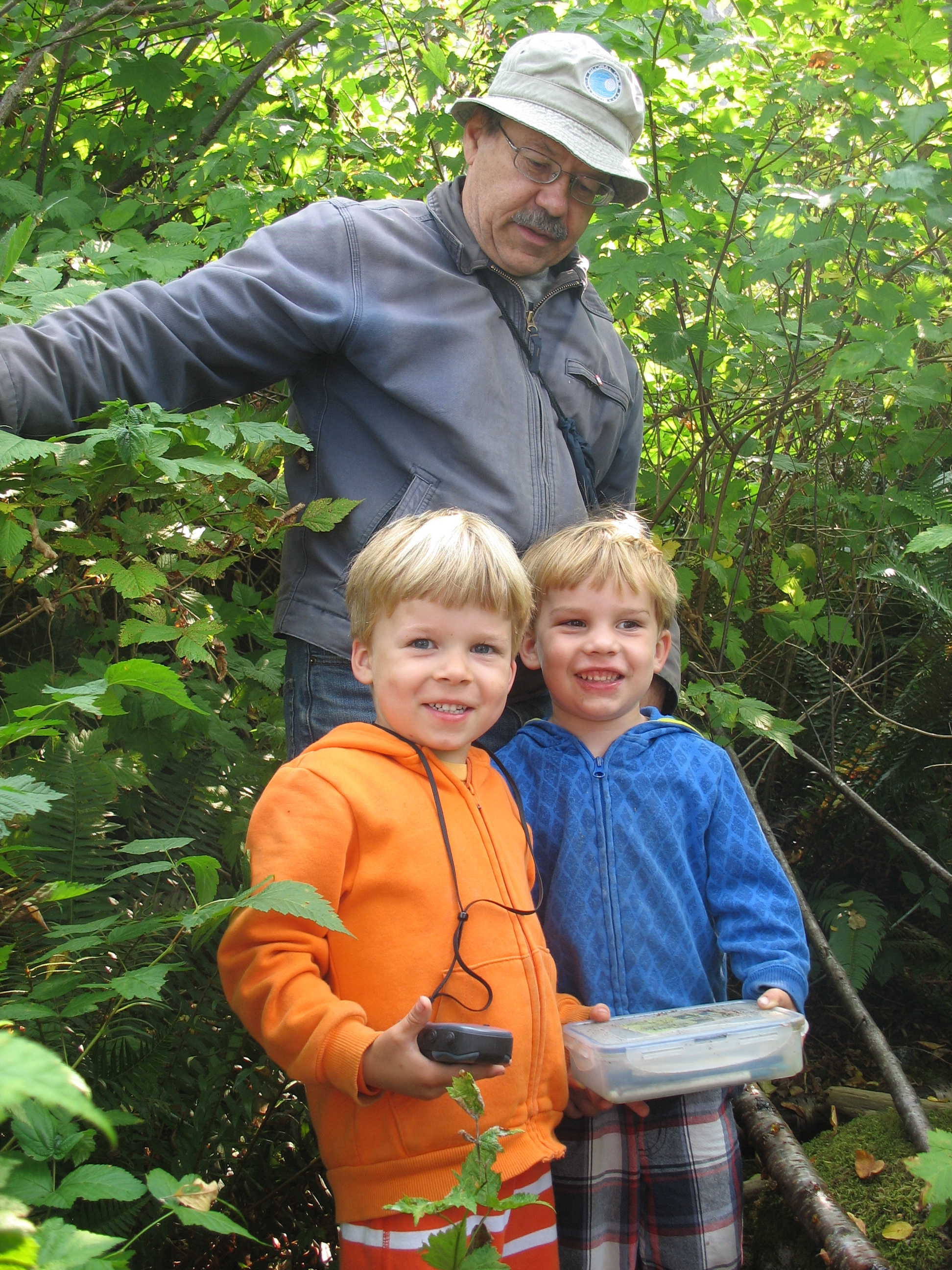
On the way, we stopped to find a couple of geocaches. For those of you who aren’t familiar with this high-tech adult treasure hunt, you can learn all about it here.

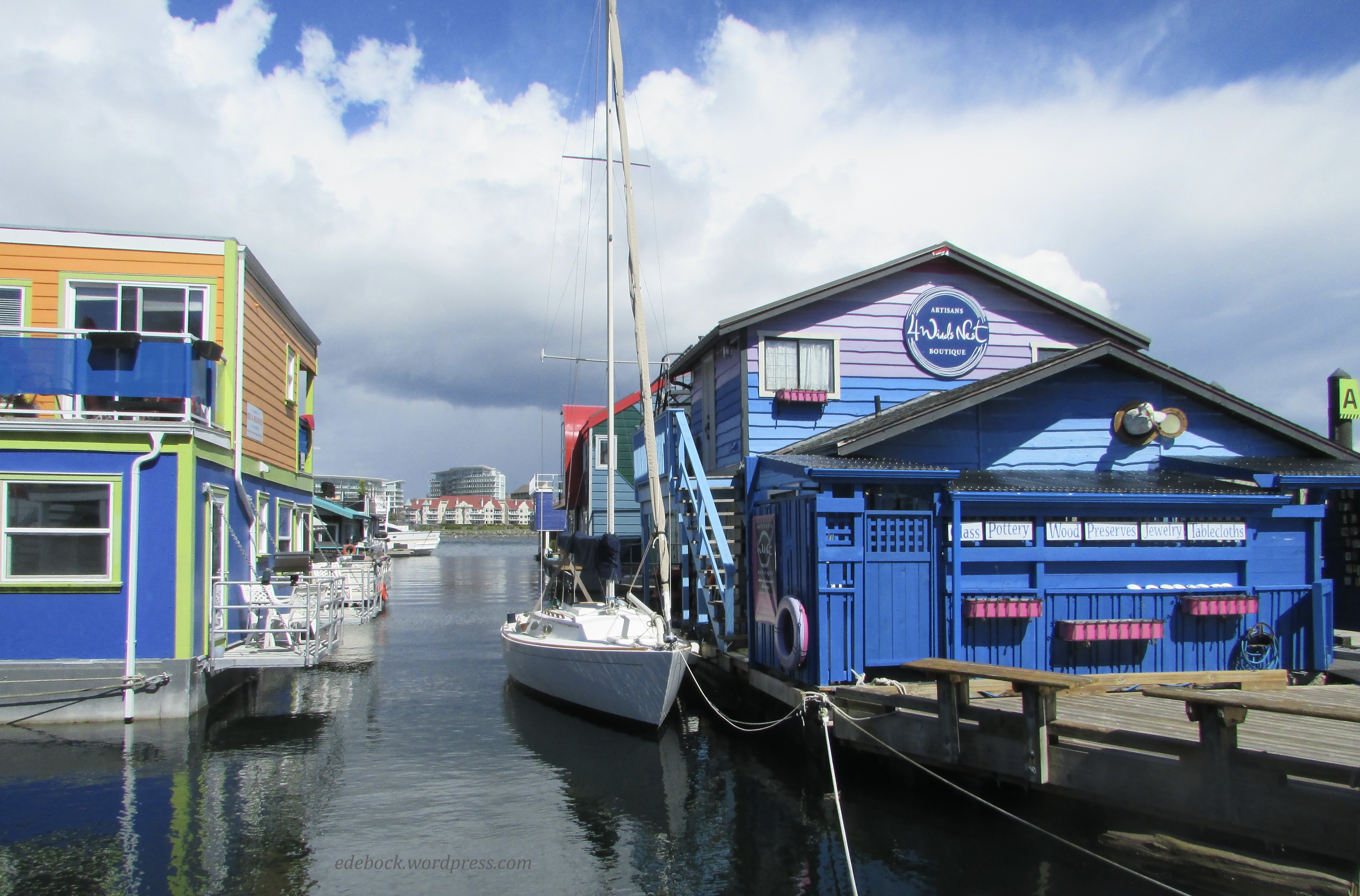
Fisherman’s Wharf is a unique destination with working fishing vessels, pleasure boats with live-aboard residents, float homes, and commercial businesses all moored at the docks. I loved the colourful float homes. Imagine living in a house that gently rocked with the movement of the water! Richard, a lifelong prairie boy, didn’t think he’d like that, but as a displaced coastal girl, I’m pretty sure I’d love it! He did have a point when he commented that there’d be no place to park our golf cart though! 

IMG_3732

IMG_3746

IMG_3748

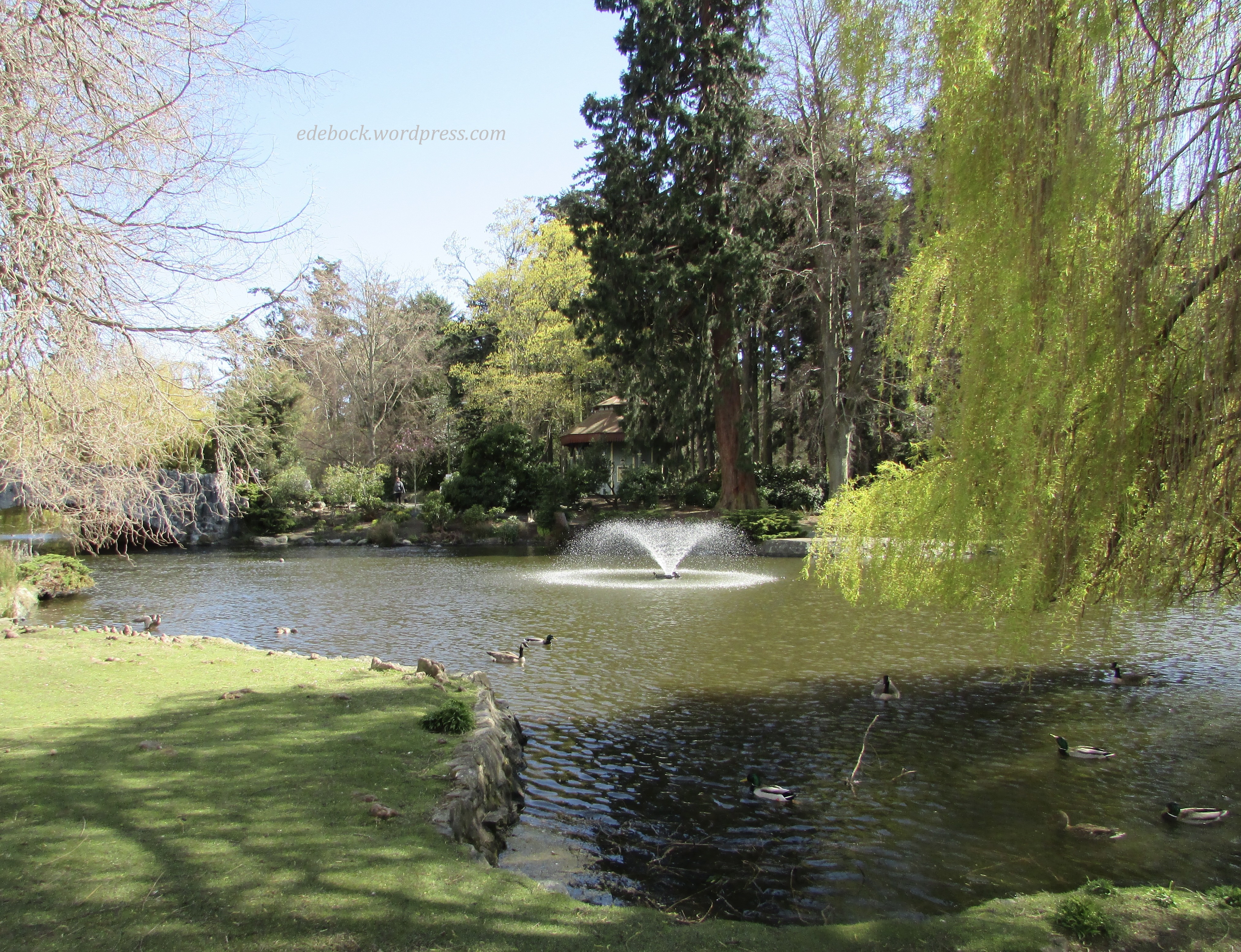
After a delicious lunch of fish and chips on the Wharf, we continued our walk eventually ending up at beautiful Beacon Hill Park, the crown jewel of Victoria’s park system. 

IMG_3770

IMG_3771

IMG_3775

IMG_3778

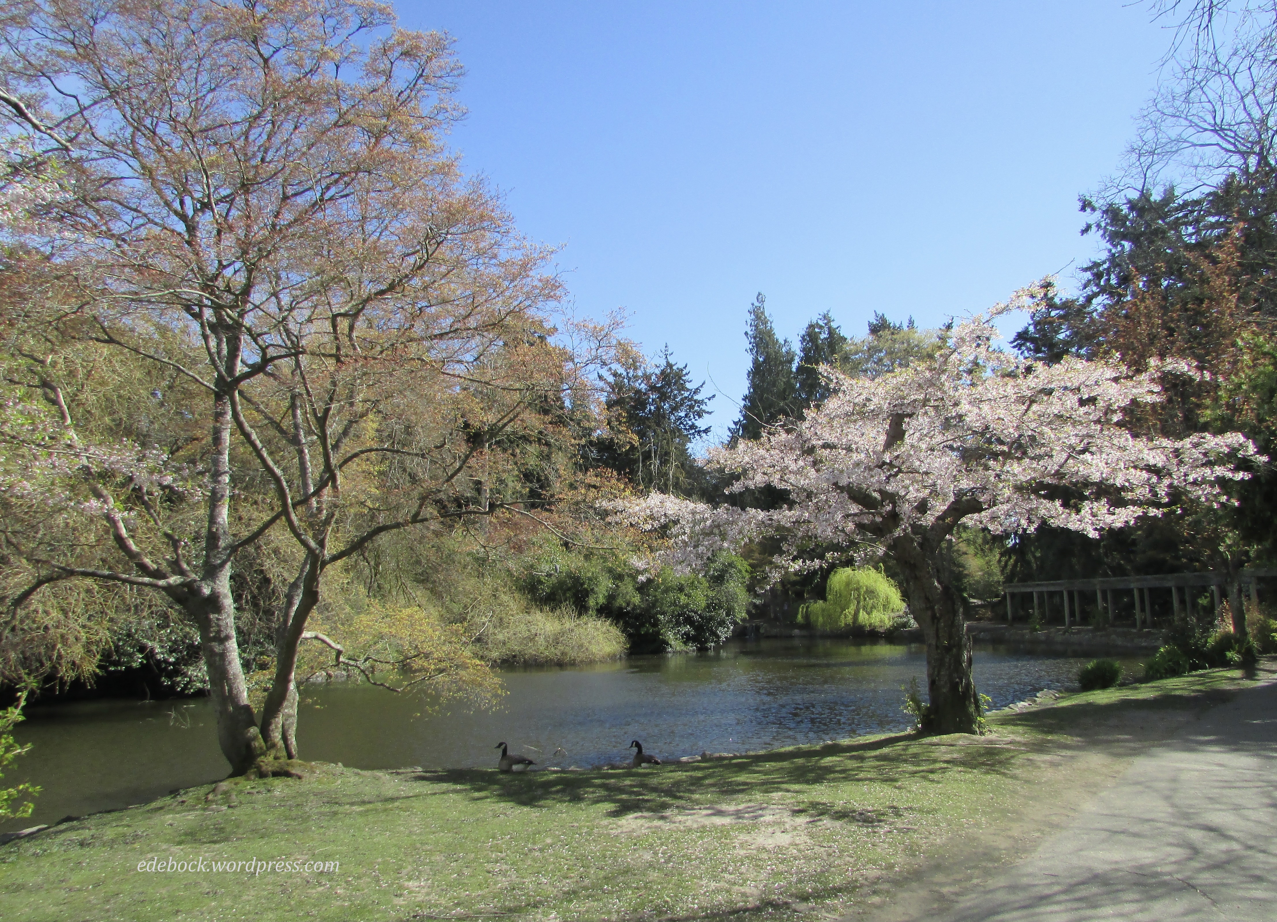
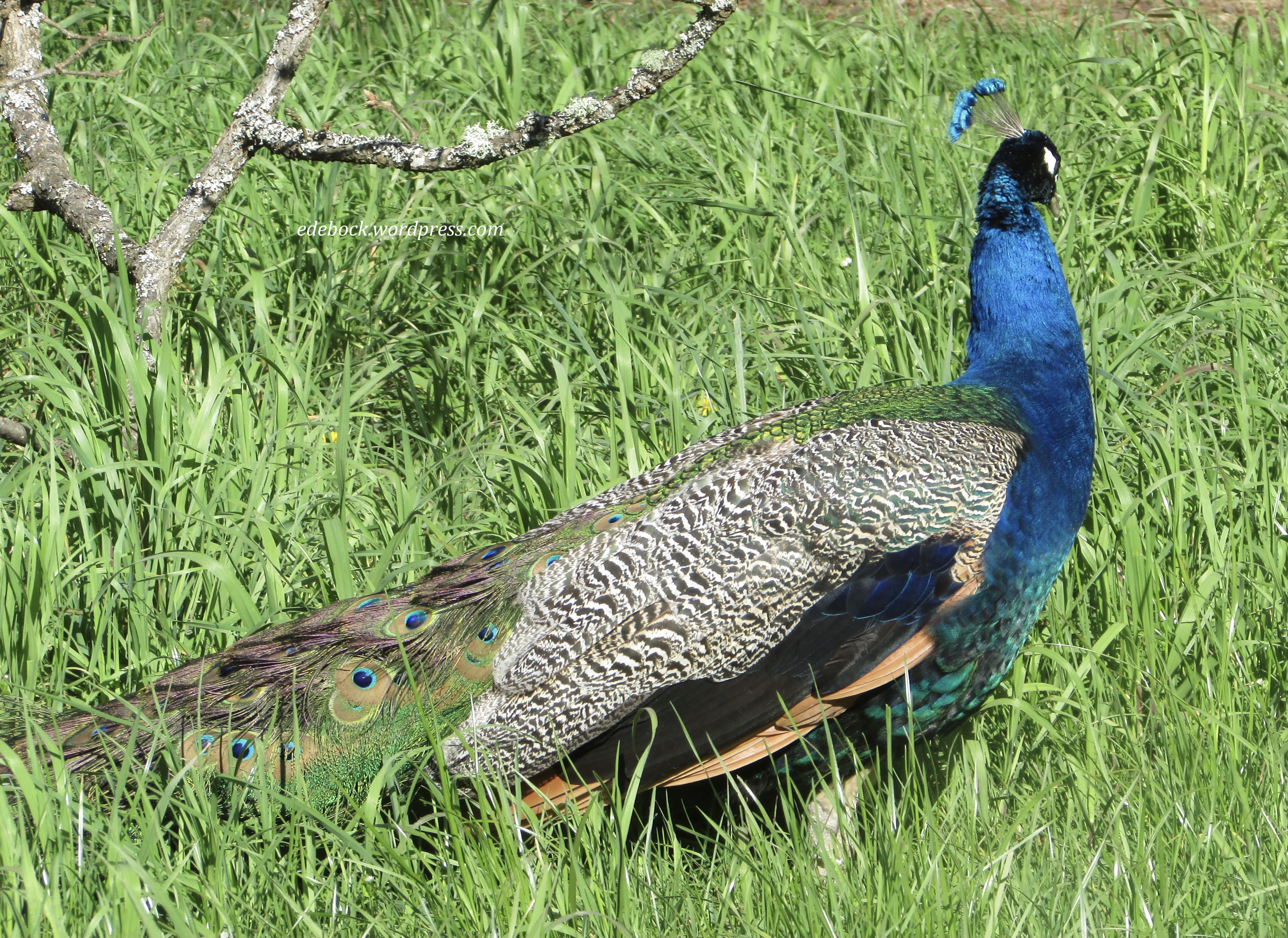
We found several more geocaches while exploring the park. We even had the pleasure of meeting and visiting with another couple who were also hunting for the hidden caches. In addition to the ducks and geese that make the park their home, this gorgeous peacock was just a few feet away from one of the caches and seemed completely unconcerned about our presence. He didn’t oblige us and spread his beautiful tail though. 

IMG_3783

These turtles sunning themselves on a log on one of the park’s ponds appeared to have about as much energy as I have after our very long walk!

IMG_3777

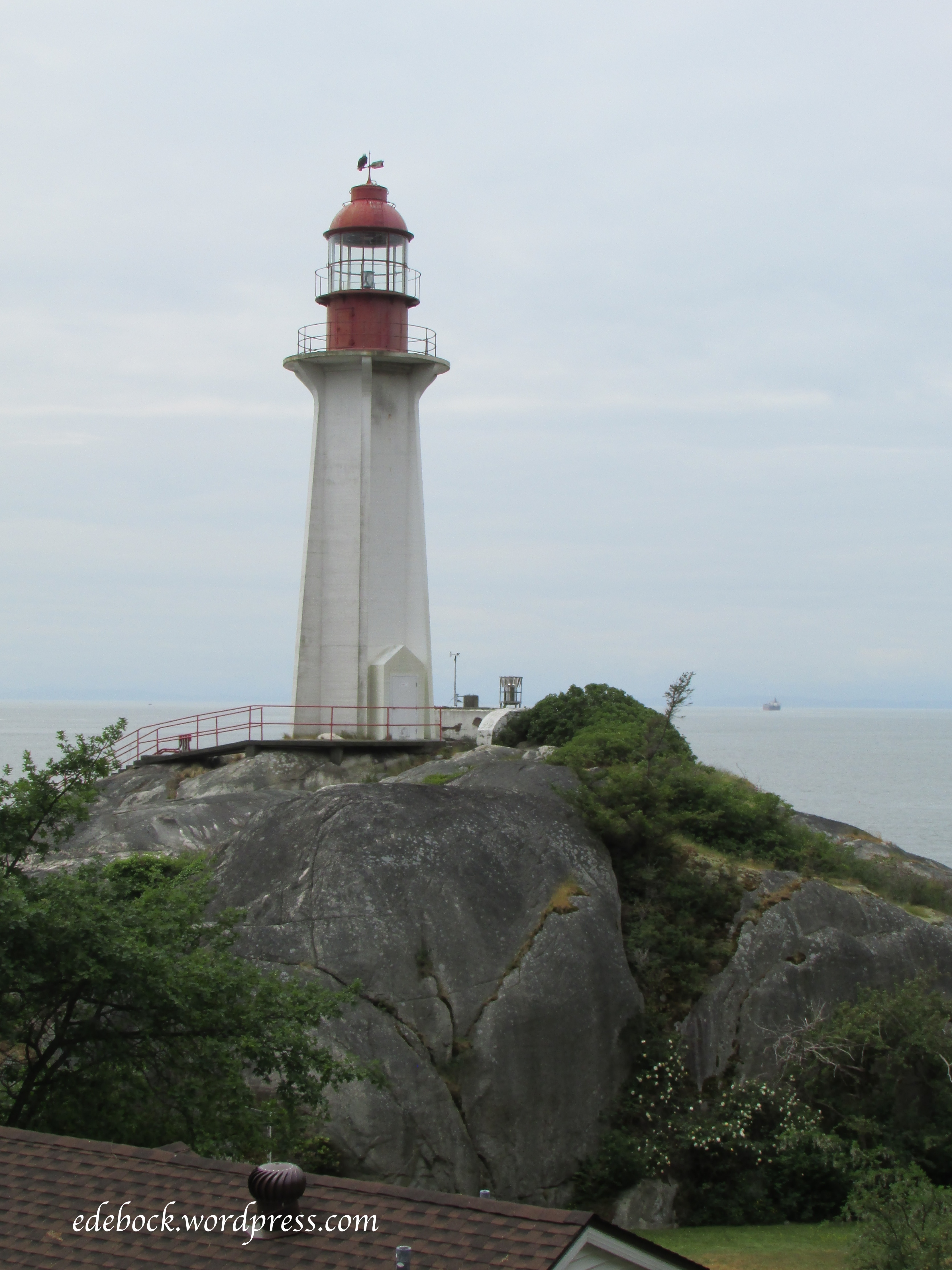
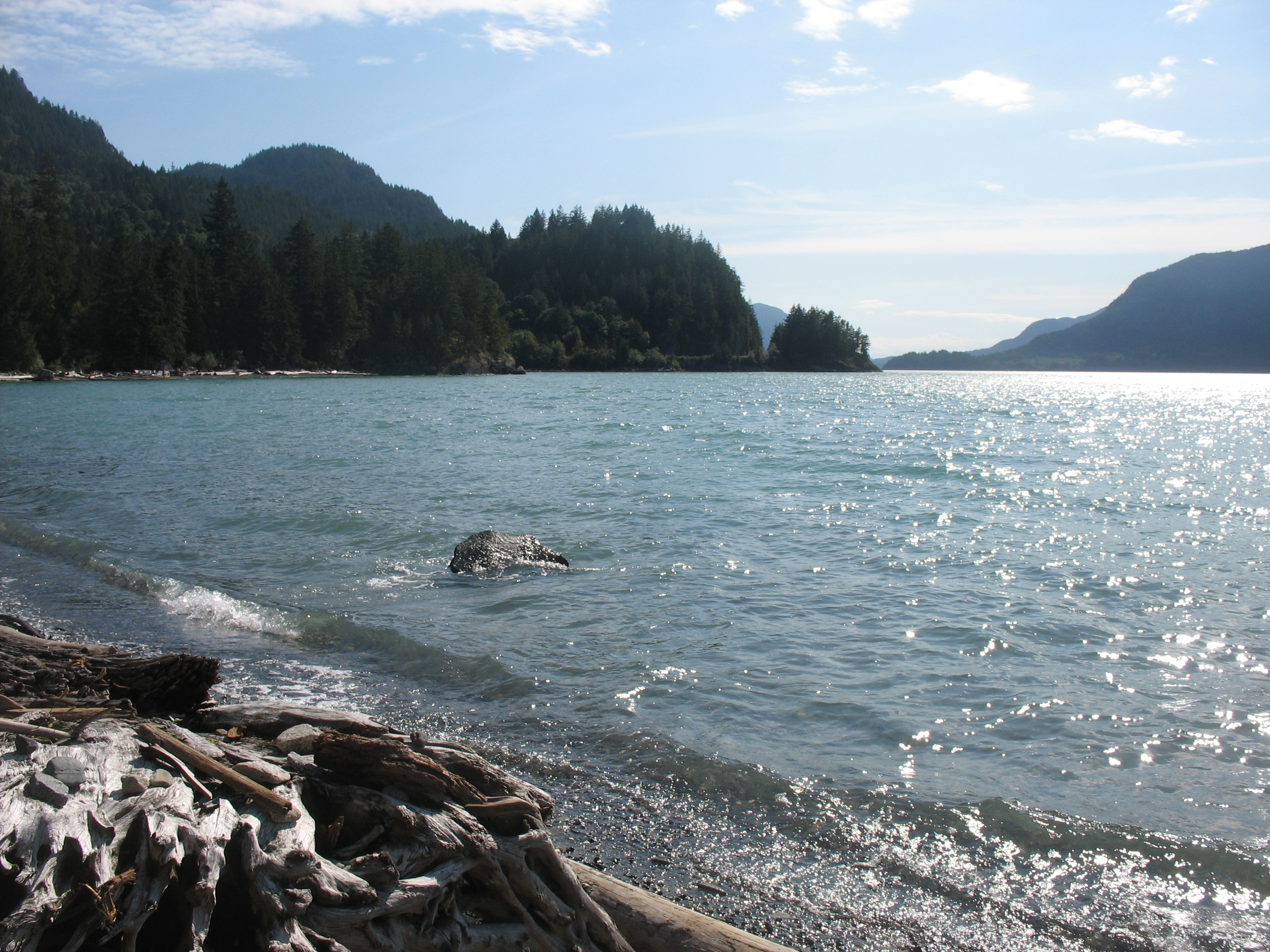
Eventually, we made our way all the way through the park to the oceanside where we could look across the Juan de Fuca Strait to Washington State in the distance. 

IMG_3789

IMG_3792

As you can see, it was a sunny, but very windy day. Perhaps that’s best illustrated by this, one of the windsurfers we saw riding the waves. 

IMG_3791

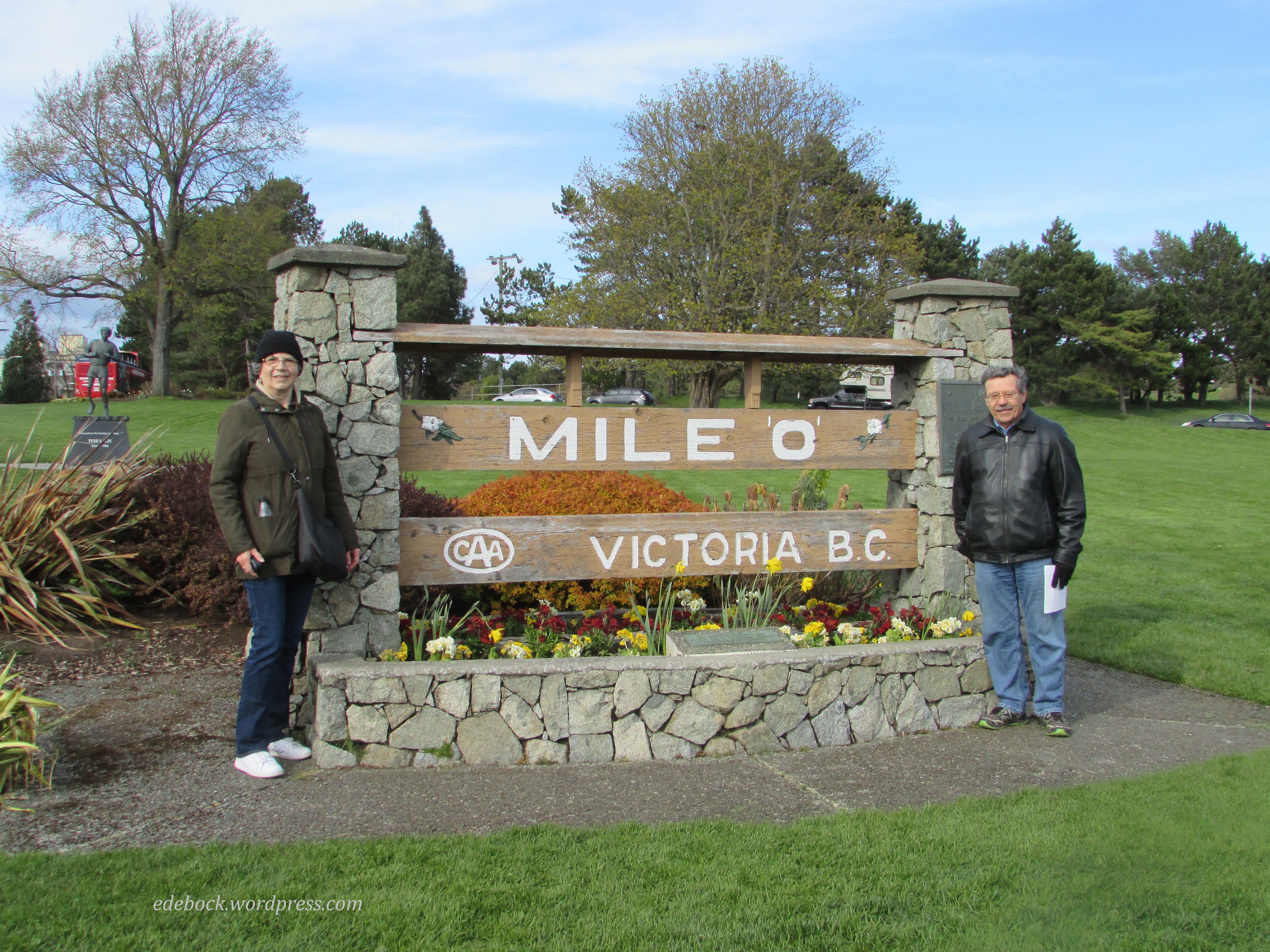
Before beginning the long trek back to our hotel, we stopped at the monument marking Mile 0 on the Trans Canada highway that spans the country from Victoria to St. John’s, Newfoundland. Our geocaching pals offered to take our picture there and I suggested to Richard that perhaps we should visit the other end of the highway this year too. A trip to Newfoundland has been on my mind since acquaintances of ours moved there a few months ago and started posting amazing photographs and videos on Facebook!

IMG_3799

Nearby stands a bronze and granite monument to Canadian hero, Terry Fox, as this was where his Marathon of Hope would have ended if cancer had not returned and claimed his young life before he was able to complete his cross Canada run. 

IMG_3800

And now it’s time to go soak my weary muscles in a hot bath, but do stay tuned. I’ll be back with more of our Victoria visit soon. 

Special dates with Sam and Nate

Separated by distance, we aren’t able to spend as much time with our Vancouver grandsons as we’d like and when we’re here, we also need to spend time with my very elderly father and my special brother, Donald. Fitting in quality time with the boys is a priority, however, and this time we managed to go on a special date with each of them. Though they enjoy a lot of the same activities, Sam and Nate are as different as night and day personality-wise, so one on one time with each of them individually was great.

Sam is just finishing first grade, but Friday was a professional development day for the teachers at his school. Nate was at preschool that morning, so it was a perfect time for our date with Sam. He decided that he wanted to go geocaching, a hobby of ours that we introduced the boys to a couple of years ago. We started by searching out a couple of caches within easy walking distance of his house. He was especially intrigued by this old gent sitting very near the location of the first one.

IMG_1677

Here he is retrieving the next one from beneath a cedar tree!

IMG_1679

Found it!

Here in North Vancouver you are never far from nature and forest trails are easy to find. Part of our morning was spent in Princess Park. The clue for one of the caches there included this description: “You are steps away when you see a trunk that looks like a bird bath, or a water bowl for a Great Dane.” What in the world could that mean?

IMG_1682

It was obvious when we saw it and sure enough, the cache was hidden nearby.

Sam loves sushi and so do we, so when we asked him where he wanted to go for our lunch date, he chose Valley Sushi, a great little restaurant close to his Lynn Valley home.

IMG_1691 - Version 2

This morning, Sam was back at school and it was time for our date with Nate who only attends preschool three mornings a week. He knew exactly where he wanted to go; Lighthouse Park in West Vancouver. He’d been there once before with his other grandfather and had shown me a brochure containing a map of the trails that criss-cross the park the day we arrived. He wanted to hike to Juniper Point and after hearing about Sam’s geocaching adventure, he also wanted to find some caches. There were two of them along that trail. The hint for the first one said, “Horizontal tree meets vertical tree.” The GPS doesn’t work really well under tree cover, but we thought we’d found the right spot when we found a fallen tree right beside a standing one. When we didn’t find the “treasure” right away, Nate grew bored and wandered a little ways away. Suddenly we heard his shout, “I found something! I think this is it!” Sure enough, he’d located the cache all on his own, tucked into the end of another fallen tree.

IMG_1757

Another cache was found near the beautiful rocky point where we enjoyed a snack overlooking the ocean.

IMG_1753

After completing that trail, I also managed to convince Nate to hike out to the lighthouse. Look closely and notice the bald eagle perched on the weathervane!

IMG_1771

Nate’s date ended just like Sam’s with lunch at Valley Sushi. Even his order was the same; California rolls and Dynamite Rolls. Yum!

IMG_1775

Making memories with the boys on our special dates worked out so well that I think this should be the beginning of a new tradition. I wonder where they’ll want to take us next time we visit?

October!

“I’m so glad I live in a world where there are Octobers.”
L.M. Montgomery, Anne of Green Gables

October is my favourite month; a bittersweet interlude between summer and winter. Here in Alberta, it arrives amidst a blaze of colour, but by the end of the month, there will likely be snow on the ground. Each golden day is a treasure.

The tiny hamlet of Gwynne, located midway between Camrose and Wetaskiwin, is nestled in a valley that is absolutely gorgeous in the fall. We often take that route on our way to Edmonton, but until today we’d never stopped to explore the area. I recently learned of two hiking trails in the valley, however, and they were today’s destination.

The first, officially called the CPR Canyon Hiking Trail, is a relatively easy 4 km walk along a creek. The name seems apt as the railway follows the creek on the opposite bank and three trains rumbled by while we were hiking. It’s known locally, however, as Chickadee Trail and we soon found out why!

The inquisitive little critters were landing on my outstretched hand before we even took any food out of the pack on Richard’s back. Soon we were sharing lunch!

IMG_5726

IMG_5730 - Version 2

There were six geocaches hidden along the trail which added to our fun.

The second trail circled through Pipestone Creek Conservation Lands where we searched out three more geocaches and enjoyed some spectacular views including an oxbow lake.

IMG_5760

There are clearly many more trails criss-crossing the conservation area and we found a lovely little campground close by, so I suspect that we’ll be spending more time there in the future.

IMG_5741

I have no idea how far we walked today, but my knees are telling the tale this evening and it’s time to go soak in a hot bath!

IMG_5735

Hopefully October holds many more days like this one!

Fall camping

IMG_5618I’ve always wanted to go camping in the fall; always hoped for just one more outing with the trailer before winter hit. As teachers, it never happened. We were back in the classroom and up to our eyeballs in work by late August or the first week of September. Then, with retirement came several years of helping our friend, Louis, with harvest. I loved being out on the combine, but it meant that there was no time for camping in the fall.

Finally, this year it happened! We packed up the trailer last Wednesday morning and headed for Miquelon Lake Provincial Park, less than an hour and a half from home. Surrounded by the spectacular colours of the season, fall camping was everything I always thought it would be! Though we got caught in the rain while out geocaching on Wednesday afternoon, the clouds soon disappeared and for the remainder of our time the weather was glorious.

Here in Alberta, we don’t get the wide variety of fall colours that are found in eastern Canada, but everywhere I turned I was surrounded by beauty and I took dozens of pictures!

IMG_5594  IMG_5617

IMG_5633

We found 14 geocaches within the park boundaries, but the highlight of our trip was definitely Friday’s hike. We left the trailhead late in the morning intending to hike 7.3 kilometres, but we’d completed all but 1.5 km of that by the time we stopped to eat lunch! Digging out our trail map, we quickly decided to add what we had originally thought might be a separate hike sometime in the future. In the end, we covered 13.2 km! Considering the fact that just a few months ago, I couldn’t walk more than two km without playing out, I was pretty stoked!

IMG_5608  IMG_5613

IMG_5647

Those of you who’ve been reading my blog for very long know how much we enjoy exploring old abandoned houses that give us glimpses into life in days gone by. Imagine our surprise and delight when Richard spotted an old brick chimney rising out of the bush a short distance from the trail. Of course, we had to take a closer look! Although the girl manning the park office couldn’t give us any information about the house or its original inhabitants, it was easy to see that the two storey structure and its smaller outbuilding must have been there long before the park was established in 1958.

IMG_5663

IMG_5652

IMG_5659

Though we didn’t see any of the larger wildlife, including deer, moose and elk, that live within the park, there was clear evidence of their presence along the trails. Plenty of fresh hoof prints and droppings told us they weren’t far off. What we did see were squirrels, muskrat, tiny frogs, a surprising number of garter snakes and an abundance of water fowl. As Miquelon Lake and the numerous wetland areas within the park are located within two of North America’s migratory flyways, flocks of migrating geese honked their way overhead and settled on the lake each evening.

Miquelon Lake is also part of the Beaver Hills Dark Sky Preserve, an an area that has been established to reduce the glare of artificial light and increase the visibility of the night sky. Each evening, as we sat around the fire in the crisp evening air, darkness settled around us and stars filled the sky. What could be more relaxing?

Dare I hope for one more camping trip before winter arrives?

IMG_5623

Donalda day trip

Every time we travel Highway 53 on our way to Red Deer, Calgary or other points to the south, we dip down into Meeting Creek Coulee, the northern most point of the Canadian Badlands. As we climb back out, we pass the access road to the tiny village of Donalda. With its population of about 260 people, it perches on a bluff overlooking the vast valley below. Over the years, we’ve often thought that this would be a great area to go hiking and apparently, we weren’t the only ones. A few years back, the community developed and advertised a hiking trail. When we discovered that geocachers had hidden some caches both in town and along the trail, our interest grew and finally, yesterday was the day. We packed a picnic lunch and off we went! IMG_5318Donalda’s greatest claim to fame is the world’s largest lamp, a replica of the oil lamps that once lit the homes of early settlers across this land. Standing 42 feet tall at the end of the town’s quaint main street and just across the corner from a museum that houses the world’s largest collection of oil lamps, it was lit for the first time on July 1, 2000. All night, every night, its light shines out over the valley below. Inside its base, visitors enjoy a series of paintings depicting the town in its earlier days. Our first cache was hidden just outside. IMG_5327 IMG_5323  IMG_5322 IMG_5321 IMG_5316 After picnicking close to the lamp and the restored railway station nearby, we searched out the other two caches that are hidden in town and then set off along the hiking trail. We expected to find ourselves walking along the rim of the coulee, but instead, we followed a woodland trail that eventually led us out onto an open bluff overlooking the valley below. Seldom ones to stay on the beaten track, after stopping to rest at a picnic table with a spectacular view, we set off to follow an animal trail down into the valley. IMG_5351 I hiked down to the flat valley floor while Richard explored the interesting formations on another close by bluff. IMG_5344 IMG_5345 IMG_5346 The valley is far vaster than we ever realized from the highway and my photos hardly do it justice, but it was great to finally trek through a very small part of it. There are so many interesting places close to home if one but takes the time to explore them! IMG_5334 IMG_5335 IMG_5336

Solitude

IMG_5153

Richard and I spent the past couple of days doing three of the things that we most enjoy at this time of year… camping, hiking and geocaching.

Big Knife Provincial Park, located in central east Alberta where Big Knife Creek flows into the Battle River, is less than an hour from home for us. Like many locations on the Canadian prairie, it takes it’s name from our native history. Two hundred years ago, the Blackfoot and Cree who inhabited the area were bitter enemies. According to legend, Big Man, a Cree, and Knife, a Blackfoot, fought near the banks of the creek, which at this time of year is little more than a muddy breeding ground for mosquitoes. Apparently both warriors died in the battle.

Though the campground and day use areas are probably somewhat busier on weekends and during the height of the summer, the park was almost empty while we were there providing us the peace and solitude we were looking for. We spent several hours on Wednesday tramping the River Flats trail system and yesterday we hiked the Highland trails. Though my stamina isn’t quite what I’m used to it being and we stopped to rest more often than we might have in the past, I was impressed that I could quite easily hike for several hours a day without completely wearing out.

The trails were far from challenging, mostly level and grass covered. With the sun shining overhead, tiny wildflowers strewn along our path, butterflies flitting around our ankles, birds singing in the nearby trees, and the sweet musky scent of the silver willow bushes wafting on the breeze, walking was a delight. We did do a bit of “real” hiking though, first leaving the River Flats trails to get a close-up view of the nearby hoodoos, then deciding to climb a steep hill and follow a narrow animal track along the top of a bluff that would have scared me out of my wits a few years ago before I overcame my fear of heights.

IMG_5151

IMG_5157

IMG_5166

IMG_5170

Only one of the eleven geocaches hidden throughout the park eluded us. It was suppose to be at the end of that narrow animal track, though the cacher who placed it recommended coming at it from the other direction. We searched a wide area around the given coordinates but came up empty handed. The view was spectacular though and the trek well worth it.

IMG_5171

There’s a cache up there somewhere… maybe

Not all of the caches were out on the trails. Shortly before dusk, we spotted a beaver in the water’s edge munching on a stick while we were searching for the one that’s hidden not too far from the boat launch. I couldn’t get close enough to get a good photo, but we stood and watched him until he quietly slid into the water and swam away.

IMG_5177

Storm brewing

I love the solitude of nature; no TV, no telephone, and no internet, but I also love the conveniences of modern day camping. On Wednesday night, a storm blew in bringing much needed rain to the surrounding countryside but we were snug and warm in our trailer bed as the thunder crashed and lightning flashed. It had blown over long before morning came and oh, how well I slept!

Porteau Cove

As we sat in an Edmonton waiting room on April 10th anticipating our first meeting with the surgeon who was to remove the cancerous tumour from my salivary gland, my cell phone rang. It was our four-year-old grandson, Sam.

“Can we go camping with you this summer?” he asked.

We spent the past week honouring that request at beautiful Porteau Cove Provincial Park, just a half hour drive from his North Vancouver home. At Sam’s age, I lived in an oceanfront house and the beach was my playground. I’ve always said that you can take the girl away from the ocean but you can’t take the salt out of her blood. This week at Porteau was good for my soul!

IMG_4197

From the morning mist hanging over Howe Sound to the sun sinking behind the ridge across the water, our days were spectacular. We watched seals bobbing in the water, bald eagles plunging from the sky to catch fish, and herons standing like sentinels at the low tide line every morning. We also watched the brazen little squirrel that we nicknamed Sticky Fingers attempting to steal food from our table!

Our days were filled with fun. With our two little pirates, Sam and Nate, we built a driftwood fort amongst the logs on the beach and searched for treasure (geocaches). We visited nearby Shannon Falls and toured the Britannia Mine Museum again. We even had front row seats for the beginning of the first Canadian Surfski Championships yesterday. We ended every day around a propane fire pit roasting marshmallows and eating s’mores. It lacked the crackle of a wood fire and the smell of smoke that usually goes along with camping, but the blue sky days and lack of rain have resulted in a fire ban along the coast and only propane is allowed.

IMG_4206IMG_4277

IMG_4210

Now we’re back in the city where the next few days will be spent, in part, helping my 91-year-old father with banking and other issues related to my mother’s estate, but the memories made over the past week will be with us for a very long time!

IMG_4295

Top six

This is Following Augustine’s 600th post written over a period of slightly more than six years! I think that the secret to the blog’s longevity is its eclectic nature.

Originally started as a way to share our year in Japan (2008-2009) with friends and family, it has become much more than a travel blog. Family often shows up but it isn’t a mommy blog and while I occasionally focus on clothing, shoes or accessories, it definitely isn’t a fashion blog. In recent months, I’ve been using the blog to share my cancer journey but, just as my life continues to be about more than just my health, so does the blog. My faith permeates every part of my life, including what I write, but this isn’t a religion blog either. For lack of a better description, I refer to it as a travel and lifestyle blog but I also like to think of it as an active retirement blog.

One of the things that I like about blogging with WordPress is the stats page where I can see how many readers view the blog, where they’re from and which posts are most popular. I’m often surprised by which ones generate the most interest. In fact, some of the most popular posts are ones that I wondered if anyone would find interesting!

Today, in honour of 600 posts in 6 years, I’m going to profile my top 6 posts of all time. Since several of them are older posts, I’ll include a link to each one in case newer readers are interested in looking back with me. Just click on the titles below to check them out.

Following Augustine’s Top Six Posts of All Time


#6  What influences your sense of self-worth?   Oct. 29, 2011

The idea for this post came from Charles F. Stanley’s Bible study, How to Reach Your Full Potential for God, and was the result of some serious self examination. It was one of the most difficult posts I’ve written because it involved baring my soul and owning up to an attitude that I knew needed to change.

#5   Tatami   Aug. 28, 2008

I find it quite funny that the most popular post from our entire year in Japan was about the traditional floor covering known as tatami! Tatami has many advantages and I loved it but I didn’t love the insects that crawled out of the tightly woven mat at night to bite me! Eww! Fortunately, we learned how to get rid of them and it’s obviously this information that people are looking for when they Google “insects in tatami” or other similar phrases and find their way to this post.

#4   A new journey…   Aug. 30, 2013

The newest post on my Top Six list, this is the one that shared my cancer diagnosis. I was walking this trail beside a peaceful lake in southern Alberta when the cell phone in my pocket rang and I first heard that dreaded C word.

Where will this journey take us?

Now that a second cancer has been diagnosed, we are no closer to knowing where this journey is going to take us.

#3   Alex’s yellow lizard   May 28, 2012

IMG_9629_2Richard and I are avid geocachers. Geocaching is a grown up, high-tech game of hide and seek. Participants use GPS units to hide and find containers called geocaches and then log their activity online. One of the aspects of geocaching that I like best is trackables; geocaching game pieces that are moved from cache to cache by geocachers like ourselves. Alex’s Yellow Lizard was a trackable that we picked up from a roadside cache in Manitoba on our way home from Winnipeg a couple of years ago. When it started its journey in Minnesota, its owner asked that pictures be taken and posted along the way so that his seven-year-old son could watch his little yellow lizard as it traveled around the world. We placed it in a geocache at a native ceremonial site on a high point of land about 24 km north of our home. When I posted this information on the geocaching website, I included a link to my blog.

#2   Like a gold ring in a pig’s snout   Jan. 21, 2011

pig-nose-ringI have no idea why so many people enter things like “gold ring in pig’s snout” and “pig nose ring” in search engines! I thought this was a pretty obscure thing to write about! The phrase comes from Proverbs 11:22 and refers to a beautiful woman who has no discretion.


And now, drumroll please!

#1   Bridges of Madison County   July 21, 2010

My most read blog post of all time is also one of my shortest. On a road trip to Kansas City for a missions conference during the summer of 2010, we purposely went out of our way to visit Winterset, Iowa, the setting of my favourite novel, The Bridges of Madison County by Robert James Waller. Like Robert Kincaid, one of Waller’s main characters, we drove the back roads of Madison County photographing the covered bridges that were made famous by the novel and the movie that followed. I crossed another dream off my unwritten bucket list when I stood on Roseman Bridge and touched the spot where farmer’s wife, Francesca (Meryl Streep), pinned a note inviting Robert (Clint Eastwood) to come for dinner “anytime the white moths fly”.

And here it is, the most viewed photo to appear on my blog thus far!

Roseman Bridge

Roseman Bridge

First day at the Cross

After finding our way from the parkade to the registration desk and being issued the red and white Cross Cancer Institute ID card that I’m supposed to show each time I enter the facility, we started our first day there with a new patient orientation session. In my mind’s eye, I had visualized us sitting in a classroom with several other brand new shocked and bewildered patients listening to someone give us an overview of how things work at the Cross. Instead, the two of us sat on a comfy couch in a cozy corner of the patient library and chatted with a volunteer, a colon cancer survivor who was treated at the Cross about 15 years ago. He shared a little of his own experience, told us about the services and resources that are available to patients and their families, gave us excellent suggestions about dealing with the practical and emotional challenges of living with cancer and encouraged us to take an active role in my care.

Of all the many volunteers who perform this service, God sent us Gar! About mid way through his presentation, while telling us about the psychosocial and spiritual resources that are available, he made this comment, “People have many different ways of dealing with cancer but I just put mine in the hands of my Lord and Savior, Jesus Christ!” I replied with a resounding “Amen!” Gar was one of us and God had put him right where we needed him when we needed him there.

Following our chat, Gar took us on a tour of the facility making sure that he clearly pointed out the various places that I’d need to return to later. By the time we hugged and said good-bye, we felt much more at ease.

After a quick bite to eat, it was time for our first visit to the Nuclear Medicine department where I received my mIBG injection. This was the first of two injections of radioactive drugs that will aid in determining the extent to which my cancer has spread. Tomorrow, I’ll return for a full body scan, which will involve lying perfectly still for up to an hour, followed by the injection of the second drug.

A visit to the lab, where blood was taken, brought today’s appointments to an end. Over the four weeks since this journey started, I’ve been poked numerous times including three tries to get an IV started the day I had my colonoscopy. I must say that the gals at the Cross have been the gentlest so far. I hardly felt the two needles that entered my arms today!

Before we left the Cross this afternoon, we visited the gift shop where we stocked up on used books for $1.00 apiece and then headed out into the sunshine to find the geocache that’s hidden on the hospital property! It was placed there in April 2010 by a young geocacher who wanted to honour his twin sister, a breast cancer patient at the Cross.

I was pretty tired this afternoon, probably just a response to the emotional overload of getting this far, but after resting a bit and enjoying the first meal our youngest son has ever cooked for us, I’m recharged and ready to go back again tomorrow.

Hidden treasure!

If you’ve been reading my blog for the past year or more, you may remember that Richard and I are avid geocachers. Geocaching is a high-tech adult treasure hunting game in which participants use GPS devices to search for geocaches, or containers, that have been hidden by other players. Every find is logged on the official caching website at www.geocaching.com. There are presently more than 2 million geocaches and 5 million geocachers worldwide and these numbers are growing all the time.

Between April and November of last year, Richard and I located 221 caches spread across Canada’s four western provinces. When we decided to come to China, I checked the website and discovered that there were only a handful of caches in the Dalian area. Most had been placed here by foreign tourists and I got the impression that they weren’t being maintained so we decided to leave our GPS unit at home.

A couple of days ago, just for a lark, I decided to take another look at the website. Now that we’ve been here for several months and know our way around the city, I wondered where the caches were located. When I read about the one called Dalian 360, I immediately wished that we’d brought the GPS with us. "A beautiful panoramic view awaits," read the description. "A nice but steep hike, paved steps, along the ridge of a hill at Fuguo Park." A quick check using Google Maps told me that Fuguo Park was an easy bus ride from here in an area we were familiar with. When I discovered that the last person to visit the cache had dropped not just one, but two trackables into it, I wondered if there was any chance that we could find it without the GPS!

A trackable is geocaching game piece that is stamped with a unique tracking code. Some of them have travelled thousands of miles thanks to geocachers who move them from cache to cache and record their movements on the website. This is an aspect of the game that we really enjoy. In addition to helping 15 trackables along their way, we’ve launched two of our own by placing one in each of the two caches that we hid near our home in Alberta, Canada. One of them is now in a cache in Colorado and the other is in the Netherlands.

I knew that finding a geocache without using its GPS coordinates was a long shot but I’ve been wanting to hike some of the hills in and around Dalian anyway and I knew that we’d enjoy the outing even if we didn’t find the cache. Immediately after lunch today, I looked up the webpage again and jotted down a few notes:

  • on hill above trail following ridge line
  • views of Dalian skyline and Xinghai Bay
  • under rock near 9 trunked "octopus tree"

I also drew a rough map and made a couple of quick sketches based on photos that had been posted by previous finders. Without those, finding the cache without a GPS would have been virtually impossible.

After exiting the bus, we had no trouble finding the street that took us up a very steep hill to the park’s east entrance. From there, we continued to follow a narrow road and then well maintained trails higher and higher. Each time we came to a V, we took the path that looked like it would take us up to the ridge. Once there, we hadn’t walked very far when I recognized the views I’d seen in the photos online. Glancing to my left, there it was; the very distinctive octopus tree! We were in the right place but could we find the cache? I climbed to the left of the tree while Richard scrambled around to its right and within moments, he made the find!

Before we’d even had a chance to open the container, three muggles (non cachers) arrived on the scene and started picking berries! We moved a short distance away and surreptitiously removed the trackables, replaced them with a keychain for someone else to find and signed the logbook. But how could we put the container back in place with three people watching us? Instead, we took it with us and continued our hike along the ridge to the next peak. By the time we returned, the berry pickers had moved on and we were able to put it back in place for the next cacher to find!

The trackables will go back to Canada with us next month to be placed in geocaches there. One of them started its journey in Finland in October of 2011 while the other was released in Okinawa, Japan in January of this year.