A day on False Creek

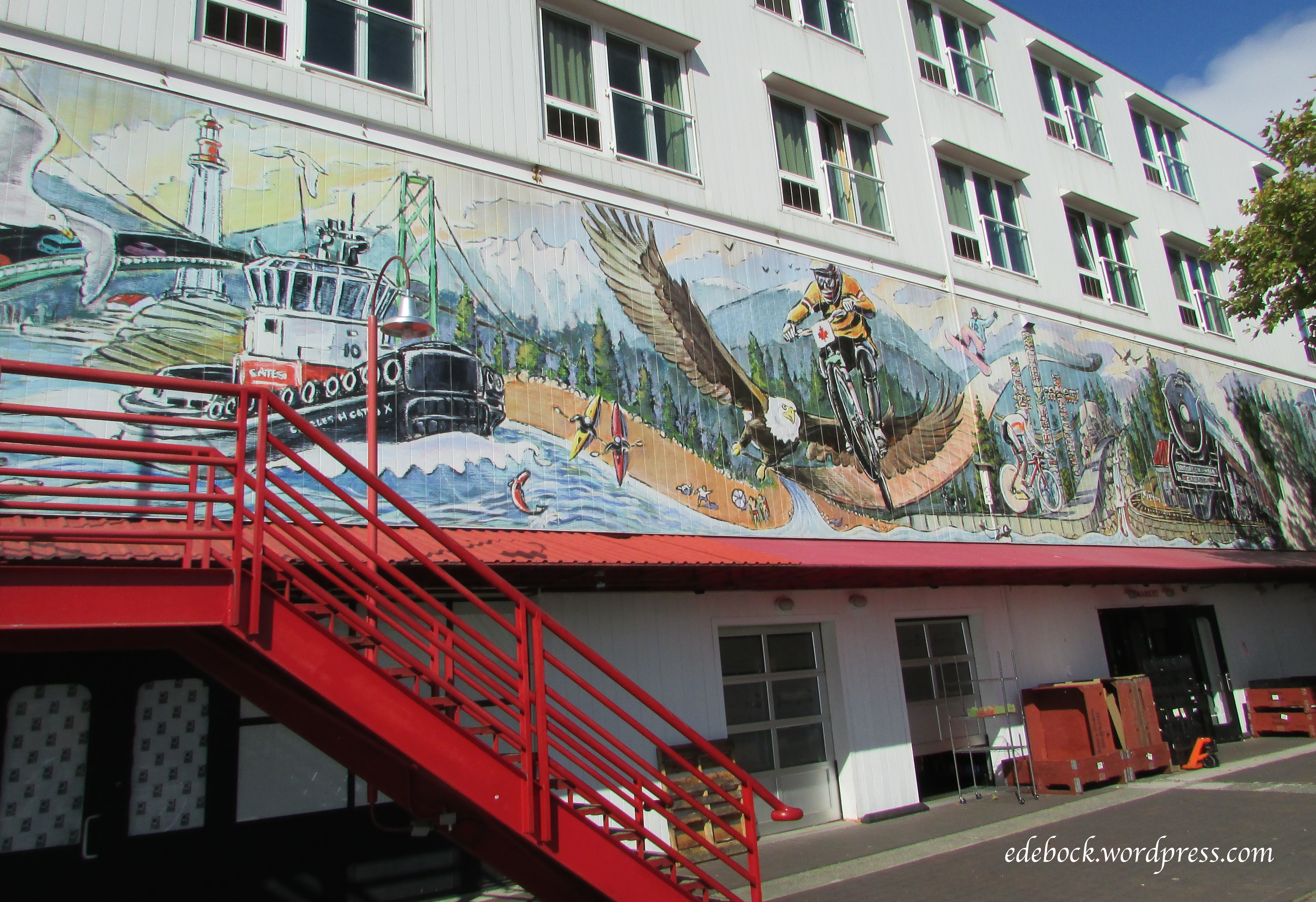
On our final day in Vancouver, the rain had finally stopped and we decided to spend the day playing tourist.

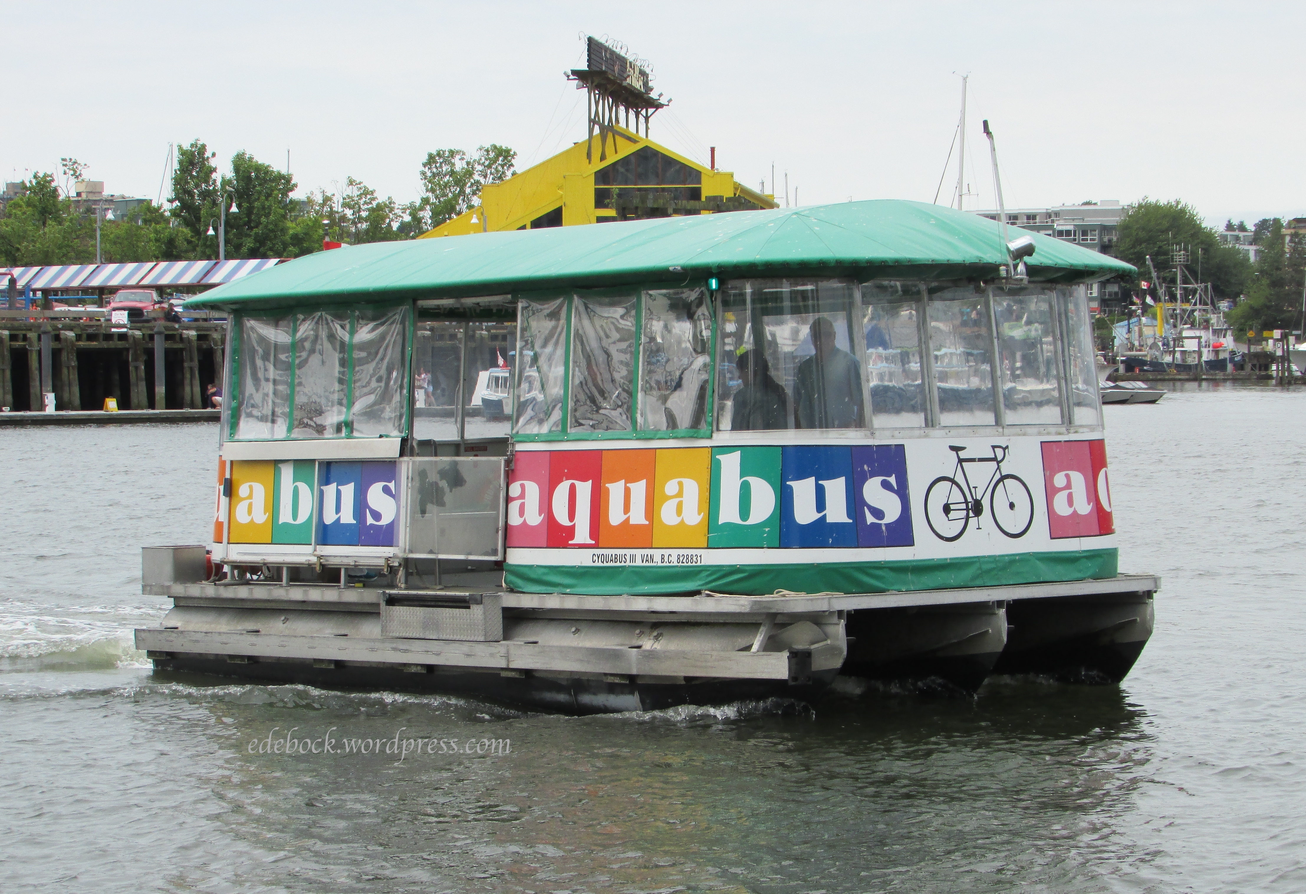
Vancouver has two inner harbours. Burrard Inlet, the fjord that separates the north shore with its coastal mountains from the city proper, is the main port and welcomes ocean going freighters and cruise ships. To the south of downtown is the smaller inlet known as False Creek. False Creek is home to a vast array of pleasure crafts, some houseboats, and the little False Creek ferries that shuttle passengers between Granville Island and eight other stops along its shores. 

IMG_3237

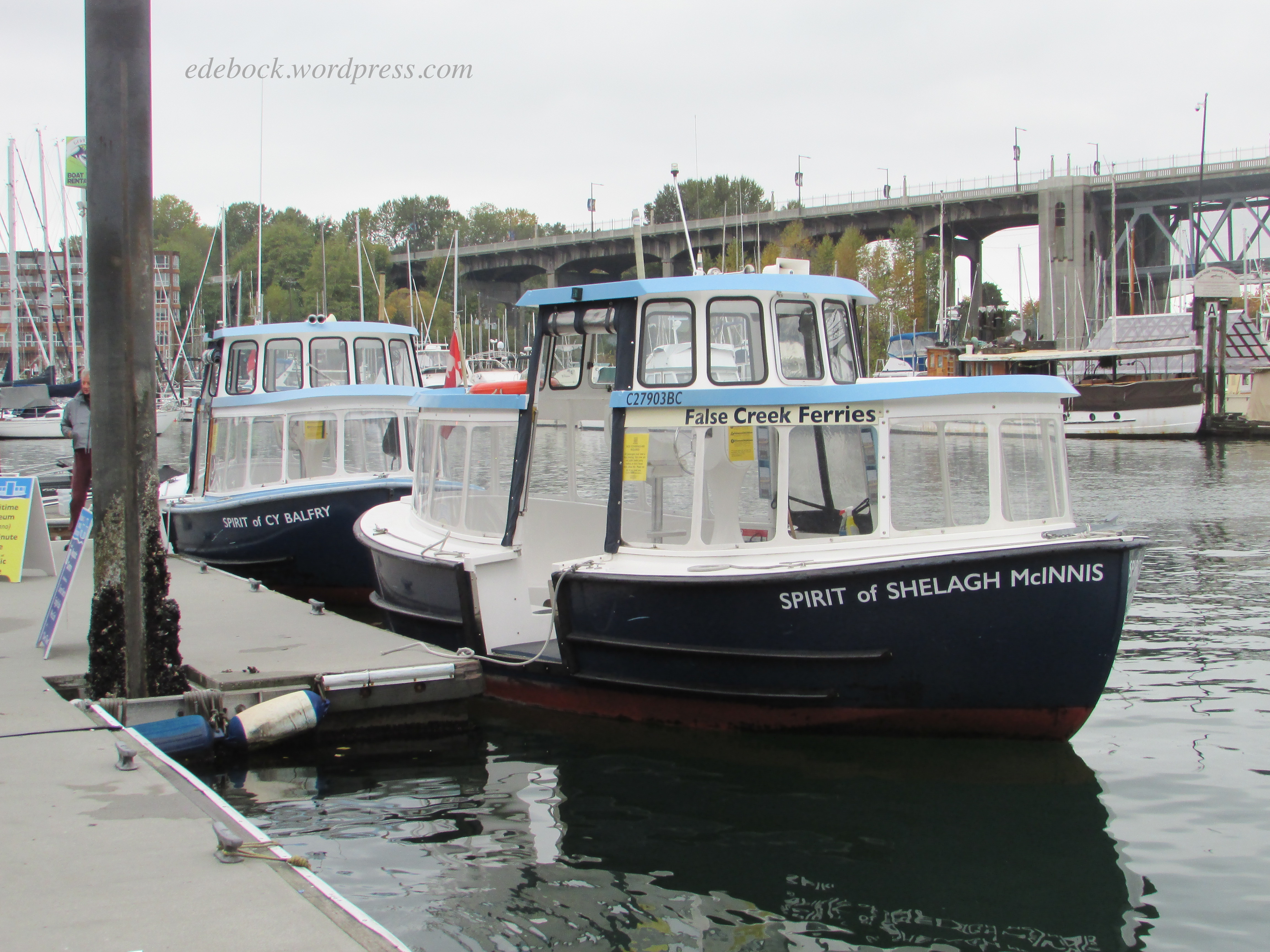
We parked beside the Vancouver Aquatic Centre ($14 for a full day). Ferries between the Aquatic Centre and Granville Island run every five minutes, so we had only a few minutes to wait before beginning our adventure. Climbing aboard the little blue ferry, we purchased day passes which would allow us to hop on and off wherever we wanted all day long ($14 each for children and seniors, $16 for adults).   

Screen Shot 2021-10-24 at 8.49.58 PM

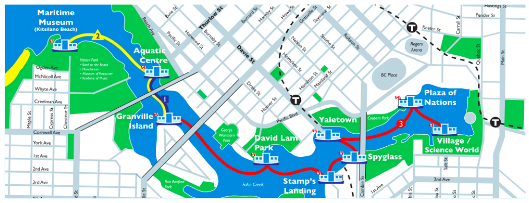
Granville Island which is really a peninsula, is home to a Public Market and many interesting shops. We decided to leave it for later in the day so that if we bought anything, we wouldn’t have to carry our purchases with us for the rest of the day. We had to switch ferries at the Island stop and wait for one of the boats that travels the red route #3 on the map. They run every 15 minutes all day long. 

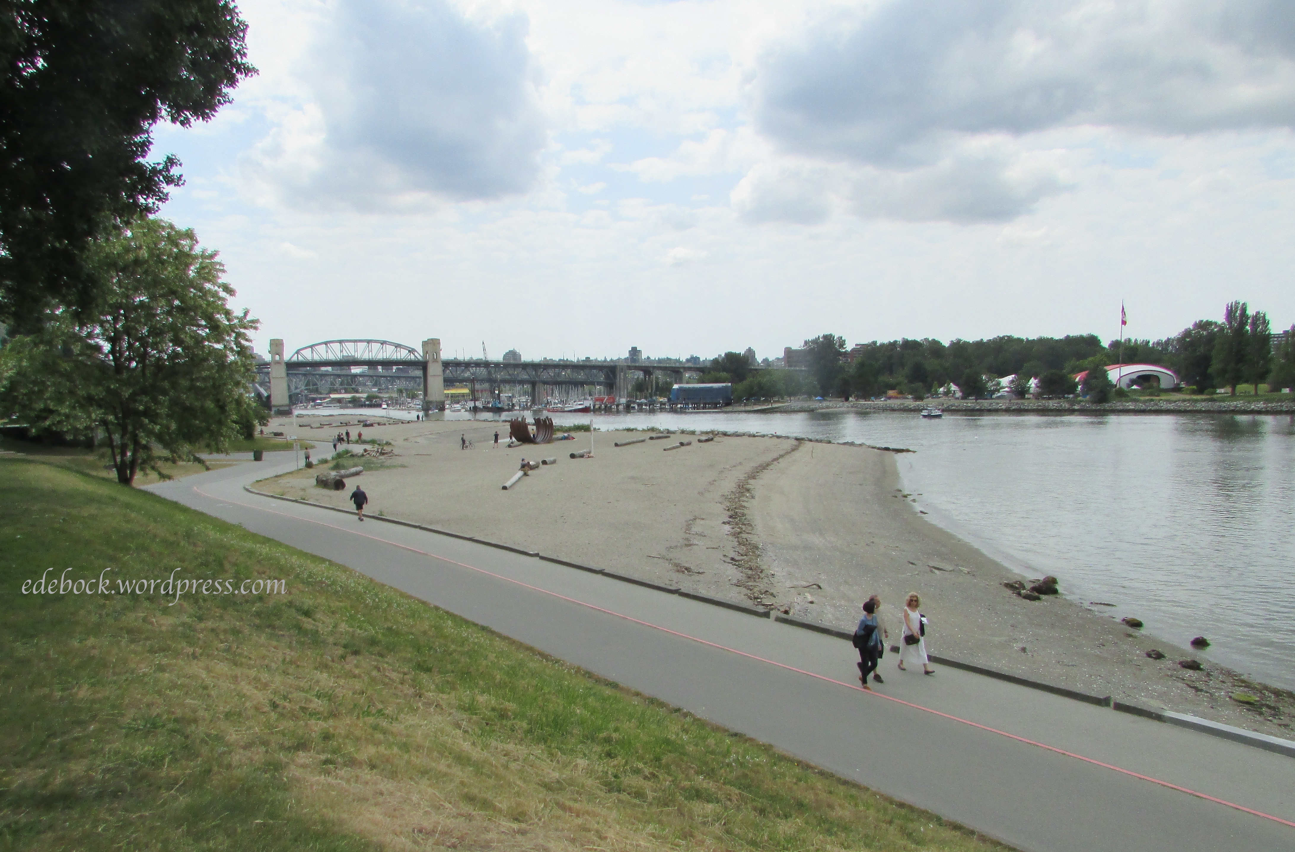
Our first destination was David Lam Park. After disembarking, we first walked along the seawall to nearby George Wainborn Park, then back to David Lam enjoying the sights. 

IMG_3243

IMG_3244

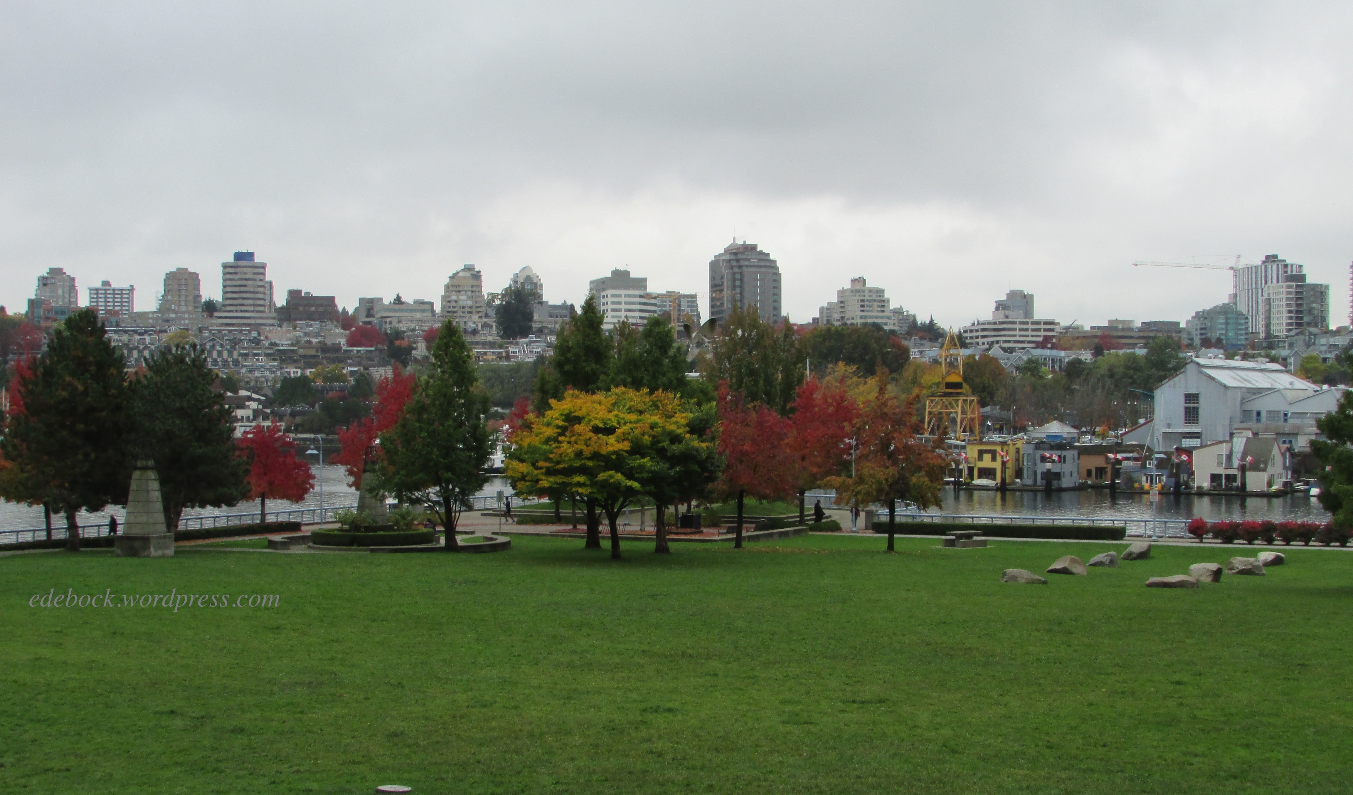
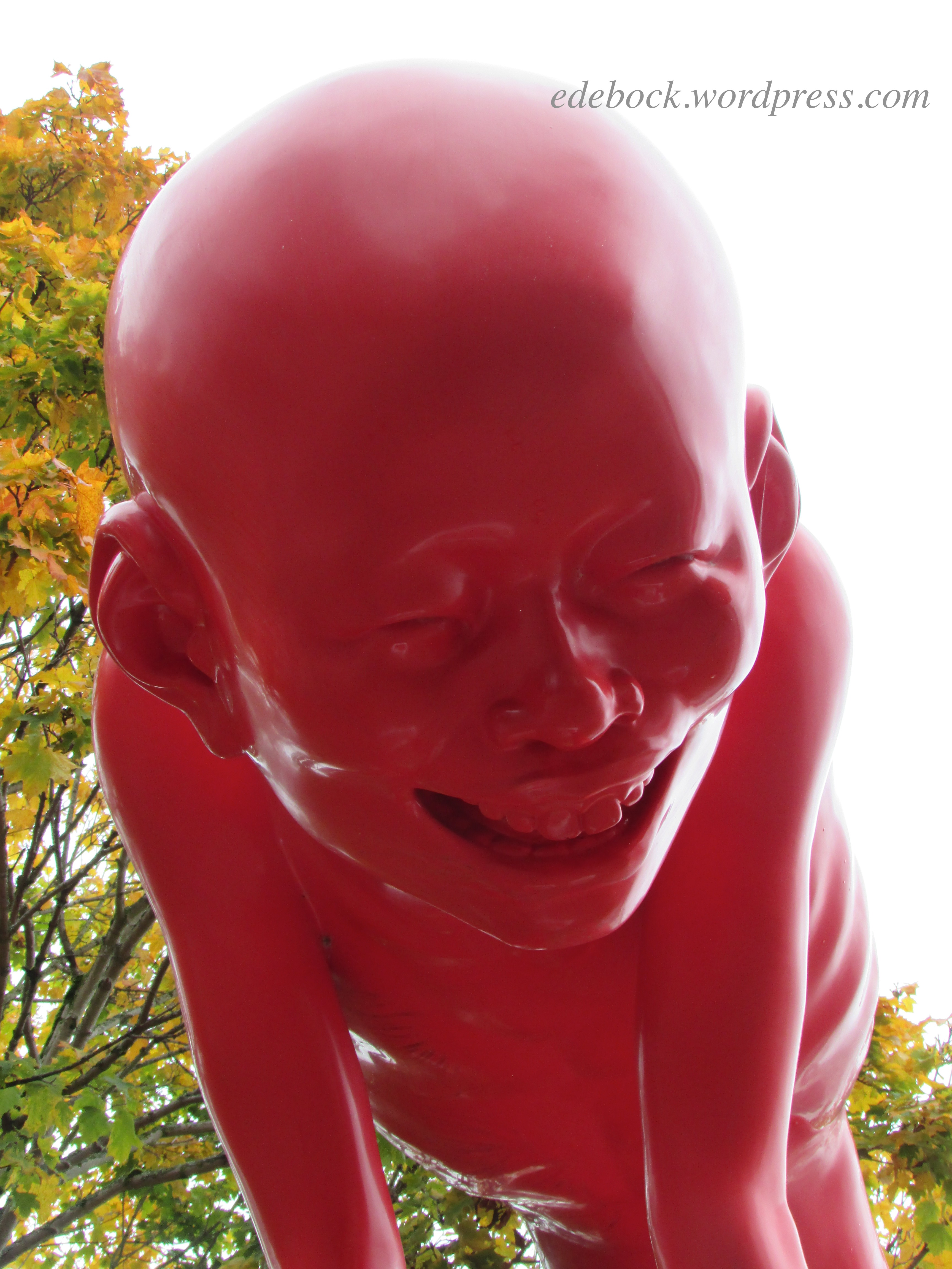
We had planned on getting back on the ferry to ride to the next stop at Yaletown, but soon realized that we had walked most of the way! Continuing on foot, we soon came across a delightful art installation known as The Proud Youth. 

IMG_3246

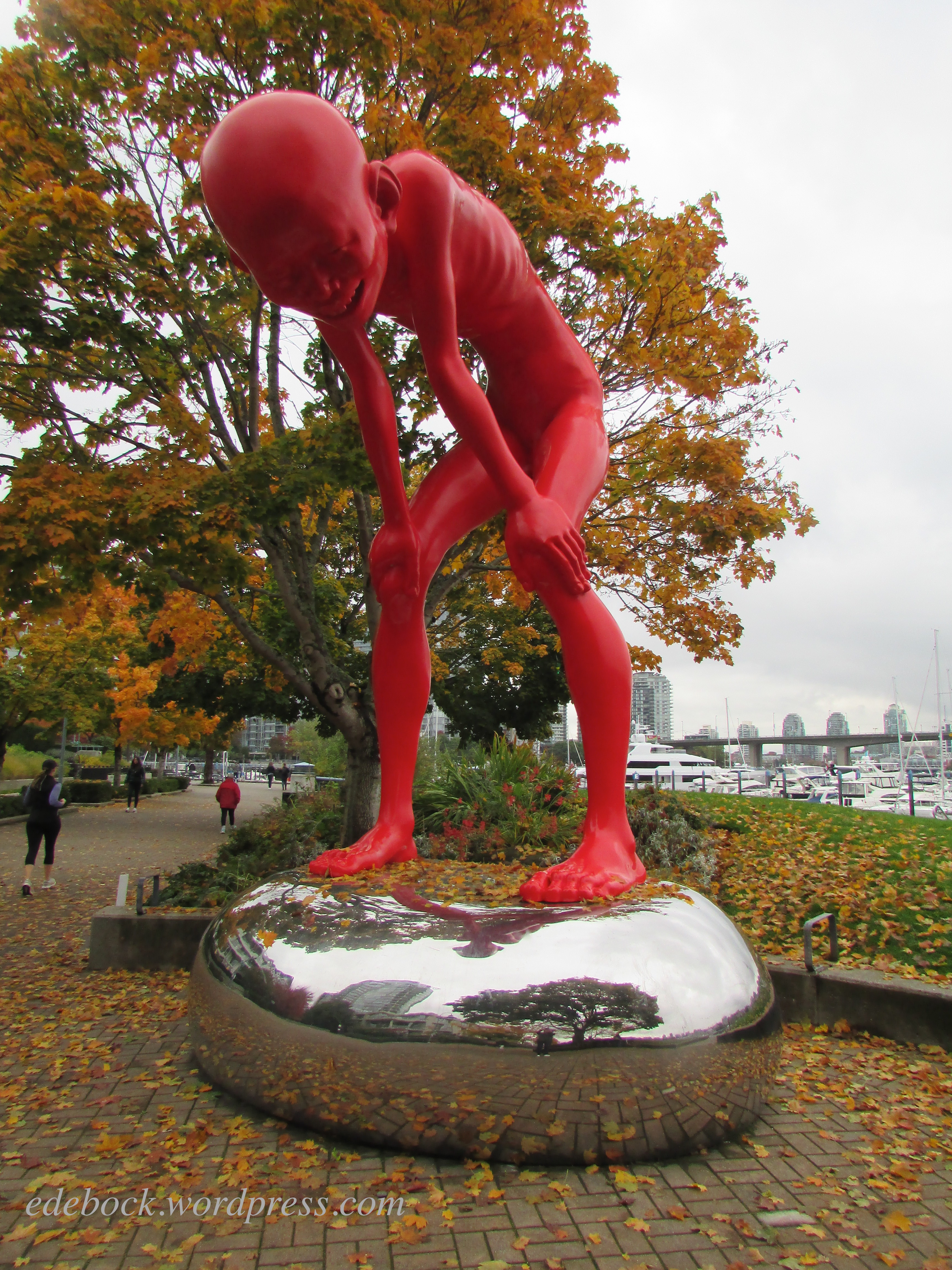
I first read about the gigantic 5.5 metre high (18 feet) boy with the mischievous grin back in March when Vancouver blogger, Frances Sprout of Materfamilias Writes, published this post. The whimsical sculpture by Chinese artist, Chen Wenling, is meant to encourage us to live a carefree life in a world of strife; to embrace our inner child and have some fun! What a perfect message in the midst of a worldwide pandemic!  

IMG_3249

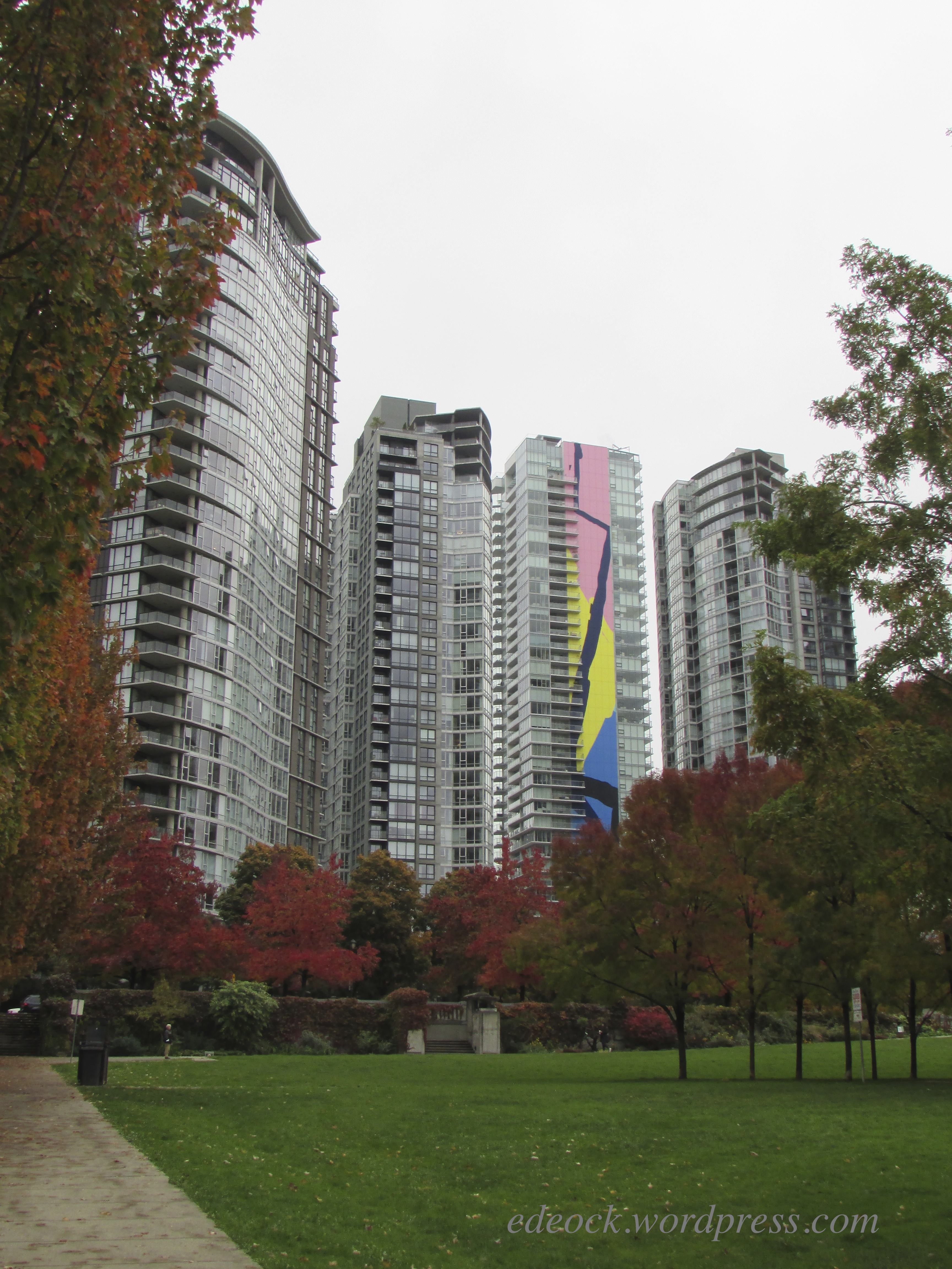
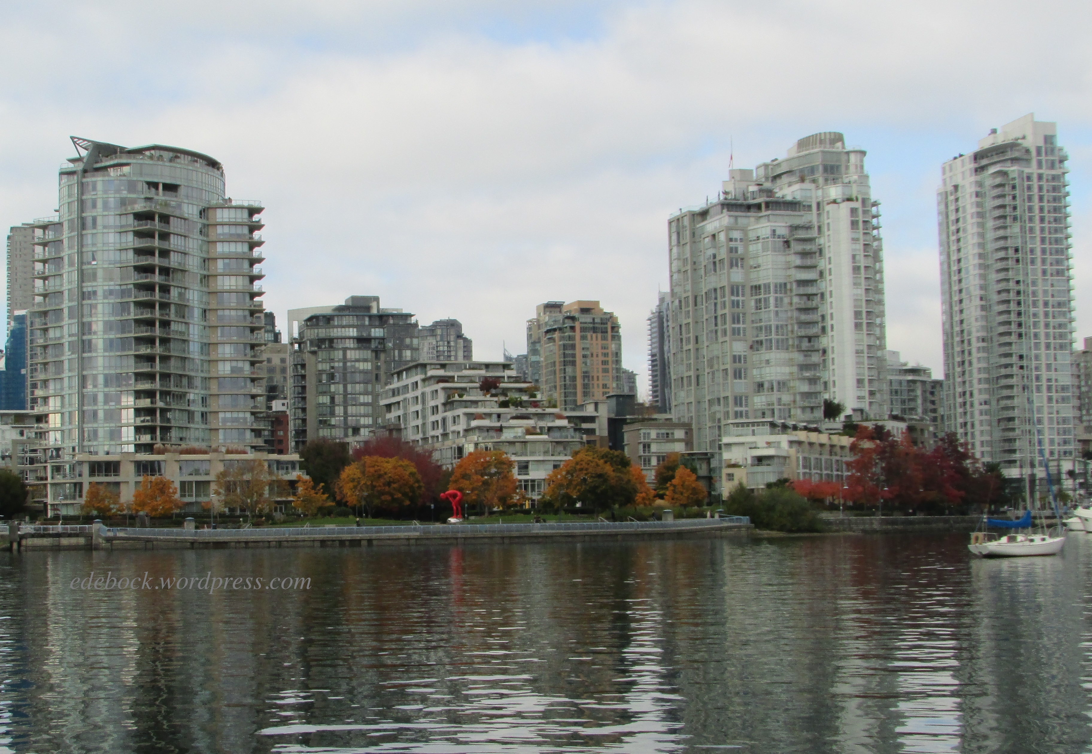
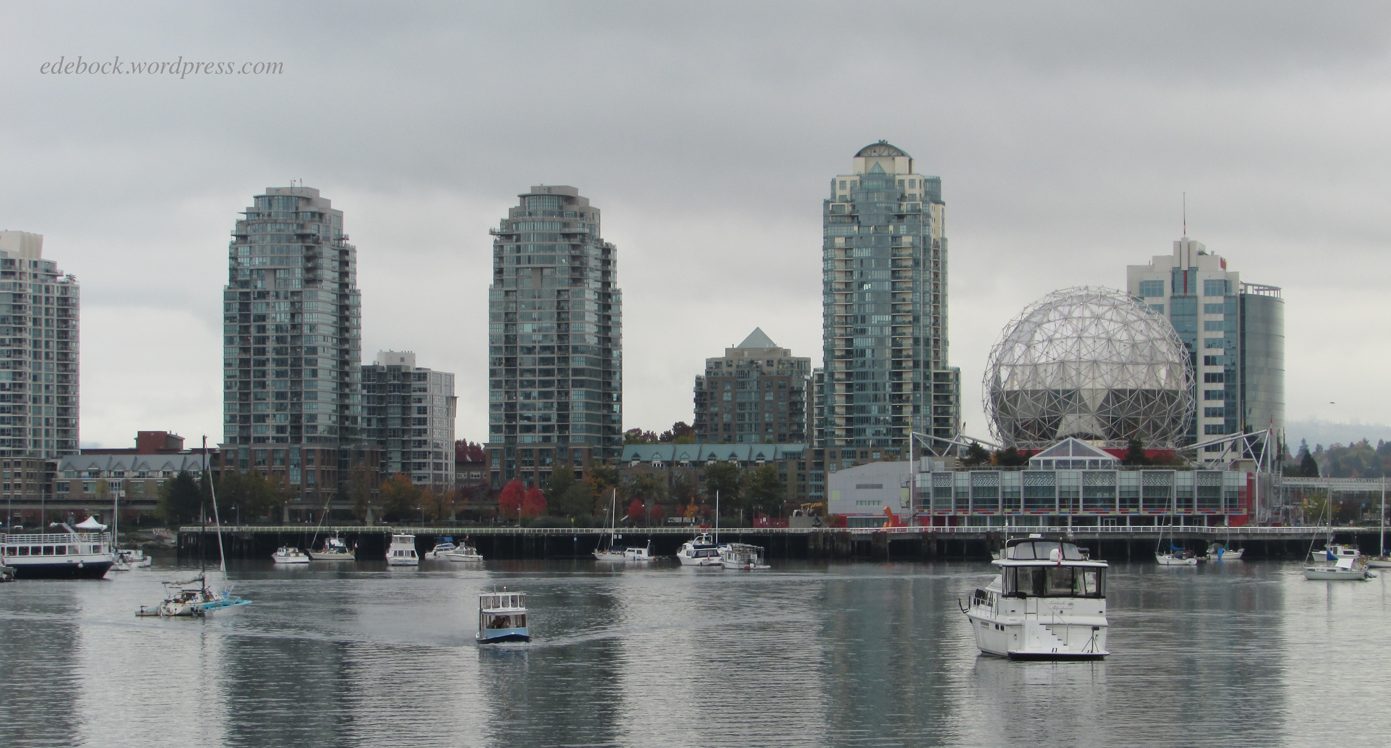
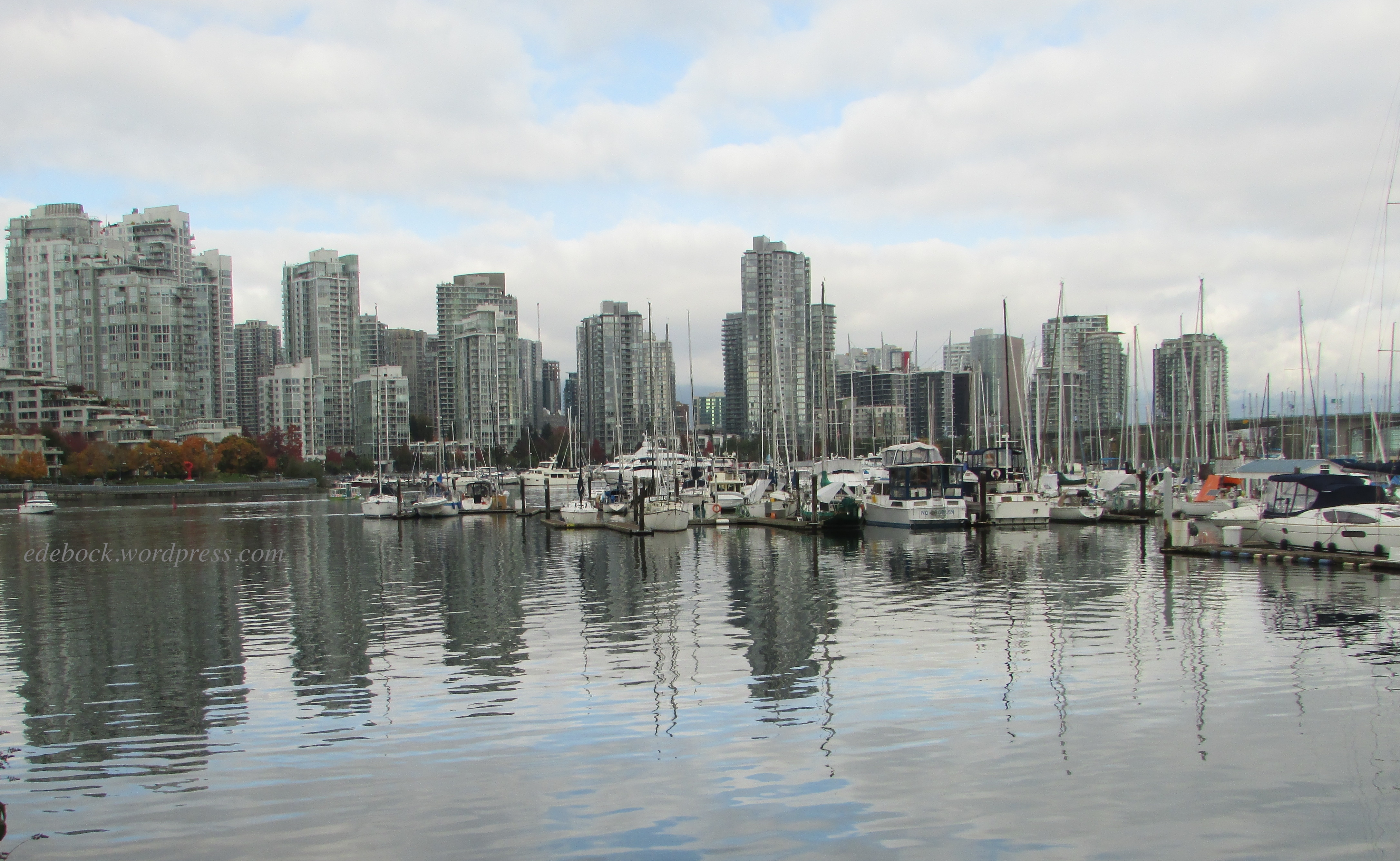
The sculpture is so big that it can be easily seen from the other side of False Creek as seen in this photo taken later in the day. 

IMG_3277

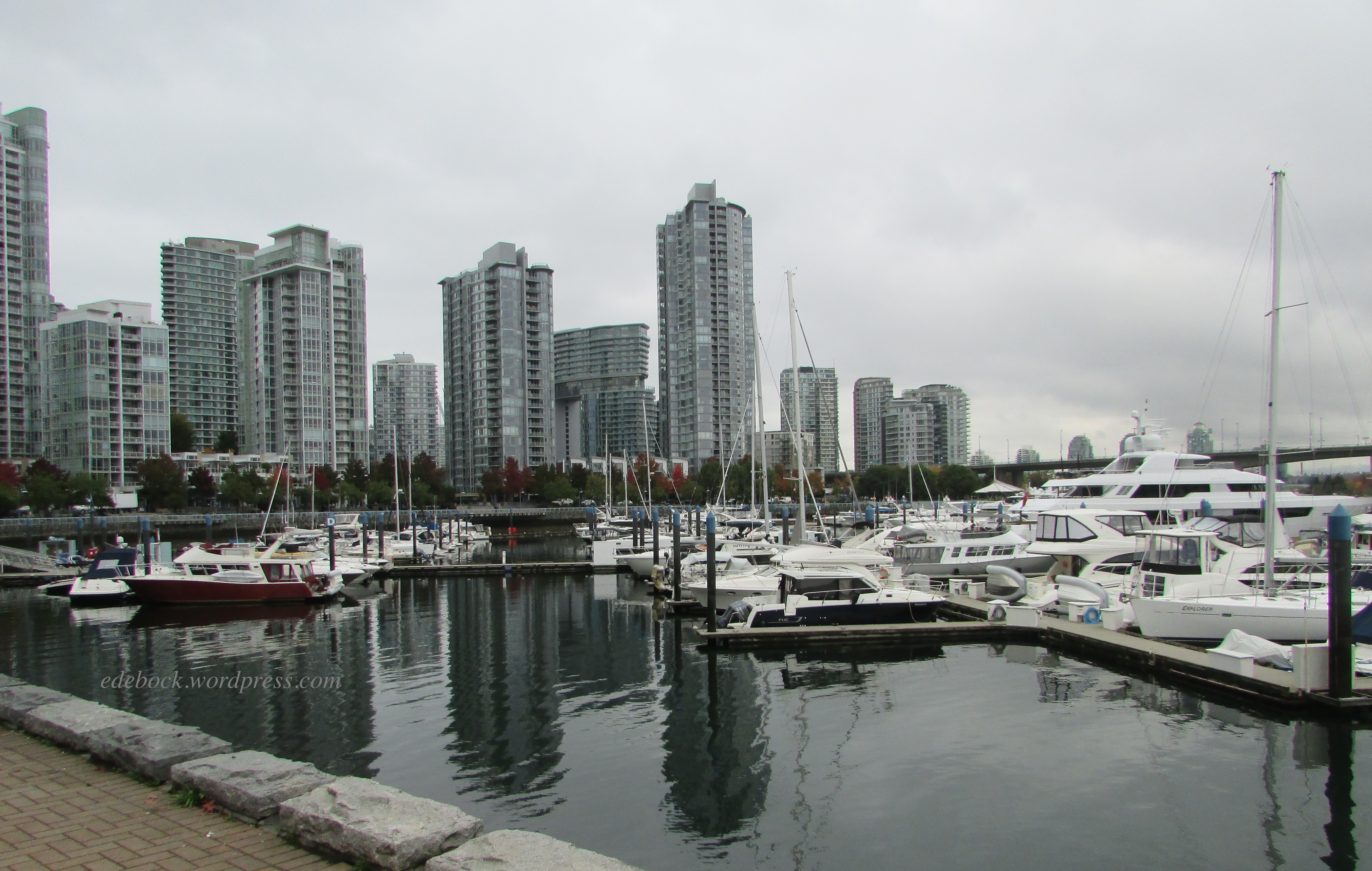
Still walking, we admired the many sailboats and yachts in one of many marinas along False Creek. If you look closely, you can see the top of a gigantic super yacht towering above the others in the right hand side of the photo. That’s the 46 metre long (152 feet) After Eight, owned by the Don Wheaton family. 

IMG_3251

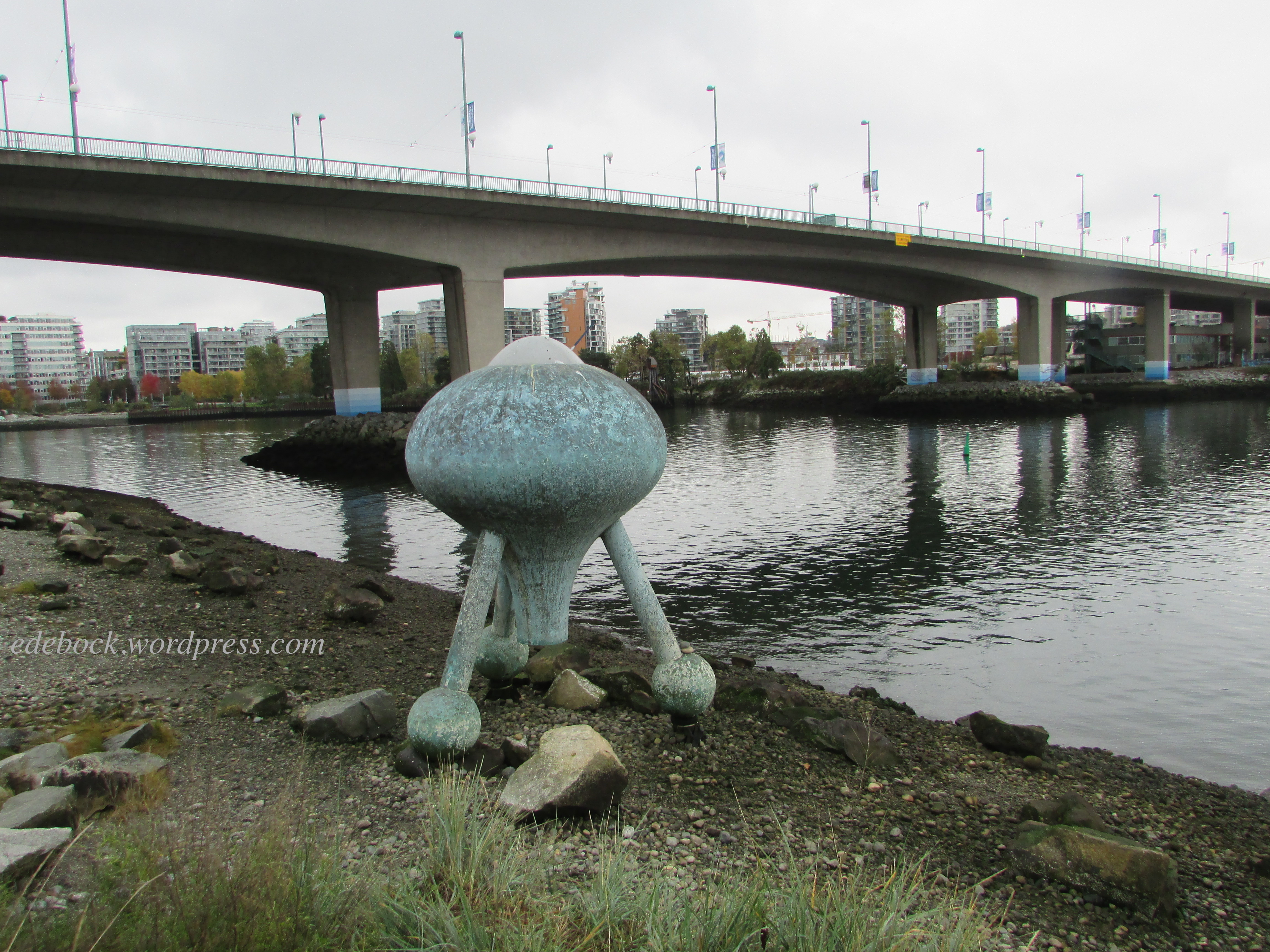
Further along our walk we came across another interesting art installation, the Time Top by Jerry Perkins, looking like it had just arrived from outer space! 

IMG_3254

After strolling around the trendy Yaletown area a bit and enjoying lunch in one of it’s many restaurants, we boarded another one of the little ferries and rode it to the final Village/Science World stop.  

IMG_3255

IMG_3257

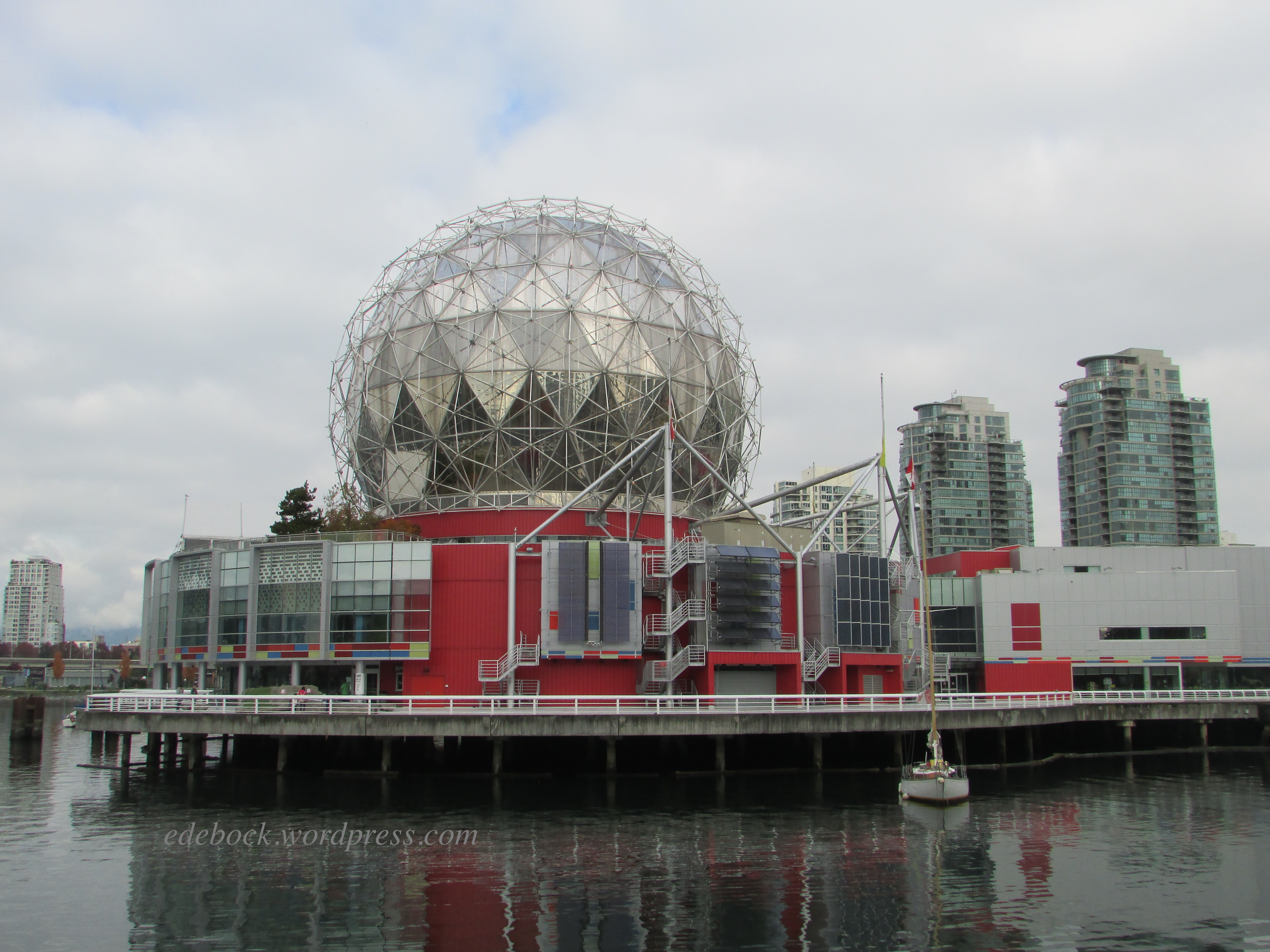
The giant “golf ball” that houses Science World was originally built as the signature building for Expo 86. Today, the sparkling structure is an iconic part of the Vancouver skyline. 

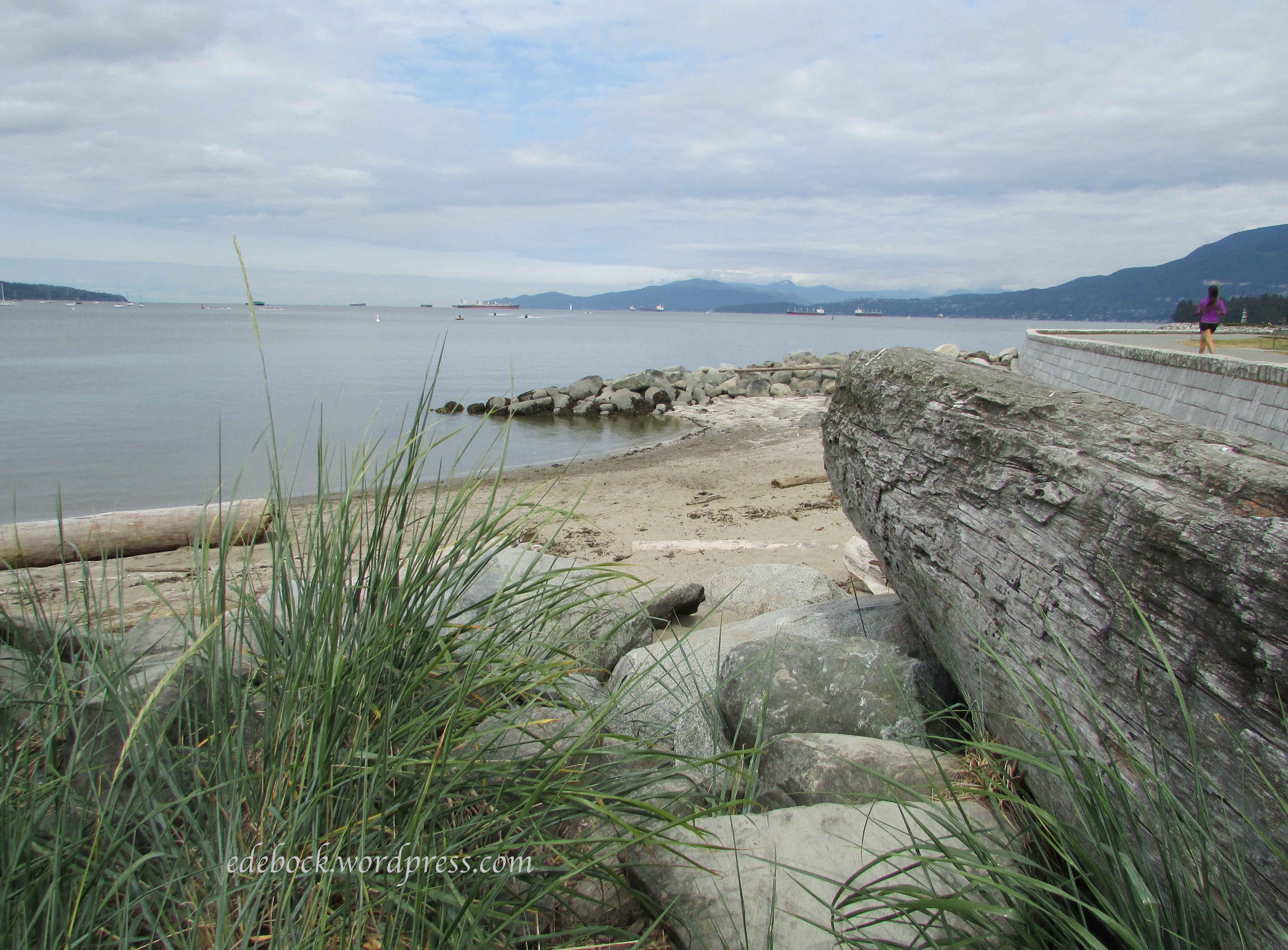
Our next stop was at Stamps Landing where we again went for a walk and enjoyed some of the sights. Though it had been cloudy most of the day, the sun was beginning to come out and I love the way the sky is reflected on the water in this final photo. 

IMG_3276

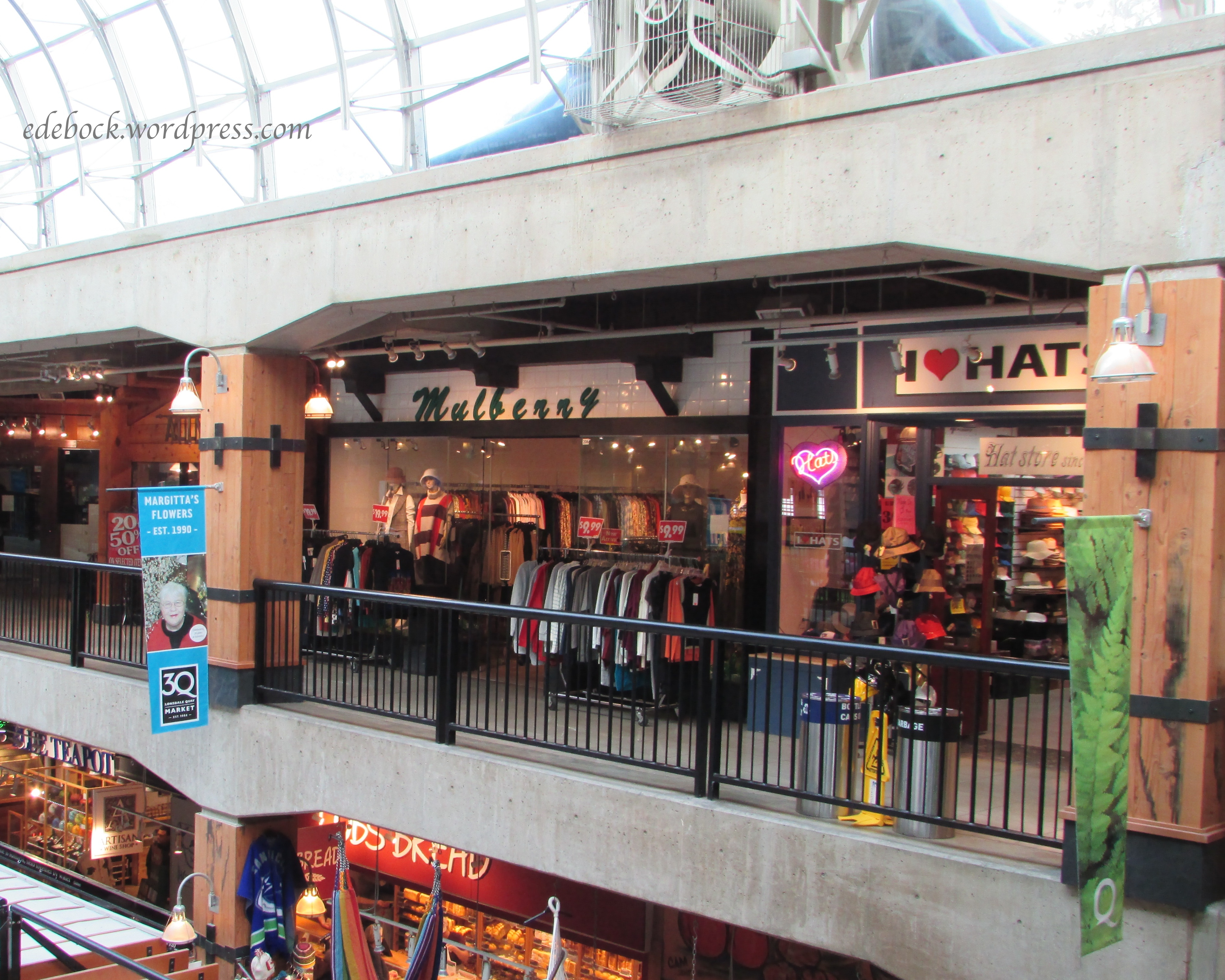
Returning to Granville Island, we wandered through the market and browsed a few shops. By this time it was late afternoon, so we crossed the water one last time back to the Aquatic Centre where we’d left the vehicle several hours earlier. 

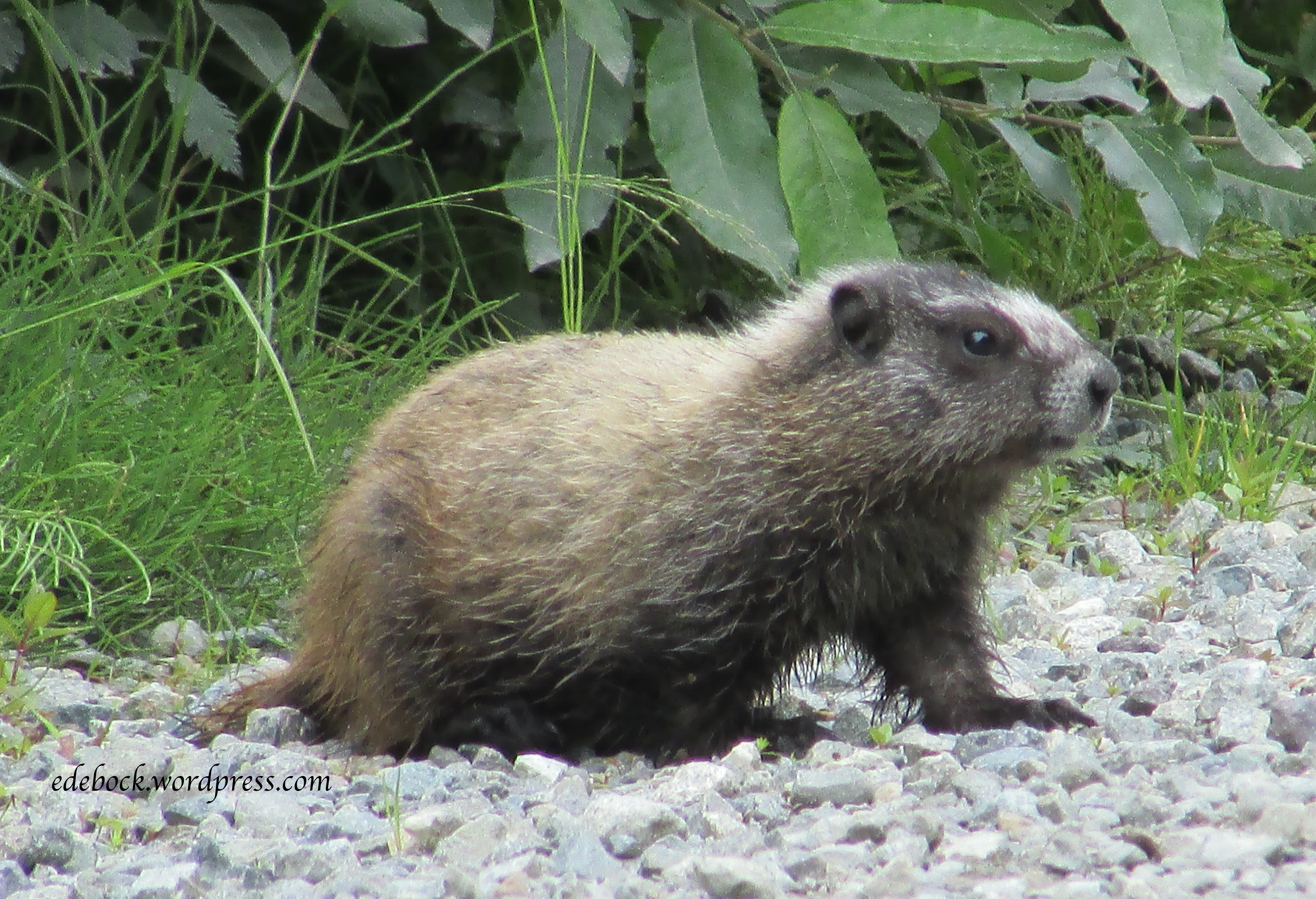
If you’re ever in Vancouver and wondering what to do, I’d highly recommend a day on False Creek. Though I didn’t get photos, we even saw a couple of harbour seals and, at a distance, a giant sea lion! 

Two rainforest hikes

I’ve been living out of a suitcase for the past two and a half weeks which hasn’t inspired a fashion post for today. Instead, I’m going to begin sharing some highlights from our trip.

Two full years had passed since our last real visit with our son and his family and my brother at Vancouver. I’m not counting the four days that we spent at the coast at the beginning of December 2019 helping my father settle into long term care and dealing with the contents of the assisted living suite that had been his home for several years or the return trip three months later when he passed away. Those trips were all about doing what needed to be done and left little time for anything else.

Though Covid still made traveling somewhat of a concern and we were extra cautious due to the clinical vulnerability of some of the family members that we’d be visiting, we felt that we couldn’t wait any longer. Grandchildren change so much in two years! 

One of the things that we had hoped to do while we were at the coast was hike. In spite of several days of heavy rain (6 inches in one 48 hour period!) we managed to enjoy two wonderful hikes in the coastal rainforest; so different from our prairie hikes close to home. 

Cypress Falls, West Vancouver

We celebrated Canadian Thanksgiving on Monday, October 11. While our daughter-in-law was preparing a delicious turkey dinner, hubby and I joined our son and his youngest for a hike to Cypress Falls in West Vancouver. 

IMG_3110

Just a short distance from the highway, Cypress Hills Park is easy to access. Though we were never far from civilization, this was definitely a wilderness park. The first part of the 2.7 km out and back trail was easy, as shown in the photo above, but it became somewhat steeper and more rugged further on.

IMG_3125

Mist from the water thundering over the lower falls hung in the trees above and provided a perfect environment for lush ferns and mosses. 

IMG_3128

IMG_3135

Many varieties of mushrooms grew on the forest floor. I particularly liked these little splashes of colour. 

IMG_3121

Continuing on through stands of old growth Red Cedar and Douglas Fir, we reached the impressive upper falls at the end of the trail.

IMG_3141

Lynn Canyon, North Vancouver

The following Sunday, after days of rain, the weather cleared enough for us to enjoy a second hike, this time with the entire family.  Lynn Canyon Park, which is home to several beautiful trails, is located within walking distance of our son’s house as well as my teenage home. We hiked from the north entrance of the park, across Pipe Bridge and down to the very popular 30-Foot pool. Leaves from the park’s many maple trees formed a wet, but beautiful carpet.

IMG_3215

IMG_3208 2

Never have we seen the creek and the pool so full!

IMG_3206

IMG_3213 2

IMG_3222 2

Toward the end of our hike, we crossed the 40 metre (130 foot) long suspension bridge that hangs 50 metres (160 feet) above the canyon. For much of my life, an extreme fear of heights kept me from crossing the bridge and enjoying the trails on the far side of the creek. Several years ago, however, I conquered that fear and this time I was able to stop and take photos from the middle of the bridge! 

IMG_3227 2

These are just two of the many beautiful places to hike on Vancouver’s beautiful north shore. In my next post I’ll share another one of our adventures, but this time in the heart of the city. 

Hike to Mystery Lake

Much of our time since we arrived in Vancouver a little over a week ago has been taken up dealing with issues pertaining to my elderly father’s declining health, but this weekend we’ve changed gears and we’re on grandparent duty while our son and daughter-in-law enjoy a short getaway without kids. Alhough the temperature was only 5ºC (41ºF) when we got up this morning, the sun was shining and we decided to take the boys on a mountain hike.

It’s been almost two years since our snowshoe adventures on Mount Seymour, but we took the same road that zigzags up the mountainside to the ski resort. Locating the trailhead near the bottom of the ski lift, we set off for Mystery Lake.

IMG_0347

IMG_0346

Though the Vancouver Trails website calls this an easy hike, I tend to agree with those who left comments saying that it’s significantly more challenging than that. It’s fairly short, but steep, ascending approximately 150 metres over slippery tree roots and loose rocks. It was also quite wet and icy this morning which made it a bit more arduous than it might be during the summer months when, on hot days, people hike up to the lake to picnic and swim.

Although the hike was a bit more challenging than we expected, it was well worth it for the beauty that greeted us when Mystery Lake came into view.

IMG_0349

IMG_0355

We sat on a rocky bluff along the shoreline and ate our picnic lunch. Though the lake wasn’t frozen yet, we had no desire to plunge in for a swim! In fact, the boys had lots of fun playing with the ice on the puddles.

IMG_0357

Rather than returning by the same trail we climbed up, we headed toward the Mystery Chairlift and went down the rocky path directly below it. Though not as scenic, it was an easy descent.

I didn’t think about the fact that we might fit in a hike while we’re here, so I didn’t bring my hiking shoes. I was impressed, however, to find that my golden sneakers managed the trail without any problem! They provided plenty of grip even on the most difficult parts.

Mountain Ropes Adventure

Whenever we come to Vancouver, much of our time is spent with my father who celebrated his 96th birthday last week.

IMG_9456

At the same time, we try to squeeze in as much time as we can with our son and his family. None of our grandchildren live close to us, but these two are the farthest away. In spite of that, we’ve managed to enjoy many wonderful adventures with them over the years and yesterday was definitely no exception! Here we are geared up and ready to challenge the Mountain Ropes Adventure on Vancouver’s Grouse Mountain, our Christmas present from Matt, Robin, and the boys.

IMG_9474

Mountain Ropes Adventure is a series of four aerial ropes courses with varying degrees of difficulty. The Intro level is designed for anyone 8 and over who doesn’t meet the minimum height required to do the higher levels. Sam and Nate zipped around that course numerous times while we completed the Beginner and Intermediate levels. Afterward, since it wasn’t busy, the staff allowed us to join them for a round of the Intro level. It was more challenging than we expected! Those boys are agile little monkeys!

Can you spot me walking on air?

walking on air

This is part of the Intro course and I’m actually walking inside a giant net slung between two trees.

in the net

The complete adventure is made up of 56 elements distributed between four courses which include the Expert level that we decided not to do. We’re in pretty good shape, but we are grandparents, after all! The highest element is part of that course and is 10 metres above the ground. The longest is a 38 metre zipline in the Beginner level, one of several ziplines.

zipline

The Intermediate level started with a small climbing wall, something I’d never attempted before. The lady immediately before me, who was at least 20 years my junior, couldn’t do it. She gave it a valiant effort, but she was unable to scale it. While I felt bad for her, I was determined to make it to the top and carry on.

Climbing wall

It was an element a little further along that course that almost did me in. It involved grabbing a thick rope and swinging Tarzan style from one wooden platform to another. From the ground, it doesn’t look very far, but I froze and wasn’t sure I could do it. With encouragement from Richard coming behind me and a number of people on the ground below, I went from “I can’t do this!” to “I’m going to do this!” and I did!

Other elements included everything from walking across cables and ropes to navigating all sorts of swinging wooden bridge contraptions. For someone who was terrified of heights for most of my life, I was pretty pleased with my ability to do all but the toughest level. In fact, the height didn’t bother me at all. We were secured to safety lines at all times and knew that if we lost our balance and fell, we might need rescuing, but we wouldn’t crash through the branches to the ground below. Richard and I may not have been as quick and agile as some of the younger participants, but we did it and we had fun!

Richard ropes course

ropes course 2

treetops

Mountain Ropes Adventure photos: Robin Thorneycroft

Anniversary on Lonsdale

IMG_6265

In recent years, we’ve been coming to Vancouver at least twice a year. Dividing our time between my very elderly father, my mentally handicapped brother, and our oldest son, his wife, and their two growing boys always seems to be a balancing act. We planned our current trip specifically because my father was having minor surgery last Thursday. Thankfully, that went extremely well and as we did when we were last here in June, I decided that we ought to take a bit of time to enjoy the city. Of course, the fact that today is our 42nd wedding anniversary was also a good reason to do something a bit out of the ordinary!

Though we spent the first few days of this visit staying in one of the guest suites at the assisted living facility in Burnaby where my father lives, we relocated to our son’s home in North Vancouver on the weekend. After walking the boys to school this morning and then having a late breakfast, we headed off to spend a few hours exploring Lower Lonsdale.

With stunning mountain views in one direction and Burrard Inlet in the other, bustling Lonsdale Avenue is main street North Vancouver and Lower Lonsdale is its oldest neighbourhood. There past and present come together in a unique area bursting with shops, restaurants, cafés and pubs. At its heart is Lonsdale Quay.

IMG_6255 - Version 2

Lonsdale Quay Market has an abundance of unique shops and services selling everything from fresh seafood to authentic west coast art to kitchen ware and handmade chocolate. It’s also the northern terminus of the SeaBus, the passenger-only ferry that crosses the inlet and connects the North Shore to downtown Vancouver.

IMG_6248.JPG

After wandering the shops inside the market and enjoying a delicious lunch of fresh fish and chips overlooking the harbour, we made our way outside.

IMG_6253

Public art reflecting the heritage, culture, and environment of the area is found all over the city of North Vancouver. The 100 foot mural “Coastal Energy” on the side of Lonsdale Quay was designed by North Vancouver students in collaboration with local artist, Dennis Creighton.

IMG_6259

After leaving the Quay, we walked a few blocks up one side of Lonsdale Avenue and back down the other checking out a few of the shops and enjoying the character of the place.

IMG_6262

IMG_6264

IMG_6267 - Version 2

IMG_6270

Then, anniversary or not, it was time to return to our real reason for being in Vancouver; time to pick up Dad and take him for a follow up appointment with his doctor. Thankfully, he is doing well!

Taking time to play tourist

In recent years, whenever we’ve come to Vancouver, it’s been a balancing act trying to spend time with my aging father, my mentally handicapped brother, and our quickly growing grandsons (as well as their parents, of course!) We’ve spent very little time enjoying this beautiful city that was my home many decades ago during my teen years. This time I decided to carve out a little bit of time to play tourist.

IMG_5813

Deep Cove

Deep Cove, the easternmost part of the District of North Vancouver, is one of the most scenic spots on the lower mainland. Once a sleepy little village at the end of the road, it has become a major tourist destination. While there are many things to do and see in Deep Cove, the hike to Quarry Rock, which we did with our daughter-in-law and grandsons a little over a year ago, attracts so many people that the District has recently had to introduce more stringent parking regulations and put a cap on the number of hikers allowed on the trail at any one time. Not knowing this, we headed out to Deep Cove late yesterday morning and were lucky to find what might have been the only available parking space in the area! We wandered the two block stretch of Gallant Avenue that forms the community’s commercial core checking out some of the galleries and boutiques before stopping at a tiny bistro for a fish and chips lunch.

—————————————————————————————————————————————-

This morning, we crossed the Lions Gate Bridge and drove through Stanley Park on our way to English Bay Beach, Vancouver’s most densely populated beach area.

IMG_5828

IMG_5851

IMG_5831

Not far from the hustle and bustle of downtown Vancouver, we walked the long stretch of sandy beach and I breathed deeply of the salty sea air. Continuing on under the Burrard Street Bridge to the foot of Hornby Street, we caught the colourful Aquabus and crossed the narrow inlet to Granville Island.

IMG_5836.JPG

IMG_5837

While a person could easily spend all day on Granville Island, one of Vancouver’s most popular tourist attractions, we only had time for a quick wander through the Public Market and a few of the shops and galleries. After enjoying an outdoor lunch overlooking the water, it was time to cross the inlet again and retrace our steps so that we could spend the afternoon visiting with Dad and get back to North Vancouver in time to watch the boys’ Little League baseball game.

Just before we got back to the car, I had to stop and take several pictures of this Pacific Great Blue Heron near the water’s edge.

Driving the Icefield Parkway

Though the Icefield Parkway, the highway between Jasper and Banff in the Canadian Rockies, is only 288 km (179 miles) long, it can easily take all day or longer to travel because there are so many amazing places to see along the way. Come along with us and I’ll show you a few of the places that we stopped on our most recent trip.

Athabasca Falls

Approximately 30 km (19 miles) south of the town of Jasper, Athabasca Falls is neither the highest or the widest waterfall in the Canadian Rockies but it is thought to be the most powerful. The falls can be safely viewed and photographed from various viewpoints on both sides of the river. The parking lot is on the north side, but be sure to cross the pedestrian bridge and view the falls from the south side as well. The morning that we were there, the sun was in just the right position to create a vibrant rainbow in the gorge below the crest of the falls when viewed from that side.

IMG_4906

IMG_4918

IMG_4912

IMG_4919

Sunwapta Falls

Another 25 km (15.5 miles) down the Icefield Parkway is beautiful Sunwapta Falls. Sunwapta means “turbulent water” in the language of the Stoney First Nations people.

IMG_4922

IMG_4923

IMG_4925

Columbia Icefield

Another 49 km (30 miles) southward brings you to the Columbia Icefield Discovery Centre at the foot of the Athabasca Glacier. Entering the Discovery Centre was like visiting West Edmonton Mall at Christmas time or a Tokyo subway station at rush hour as tourists from around the world crowded in to purchase tickets to the various tours and adventures in the area! If you visit, however, descend the staircase to the lower level where things are a lot quieter. There you will find a fascinating display of historical photos and a diorama that provides an excellent overview of the entire ice field.

Straddling the Continental Divide along the Alberta/British Columbia border as well as Jasper and Banff National Parks, the Columbia Icefield is the largest ice field in the Rocky Mountains and one of the largest non-polar ice fields in the world. Meltwater drains to three oceans – the Atlantic, the Pacific, and the Arctic via three great river systems – the Saskatchewan, the Columbia, and the Athabasca.

The most accessible part of the Columbia Icefield is the Athabasca Glacier. Even though it has receded significantly in recent times, this six kilometre tongue of ice flows to within one kilometre of the Icefield Parkway. During the summer months, adventurous visitors can hike out onto the glacier with a guide or explore it from the comfort of massive all-terrain vehicles. We chose simply to walk up the trail that leads to within metres of the glacier’s edge.

IMG_4931

IMG_4939

The Athabasca Glacier is only one of many tongues of ice that flow from the massive Columbia Icefield. Right next to it is the Dome Glacier, less accessible, but also impressive. Look at that amazing snow pack atop the ridge! It reminds me of icing on a cake.

IMG_4932

Lower Waterfowl Lake

There are numerous glacier-fed lakes along the Icefield Parkway; too many to stop and photograph each one! Lower Waterfowl Lake struck me as one of the most beautiful.

IMG_4944

IMG_4947

Yes, that truly is the colour of the water! The incredible turquoise colour is the result of glaciers grinding the rock beneath them into a fine powder called rock flour. Meltwater washes this powder into the lakes where it is suspended in the water. These silty waters absorb all the colours of incoming light except the striking turquoise or vivid blue that is reflected back to our eyes.

Lake Louise

If you stopped nowhere else along the Icefield Parkway, world famous Lake Louise is an absolute must! Named for Queen Victoria’s fourth daughter, it is a truly awe-inspiring sight. With Victoria Glacier and an amphitheatre of rugged mountain peaks providing an imposing backdrop, it is a photographer’s delight.

IMG_4953

IMG_4957

IMG_4971


The Hazeltons

After six weeks in the trailer, we are home! Though it was our plan from the beginning to arrive home today, I really wasn’t ready to end our gypsy wandering and I would have happily extended our travels indefinitely. Real life issues beckoned, however, and so it seemed wise to follow through on our original plan. As much as I loved being away from home, I did miss having access to wifi and being able to update the blog on a regular basis. Now that I’m connected again, I’ll do my best to share the remainder of our travels with you over the next few days.

The Hazeltons, a collection of small communities, located around the confluence of the Skeena and Bulkley Rivers in northwestern British Columbia, have been home to the Gitxsan people for centuries. The Gitxsan are a matrilineal society made up of the Frog, Eagle, Wolf, and Fireweed clans. Though their territory is inland, their villages with intriguing names like Kispiox, Gitanmaax, and Hagwillget as well as Hazelton, New Hazelton, and South Hazelton, are a centre of Northwest Coast native culture and, as such, are a place that I’ve long dreamed of visiting. My love for the art and the culture of the native peoples of the Pacific Northwest began as a child growing up on the coast of British Columbia and grew as a student of anthropology during my university years.

After settling into our campsite, we drove a few miles north to Kispiox, best known for the 15 totem poles, some dating back to 1880, that stand in the village alongside the Kispiox River. On the way into the village, we stopped to look at the art work decorating the band office.

IMG_4723

IMG_4732

IMG_4729

IMG_4733

IMG_4730

The following morning, we took a fascinating interpretive tour of the ‘Ksan Historical Village adjacent to our campground. It consists of seven replica cedar longhouses. One of the longhouses contains a small museum and a gift shop that are open to visitors who are also free to enjoy the grounds and photograph the buildings and totem poles. Only the guided tour, available in several languages, allows entrance into the three of the longhouses that contain an abundance of artifacts. The price is nominal and was well worth it! Aside from the Museum of Anthropology at the University of British Columbia in Vancouver, I have not seen such an extensive collection of Northwest Coast history anywhere! Unfortunately, photography was not allowed inside the longhouses, so I’m not able to share that part of the experience with you.

IMG_4774

IMG_4759

IMG_4763

IMG_4762

The small, narrow door in the last photo was designed to prevent enemies from entering in full armour.

As always, the totem poles fascinated me. Here’s a closer look at a few of them.

IMG_4767

IMG_4776

IMG_4761

IMG_4760

We were especially fortunate to be in the area on a Wednesday. Every Wednesday evening during the summer months, a local group offers a traditional song and dance presentation in the Wolf House, one of the historical village’s longhouses. Again, for a nominal fee, I was thrilled to have the unique opportunity to see and experience this aspect of the Northwest Coast culture. I was especially delighted to see that the group included all ages; that the traditional songs and dances are being passed on to the younger generations.

IMG_4799

As we explored the various villages that make up the Hazeltons, we were especially impressed with how welcoming the First Nations residents were. While we were strolling around the historical section of Old Hazelton a local woman stopped to chat and told us about an easy 10 minute hike from New Hazelton to a beautiful waterfall. Had she not been willing to share with us, we would never have known about it!

IMG_4792

The day the tires went flat

On our way to the Yukon, we made a quick stop at the information centre at Dawson Creek, BC to take the obligatory tourist photo.

IMG_4350

I was about to step back into the vehicle when I heard a distinct PFFFT! Something was definitely wrong! A tire on the trailer had blown. This was no simple puncture. The tire was shredded! Thankfully we were sitting still when it happened and we were in a community large enough to have three tire shops! Within an hour, we’d found a replacement and we were on our way again. That wasn’t the case a couple of weeks later!

Shortly after leaving the remote community of Stewart, BC, while slowly following a pilot vehicle through a long construction zone, we began to hear a rhythmic FWUP, FWUP, FWUP! Pulling over as soon as we were able to, we discovered that another trailer tire had blown! Thankful that we weren’t travelling at highway speed when it happened and that we’d replaced the spare in Dawson Creek, Richard changed the tire and we moved on again, this time without a spare. There was nowhere within a couple of hundred kilometres to get another tire!

At the same time, we knew that we were also travelling with a slow leak in one of the vehicle tires. Richard had added air in Stewart that morning and we carry a mini air compressor for emergency purposes, so we were hoping that it would get us to a larger centre where we could get it fixed. No such luck! Less than an hour after losing the trailer tire, the dashboard sensor told us that the right rear tire was rapidly losing air. Stopping to check, we immediately heard that familiar PFFFT sound again! My poor hubby had another tire to change!

IMG_4722

Now we were 116 km from the nearest community with no spare tire for the trailer AND no spare for the vehicle! Yikes! On we went with a prayer that nothing else would go wrong. Pulling into Hazelton, BC our first stop after the visitor information centre was the only tire shop in the area. At the very least, we’d be able to get the vehicle tire fixed there. Amazingly, not only were they able to serve us immediately, but they also had a trailer tire that was almost a perfect match for the one we’d bought back in Dawson Creek!

Now we’re just hoping that we get home without any more tire woes! Though we’ve already put on the majority of the miles that we plan to travel, we’re less than three weeks into our six week odyssey.

Stewart, Hyder and a river of ice!

As we travelled south on northwestern BC’s Cassiar Highway, a 65 km (40 mile) side trip took us into the tiny town of Stewart located at the head of the Portland Canal, a narrow salt water fjord approximately 145 km (90 miles) long. The fjord, the fourth longest in the world, forms a natural boundary between Canada and Alaska. Stewart boasts that its deep harbour is Canada’s northernmost ice-free port.

IMG_4702

I had to visit this picturesque spot if for no other reason than I was born a Stewart!

IMG_4621 - Version 2

Most tourists come for other reasons though including the Salmon Glacier, the fifth largest glacier in Canada. A self-guided auto tour brochure, available at the Stewart visitor information centre, explains the history and natural surroundings of the area as you drive the 37 km (22.9 miles) to the Summit Viewpoint overlooking the glacier.

Although the Salmon Glacier is located in Canada, accessing it requires crossing the border into Alaska at Hyder, just 3 km (2 miles) from Stewart. If you go, make sure you have your passport with you so you can re-enter Canada after your drive!

IMG_4705

Once a booming mining town, Hyder, with its population of “100 happy Americans” is almost a ghost town. Though there are still a post office, 2 motels and couple of stores, most of its main street is boarded up. This building, a gorgeous reminder of days gone by, was definitely my favourite.

IMG_4699

About 6 km (3.7 miles) after leaving Hyder, we stopped at the Fish Creek Wildlife Viewing Area hoping we might be lucky enough to see some of the bears that come to feed at the creek during the annual salmon run from July to September. Though salmon had been spotted further downstream, they hadn’t made it that far yet and there were no bears to be seen. Further up the road, however, we did see several of these little creatures.

IMG_4630

We weren’t sure what they were until we checked with a wildlife officer at the viewing site on our way back down and learned that they are hoary marmots. They seemed completely oblivious to or unconcerned about human traffic. In fact, at one point, three of them engaged in a playful wrestling match in the middle of the road while we and other motorists waited for them to tire and move on! I was able to walk right up to one of them to take pictures!

The drive to the glacier, some 4300 feet (1300 metres) above sea level, was almost like climbing a mountain by car! The narrow, bumpy road, unpaved after the Wildlife Viewing Area, clung to the mountainside as we climbed higher and higher. Soon we were passing expanses of snow!

IMG_4654

A little further along, the toe or snout of the glacier came into view.

IMG_4643

Continuing onward and upward, we enjoyed many views of the enormous river of ice.

IMG_4648

I was still awe struck when we reached the Summit Viewpoint and realized that there was so much more to the glacier than we had been able to see before that.

IMG_4661

It was chilly, but we ate our lunch overlooking the vast expanse of ice.

IMG_4663

Turning around and noticing the bluff overlooking the parking lot, I realized that it begged to be climbed, so off we went!

IMG_4688

I’m so glad we did. It was an easy scramble and the sights that greeted us were amazing!

IMG_4669

IMG_4674

I think the views of the glacier were even better from the top of the bluff. Looking down on the parking lot and our vehicle on the far left (with our bright red kayak on top) helped put the vastness of the glacier into perspective.

IMG_4682