Don’t get eaten by a bear!

We have never seen as many bears in the wild as on this trip… 18 so far! We’ve even hesitated to go hiking in some areas due to the risk of meeting a bear on the trail. In spite of the sign, we did do the 9th Avenue Trail at Dawson City though.

IMG_4476

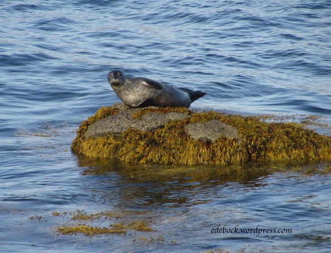
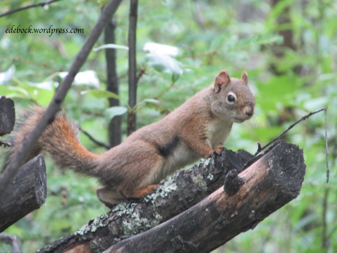
The only wildlife we saw was this curious fellow who stopped munching long enough to watch us go by.

IMG_4464

Well, that’s not entirely true. There were also mosquitoes! Lot’s of mosquitoes! We made two errors that a hiker should never make. First, I forgot my water bottle. I filled it and left it sitting on the counter in the trailer. Fortunately, I’d packed some pop for our lunch, so we were able to stay hydrated. Second, we forgot bug spray, a big mistake, especially in the north! The mosquitoes hadn’t been bad in town, so we didn’t didn’t even think about them until we were out in the bush getting bitten. Luckily, it was a cool day and we were wearing long pants and sleeves, so we didn’t get eaten alive.

Back to the bear sign though. Notice that it says, “BE ALERT MAKE NOISE”. I’ve been giving Richard a hard time lately over the fact that throughout our many years of marriage, he hasn’t been a very open communicator. I know that some of you who know him will find that difficult to believe, but it’s true. I also read that talking works better than carrying bear bells as a way to avoid an encounter with the furry beasts. When we read the sign, I told Richard, “Today you’d better talk to me or you might get eaten by a bear!” In fact, I think a new code phrase has been born. From now on, if I think he’s being particularly uncommunicative, all I’ll have to say is, “Don’t get eaten by a bear!” and he should know what I mean!

Anyway, I digress. Back to the hike…

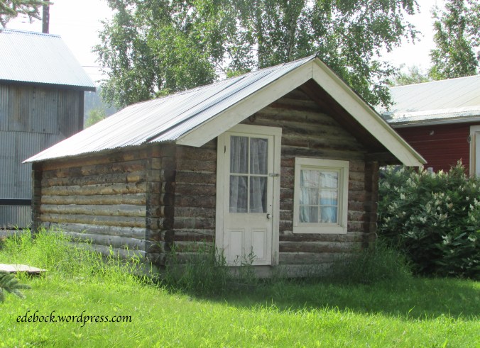
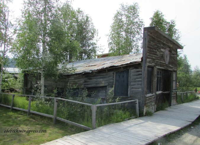
Beginning in 1898 when the population of Dawson City swelled with thousands of people hungry for gold, tents and then log homes were built up the steep hillside behind the present day town. Today, the uppermost avenue is 8th, hence the name of the 9th Avenue Trail that follows the perimeter of the town, but further up the hill. As the gold rush came to an end and the population dwindled, the hillside homes were eventually abandoned, but there are glimpses all along the trail that there were once people living there. The homes were often built on flat platforms with stone retaining walls. Most of these wooden structures are long gone, but a few signs of them can still be seen.

IMG_4462

IMG_4466

There was no garbage collection in Dawson’s early days. Broken and discarded items were often piled up outside the buildings. Rusty remnants can still be seen along the trail offering archaeologists plenty of information about life in early Dawson.

IMG_4478

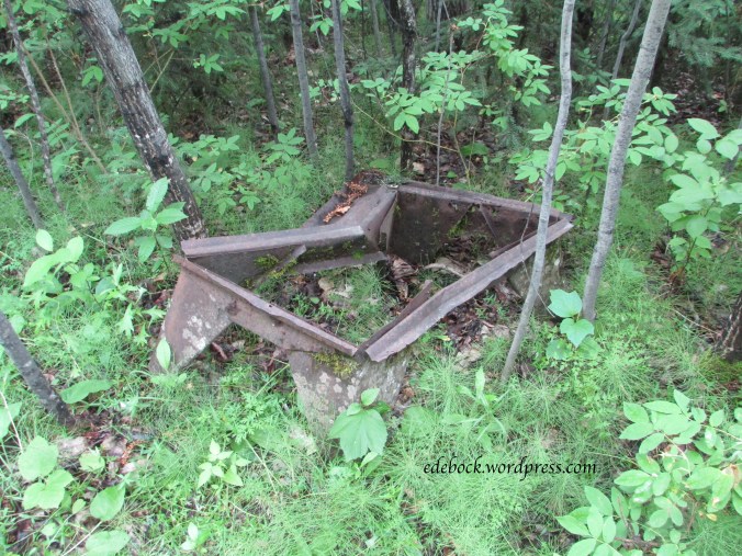
I’m not even sure what that was, but the bed springs were obvious. I wonder who slept on them and what their story was?

IMG_4477

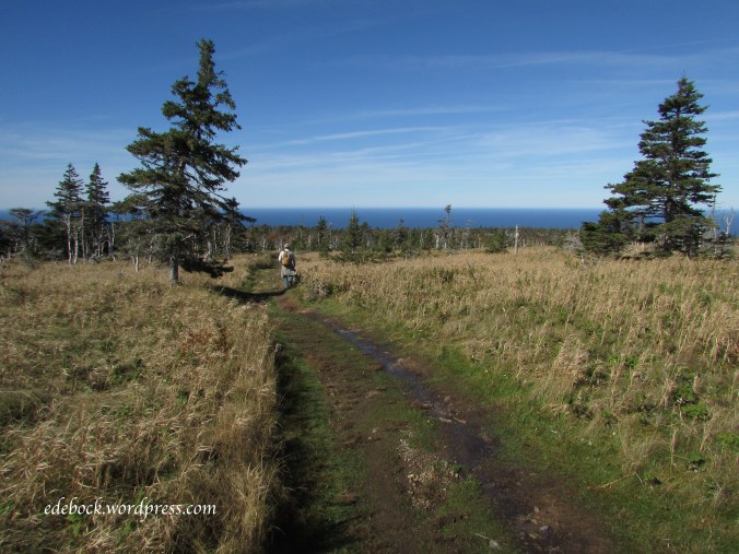
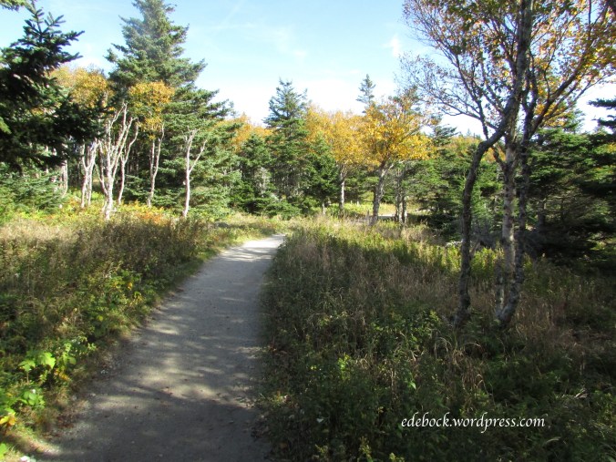
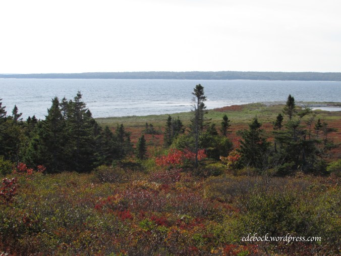
The hike was not a long or strenuous one. The 9th Avenue Trail itself is only about 2.5 km in length. We made it a little longer by adding the connecting Crocus Bluff Nature Trail which leads out to a viewing platform perched on a rocky bluff overlooking the highway entering Dawson and the confluence of the Klondike and Yukon Rivers.

IMG_4473

IMG_4470

Dawson City, heart of the Klondike

On August 16, 1896 gold was discovered on Rabbit Creek (later called Bonanza), a tributary of the Klondike River. When news of the strike reached the outside world the following summer, the Klondike gold rush was on! 100 000 people set off for the Klondike and approximately 30 000 of them made it. By the summer of 1898, Dawson City, at the confluence of the Klondike and Yukon Rivers, had become the biggest city north of Seattle and west of Winnipeg!

We thoroughly explored Dawson’s gold rush history on previous visits, but this time we were there for our nephew’s wedding. Richard and his five siblings were all together for the first time since 2012, so much of our time was spent visiting with family.

With a present population of less than 2000 people, however, the town is small and easy to see. Come take a look around with me.

Built by Arizona Charlie Meadows in 1899, in its heyday The Palace Grand Theatre saw everything from vaudeville to silent movies. Eventually, however, it fell into disrepair. In 1992, the then condemned structure was given to Parks Canada by the Klondike Visitors Association and underwent complete renovation. For many years, it was home to the Gaslight Follies, a high energy musical comedy that played nightly from May to September. Sadly, once more in need of refurbishing, the theatre is presently closed again. Plans to have it reopen in time for Canada’s 150th birthday and the 75 anniversary of the building of the Alaska Highway this summer fell through when asbestos was discovered and progress on the project slowed significantly.

IMG_4422

From 1896 to the mid 1950s, more than 250 sternwheelers plied the waters of the Yukon River. At one time, as many as 70 of these majestic riverboats carried passengers and supplies from Whitehorse to Dawson City. Now the stately SS Keno sits on Dawson’s riverbank welcoming visitors to come aboard for a step back in time.

IMG_4444

The streets of Dawson offer a mix of old and new, often side by side.

IMG_4427

Many buildings remain from Dawson’s early days, some still in use and others reminders of days gone by.

IMG_4426

IMG_4428

IMG_4435

Even modern structures retain the look and character of historic Dawson.

IMG_4424

IMG_4431

Permafrost, a thick layer of permanently frozen soil below the surface of the ground, underlies this northern community and requires special building techniques to keep it from melting. Old buildings like these ones, hastily constructed during the gold rush, show what happens when the frozen sublayer softens.

IMG_4434

No visit to Dawson would be complete without at least strolling by Robert Service’s cabin. It was here that the poet who penned The Cremation of Sam McGee and numerous other northern tales lived from 1909 to 1912.  A costumed actor playing the role of Robert Service offers readings there every afternoon during the summer months.

IMG_4481

The Cremation of Sam McGee begins with the words “There are strange things done in the midnight sun by the men who moil for gold”. The midnight sun is one of the things that I love best about northern Canada in the summertime. Here’s a photo taken at 11:30 PM. As you can see, the sun has dipped behind the hill overlooking Dawson, but it never gets any darker than this!

IMG_4513

The final stop on our virtual tour of Dawson City, the Commissioner’s Residence, built 1901 as to house the government leader of the newly formed Yukon territory, now has a permanent place in our family history. It was on those steps that our nephew and his beautiful bride were married on Saturday, July 8th!

IMG_4438

Liard River Hotsprings

Finally, internet that works well enough to download photos (albeit slowly) and share some of our past week’s travels with you!

Last week I travelled the Alaska Highway as far as Dawson City, Yukon for the fourth time. The first time was 50 years ago when I was a young teen. The second and third times were in the early 1990s when our own children were young and now we’ve made the trek again, this time to attend our nephew’s wedding.

Every time I’ve travelled this route, Liard River Hotsprings, Canada’s second largest hot springs, located in northeastern BC, has been a highlight of the trip. After a long day’s drive, we arrived at the hot springs around supper time, too late to secure a site in the provincial park campground. Instead, we set up in the overflow area across the highway, had a quick dinner and set off for a soak in the warm water.

From the campground, a short (0.4 mile/0.6 km) walk leads to the hot pools. The boardwalk trail crosses over a warm water swamp and through a forested area that support a variety of plant life that survives at this latitude only because of the hot springs. The area, where we saw a mother moose and her calf feeding on one of our previous visits, has not changed since I was there the first time.

IMG_4400.jpg

IMG_4369

Ostrich fern and cow-parsnip are two plants that flourish in this warm, rich environment.

Relaxation seeped into my body as I eased into the water which ranges from 42ºC toward the lower end and 52ºC at the upper end where hot water bubbles out of the ground (108ºF to 126ºF). Though facilities including change rooms, benches, and composting toilets have been added since my first visit, the gravel bottomed hot springs, nestled in the boreal forest, are still very much a part of their natural surroundings.

IMG_4383

IMG_4386

IMG_4375

If you ever travel the Alaska Highway, don’t miss Liard River Hotsprings. You don’t have to stay if that doesn’t fit into your plans. For those who camp, soaking in the springs is included in their campground fees, but day use passes are available for just $5/person.

*If you do go, make sure you remove any silver jewelry before you enter the water! I found out the hard way that it oxidizes it. My pewter pendant was unaffected, but the chain is black!

Happy Birthday, Canada!

Can150intro

As Canada celebrates it’s 150th birthday today, I can’t help but reflect how blessed I am to have been born in such a country.

Canada is a country of amazing diversity. We have oceans (3 of them!), mountains, forests, and wide open prairies. We have an abundance of natural resources and unlike much of the world, we have pure, clean drinking water.

With the exception of our First Nations and Inuit people, we are all descendants of newcomers to this land; people who came dreaming of a better life and who were willing to work hard to achieve it. We still see that in our recent waves of immigrants and refugees. We are truly an international country. In fact, one in five Canadians is foreign born! Learning to live together in spite of our differences isn’t always easy and many people have mixed feelings about topics like immigration and integration, but we pull together when times are tough, we help one another, and we do it with pride because that’s what being Canadian is all about. We are known for our kindness and generosity, our open mindedness, and our optimism.

According to the 2016 Global Peace Index, Canada ranks among the ten safest countries in the world. Though I don’t think too highly of the man-child that we elected as our present Prime Minister or the policies put forth by his government, I don’t have to look very far beyond our borders to see so much worse.

For me, especially in recent years, one of the greatest benefits of being Canadian is our publicly funded health care. I have absolutely no idea how much my care has cost since I was diagnosed with first one cancer and then another, but I have no doubt that by now I’m a million dollar girl! Amazingly, it hasn’t cost me a cent! Even the money we spend on gas, meals and parking for our many trips to the city for tests, appointments and treatments is tax deductible.

Print

Our taxes are high. In fact, most Canadians pay close to 50% of their incomes in taxes of one kind or another, but in addition to world class health care, we get a lot for our tax dollars. We tend to take the twelve years of free public education available to every Canadian for granted, not to mention other social programs such as unemployment insurance and old age pensions.

Sure, we do have long, cold winters, but I try not to think about that at this time of year!

Happy Birthday, Canada!


Hike to Quarry Rock

One of the big advantages of living in (or visiting) North Vancouver is the fact that you’re only minutes away from a wide array of beautiful backcountry hiking trails. Our grandsons didn’t have school today due to a teacher professional development day and though it poured rain overnight this morning’s weather looked suitable for an outdoor adventure.

Quarry Rock is a large rocky outcrop overlooking Indian Arm at scenic Deep Cove. Clouds hung low over the cove as we set off on our hike.

IMG_4111

The 3.8 km round trip trail, which is also part of the easternmost section of the much longer Baden Powell Trail, begins with a long stair climb that quickly informed me that after a long winter, during which the treadmill in our basement mostly gathered dust, my legs and my cardiac conditioning are somewhat out of shape. It didn’t help that in my eagerness to get out and onto the trail, I’d forgotten to have my morning cup of tea! Fortunately, the fresh air, the enthusiasm of our young hiking partners, and the wonderful smell of the damp forest were invigorating.

IMG_4114

The overall elevation gain on this trail is approximately 100 metres, but there are lots of ups and downs along the way. In addition to many flights of wooden steps, boardwalks and small bridges, much of the trail is a maze of tree roots.

IMG_4130

IMG_4122

IMG_4134

The terrain is typical of North Shore hikes with the trail wending it’s way through densely wooded areas of Douglas fir and hemlock. Morning mist hung in the trees as we set off, but before long the sun began to peek through and we soon started removing layers of clothing.

IMG_4137

Along the trail, many small creeks filled with spring runoff from the mountains tumble down the hillside in their rush to reach the ocean.

IMG_4120

IMG_4125

IMG_4128

IMG_4132

Eventually the trail climbed up onto solid rock and we walked out onto the bluff where the views were spectacular.

IMG_4150

IMG_4142

IMG_4143

This trail is clearly a popular one. Even on a cool Monday morning, there were lots of hikers out and when we reached Quarry Rock, it was so crowded with people that it was difficult to get good unobstructed photos!


Meat Cove… at the end of the road

When I was young, my father’s desire to get away from it all often led us to the end of little out of the way roads in our home province of British Columbia. As a child, I didn’t always appreciate those trips to nowhere, but they eventually bred in me a yearning to take the road less traveled and see what’s at its end.

On our first weekend in Halifax, a gentleman told us that if we were going to drive the Cabot Trail, we should go into Cape North and then take the little side road to Meat Cove. Looking at the map, I discovered that Meat Cove is the northernmost community in Nova Scotia. A lone gravel road leads to a tiny dot on the map surrounded by nothing but blank space. Of course, we’d have to go!

As is often the case, the journey was as interesting as the destination. Along the way, we missed a turn and first ended up at another small fishing village, picturesque Cape St Lawrence.

img_3091

Back on the right road, the views were spectacular.

img_3121

img_3118

img_3117

img_3094

img_3099

Meat Cove, with a population of 65 people, is a remote fishing village. Apparently, it takes it’s unusual name from the fact that in days gone by, boats would stop there to reload with wild meat. There isn’t actually a lot there; just a dozen or so houses scattered around the area, a guest lodge, a tiny campground clinging to the cliff top high above the cove itself and a small community centre that also serves as a restaurant and an internet access site.

img_3110

img_3103

img_3106

img_3108

As I looked down on the crystal clear water, I was glad that we’d taken the time to drive to the end of the road and when I called my 93 year old father to tell him about it, I could hear the pride in his voice!

Colourful Cabot Trail

Nova Scotia’s Cabot Trail is a scenic roadway measuring 298 km in length that forms a loop around the northern part of Cape Breton Island and passes through Cape Breton Highlands National Park. Prior to this trip, we had driven the Cabot Trail twice before, both times doing the entire loop in one day.

The first time was in 1991. We were traveling with our young children and had the privilege of doing the drive with a colleague who is a native Cape Breton Islander. He was home on summer vacation and acted as our guide for the day. It was bright and sunny and we were awed by the beauty that surrounded us. Stops along the way to enjoy the views, eat a picnic lunch and take a swim made it a long, but very memorable day.

Our second trip around the trail seven years ago was somewhat disappointing. It poured rain much of the way and we crossed the northern highlands in dense fog barely able to see the road let alone anything else! We made very few stops.

This time we spent three days on the trail! We stopped at many viewpoints, or lookoffs as they’re known in Nova Scotia, to soak in the beauty and take a multitude of photos.

img_2962

img_2967

img_3031

That’s the little Hyundai Accent rental that’s been our wheels for this entire trip.

We enjoyed a traditional community breakfast with the locals at the Southwest Margaree Parish Hall and spent a couple of evening hours listening to local musicians in a Cheticamp pub.

We walked rocky beaches

img_3040

img_3057

img_3061

and sandy ones.

img_3166

We hiked the Skyline Trail and explored out of the way places like this one near Cheticamp where we stopped to find a geocache.

img_3051

We took side roads to places like Mary Ann Falls

img_3146

and everywhere we went, we marvelled at the amazing colours.

img_2957

img_3078

img_3087

Yes, the Cabot Trail is beautiful anytime of year, but in autumn it’s absolutely spectacular!

Hiking the Highlands

Nova Scotia’s Cape Breton Highlands National Park boasts more than 20 trails ranging from short easy walks to spectacular hiking expeditions. We chose one of the most popular, the dramatic Skyline Trail on the western side of the Cabot Trail, for Wednesday’s hike.

As we approached the trailhead, we could see the tiny silhouettes of hikers against the skyline on the ridge high above us. Soon we would join them!

img_3024

The Skyline Trail offers two options. Many choose to stay on the well groomed path that takes them directly out to the headland cliff overlooking the Gulf of St. Lawrence. This out and back route is 7.5 km long. We chose the longer 9.2 km loop.

The back side of the loop, the road less traveled, crosses a high plateau. The trail is rougher and some sections were muddy as a result of the horrendous storm that swept across Cape Breton two days earlier.

img_2972

Once we reached the far side of the plateau, the views were gorgeous.

img_2985

Sometimes we just had to sit and soak them in.

img_2982

Nothing prepared us for the spectacular views from the headland, however! There, a wooden boardwalk and a series of steps took us down the middle of the cliff. The open ocean was far below to our right and a deep ravine to our left. We watched eagles soar below us and vehicles winding their way along the Cabot Trail looked minuscule.

img_3006

Strategically placed by Parks Canada so that it isn’t visible from the highway below, the boardwalk protects the fragile headland plants from trampling and also gave me a sense of security as I crossed the ridge.

Once we tore ourselves away from the the amazing vistas spread out before us, the most used and best maintained portion of the trail took us back to the parking lot. There was a small change in elevation along this portion, but it was very gradual.

img_3018

Is it any wonder that I’m overwhelmed by the beauty of Nova Scotia?

Hiking Kejimkujik Seaside

Nova Scotia’s Kejimkujik National Park is actually one park divided into two completely separate areas. Thankfully, locals refer to it as Keji because I’ve had a terrible time getting my tongue around that name! The meaning of the Mi’kmaq name is uncertain, but the park’s official stance is that it means “tired muscles”. Yesterday, we spent several hours hiking the beautiful Seaside portion of the park; 10.7 km in all and I’m proud to say that my muscles are just fine today!

The hiking trails ramble through coastal barrens and bogs, around rocky headlands and along cobbled and sandy beaches offering views that are breathtaking. The trails are well maintained and there’s very little change in elevation, but if you go, you’ll definitely want good footwear for the rocky sections.

Come along on a virtual hike with me.

img_2885

img_2887

img_2890

img_2891

In the past, sheep were grazed on the barrens. Here are the remains of the shepherd’s home; definitely a room with a view!

img_2895

img_2898

img_2903

img_2905

Wildlife share the park with hikers. A sign at the entrance warned that bears have been sighted. Thankfully, we didn’t see any, but there was plenty of scat along the trail. The only wildlife we saw was birds, a squirrel and this harbour seal sunning itself!

img_2908-version-2

img_2915

Colourful Lunenburg

Old Town Lunenburg, Nova Scotia is one of only two urban communities in North America to have been designated a UNESCO World Heritage site. It’s also considered to be the best surviving planned British colonial town in North America. Its harbour-side streets are lined with well preserved and colourfully painted historic buildings.

This colourful section of King Street is known as the UNESCO Fresco!

img_2848

Canada’s Maritime provinces are dotted with old wooden churches, none more beautiful than St. John’s Anglican Church in Lunenburg.

img_2830

Visible for miles around, Lunenburg Academy, built in 1895, dominates the hilltop. Imagine going to school there!

img_2836

This stately giant stand nearby.

img_2834

Though we’d visited before, we thoroughly enjoyed wandering the streets and busy harbour front again.

img_2847

img_2849

img_2856

img_2854

I loved the name on this fishing boat!

img_2857

img_2867